
Back to the main Gullfjellstoppen page
This route is one of the shortest round trips across Gullfjellstoppen in distance, outside Glamragjelet.
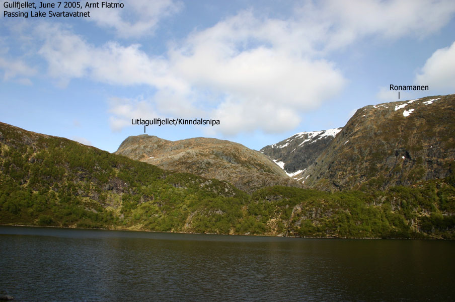
The plan was to head up Kinndalen, then straight up Litlagullfjellet (Kinndalsnipa), up the steeper part of Gullfjellhalsen and up a steep snow field before I would reach the summit. I normally do this route in 1h:30m during summer, but I added 30 minutes because of a bad leg. My dachshund "Troll" also "came along" for the walk.
As I got ready to walk from Lake Osavatn, a man came and introduced himself as "Blåbærkongen" (the blueberry king). He told me that he had earned an honest reputation in the press after picking 15,000Kg of blueberries. So what can you say? "That's a whooole lot of berries.." As I was ready to leave, Troll was recognized by another group. That's the third time this spring. Don't all dachshunds look alike? At least from distance? OK, I realize that the combination of dachshund+mountain narrows the list down.
We left the trailhead 17:15PM. A dark-grey belt of clouds made me wonder if we would run into rainshowers. I had a slow start, as I couldn't stretch my foot properly. I followed the path to the foothills of Litlagullfjellet and then headed up the long, and somewhat steep slope to the top.
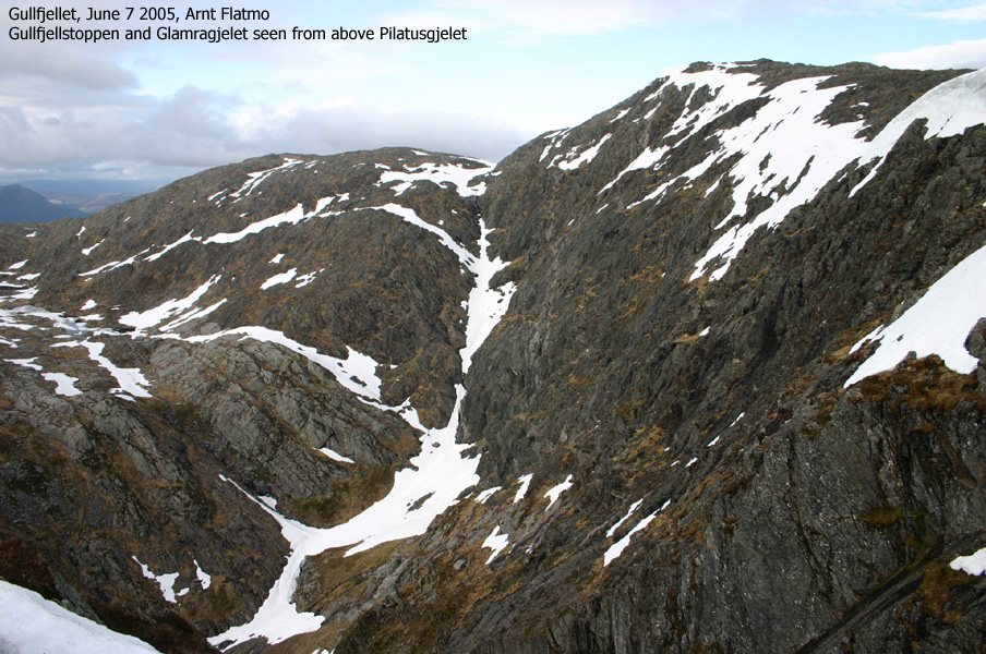
From Litlagullfjellet, I headed towards Gullfjellhalsen and hiked up the eastern ridge closest to Glamragjelet. I had good views towards the steep couloirs coming down from Ronamanen. Parts of this route were not trivial for a tiny dog, but Troll put up his best performance.
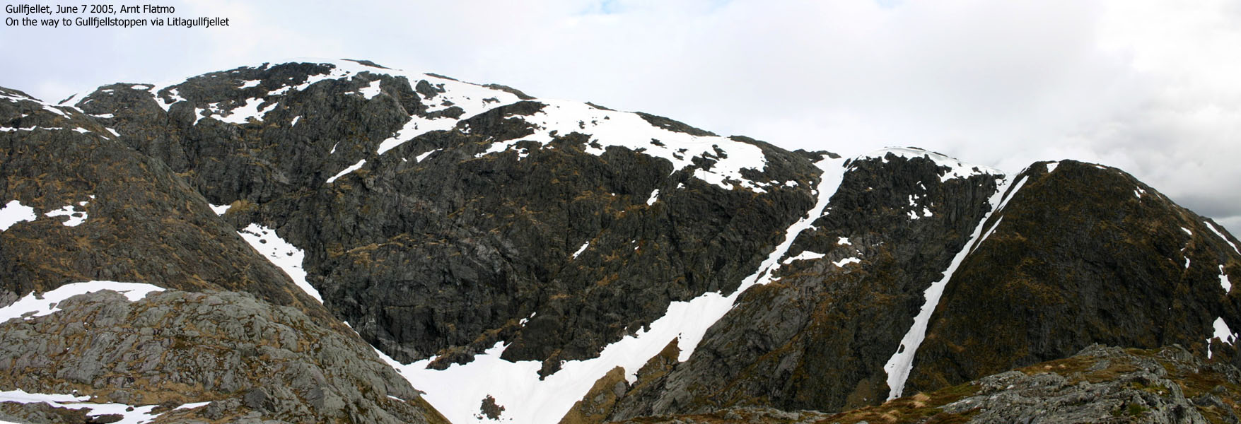
Only 1 hill left. I chose the shortest route (also the steepest) and had to kick in steps in order to get up. This hill was probably the closest thing to hell that a dachshund can encounter.
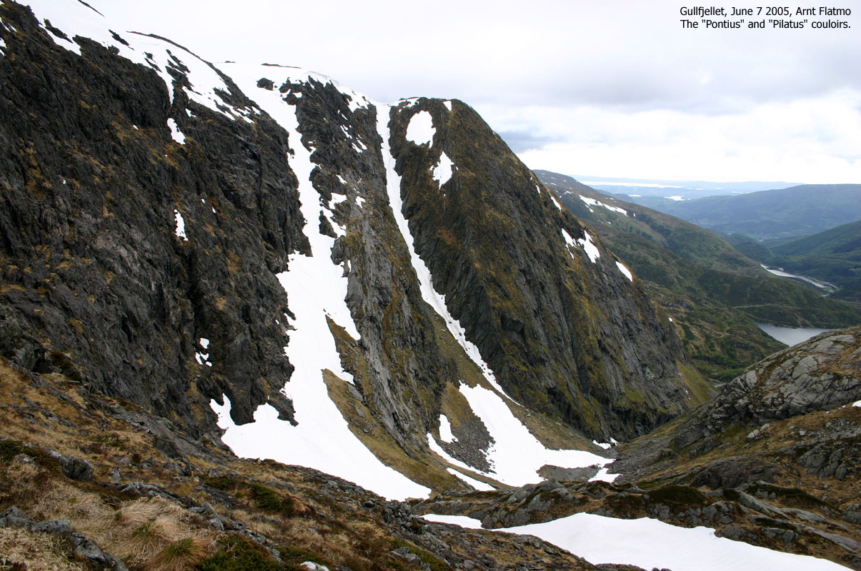
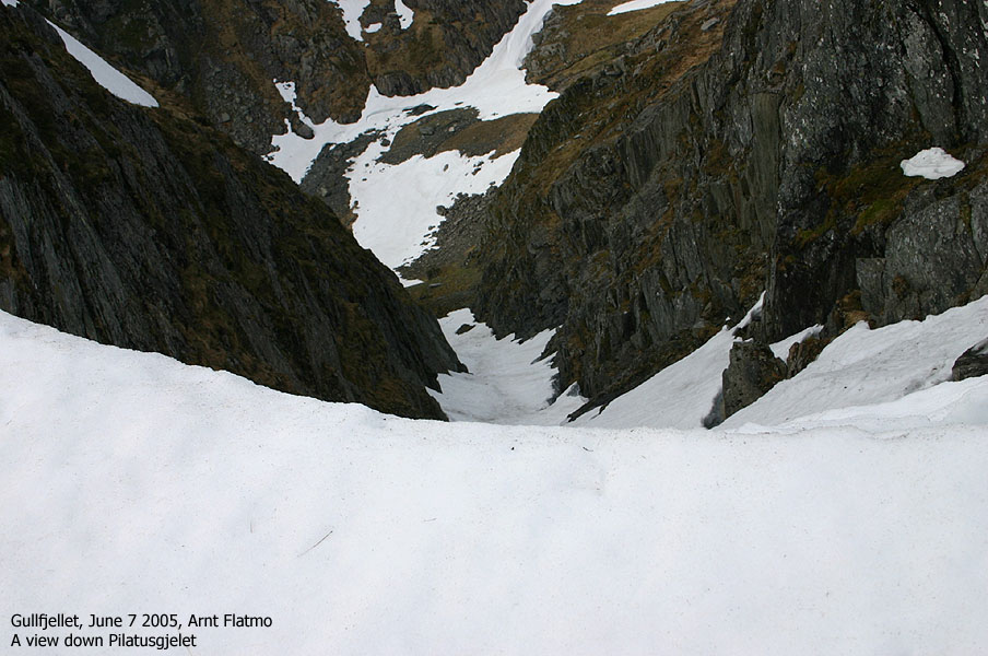
I reached the top 19:15PM, exactly two hours after I started. Good timing. I was now partly in the clouds, and the views were limited. The rain did however not seem to set in, and it wasn't particularly windy either. After a break on the summit, we headed down towards Ronamanen. My leg was getting better by the hour, and the weather was turning good. Things were looking up. I stopped by Pilatusgjelet and concluded that people should not attempt to climb this thing in June.
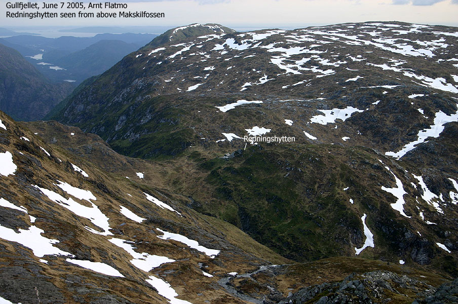
I continued across Ronamanen and made a direct descent rather than following the trail down Makskilfossen. I had gone up here several times (on dry rock), but it was more difficult to find a good route down. The wet and slippery ground made the descent more airy than I had planned for. I was able to downclimb a short, but airy section, and found the combination of a backpack, camera around my neck, the dog in my left hand and the slippery ground a bit cumbersome. Once down, I followed a path along a stream down to the road from Redningshytten. I arrived the car 21:15PM, two hours after arriving the summit.
Move cursor to read notes, and click on the images to see full version.
Some of the thumbnails may have been cropped to fit the format.
Pictures are presented in the order they were taken.
Note: A number of pictures have been taken with medium quality resolution.
To Gullfjellstoppen


Summit views


Descent


No Javascript:
1 2 3 4 5 6 7 8 9 10 11 12 13 14 15 16
 Other hordaland mountains
Back to Gullfjellstoppen page
Other Bergen K. mountains
westcoastpeaks.com
Other hordaland mountains
Back to Gullfjellstoppen page
Other Bergen K. mountains
westcoastpeaks.com