
|

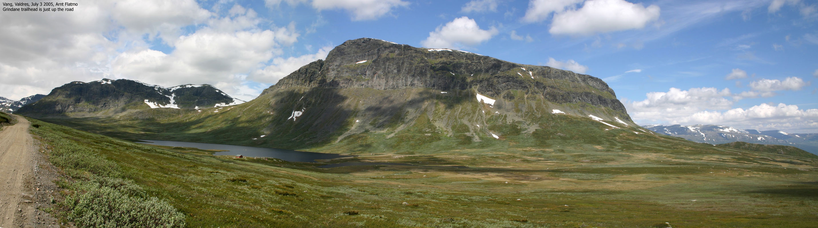
Grindane seen from E16(No Javascript) |
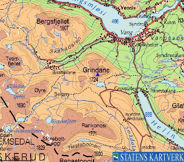
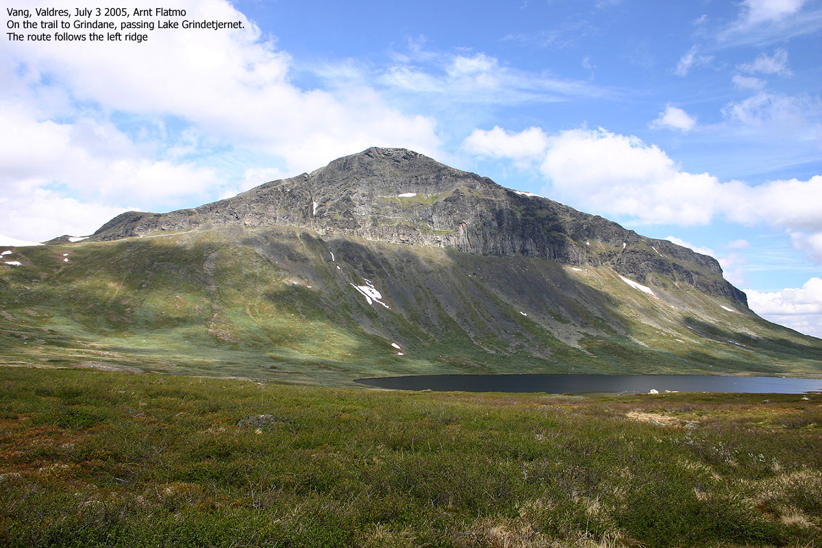
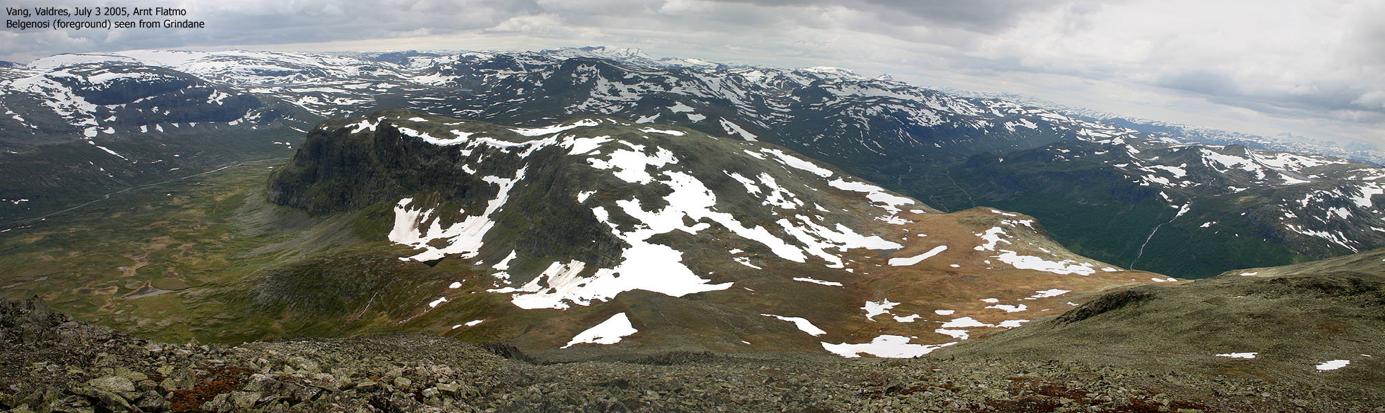
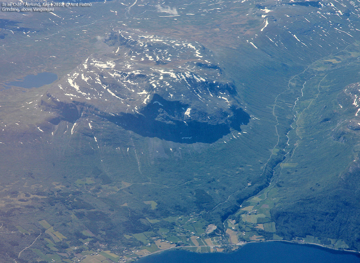
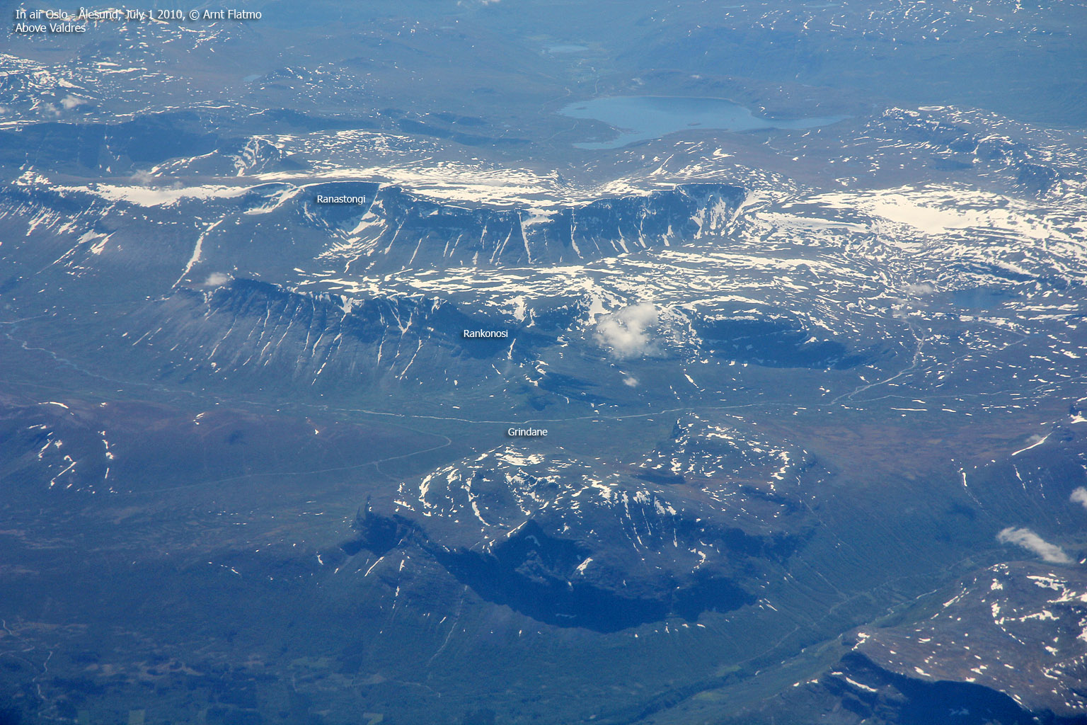
Grindane is one of many characteristic Valdres mountains located around the lakes Helin, Syndin and Vangsmjøsi. The mountain consists of three local tops; the high point (1724m), Storenibb (1674m) and Veslenibb (1666m). From Grindane, you can follow the high terrain westbound via Belegnosi, Øyre, Kljåkinnknippene, Skoddetinden, Storeknippa and the higher Sulefjellet (1812m) bordering to Hemsedalsfjellet.
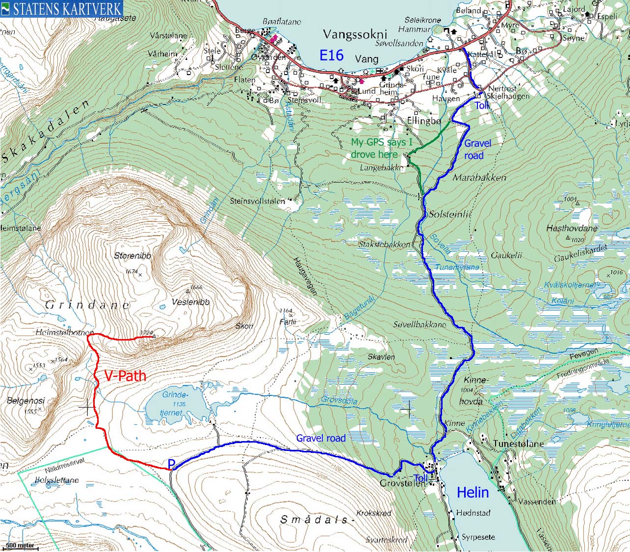
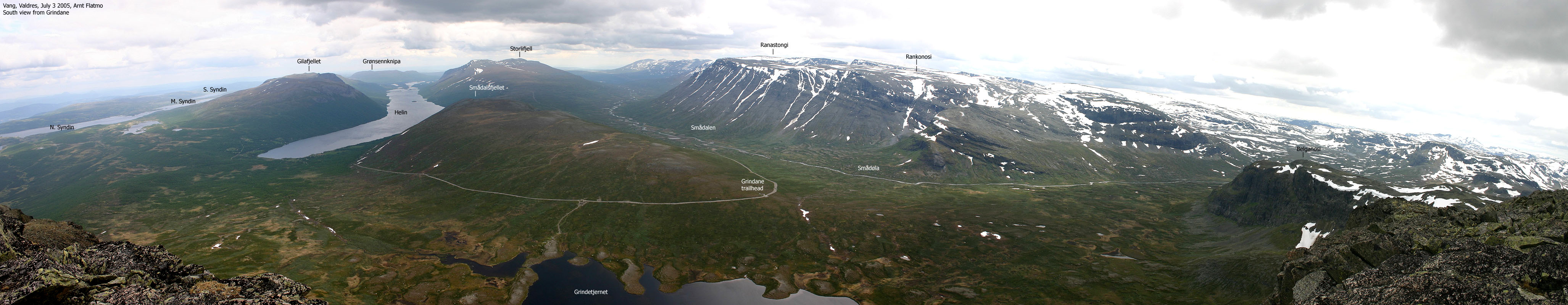
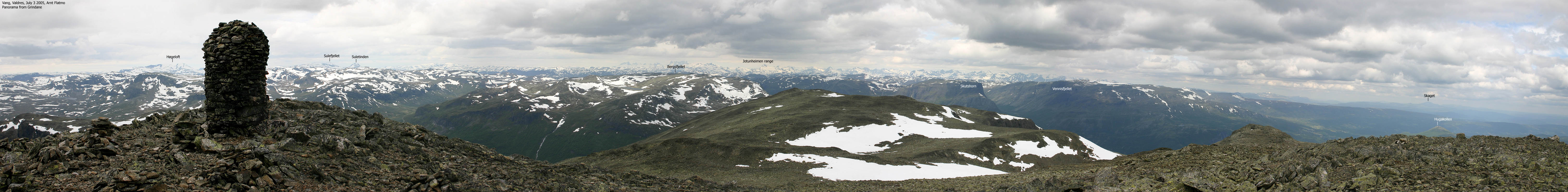
When the road to Smådalen is open, Grindane is an easy mountain to reach. A mountain road (toll) takes you to the Grindane foothills at approx. 1190m. By following the V-marked trail, you should be on the top within 1,5 hours of normal walking. The views are fantastic; an unbroken chain of Jotunheimen mountains in the north and the characteristic Valdres mountains towards the south.
In winter, the approach is significantly longer, and is determined by how far towards Smådalen you can drive.
Grindane (M711: 1724m, Ø.K: 1723,66m) has a primary factor of 456m towards the higher Sulefjellet (1812m). The saddle is found W of Belgenosi and Grindane, at Belgeflænane (Bælgefl&aeing;nadn). Ref. Økonomisk Kartverk (10m contours!), you cross the 1270m contours on the high route, but not 1260m. The saddle height has been interpolated to 1268m, considering a lake at 1265m near the saddle.
Notes: Class ratings are in reference to YDS. Click here for more information.
The trails described below are not necessarily the *easiest* trails to this mountain.
|
Grindadn - Grindane (summer/autumn)
|
|
Locate the "Smådalen" road (signed) a couple of kilometres east of Vang by Lake Vangsmjøsi in Valdres. Follow the road from highway E16 towards Smådalen. In the first Y-fork, go left. In the second fork, turn right. After approx. 800m from E16, you reach the first toll station (self-served). The fare for passenger cars (per July 2005) is NOK 40,-.
Approx. 7Km from E16, turn right towards "Smådalen". Continue approx. 600m down towards Lake Helin and turn right towards "Grindafjellet". After 200m, you reach the second toll station (self-served). Per July 2005, the fare for passenger cars was NOK 40,-. Continue approx. 3,8Km to "Grindadn" trailhead which holds a parking area. Park here.
Follow the V-trail NE approx. 1,3Km and turn right (north) onto the V-trail that takes you up to the Grindane - Belgenosi pass. Cross the fence via a ladder and turn right (east). The V-trail takes you through rocky terrain up to the summit.
|
Trip report July 3 2005This week-end was dedicated to the celebration of my good friend Arne's 40th birthday in Hamar. Arne had organized a soccer cup before the party, and as I headed back to Bergen on Sunday, my body felt 10 years older. I insist that the soccer tournament had the blame, and not the party... I knew I was heading into rain on my way westbound, and decided I should look for a place to hike before reaching Filefjell. My choice fell on Grindane, which I have always admired down from the highway. I stopped at Vang and asked around. Grindane would have been a long walk from Vang, but fortunately, a mountain road took me so far that the remaining walk was doable for very tired legs. By 12:55PM, I was on my way to Grindane on a V-marked trail. A person down in Vang, whom I mistook for knowing the mountains, told me there was a lot of snow up there. I knew nothing about the mountain, and I didn't even have a map. I figured I should be prepared and had put crampons and ice-axe into the backpack. This *felt* wrong, as I hardly saw any snow on the mountain. My dachshund "Troll" parked early on the trail, and the backpack suddenly felt heavy. I had brought along brand new boots, and decided to break them in on this hike. It didn't take long before I was bleeding from both heels. The hike upwards went in a slow pace and was painful and strenuous. We reached the summit 14:10PM. For this height (1724m), the hike was exceptionally short. It reminded me of Skogshorn in Hemsedal. High and mighty, but very close and accessible. All traces of blue sky had vanished, but the view towards the Jotunheimen range was breathtaking. I was glad I had brought along my zoom-lens. This was a perfect place to watch Jotunheimen from. Troll insisted on lunch, even if he had been carried all the way to the top. I gave in, mostly to be able to focus on the pictures without him whining. Troll realised he had no other option than to walk all the way down. I limped after him. After passing 4 hikers on the way upwards, we were back at the car 15:35PM and could continue our journey back to Bergen.
|
Move cursor to read notes, and click on the images to see full version.
Some of the thumbnails may have been cropped to fit the format.
Thanks to Jonathan De Ferranti for invaluable help with the panoramas. Also thanks to Petter Bjørstad and Kjell Åge Norbeck. Note that some of the panoramas are over 1MB in size.


Views from the top


No Javascript:
1 2 3 4 5 6 7 8 9 10 11 12 13 14 15 16


No Javascript:
Other hordaland mountains
 Other Norwegian mountains
westcoastpeaks.com
Other Norwegian mountains
westcoastpeaks.com

