
|

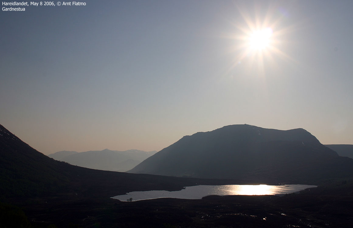
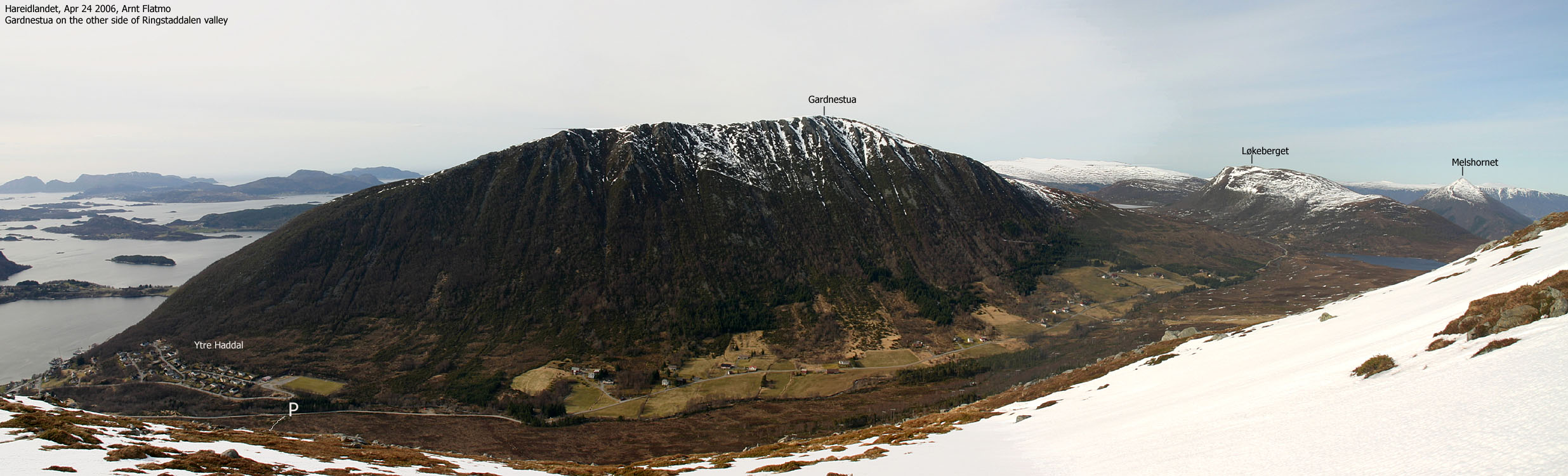
Gardnestua is the 3rd highest mountain in Ulstein kommune, and the 4th highest mountain on Hareidlandet island. I believe the locals refer to this mountain as "Garnestua", while the map authorities have added a 'd' on the newer maps.
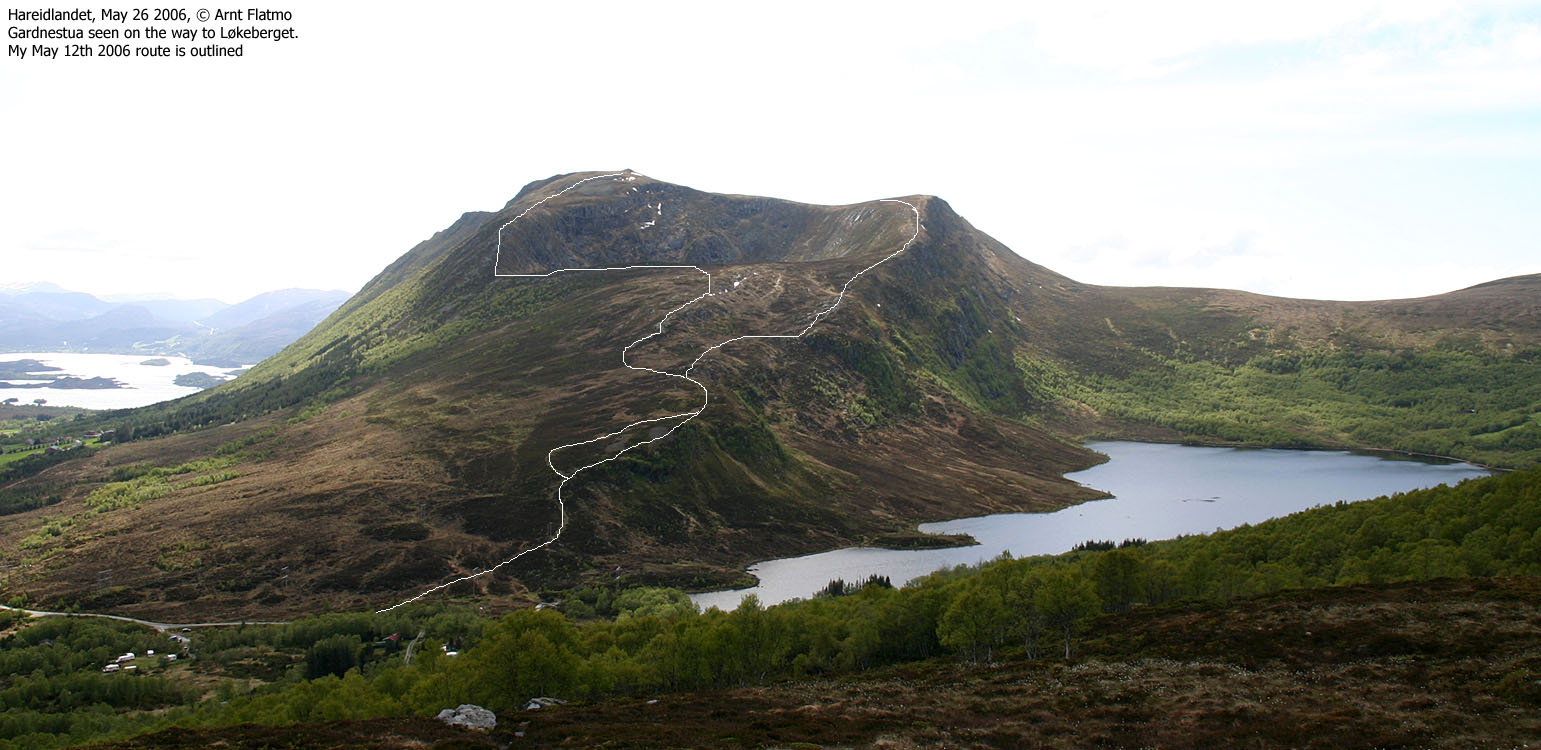
Gardnestua shares the same trailhead as Kongsvollen and Løkeberget at Lake Løsetvatnet. A very easy and short path takes you to the top of the mountain, where you can enjoy fine views in all directions. Upon descent, follow a vague path down the southeast ridge. The ridge descends steep down to Mørkevatnet, but unless the ground is icy, the path is fairly easy to follow.
Hasundhornet is a lower top, 2Km north of Gardnestua. The normal route runs from Hammarstøylvatnet - the same trailhead you would use for Ramnefjellet.
Both tops are excellent view points towards the Ytre Sunnmøre region, and from Hasundhornet, you have the best view towards the village of Ulsteinvik.

Gardnestua (Norge 1:50,000: 654m, Økonomisk Kartverk: 652,5m ~ 653m, UTM 32 V 338923 6911512) has a primary factor of 415m towards the higher Kongsvollen (683m). The saddle (approx. UTM 32 V 342096 6911702) is found between Løkeberget and Kvamstua, northeast of Løsetvatnet. Ref. Økonomisk Kartverk (5m contours), the saddle is within the range 236-240m, interpolated to 238m.
Personal GPS reading measured 649m as average height over 10 minutes, on top of the cairn. This was a surprising result, compared to the map elevation.
Hasundhornet (Norge 1:50,000: 533m, Økonomisk Kartverk: 533m, UTM 32 V 338226 6913510) has a primary factor of 93m towards the higher Gardnestua (653m). The saddle (approx. UTM 32 V 338525 6912903) is found between the two tops. Ref. Økonomisk Kartverk (5m contours), the saddle is defined through a fixed point - 440m.
Personal GPS reading measured 532m as average height over 5 minutes, 1m above the ground.
Google's interactive map. You can zoom, pan and click on the markers.
Notes: Class ratings are in reference to YDS. Click here for more information.
The trails described below are not necessarily the *easiest* trails to this mountain.
|
Løsetvatnet - Gardnestua (summer/autumn)
|
|
Access
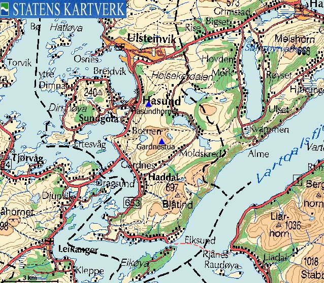
From Ålesund, follow highway E39 towards Bergen, and then RV61 towards Hareid. Take the Sulesund - Hareid ferry and follow RV61 (roughly) 3Km towards Ulsteinvik. At the roundabout junction outside Ulsteinvik, turn left and follow RV61 southbound. RV61 later turns right (SW) towards Måløy. At this junction, drive straight ahead and keep driving for approx. 1,3Km and turn left towards "Haddal".
Drive approx. 500m on the main road (which curves sharp to the right in the beginning) and turn left into "Ringstaddalen". Follow this road approx. 3,8m (the road turns to gravel road after 2,9Km) to a parking area. You will see the "Blåtind" trailsign on the left-hand side of the road. The parking slots are for the most part reserved, but you will find available pockets here and there. This is also the trailhead for Kongsvollen and Løkeberget (the path begins a few meters up the road).
Alternative route from Hareid;
Follow RV61 6,5Km and turn left onto a gravel road just before the top of the hill. Follow this road (it is a bypass road, so turn left again after 500m) 6,3Km to the Løsetvatnet trailhead described above. This road is not plowed in winter, and opens when the snow has melted away.
The route

The Løsetvatnet route to Garnestua

(Click for larger image)
Next to the "Blåtind" trailsign (on the west side of the road), follow a path north in the direction of Lake Fjellsvatnet. The path turns west, crosses under the powerline and continues up Gardnestua's northeast ridge. From the meadow betwen Flåna (613m) and Gardnestua, the path runs southbound up to the Gardnestua summit.
Descend your ascent route, or follow a *vague* path down Gardnestua's southeast ridge. A couple of places can be dangerous when icy. When dry, the route is overall trivial. You may need to use your hands for support here and there. From the south side of Lake Mørkevatnet, head northbound and follow a vague path running parallel to your ascent route. These paths join at approx. 350m elevation.

|
Hammarstøylsvatnet - Hasundhornet (summer/autumn)
|
|
Access
From Ålesund, follow highway E39 towards Bergen, and then RV61 towards Hareid. Take the Sulesund - Hareid ferry and follow RV61 6,5Km to the top of the hill between Ulsteinvik and Hareid. Turn left onto a side road and drive 2.2Km (turn left after 500m) and find a parking area on the left-hand side of the road. Park here.
The route
The route (signed) begins on the other side of the road. A gentle ascent on a wide (can be boggy!) path takes you via point 459m and up to Hasundhornet summit, marked by a proper cairn. There is a circular viewfinder, allowing you to pinpoint mountains in the horizon, and a summit logbook in a mailbox next to the cairn.
Descend your ascent route, but from point 459m, you can take a different path, which merges with your ascent route a bit further down.
 westcoastpeaks.com
Other Møre & Romsdal mountains
Other Norwegian mountains
westcoastpeaks.com
Other Møre & Romsdal mountains
Other Norwegian mountains

