
|

Galdhøpiggen seen from Vetlepiggen(No Javascript) |
Galdhøpiggen is the highest mountain in Norway and Scandinavia, 2469m above sea level. The mountain attracks large crowds of hikers every year, and is probably the most visited mountain in Norway. The view from the summit towards glaciers and hundreds of other wild and rugged Jotunheimen peaks, is spectacular. A stone hut is located on the summit, and a warm drink and chocolate could be purchased if the hut is manned.
Even in summer, the weather on the mountain can be severe. Even on the finest day, you may experience the coldest winds. In other words, one should always dress accordingly.
Keilhaus topp and Svellnos are two smaller humps you pass over, on your way from Spiterstulen to Galdhøpiggen
The "trade route" runs from Spiterstulen, located 1110m above sea level. The route runs over the 2000m tops Svellnosi (2272m) and Keilhaus topp (2355m) before you reach Galdhøpiggen. This is the route described on this page. An alternative route from Spiterstulen runs up the Svellnosbreen glacier.
Another popular approach runs from Juvasshytta, located at approx. 1840m above sea level. This route runs across the Styggebreen glacier, and guiding is available at Juvasshytta.
You can also reach Galdhøpiggen from Geitsetri in Leirdalen. Follow the river Nordre Illåe up to the Nordre Illåbreen glacier. Ascend up to the Illåbandet band that separates Storjuvbreen glacier from Nordre Illåbreen glacier. Cross the Storjuvbreen glacier and climb up "Porten", a couloir between Galdhøpiggen and Vesle Galdhøpiggen (Vetlepiggen). Head east towards Styggebreen glacier and join the route from Juvasshytta. This is a mountaineering route, and should only be traveled by roped parties.
From Styggebreen glacier, you may also traverse the Ymelstinden - Storjuvtinden - Galdhøpiggen ridge. This is a classic ridge mountaineering traverse where ropes are required for security.
Primary factor:
Galdhøpiggen (M711: 2469m, Ø.K: -) has a primary factor of 2372m towards the higher Tatra mountains in Poland/Slovakia. Saddle:The mountain is separated from other (higher) areas by a system of rivers connecting the Baltic Sea with the White Sea (Arctic). The saddle is estimated to be 97 meter. This location is NW of Poca
Source: Petter Bjørstad's research on primary factors for Norwegian mountains.
Svellnosi (M711: 2272m) has a primary factor of 20m towards the higher Keilhaus topp. Keilhaus topp (M711: 2355m) has a primary factor of approx. 20m towards the higher Galdhøpiggen. Source: nfo2000m.no by Torgeir Eraker.
Notes: Class ratings are in reference to YDS. Click here for more information.
The trails described below are not necessarily the *easiest* trails to this mountain.
|
Spiterstulen - Galdhøpiggen (summer/autumn)
|
|
Either you come from east or west, you will have to locate highway RV55 across Sognefjell. Exit towards "Visdalen" (the exit is approx. 19Km west of Lom) This gravel road takes you 18Km through Visdalen to the Spiterstulen tourist centre. The road also ends here. There is a fee for parking and access to the road (NOK 50,- for passenger cars per Aug 2001), and must be paid in the Spiterstulen reception. The road is bumpy, but easily traveled by a passenger car.
Conventiently, the trail starts at Spiterstulen. Cross the bridge over the Visa river and follow the "T" marked trail. Very early on the trail, you arrive the Juvasshytta hut trail junction. Go left.
The trail is steep up to 1800m, before you enter a more gentle angle. You might choose to cross some snowfields and when you get to the upper part of the snow, you see Svellnosi (2272m) rise up over the horizon. By now, the south/southwest view should indicate what to expect from the top.
You reach Svellnosi on rockier terrain. No need for using hands, but the visible trail is almost gone. To your right, you have a grand view of the Styggebreen glacier (Stygg = Ugly), and you might see the crowds walking in rope from Juvasshytta hut.
From Svellnosi, you are looking towards your next stop - Keilhaus topp (2355m). The trail takes a little dip before you walk up Keilhaus topp. You can either hike on rocks close to the fall to Svellnosbreen glacier on your left, or follow the snow a little more to the right.
From Keilhaus topp, another short descent is required, before you start on the final slope to the Galdhøpiggen summit. You clearly see the summit hut from Keilhaus topp.
Just below the summit, the trail leads out towards the Svellnosbreen glacier. Under blue ice conditions, a short section requires caution. This also apply if you choose to go around Keilhaus topp (facing Styggebreen) instead of over the top. The exposed (not steep, but it will be a long slide) section towards Styggebreen is longer than the exposed section below Galdhøpiggen sumit. Bring an ice-axe, crampons or poles to be on the safe side, unless you know that there is snow on top.
|
Trip report Aug 2001:After having done the highest mountain in the U.S Rockies (no big feat in itself, but still it was the highest), it was embarrasing not to have been on top of Norway. I had done Glittertind the week before, and now the time had come for Galdhøpiggen). The weather forecast suggested a lovely day, so I was really exited. Previous hikes in Jotunheimen had offered little but rain and clouds.I left Bergen 04:00AM Sunday morning. Encouraged by seeing the stars, I kept a steady course through the (relatively) new Lærdalstunnel (25Km), heading for the Øvre Årdal - Turtagrø road. Although a total of 50Km tunnels in 45 minutes made me a little dizzy, I rapidly awoke when the first 2000m peaks came in sight on my way to Turtagrø. After giving a glacier guide a hike (he was waiting for a bus that never came), I arrived Spiterstulen 09:15AM. After paying the parking/toll road fee, I was ready to go at 09:30AM. I had done a lot of pep talk with the dog - Troll, and was confident that he would scale this mountain in fine style, at least up to the rocky terrain. But he took a look at the steep trail and gave me the "you've got to be kidding me" eyes. So I left the ice axe and the rain gear. Enough weight already... Even with a 8Kg dog in my backpack, all recent hiking paid off. I had expected to use the full estimated 4 hours, but was up in 2 hours, 40minutes. This was one of the crowdy days. A long line of people as far as I could see. I passed most of them, and swallowed many laughs behind my back. A dog in a backpack looks ridiculous. I admit it. Although the folks at Spiterstulen said I didn't need any axe that day, I still wish I had carried one, or a pole. Just to be on the safe side in case of any worn-down snow. And on the final slope to the summit, where they have set up poles to mark the right way, the snow was almost gone. It didn't pose big problems, but I was careful to step in the right places (with the dog on my back, I was a little top-heavy). I mean, it wasn't difficult, but when you know that if you slip once, you'll end up down in the Svellnosbreen glacier, and you need to show appropriate caution. As I reached the summit, I started to freeze immediately. The western face looked as it had been sprayed with a snow-canon. Thirtysome school kids left the summit as I came up, so I had golden photo opportunties. The dog wanted goodies, but he hadn't earned them, and I ignored him easily. Spiterstulen had promised rain at 15:00PM, but as I decided to leave at 13:30, there was no rainy clouds to see anywhere. This was my lucky day. On the way down to Keilhaus topp, I saw another trail on the left hand side of the summit. I decided to follow this one, instead of walking back up to the summit (not far, but still..) At the end of this detour (or perhaps this is the regular route), I once again hit worn-down snow. Again, I had to make sure each step was safe, to avoid sliding down to the Styggebreen glacier. If there is little snow, you should absolutely bring a trekking pole or something. On the way down, arriving the snowfields, Troll finally decided to walk on his own. Annoyed, I had to put him on a leash as there were sheep in the hill. Annoyed, because he wouldn't chase sheep (sometimes it's the other way around), but I wouldn't allow anyone teaching me the rules and ruin my day. I left Spiterstulen at 15:30PM and arrived Bergen 21:00PM. A nice day-hike ...
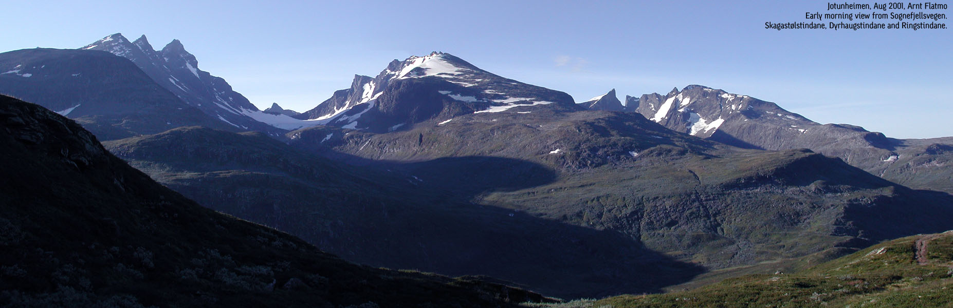
Pictures from the Aug 2001 hike
Move cursor to read notes, and click on the images to see full version.
No Javascript: 1 2 3 4 5 6 7 8 9 10 11 12 13 14 15 16 17 18 19 20 21 22 23 24 25
|


Other hordaland mountains
 Other Norwegian mountains
westcoastpeaks.com
Other Norwegian mountains
westcoastpeaks.com


