
|

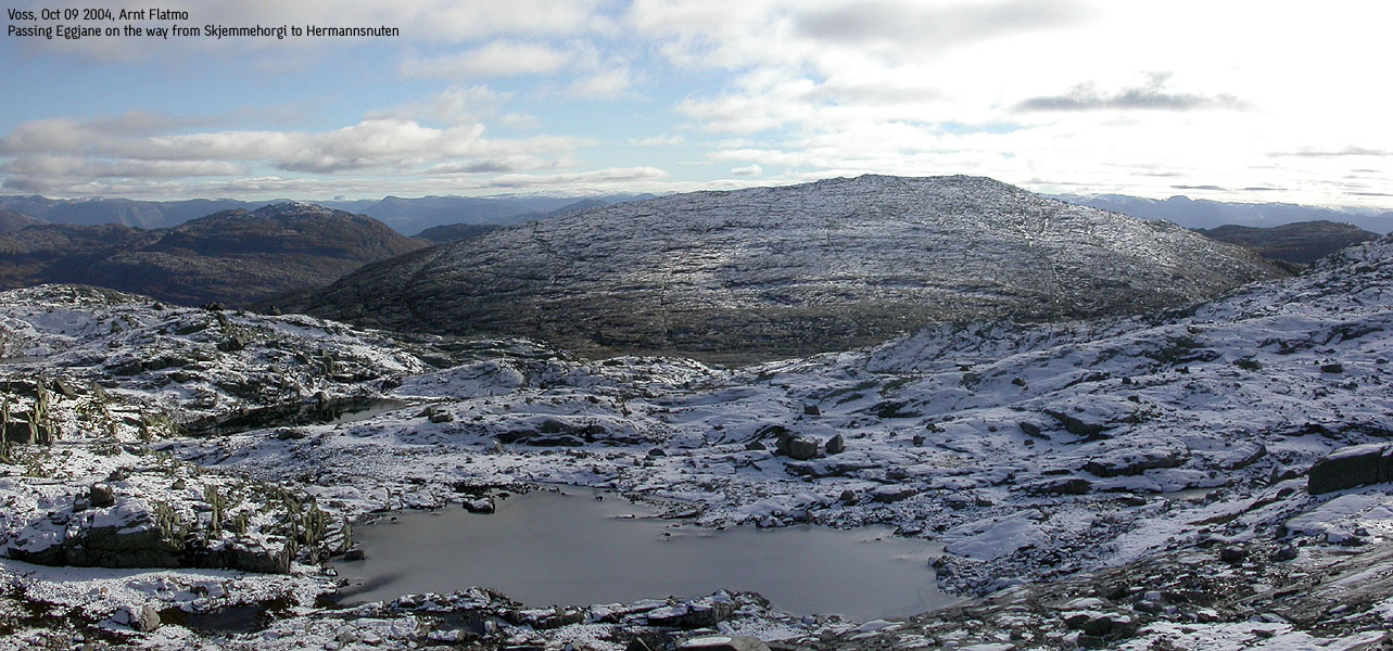
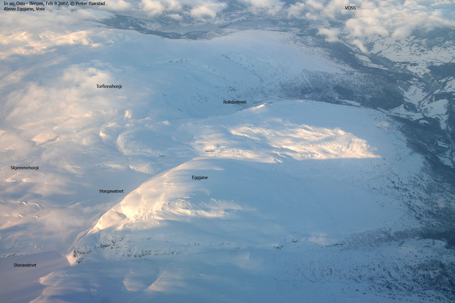
Eggjane belongs to the high mountain massif between Voss and Hardangerfjorden, that also include the lakes Torfinnsvatnet and Bjølsegrøvvatnet. While most of the individual tops on this massif are difficult to identify from distance, Eggjane has a characteristic profile. When viewed from the northeast, the mountains presents itself as a huge cone.
Eggjane connects to the Hjortahorgi - Skjemmehorgi ridge (which are the highest points on this massif) through a high pass at the north end of Lake Horgavatnet. You barely descend below the 1100m contour before you start ascending towards Skjemmehorgi. This means that the Nyestølen trailhead for Eggjane that is described on this page, also is a good route if you plan to visit Hjortahorgi. The route up Stordalen valley is easy to ski and walk, so you can visit the mountain in all seasons.
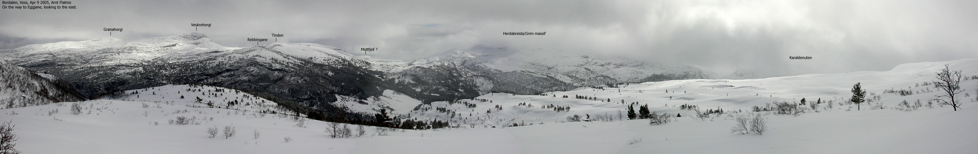
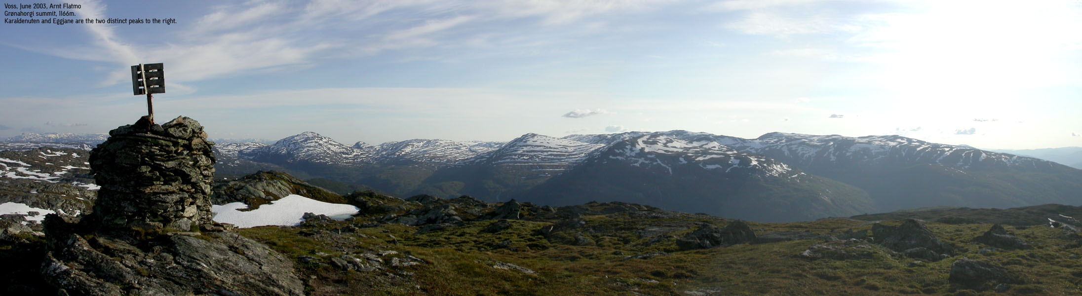
Translated into English, I assume the name means "sharp ridges". However, I cannot understand what ridges that are referred to, given that the translation is correct. The views (I was cheated on them) are good, even if the Hjortahorgi - Skjemmehorgi ridge steals the view to the northwest. And while Karaldenuten and the Grim/Herdabreida also block some views towards the south, there are still plenty more mountains to rest your eyes on.
Eggjane (M711: 1268m, Ø.K: 1268,5) has a primary factor of 178m towards the higher Skjemmehorgi (1350m). The saddle is found at the north end of Lake Horgavatnet. Ref. the M711 map (20m contours), you cross the 1100m contours on the high route, but not 1080m. The saddle has been interpolated to 1090m.
Notes: Class ratings are in reference to YDS. Click here for more information.
The trails described below are not necessarily the *easiest* trails to this mountain.
|
Nyastølen - Eggjane (on skis)
|
|
From Bergen, follow highway E16 towards Voss. From the (only) traffic light in Voss, continue towards Gjernes for 300m. Turn right towards Rong, followed by an immediately left-turn (also signed Rong). Follow the road towards Rong for 13,1Km. You have a small parking area to your left and a forest road to your right. There is also an old cabin alongside the forest road. Park here.
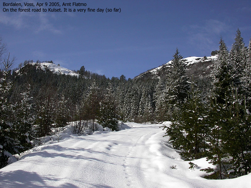
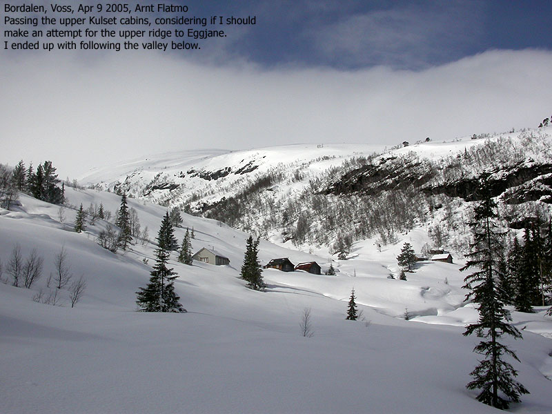
Follow the forest road upwards. After approx. 1,1Km (580m elevation), the road forks. Turn right and follow the road to the cabins at Kulset. Head towards the upper cabins and either ski the ridge above the cabins or head directly into the lower section of the Stordalen valley. Follow the valley upwards. The route is obvious, and the slopes are quite gentle.
NOTE: I have not skied the route explained in the following section:
Follow the valley all the way to Lake Storavatnet (962m). Once you pass 980m elevation, you head in and out of the 980m contours until you reach the lake. Follow the northeast shore towards the valley that leads to Lake Horgavatnet. When you reach the south drain from Lake Horgavatnet, it should be easy (according to the map) to ascend Eggjane from here. Return your ascent route.
Variation 1:
Just after having reached 980m elevation, I chose to ascend directly towards Eggjane. The entire hillside is quite steep (and the lower sections are the steepest), but if you are comfortable with skiing in such terrain, this route will save you approx. 2Km.
Variation 2:
It is probably possible to ascend the Eggjane east flank from Kulset. You may have to search for a place to ascend, but once on the flank, it is easy skiing upwards.
|
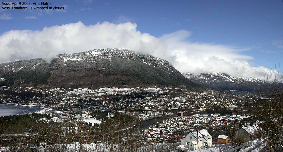
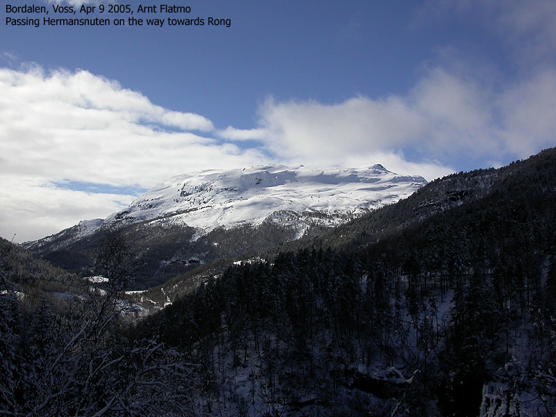
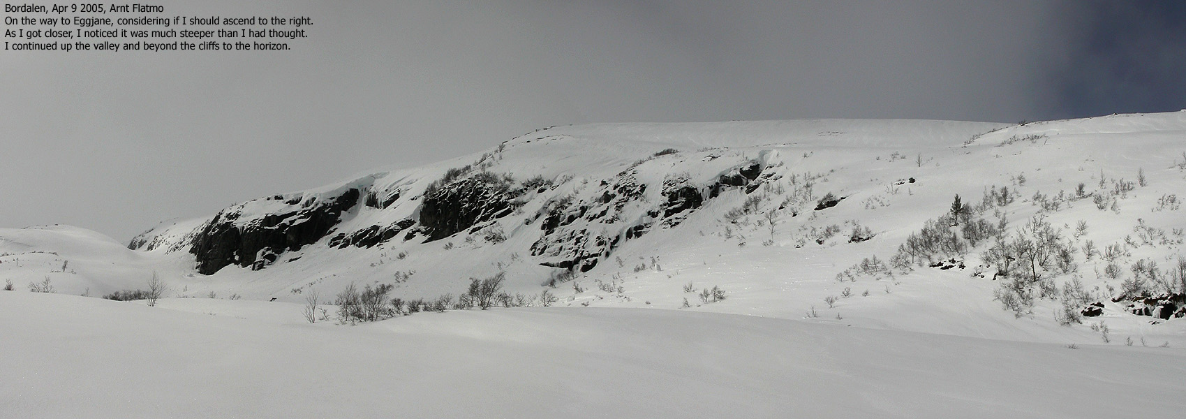
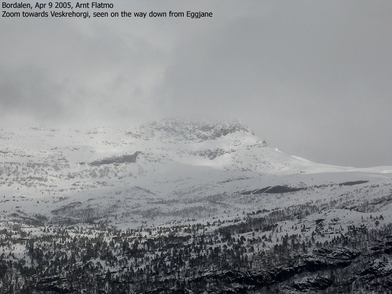
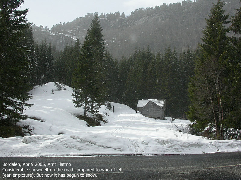
Trip report Apr 9 2005This Saturday morning, I woke up to considerable snow outside. I had hoped that spring had come and was here to stay. But in the northern regions, nature works in unpredictable ways. It was a beautiful day, though. Blue sky and sunshine was very promising for a day that was supposed to have not-so-good weather. Normally, I just put the gear in the car and take off. Not so today. I ran some "body diagnostics" and they showed a number of malfunctions. I had pulled a muscle in a leg that had kept me away from the mountains for 3 days. In addition, a muscle behind the rib bones had been bugging me off and on for some time. Today, it was "on". On top of this, I must have been sleeping in a very awkward position, as I could barely turn my head sideways. This poor condition was spiced up by a pounding headache, and there were no beers the night before to blame it on. I expected that the problems would get fixed once I got the body moving. On a beautiful day like this, I wanted to get above 1000m elevation, and picked Eggjane as the target. The snow was a concern, and I called a gas station in Voss. They told me that if I was heading towards Rong, I could not drive with summer tires. I had changed to summer tires a week earlier, but decided to switch back to spikes. Changing tires was just "great" for the headache. Now, I felt nausea on top of everything else. After a late start, I was on my way towards Voss. The road was snow-free until I got on the road towards Rong. The further in Bordalen valley I got, the more snow there was. I concluded that switching tires was probably smart, although I expected most of it to be gone upon my return. I found the trailhead right away, and was on my way 11:45AM. The leg muscle was put through a test with a dachshund ("Troll") in the backpack, Telemark boots and Telemark skis. I had forgot vax for the skis and had to put on skins. There was at least 10cm of fresh snow, and a trail had to be broken. The snow started to pile up under the skins, and progress was utterly slow. The unknown muscle behind the ribs caused tremendous agony, and when I reached Kulset, I was about to turn around. After a good rest, the pain was reduced and I decided to continue. I wished that Troll could walk on his own, but with all the fresh snow I didn't have the heart to put him down. The weather wasn't all that great anymore, and I was gradually moving into fog. When I reached 980m elevation, I could hardly see anything ahead of me in the valley. I noticed that there was a passage up between the cliffs above me, and decided to go for something that had to be a signficant shortcut (the plan was to ski to Lake Storavatnet and then ascend Eggjane from the west). As I passed 1050m elevation, the white-out was total. I had no clue what kind of terrain I was in, expect that according to the map, it was steepest in the lower parts. As I passed 1140m elevation, I got a glimpse of something black and incredibly steep above me. The map stated that there was a steep section here, so I kept a western course, aiming for the Eggjane southwest ridge. This plan worked quite well, and 14:20PM, I was on what appeared to be a high point. I took out the GPS which read 1269m and confirmed that I was on the high point. I was next to a distinct rock, with something that looked like a few minor rocks on top. But everything was frozen, so I couldn't quite tell. I knew that the trig. point (1266m) was 150m towards the east, and there would probably be a summit cairn. I decided to turn back around instead of locating the cairn. The reason for turning around was that I knew my tracks were vanishing by the minute. In addition to the white-out, it was snowing light and there was some wind. I had put some effort into making visible tracks on my way up, but every time I turned around, I could hardly see them. As such, I was a somewhat eager to see if my "stomping" did pay off. It did, and I was able to follow the contours of my tracks all the way down back to the valley. From there on, everything was much more enjoyable. Troll was able to run in my upward tracks, while I could enjoy fun skiing with a lighter load. I put him in the backpack as I approached Kulset, but only for a few minutes. He pretty much walked all the way down from the point we headed out of the fog. The descent was quick, and we were back at the car 15:30PM. It was now snowing in the lowlands, but very light. Troll had earned lunch and ate with big appetite while I was packing up. All in all, the body felt better after this short trip, so it was definitely worth it.
|
Move cursor to read notes, and click on the images to see full version.
Some of the thumbnails may have been cropped to fit the format.


No Javascript:
1 2 3 4 5 6 7 8 9 10 11 12 13 14 15 16 17 18 19 20 21 22


No Javascript:
 Other hordaland mountains
Other Voss K. mountains
westcoastpeaks.com
Other hordaland mountains
Other Voss K. mountains
westcoastpeaks.com

