
Norwegian Mountains, Møre og RomsdalBløkallen, 522m
|
| Fylke/Kommune : | Møre og Romsdal/Midsund |
| Maps : | 1220-III Brattvåg (Statens Kartverk, Norge 1:50 000) |
| Primary factor : | Bløkallen: 522m |
| Primary factor : | Litlekulten: 103m |
| Hiked : | Jan 2007 (Bløkallen), Dec 2007 (Litlekulten) |
| See also : | Rossfjellet |
| See also : | Drynjahatten |
| See also : | Klausethornet |
| See also : | Ræstadhornet |
| See also : | Oppstadhornet |
| See also : | Other Midsund mountains |
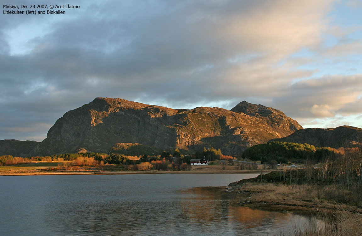
Litlekulten and Bløkallen
(Click for larger image)
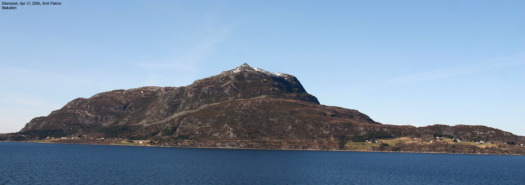
Bløkallen is a pointy top and a distinct coastal landmark. Its location is Midøya, one of several islands north of Midfjorden. Access is fairly easy, both in terms of transport and route. Whether you travel from Ålesund or Molde, only one ferry is required.
On the way to Bløkallen, you can choose between a trivial route or a steep route along the north ridge. A fixed rope is found (unless it has gone rotten and has been removed) on the north ridge, which should help you advance the most difficult section. This web page will describe a more trivial approach to the top.
Once on Bløkallen, you have the option to include Litlekulten (446m) on your hike. Litlekulten is an independent top, located 1,2Km northwest of Bløkallen. You have an excellent view towards the Haram/Vestnes coastal tops from Bløkallen.


Bløkallen (Norge 1:50,000: 522m, Økonomisk Kartverk: 521,56m, UTM 32 V 378563 6950455) has a primary factor of 522m, being the highest point on Midøya island.
Litlekulten (Norge 1:50,000: 446m, Økonomisk Kartverk.: 446,5 , UTM 32 V 377473 6950987) has a primary factor of 103m towards the higher parent Bløkallen (522m). The defining saddle (approx. UTM 32 V 378320 6950266) is found south of Lake Bløvatnet. Ref. Økonomisk Kartverk (5m contours), the saddle is within the range 340-345m, interpolated to 343m.
Google's interactive map. You can zoom, pan and click on the markers.
|
|
|

Notes: Class ratings are in reference to YDS. Click here for more information.
The trails described below are not necessarily the *easiest* trails to this mountain.
|
Route #1: Blø - Bløkallen (summer/autumn)
|
|
Access
(all distances are approx. distances)
From Ålesund, follow highway E136->E39 towards Åndalsnes. From the E136/E39/Olsvika roundabout near Breivka, follow E39 13,3Km. Turn left onto highway RV661 (Skodje/Brattvåg/Vatne). Pay toll at an unmanned toll booth (coins + credit cards, AutoPass) 1,5Km later. 8,7Km after you left E39, you reach the 659(Brattvåg)/661(Vatne) junction. Turn left towards Brattvåg.
13,6Km later (from this junction), turn right towards the ferry to Dryna, and continue 600m down to the ferry harbor.
On Dryna, turn right and drive 4,7Km to a junction. You have two options. Either go right (Ramsvik) and drive 4,9Km on a narrow, gravel road, or turn left (Molde/Midsund) and drive approx. 6.6Km to the Bløkallen trailhead. This road - RV668 - is the recommended one.
The Bløkallen trailhead is 1,1Km from the Ramsvik/Molde junction, and is marked by a trailsign in front of (north of) a red building. You will find parking on the other side of the road.
The route

The routes to Bløkallen/Litlekulten
Follow a narrow path up the forest (westbound). Your trousers will get wet after wain. At approx. 170m elevation, when you top out in a small valley, look out for an unsigned trail fork. Go left. Follow the path southbound up to approx. 280m (by the stick). Turn left here. The path to the right runws towards Litlekulten.
Once In front of the north ridge, you must decide if you want to go for the steep section, or stay on the west side until you reach a couloir that runs between the two tops.
In the couloir, turn gradually right (and get out of the couloir) and then continue
straight up to the summit. Approach the summit from your right hand side (west).
|
Route #2: Blø - Litlekulten (summer/autumn)
|
|
Access
(all distances are approx. distances)
See access for Bløkallen above.
The route
Follow a narrow path up the forest (westbound). Your trousers will get wet after wain. At approx. 170m elevation, when you top out in a small valley, look out for an unsigned trail fork. Go left. Follow the path southbound up to approx. 280m (by the stick). Turn right here. The path to the left runws towards Bløkallen.
Follow the path along the ledge. You ascend the mountain plateau next to a stream. The path turns towards the west, but seems to end by a large rock with a small cairn on top. From here on, just aim for Litlekulten and follow the terrain where you see fit. The high point (marked by a few rocks) is found on the west side of the summit plateau.
 westcoastpeaks.com
Other Møre & Romsdal mountains
Other Norwegian mountains
westcoastpeaks.com
Other Møre & Romsdal mountains
Other Norwegian mountains


