
|

Blåvasshorgi seen from Kvamsnovi(No Javascript) |
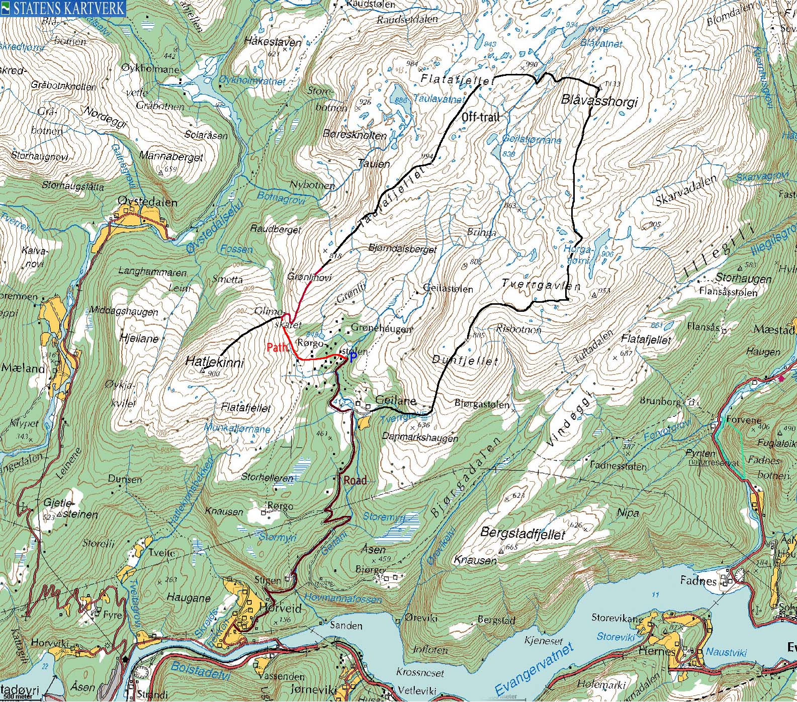
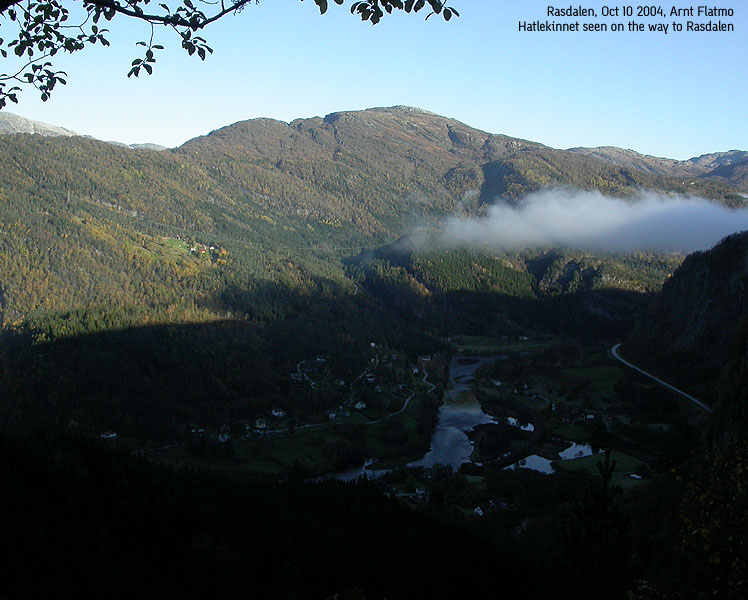
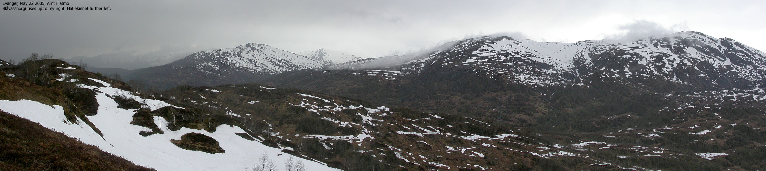
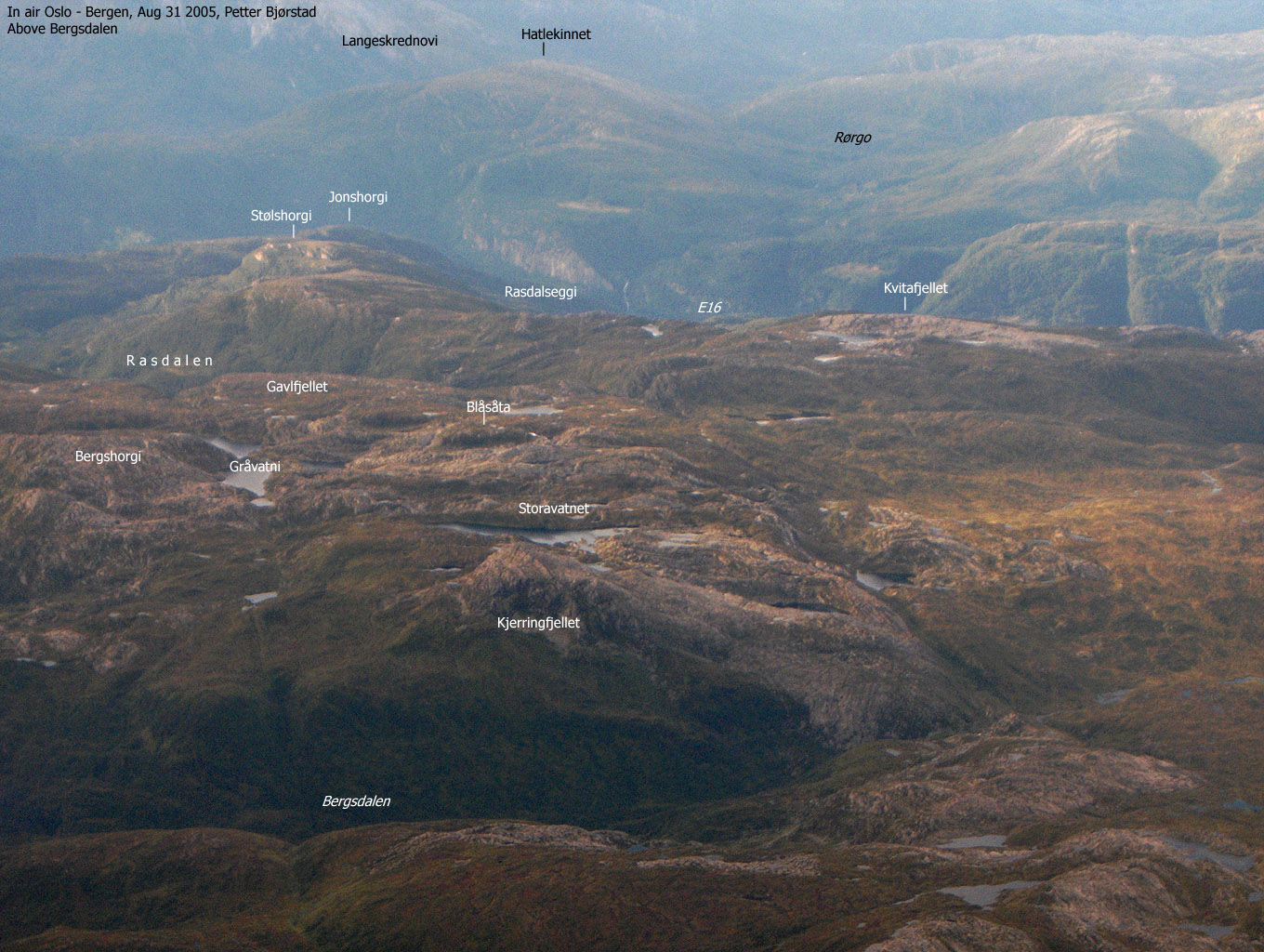
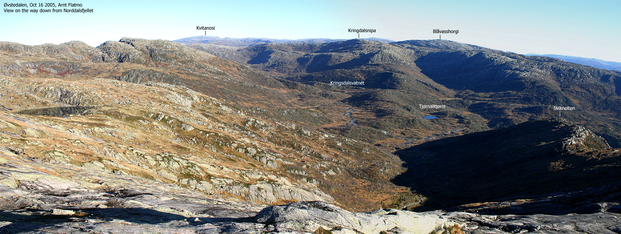
Blåvasshorgi is the dominating mountain in the southwest part of the Stølsheimen mountain range. The mountain dominates an area defined as north of highway E16, east of Eidslandet, south of Eksingadalen and west of Teigdalen. Blåvasshorgi and Storafjelli forms a horseshoe through a high mountain ridge between the two mountains. The Øvstedalen valley lies between Blåvasshorgi and Storafjelli. Hatlekinnet is located southwest of Blåvasshorgi, but is part of this high mountain range.
Blåvasshorgi and Hatlekinnet are accessible to the public from Rørgostølen. One may drive a car all the way up to 490m elevation, and follow a trail above the treeline. Although it is a long hike, it would be natural to include Hatlekinnet on your way to Blåvasshorgi.
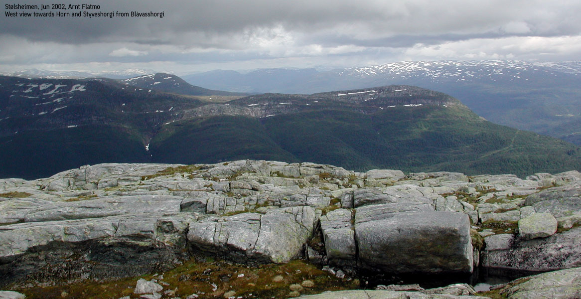
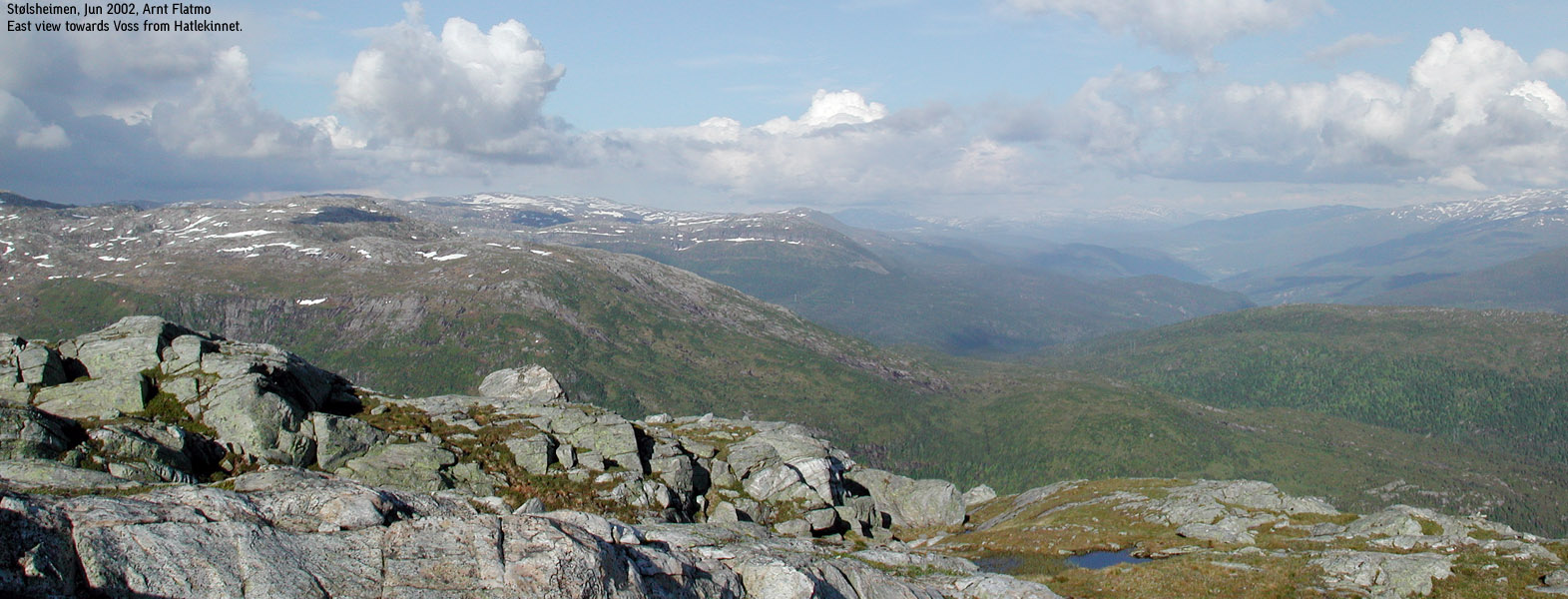
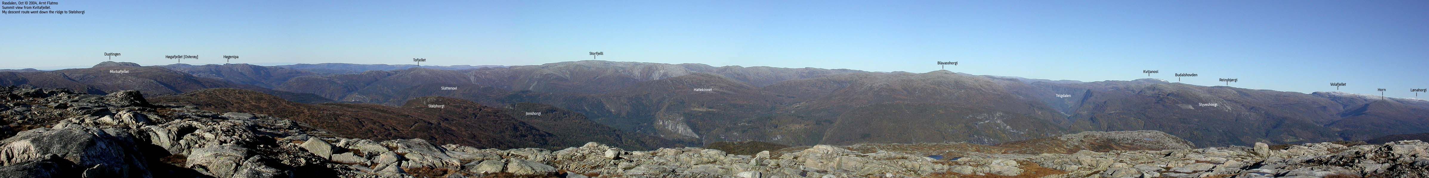
The views from Blåvasshorgi are indeed good. There are no other mountains obscuring the view in near proximity, thus you can enjoy the northern Bergsdalen mountains, the high mountains towards Voss, Stølsheimen view towards Kvitanosi and northwest view towards the Matre mountains.
Primary factor:
Blåvasshorgi (1133m) has a primary factor of 403m towards the higher Kvitanosi (1433m). The saddle is found along the road between Nesheim and Evanger. More precise, at Vinningsleitet above (south of) Nesheim. Ref. the M711 map (20m contours), you cross the 740m contours on the high route, but not 720m. The saddle height has been interpolated to 730m. (Økonomisk Kartverk has no detail map of the area where the saddle is found)
Hatlekinnet (900m) has a primary factor of 257m towards the higher Blåvasshorgi (1133m). The saddle is found in Glimyrskardet pass between the two mountains. Ref. Økonomisk Kartverk (5m contours), you cross the 645m contours on the high route, but not 640m. The saddle height has been interpolated to 643m.
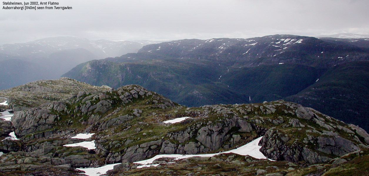
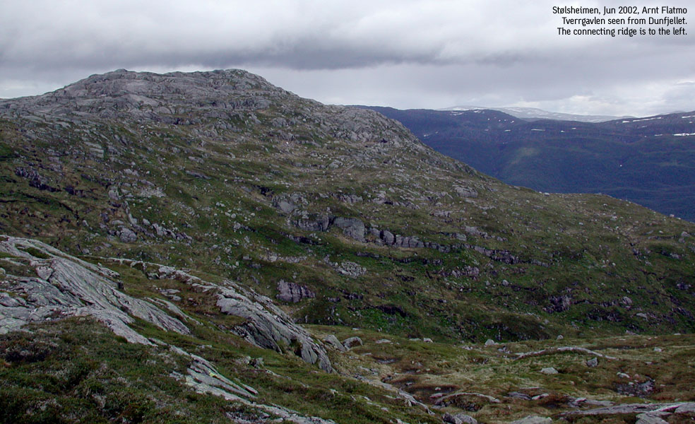
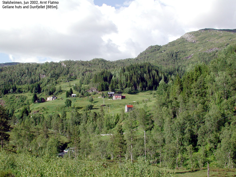
Other named points mentioned on this page are Tverrgavlen (height 990m, primary factor 42m) and Dunfjellet (height 883m, primary factor 20m). Dunfjellet's height is given as 885m on the M711 map.
Notes: Class ratings are in reference to YDS. Click here for more information.
The trails described below are not necessarily the *easiest* trails to this mountain.
|
Rørgo - Hatlekinnet - Blåvasshorgi round-trip (summer/autumn)
|
|
From Bergen, follow highway E16 towards Oslo. Roughly 65Km from Bergen, notice the exit signed "Bolstad Stasjon". Continue 3,1Km along highway E16, from the "Bolstad Stasjon" exit and turn left just after a bus-stop. Drive down to the river and cross via a bridge. Turn right towards "Horvei" and follow this road 600-650m. Then turn right and continue on a smaller road for approx. 300m. Stop and pay at the self-service toll station (don't remember the fee, I assume it was in the NOK 20-40 range).
You may consider parking here, and walk the remaining 5Km up to Rørgo. If you choose to drive, follow the forest road and turn right in a fork after 2,6-2,7Km ("Rørgo Hyttegrend") Then drive until the road ends at Rørgo. There is plenty of parking, for the most part reserved for the cabin owners. Find guest parking.
Hatlekinnet
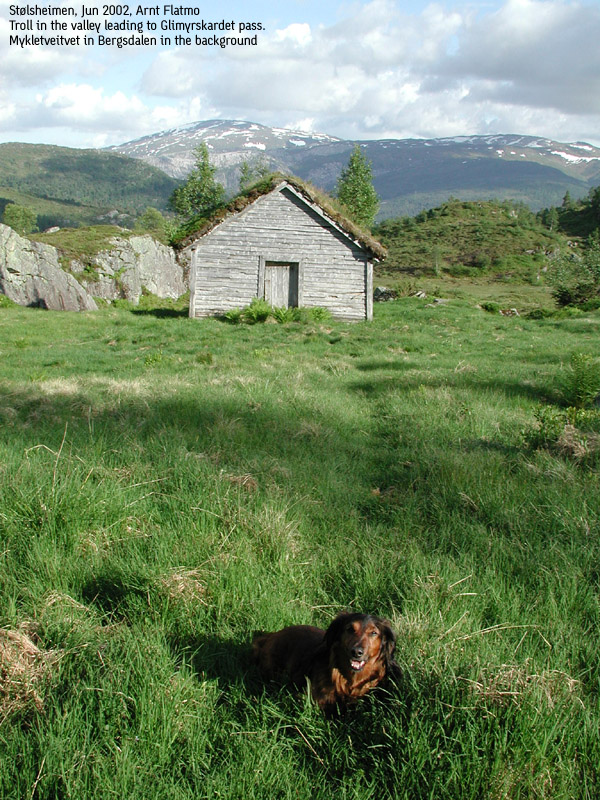
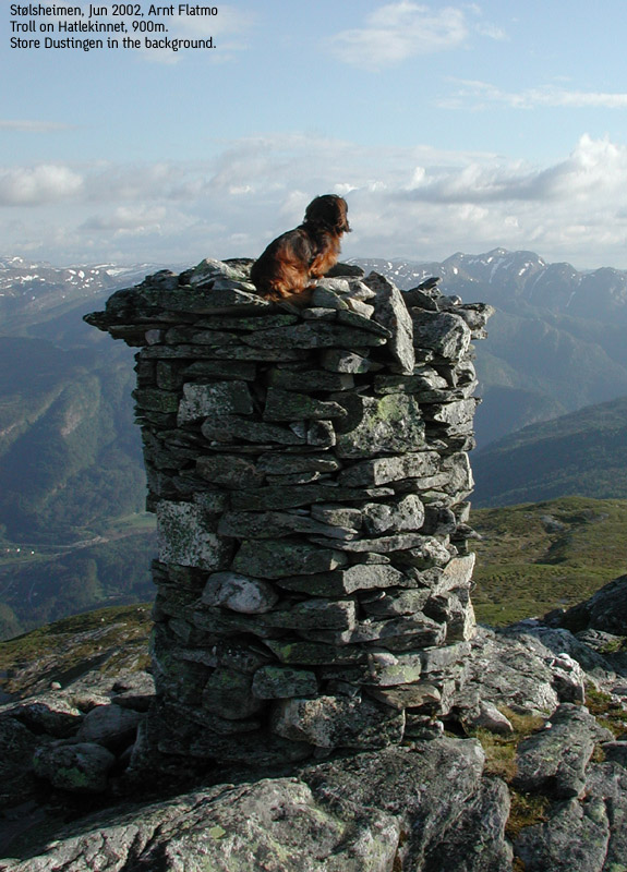
I recommend you start with Hatlekinnet. From the parking, facing Hatlekinnet, there are two paths. Follow the rightmost path between the cabins. Pass the "Fjellsbu" cabin on your right hand side and follow a path to the valley leading up to Glimyrskardet pass. In this valley, you pass two older cabins. From Glimyrskardet, turn left and walk up to Hatlekinnet. Don't rely on trails here. You're over the treeline and may simply walk upwards until you reach the top. Hatlekinnet has (per June 2002) three large summit cairns.
Blåvasshorgi
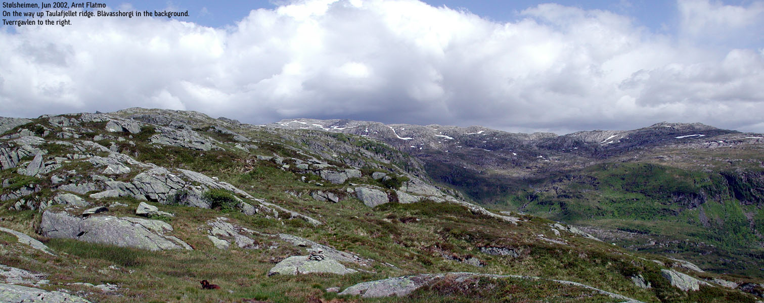
Descend back to Glimyrskardet and locate a path that leads up the ridge towards Taulafjellet. Nothing much needs to be said about this ridge walk. From Taulafjellet high point (894m), head towards point 990m, but turn east before the terrain rises towards point 990m. Descend down to a lake and pass on the south side. The terrain now turns a bit rougher. First, gain a ridge above the lake and follow it upwards. Next, descend eastbound from this ridge in order to gain another ridge. Follow this ridge northbound up to 1040m elevation before you turn east and set your course for Blåvasshorgi summit, which is defined by a large cairn.
Descent
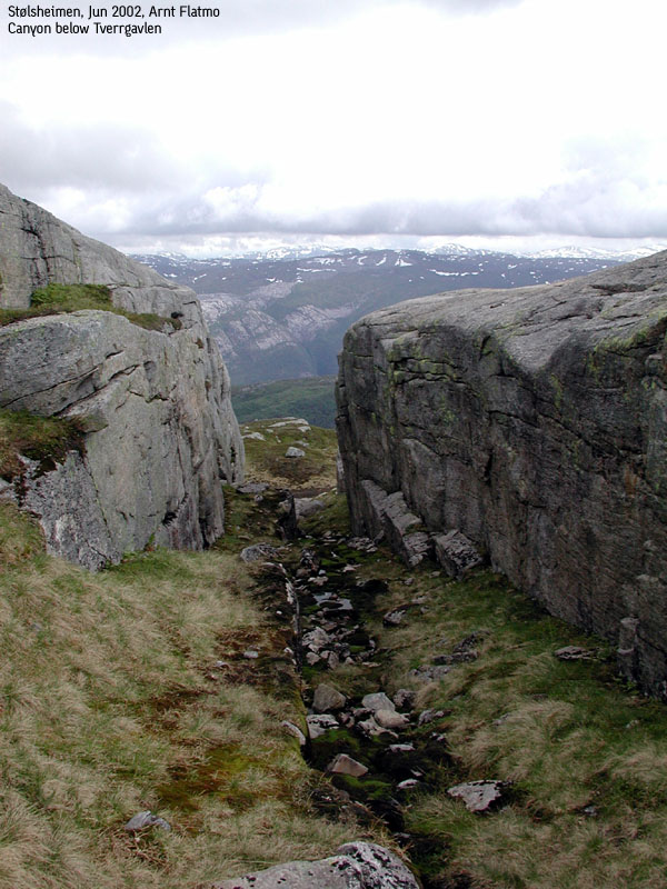
From Blåvasshorgi, head straight south towards Tverrgavlen high point 990m (height from Økonomisk Kartverk). From Tverrgavlen, head southwest towards the high ridge towards Dunfjellet. This descent involves a number of cliffbands and routefinding. Having to descend here in dense fog is most likely not what you'd be happy to do. Head over Storenipa (name found on Økonomisk Kartverk map) and then up to Dunfjellet.
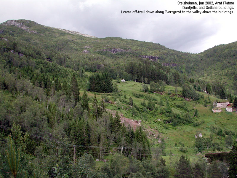
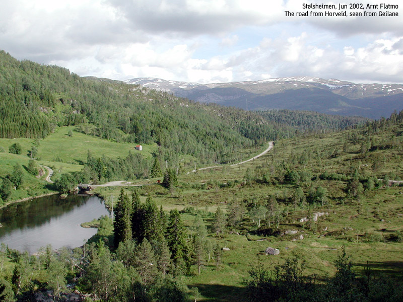
From Dunefjellet, descend down to a meadow just north of Danmarkshaugen. The lower part of this descent involves crossing long slabs, very slippery when wet. Routefinding is also necessary here. The creative task for the day is to find a good path along the stream down to Geilane. Don't be afraid of taking on some bush. From Geilane huts, head down to the forest road and then back up to the parking.
|
Pictures from the Blåvasshorgi hike, June 29 2002Inspired of the nice Hatlekinnet half a month earlier, I decided to go back and visit Blåvasshorgi. I never got around to write a trip report and I am publishing this page 2,5 years later. The nitty gritty details from the hike have escaped me, but I remember it to be a very nice round-trip hike (not including Hatlekinnet this time).
Move cursor to read notes, and click on the images to see full version.
No Javascript: 1 2 3 4 5 6 7 8 9 10 11 12 13 14 15 16 17 18 19 20 21 22 23 24
|
|
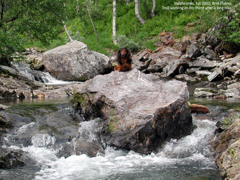
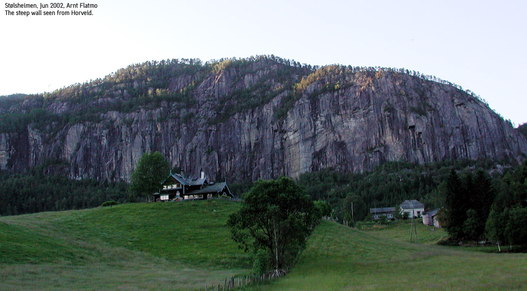
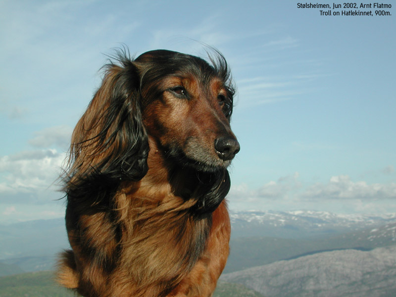
Trip report Hatlekinnet, June 14 2002This was a Friday, and after work I felt a need for an afternoon hike. After all, it had been raining for three days straight, and I was in need for some footwork. I scanned the map, trying to find something in the "neighbourhood". My eyes fell on Hatlekinnet. I never noticed this mountain before, but it matched all my search criteria: a) close by b) ranked (primary factor >= 100m) and c) a trail leading up the mountain.An hour after I left Bergen, I parked my car at Horveid. I did not get tempted by the forest road that obviously led to Rørgo. There was no road on my map, so I was already mentally prepared for the hiking distance up to the cabins. I tried to gain some tempo, but I could see from the length of Troll's (the dog) tongue that the pace had to decrease. The sun was burning and I was wearing cotton all over. I had expected afternoon showers and some winds, but was about to get neither. One hour and fifteen minutes later, we were on the trail up the mountain. I had no clue how to find the mountain trail, because of all the cabins. Fortunately, I picked a path that took us straight to the little valley that runs up the Glimyrskardet pass. Besides the stream alongside the gravel road, there was a creek running down this valley, so we both got our constant need for water satisfied. It was a nice hike altogether. The afternoon weather was excellent, and I considered spending an hour or two on the summit. But after 15 minutes, our restless souls brought us back to the car, 4 hours after we left it.
Pictures from the June 14 2002 hike
Move cursor to read notes, and click on the images to see full version.
No Javascript: 1 2 3 4 5 6 7 8 9 10 11 12 13 14 15 16 17 18 19 20
|


No Javascript:
1 2 3 4 5 6 7 8 9 10 11 12 13 14 15 16 17 18 19
Other hordaland mountains
 Other Voss K. mountains
westcoastpeaks.com
Other Voss K. mountains
westcoastpeaks.com


