
To the main Blåtind page
My colleague Kjetil (who lives in Haddal) had explained the trailhead and the general route, and 16:20PM I was on my way from the trailhead by the old shack in Ringstaddalen. I had chosen to bring skis even if snowshoes would have been more practical. From distance, it looked as if I could ski the long snow gullies, but this turned out to be a wrong decision.
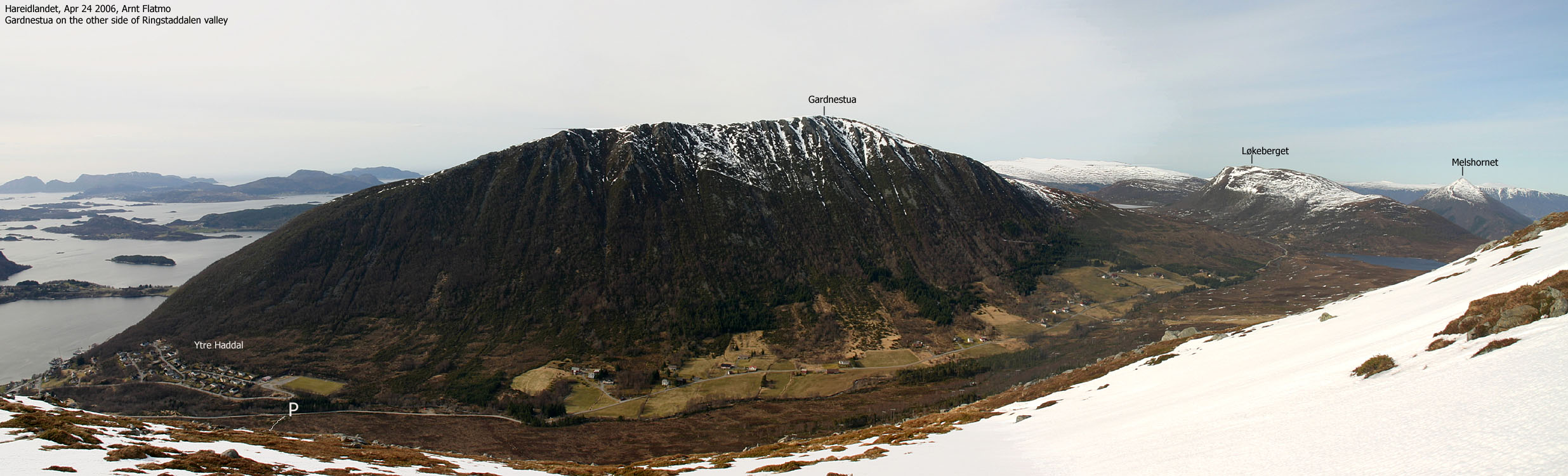
My dog "Troll" wasn't interesting in walking on the *very* wet path from Ringstaddalen and here I was on my way on this very warm evening, with the dog in the backpack, my skis over the shoulder, my poles in my left hand and Scarpa T4's on my feet. Even if I was sweating like crazy, I had a fair progress until I reached the snow. The snow reached up to my knees and was soft as butter. I had no choice but to put the skis on.
Skiing was a true nightmare. After a few minutes, I chose to ski on the juniper bush, rather than the snow. In this bush-snow-bush-snow-bush-snow terrain, I could neither ski nor walk efficiently. It took me 1h:25m to ascend 500 vertical meters, which is normally done in well under the hour. Above 500m, skiing was just a pleasure, and Troll followed willingly in my tracks. As I approached the summit, I saw lots of cornices and wondered if I had to dig my way up to the summit. But the ridge I followed was the perfect gateway to the summit, and 18:00PM, I was standing on the top of Blåtind.
I took immediately shelter behind the cairn, as the gale-force wind was insanely cold. I had been looking forward to take a 360 panorama picture, but this wasn't possible because of the narrow high point where the cairn blocked a large portion of the view. I dug a slot for the dog and gave him lunch while taking the pictures.
I left the summit 18:20PM and had 2 minutes of excellent skiing before I ran out of snow. I let the dog out of the backpack and followed a more direct line towards the trailhead. This direction led me to the top of a long snow gully, and I decided to glissade. I told the dog to stay behind (he knows that command) and we headed down. Me on my ass, whirling up large piles of snow which resembled small avalanches, and the dog behind, floating on his belly.
The only scary moment occured halfway down the gully. I looked back to see how the dog was doing, but couldn't see him. Then, to my left, I witnessed the dog passing me on top of a huge pile of fast-moving snow. As the hillside was steep, I felt strongly for reducing his descent speed. The only way I could reach him, was through my poles, which I had in my hand. I reached out for him and decreased his speed with my poles, allowing me to catch up and get hold of him. I looked down on the houses at Ytre Haddal and wondered if anyone were witnessing this unordinary descent of Blåtind.
The descent was quite swift, and we reached the trailhead 18:55PM, 45 minutes after leaving the top. The plan was to stop by the Melshornet trailhead and look for the keys I lost one month earlier, but since I was en route for the 19:30PM ferry, I decided to look for the keys later on.
To Blåtind


50mm panorama, annotated, 2 parts


Wide-angle panorama, not annotated, 2 parts


Zoom panorama, 2 parts


Other summit pictures


No Javascript:
1 2 3 4 5 6 7 8 9 10 11 12 13 14 15 16 17 18 19 20 21
 westcoastpeaks.com
Other Møre & Romsdal mountains
Other Norwegian mountains
westcoastpeaks.com
Other Møre & Romsdal mountains
Other Norwegian mountains