
Norwegian Mountains, Møre og RomsdalBlåfjellsegga, 1285m
|
| Fylke/Kommune : | Møre og Romsdal/Volda | ||||||||||
| Maps : | 1219-III Hjørundfjord (Statens Kartverk, Norge 1:50 000) | ||||||||||
| Primary factor : | 115m | ||||||||||
| Hiked : | May 2009 | ||||||||||
| See also : |
| ||||||||||
| See also : | Other Volda mountains |

Blåfjellsegga
(Click for larger image)
Blåfjellsegga (1285m), Kvanndalshesten(1289m) and Litledalshornet (1226m, also known as Aurstadnipa) form a horseshoe around Kløftedalen valley. These three tops are part of a mountain range that stretches between Volda and Sjåstaddalen, with Kvasshornet/Jolhornet (1409m) as the highest peak. Snøhornet (1309m) is the closest peak to the west, while Storetinden (1408m) is the closest peak to the east.
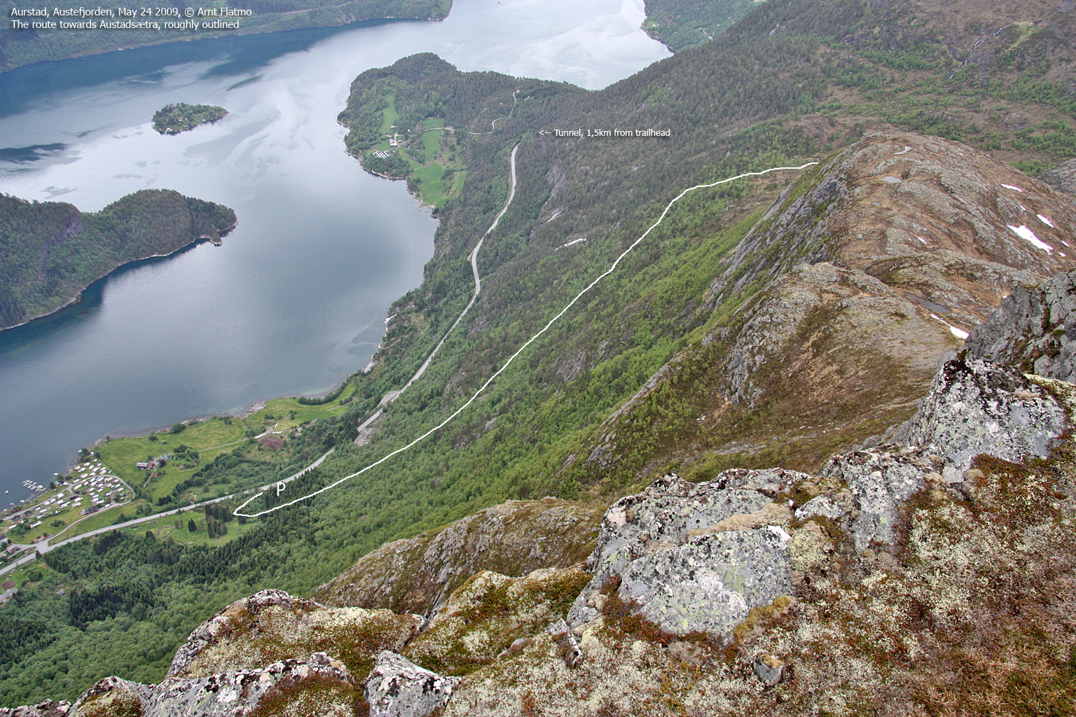
The normal route to Blåfjellsegga runs from Aurstad by Austefjorden. A very good path takes you to Lake Aurstadsætervatnet (456m) and from there on it's mostly off-trail along two different routes. One route runs up Kløftedalen valley, while another runs along the west ridge. This page will describe access along the west ridge.
The hike to Aurstadsætervatnet (and Aurstadsætra by the lake) is a nice family hike, but the onward route up the mountain - especially along the west ridge - is only recommended for experienced hikers. The route is not exposed, but there is a steep slab section that requires routefinding. The route via Kløftedalen is probably the easiest route to Blåfjellsegga, and is the recommended route for a ski-trip.

Blåfjellsegga seen from Veirahaldet
(Click for larger image)
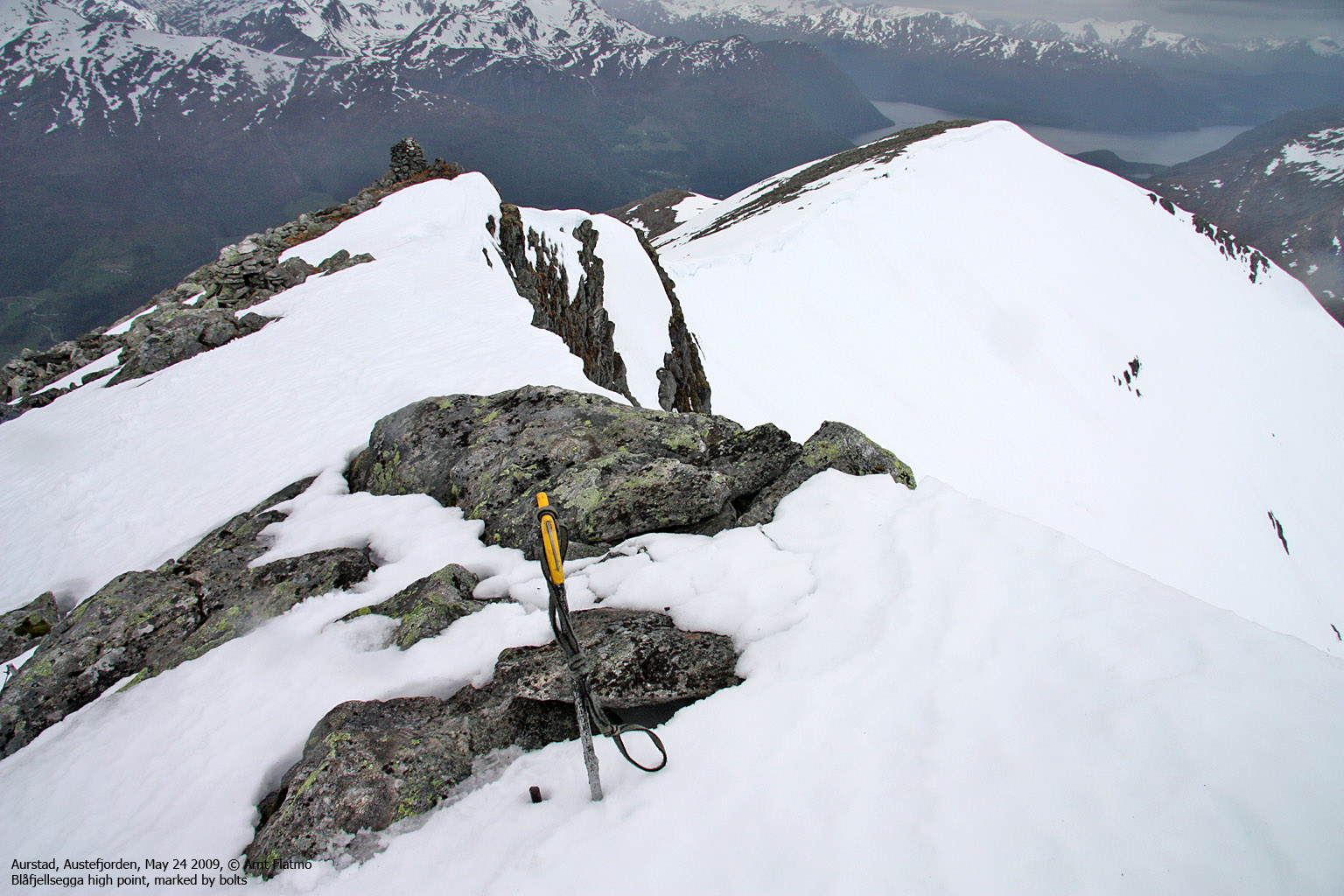
Blåfjellsegga (Norge 1:50,000: 1285m, Økonomisk Kartverk: 1284,90m, UTM 32 V 360699 6887724) has a primary factor of 119m towards the higher parent Kvanndalshesten (1289m). The defining saddle (approx. UTM 32 V 361137 6888360) is found in the saddle between the two tops. Ref. Norge 1:50,000 (20m), the saddle is within the range 1160-1180m, interpolated to 1170m.
GPS measurement read 1286m (on the ground), averaged over a 4-minute period (error margin +/- 3,3m). The summit cairn is found 50m southwest of the high point.
Google's interactive map. You can zoom, pan and click on the markers.
|
|
|
|
Route 1: Aurstad - Blåfjellsegga (summer/autumn)
|
|
Access
(all distances are approx. distances)
The nearest bigger city is Ålesund. From Ålesund, follow highway E39 towards Bergen/Volda to the ferry at Solavågen. Take the ferry over to Festøy, turn right at Festøy and follow E39 towards Ørsta (38,3Km). At the highway RV655/E39 junction in Ørsta, keep following E39 (Volda) for 9Km until you have the ferry harbor in Volda on your right-hand side.
Drive 750m along RV651 through Volda and turn left at the Andaneset junction (signposted). Drive 800m up to a roundabout. Take the first exit (RV651, Fyrde) and follow this road 15,1km. You have a turnout on your left-hand side, and you came out of a tunnel 1,5km down the road. Park here. If you see the Aurstadsætra signpost, you are definitely at the right place.
The route

The route
(Click for larger image)
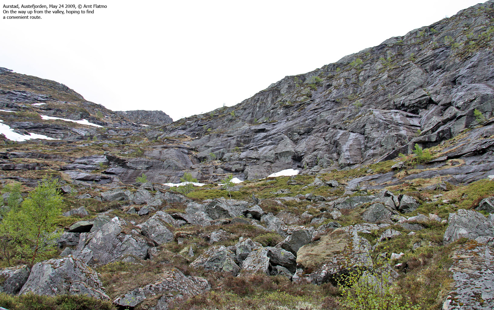
Locate the Aurstadsætra signpost and follow the path until you reach a fence. Turn sharp left and follow the path up the forest. You'll enter a pine forest, and the path runs close to the fence before it turns northwest. Part of the route towards the river runs across boulder, and a large amount of labour has been put into this path (most likely to get horses across).
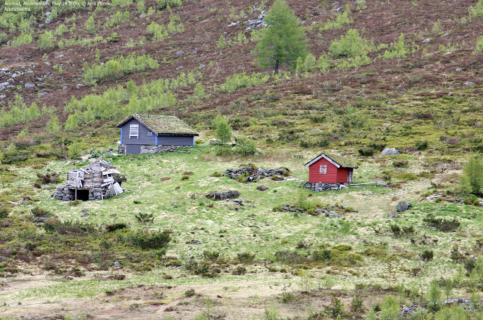
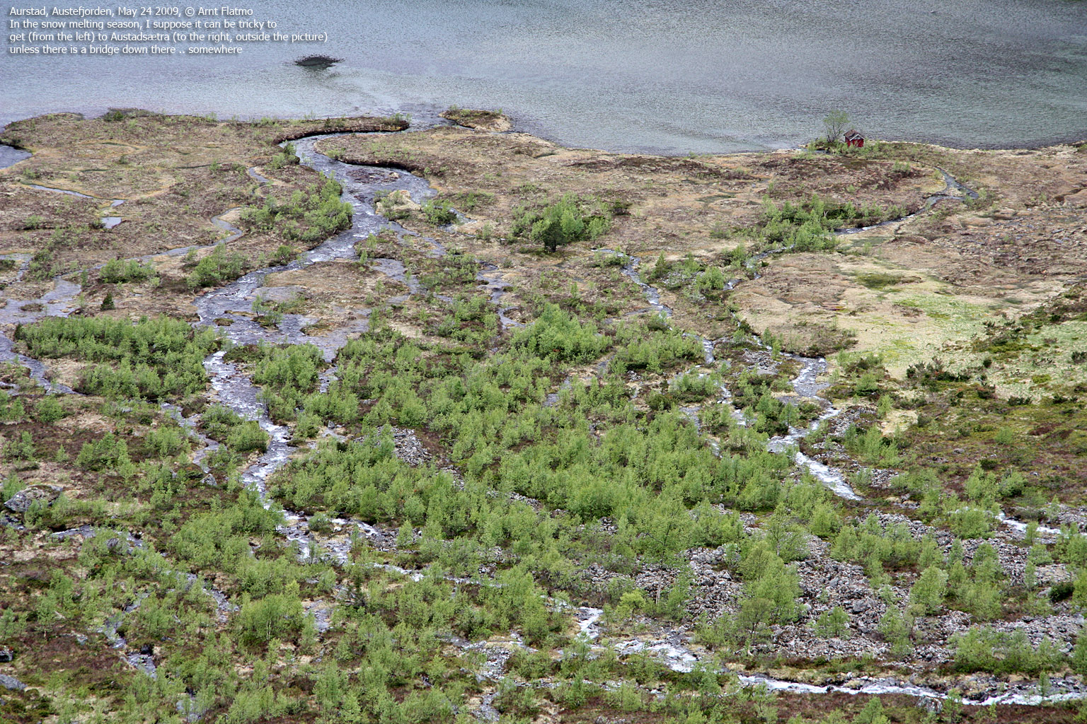
When you get to the river, the path turns north/northeast and takes you to Lake Aurstadsætervatnet. Aurstadsætra cabins can be seen on the other side of the (many) streams that drain into Aurstadsætervatnet.
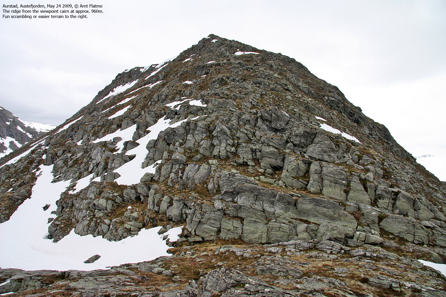
Leave the path and turn right when you get to the first stream. Follow the stream upwards until you reach a slab area that will take you up to the west ridge. Routefinding is necessary here. Once above the slabs, head upwards and pass a steep section of the ridge to the left. Then turn right and aim for a viewpoint cairn located between the 960 and 980 contour (the GPS reported 1003m at this point).
From here, follow the west ridge all the way up to the summit. The high point is 50m northeast of the Blåfjellsegga cairn. The summit ridge may seem sharp from a distance, but it is quite gentle when you get there.
Descend your ascent route, continue along the ridge in direction of Kvanndalshesten, or descend via Kløftedalen.

The route from the lake
(Click for larger image)
 westcoastpeaks.com
Other Møre & Romsdal mountains
Other Norwegian mountains
westcoastpeaks.com
Other Møre & Romsdal mountains
Other Norwegian mountains


