
|

Beljaråsen seen from RV 48(No Javascript) |
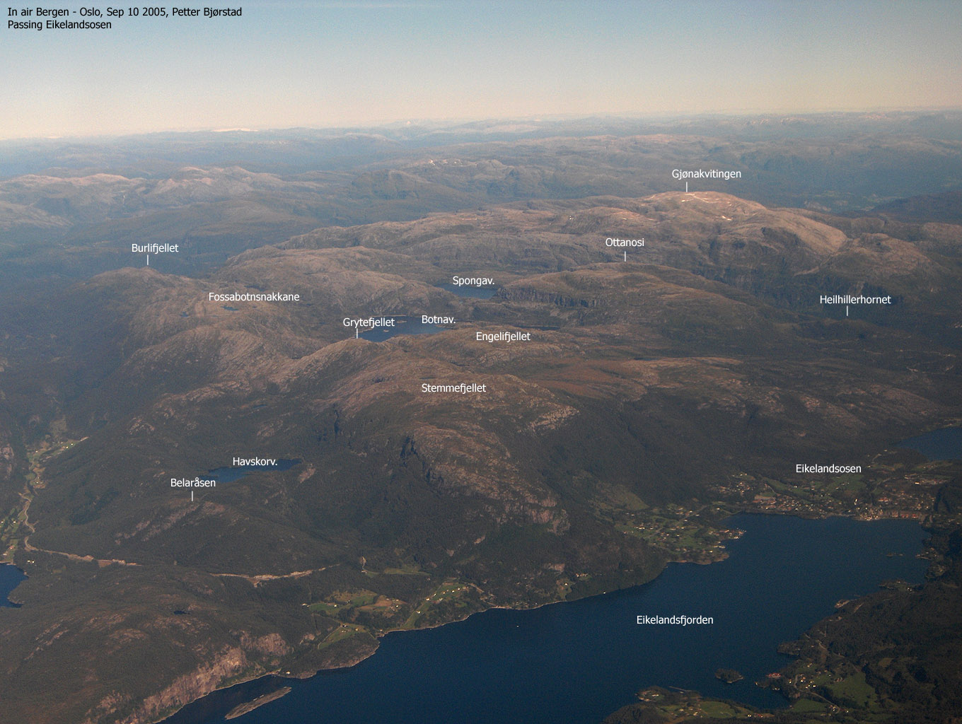
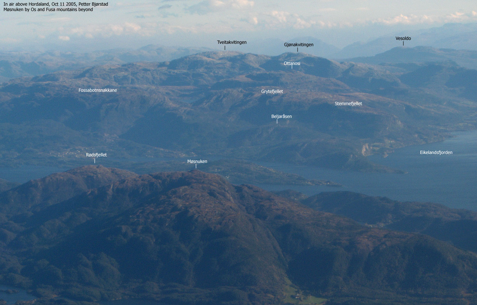
Beljaråsen is a good viewpoint, located above where Eikelandsfjorden meets Samnangerfjorden. A (surprisingly) large cairn marks the top of this forest hill, which suggest that some people enjoy visiting this top. Unfortunately, this page will not offer any trail descriptions, just a clue on how to fight your way to the top through an obnoxious jungle of bush. The paths (providing they are there) most likely run from the north (lake Havskorvatnet) or from the forest road that runs from RV 48 up to Havskorvatnet.
I don't know where the name originates from, but it gives me associations to bellows - the thing you use with your fireplace, keeping the coal or wood burning. With a vivid imagination, I could imagine this description would be taken from the summit plateau. The series of cliffbands are quite distinct, but my point is more comprehensible when viewed "live".
Beljaråsen (M711: 395m, Ø.K: -) has a primary factor of 102m towards the higher Stemmefjellet (771m). The saddle is found between Beljaråsen and Skardsnuten, near Havskorvatnet. Ref. Økonomisk Kartverk (5m contours), you cross the 295m contours on the high route, but not 290m. The saddle height has been interpolated to 293m.
Notes: Class ratings are in reference to YDS. Click here for more information.
The trails described below are not necessarily the *easiest* trails to this mountain.
|
RV 48 - Beljaråsen (summer/autumn)
|
|
From Bergen, follow RV E16 towards Oslo. At the E16/RV 7 junction (roundabout) at Trengereid, turn right onto RV 7. Drive across Gullbotn, down to Samnangerfjorden, pass Bjørkheim and two tunnels before you turn right onto RV 48. Follow RV 48 for approx. 19,6Km. You're now on top of a hill. Find parking on one of the nearby turnouts.
There's no trail in this description. Just hard work and evil bush. Head up the forest towards the high ridge that runs north-south. Follow this until you reach a high cliffband that runs east-west. There are a couple of obvious ways up here. Above these cliffs, you have excellent views towards Eikelandsfjorden and Fusafjellet. Proceed across a plateau and hike up minor cliffbands. Seek right before the forest and then walk through the tiny summit forest. The summit is marked by a huge cairn. Descend your ascent route.
|
Trip report Oct 24 2004I had just hiked Tirsåsen and decided to finish off a large mountain region by hiking Beljaråsen. My plan was to walk up the forest road that runs between RV 48 and lake Havskorvatnet. When I saw a heap of cars near this forest road, I assumed a large hunting party was nearby, and I decided to approach Beljaråsen from the west side. We left the car 14:35PM.I considered leaving Troll in the car, as it was apparent that he couldn't walk in this forest. But I ended up carrying him up the forest. I switchbacked up the hill, trying to find a path. Found a few sheep or deer paths here and there, apparently not leading to the top. I tried to find ways around the juniper bush jungle, but often had to walk straight through. Once on the high plateau, things were much easier, and by 15:25PM, we were on the summit. I was stunned about the large cairn on this forest hill. Troll finally got his lunch-box. Not fully earned, but the dog has to eat. After a short summit stay, we were back in the car 16:05PM. I was in no way successfull sticking to the same route on the way down, and if possible, my descent route was worse.
Pictures from the Oct 24 2004 hike
Move cursor to read notes, and click on the images to see full version.
No Javascript:
|


No Javascript:
Other hordaland mountains
 Other Fusa K. mountains
westcoastpeaks.com
Other Fusa K. mountains
westcoastpeaks.com


