Hordaland Mountains: Askøy |
|
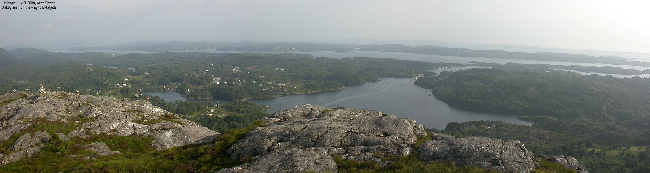
| Askøy island is a close neighbour
to Bergen, only separated by Byfjorden. Askøy is connected to the mainland via the Askøy toll bridge, but many people still commute via
express boats. Highway 555 is the main road between Bergen and Askøy. Over 20,000 people live on the island, and Kleppestø is
the kommune centre. The island is nearly 25Km long, from north to
south, and is
surrounded by a number of smaller islands. Herdla and Hanøy are among the
larger of these islands.
On the north side of the island, you will find the Herdla nature preserve, rich on birds. 224 bird species had been recorded by 2003. If you visit the Herdla museum, you will also learn about the activities that took place during World War II, and the landing strip for airplanes built by the Germans. Before 1965, Herdla and Askøy were two separate kommuner. As mentioned below, there are no mountains exceeding 300m elevation on Askøy island. The highest point - Kolbeinsvarden (231m) is the primary viewpoint on the island. Kolbeinsvarden is located only 11,8Km northwest of the Ulriken tower, and provides good views towards the Bergen city mountains.
Askøy is good for many types of leisure activities, from surfing, sailing, diving to cross-country skiing and hiking. Vågen on Herdla offer good conditions for surfing. A number of climbing routes also exist on Askøy. Click here for a climbing guide and information provided by Askøy Klatreklubb. (the page is in Norwegian)
|
Map of Hordaland. Copyright Hordaland
Fylkeskommune.
The Askøy bridge is a suspension bridge, built in the period 1989-1992, and has a main span of 850m.
|
General information:
Below is the list of independent mountains, sorted by
various categories.
Names and heights originate from Statens Kartverk (M711)/Norgesglasset
(20m contours) or Økonomisk Kartverk (part of Norgesglasset, 5m contours). The
height from Ø.K. override the M711 heights. A number of mountains may have a point higher than the
M711 trig. point marked on
the maps. Note also that if the high point of a mountain lies within
another kommune, the mountain is listed under that specific kommune. If a
mountain high point is shared by two kommuner, the mountain is listed under both
kommuner. The asterix (*) means that the high point is
(exactly) found
on a kommune
border.

There are no independent mountains in Askøy kommune, exceeding 300m elevation

<none>

The below table is sorted by height.
| Rank | Name | Height | PF | Map |
| 1. | Kolbeinsvarden | 231m | 231m | 1115-1 Bergen (Highest in Askøy Kommune) |
| 2. | Storåsen | 190m | 137m | 1115-1 Bergen |
| 3. | Ospåsen | 170m | 147m | 1115-1 Bergen |
| 4. | Folleseåsen | 166m | 114m | 1115-1 Bergen |

Click on image to get a clickable map of the mountains
listed in the tables above.