
European Mountains
Bulgaria
Vihren (2914m), Hvoynati Vrah (2649m), July 12 2011
To the main Vihren page (maps, route descriptions, other trip reports, etc.)

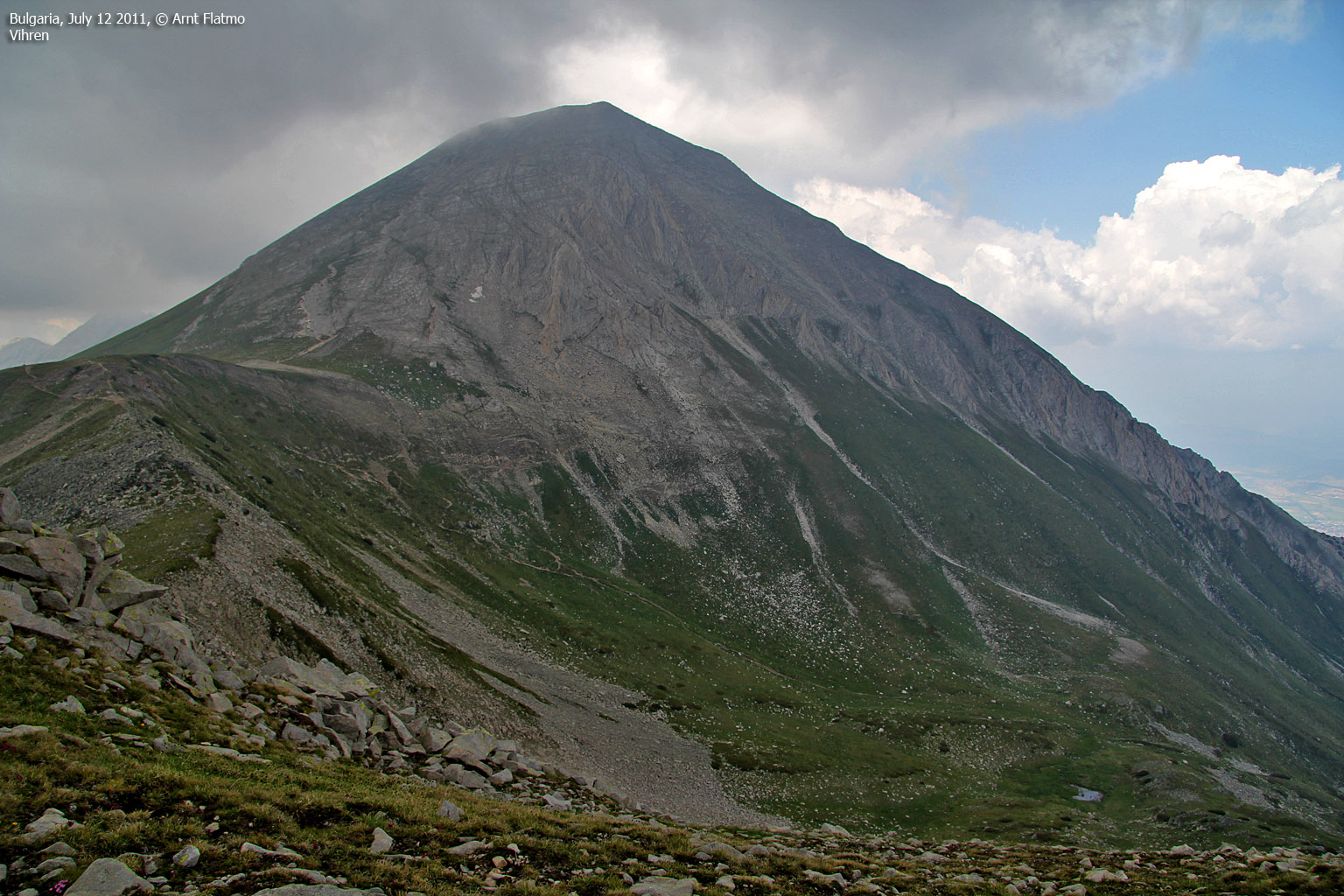
Vihren
(Click for larger image)
Summary...
We had almost come to the end of our (short) summer vacation in Bulgaria. We had driven across the country, hiked Musala - the highest peak, Cherni Vrah - a huge mountain just south of Sofia and Malyovitsa in the Rila mountain range. Today, we were heading for Bansko to hike Vihren - Bulgaria's 2nd highest peak and return to Bourgas the day after.
To Bansko...
I felt such a relief in leaving Hotel Maliovica. I did not have a good night's sleep, and the breakfast was a joke. But now we were back on the road and that was the most important thing.
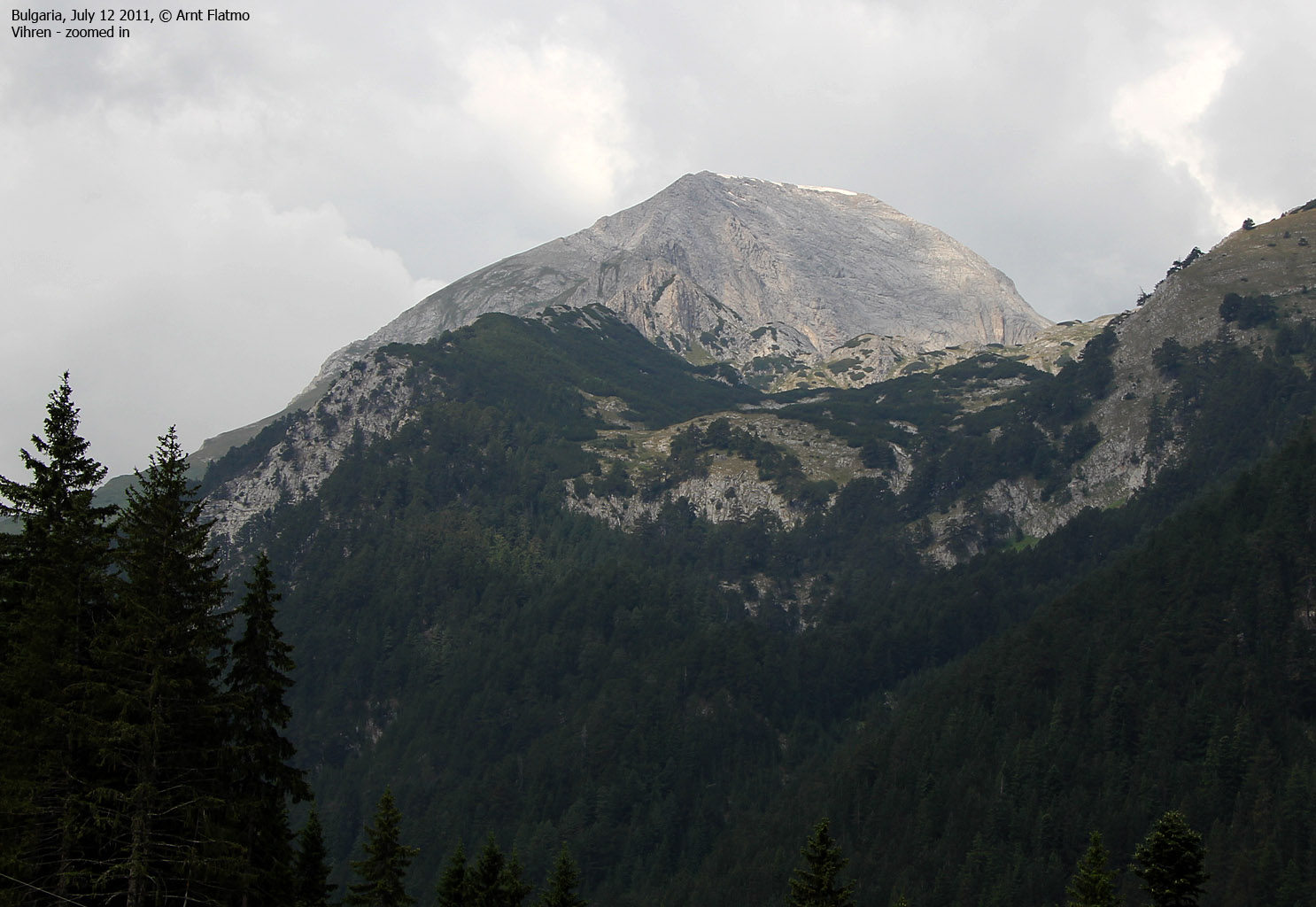
As we left Malyovitsa, we had 100km ahead of us before arriving in Bansko, passing through Dupnitsa and Blagoevgrad along the way. But driving in a new country is big fun, and we looked forward to the sightseeing. There is always something to look at. After a couple of hours, we could see Todorka and the skiing slopes above Bansko. Vihren was getting closer and closer...

Approaching Bansko
(Click for larger image)
Belvedere - heaven!
Bansko - apparently the hottest ski-resort in Bulgaria - resembled a sleepy, Alp village. There were hotels absolutely everywhere, but there were seemingly very, very few tourists around. Now that we were here, we could just as well find a place to stay for the night, saving us for this task after the hike. Hotel Belvedere caught our attention and we decided to rent an apartment for one night.
Omigod, what a luxury compared to the hotel in Malyovitsa - and for almost the same price! Below us was a bar, a restaurant and a swimming pool. We wouldn't have to travel far for a meal (and a beer) this evening...

View from Hotel Belvedere
(Click for larger image)
Vihren...
It was time to hike Vihren,
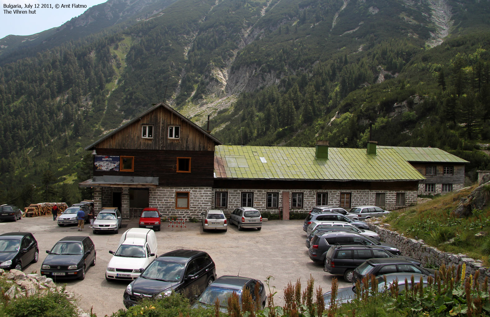
and we drove up the valley until the road ended at the Vihren hut. I was eager
to get moving, and didn't bother checking out the (vast number of) signposts.
We were well on the wrong way before we realized our (my) mistake. Anne gave me a yellow card, and then we
located the correct trail
up the mountain.
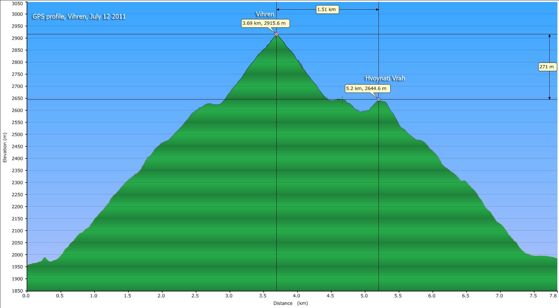
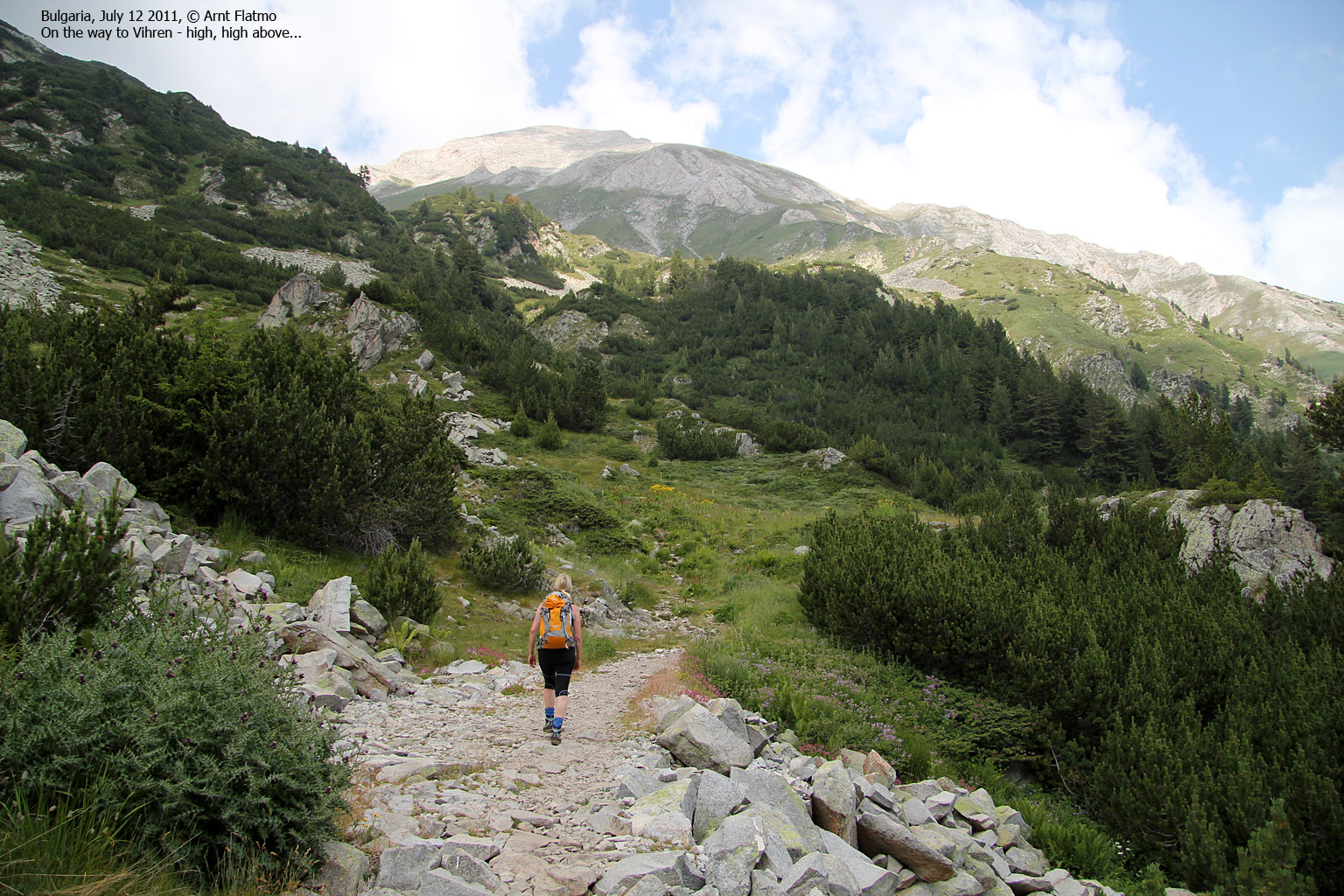
This was terrain just as I like it; straight up! The summit was only 1,9km northwest of the trailhead, with 950 vertical meters in-between. In a comfortable pace, we should be there in 90 minutes! By 11:50am, we were on our way to the 2nd highest peak in the country.

On the way to Vihren
(Click for larger image)
An easy trail...
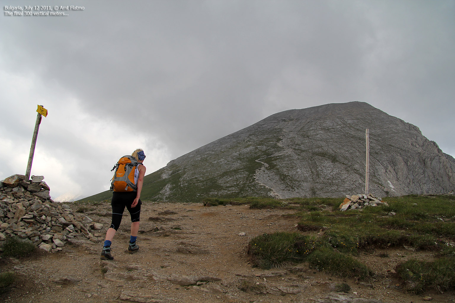
The hike up was quite easy; even if the lower part of the mountain was rocky, the trail was still easy to follow. The mountain was directly above us, all the way, and it looked tremendously high! After a while, we realized that there was a danger that we could arrive on a summit hidden in fog! That would be an utmost shame, but there was of course little to be done about the matter...
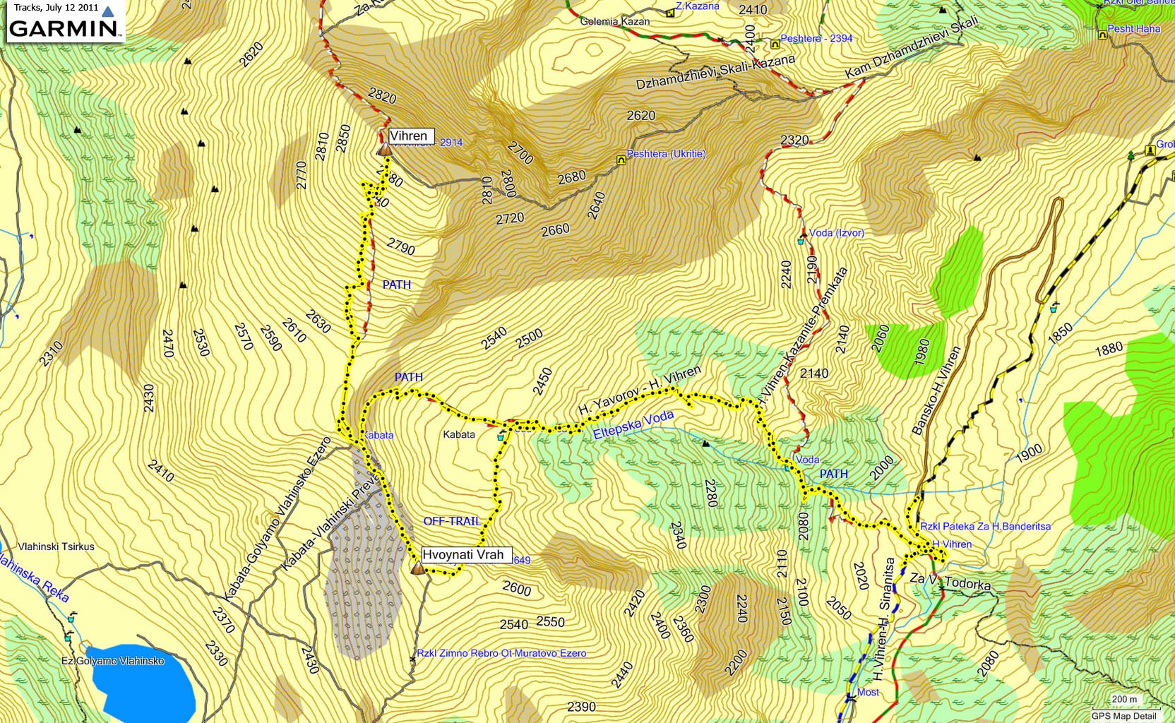
As we entered a basin at approx. 2460m, we could see the ridge between Vihren and the lower neighbour Hvoynati Vrah, and that descending via Hvoynati wouldn't be much of a detour.

The ridge
(Click for larger image)
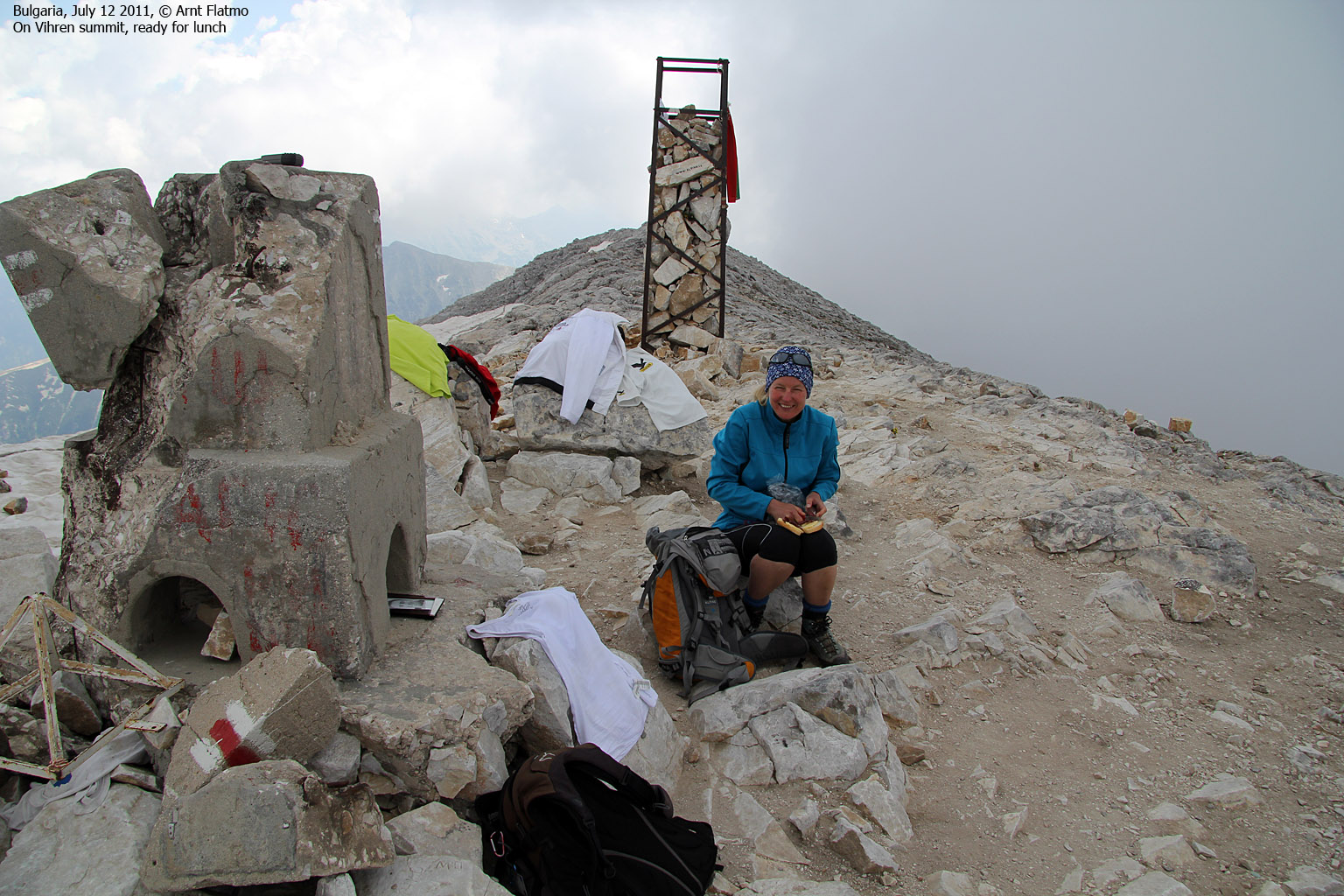
On top!
We arrived on the summit 1:27pm - 97 minutes after locating the correct route near the Vihren hut. Because of the fog, there was little to be seen towards the north. However, the south view wasn't bad at all. I must admit it was tempting to continue towards Kutelo (2900m), but in the end I'd rather enjoy some extra time in our "luxury" apartment, than walking about in fog up here.
We were not alone on the mountain. A group of hikers descended just before we arrived on top, and another couple was on the summit as we arrived there. It was a bit chilly, and this was the first time that I wore a jacket in Bulgaria...

On Vihren
(Click for larger image)
Descent, via Hvoynati Vrah...
We didn't stay for long, and
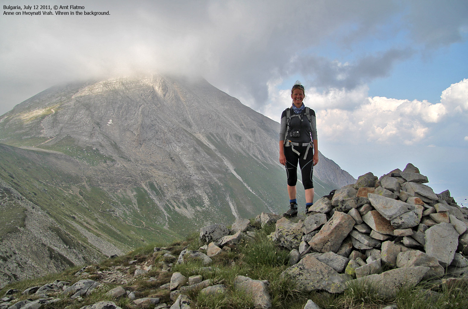
by 1:50pm, we were on our way down. We agreed to hike across Hvoynati Vrah
- although it clearly was not an independent top. In any case, it would be fun
to compare GPS vs. map data. I had measured Vihren to 2915m - fairly
close to 2914m - which is used on all maps. Hvoynati Vrah has all sorts of
heights on the internet and on maps. My GPS reported 2644m - close enough
to the GPS map's 2649m. The vertical distance down to the lowest point between
Vihren and Hvoynati was approx. 50 meters.
Techincal stuff aside, Hvoynati was definitely worth a visit, because the view towards Vihren was excellent from here.

Hvoynati Vrah
(Click for larger image)
We passed across Hvoynati 2:32pm and continued down its northeast ridge - joining our ascent route down in the basin. Further down, we overtook a family and a dog that they didn't know anything about. The dog decided to join Anne and me, and I couldn't quite figure out what was going on. If the dog had come away from its owners, there would normally be signs of stress, but this dog was as relaxed as they come. In fact, I suspected that the dog belonged to the hut, and that it was on a social mission. Or perhaps it was making sure that everyone got down, safe and sound? As we reached the Vihren hut (2:54pm), the dog joined another dog and they seemed to be telling each other about their day so far...

Back at the Vihren hut
(Click for larger image)
Back at Belvedere...
We returned to our "luxury" hotel and enjoyed life there until it was time for dinner. The local restaurant was full, but the waiters was able to bring out another table. This was clearly a good start, but unfortunately, this was the the only positive thing that happened throughout our stay there. There was however a chance of oh-happy-day at dessert when I asked for a warm chocolate cake with ice-cream and the waiter nodded satisfied. Oh yeah, that would clearly redeem the restaurant from a very bad service.
But...

Ssssh! I might lose it...
(Click for larger image)
Returning to Sarafovo..
On the next day (July 13th), we returned to Sarafovo outside Bourgas. The long drive was enjoyable and I almost felt like a native Bulgarian driver. It was also nice to drive through regions that we hadn't been to before. Some parts were clearly poor, and we could often see people selling berries from cups alongside the road. One might feel a bit guilty for not stopping now and then...

On the Bulgarian countryside
(Click for larger image)
Back in Sarafovo, we (once again) checked into Sea Horse hotel. The hotel manager - Mr. "Ok, no problem my friend" greeted us and nothing had changed since we left 6 days ago. We even got the same room. And the Black Sea was awaiting...

Who said we are not spending time at the beach??
(Click for larger image)
On July 14th, we checked out from Sea Horse and walked the 5-10 minutes up to the airport. In many ways, one week was enough. We'd obviously only seen just a little of the country, but at the same time, we felt that we'd seen a lot. We had been on top of some of the most prominent mountains in the country, and driven across it twice. We had been swimming in the Black Sea in the east and gazing over to Serbia and Macedonia in the west. All in all, Anne and me had a great week in Bulgaria!

So long, Bulgaria
(Click for larger image)


