
|

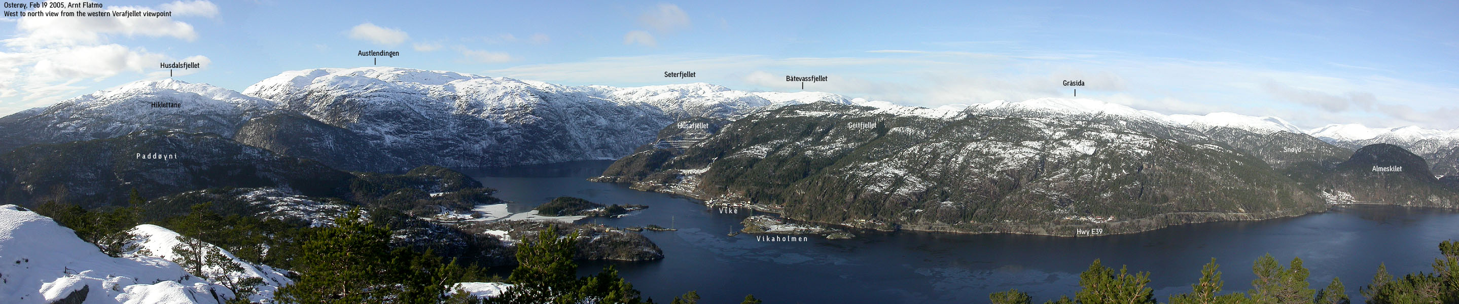
Husafjellet seen from Verafjellet(No Javascript) |
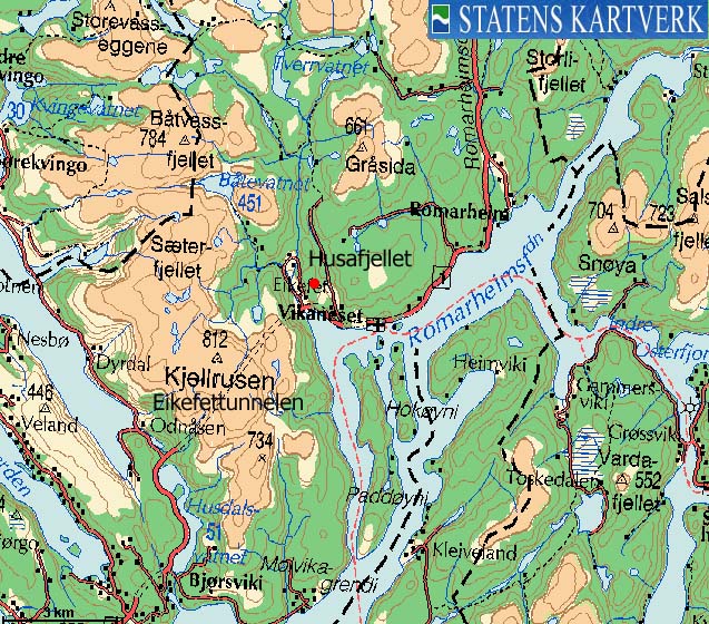
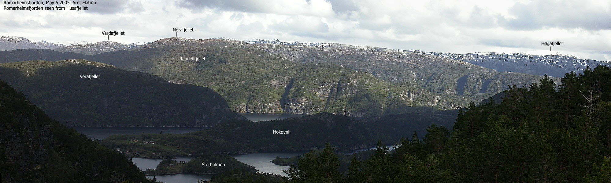
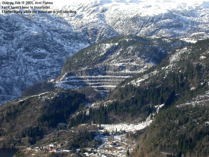
Husafjellet is the hill with the spectacular west wall, located just above Eikefet, seen immediately when you leave Eikefettunnelen northbound on highway E39. This would have been a completely anonymous forest hill had it not been for the fact that it may actually get significantly lower over the years. The Eikefet stone quarry (Oster Pukk og Sand AS) is eating its way towards the high point, and without knowing for sure, I wouldn't be surprised if this hill drops below 300m elevation some years from now.
The Eikefet stone quarry became visble on the international newsfront in connection with the capsize of the bulk carrier M/V "Rocknes" in Vatlestraumen outside Bergen, Jan 19 2004. 18 crewmembers lost their lives in this tragic accident, and the vessel had recently departed the port of Eikefet the same morning.
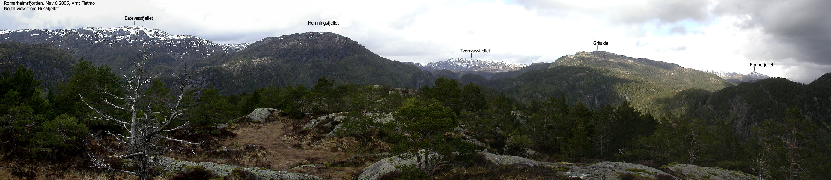
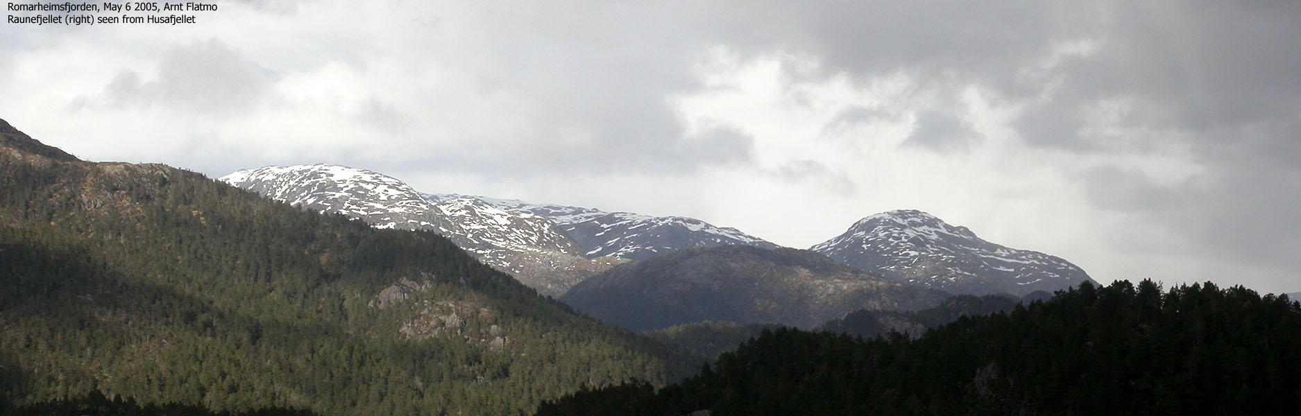
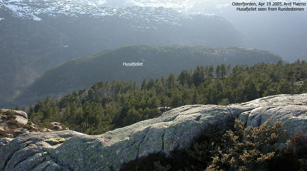
Husafjellet is very accessible from the gravel road up Store-Aurdalen valley. In fact, it is one of (if not the-) shortest hikes (800m to the top) I have done on my quest for Hordaland mountains. You park the car, walk up a steep hill, and you're there. A track can be followed more or less to the top, if you can find it. Be prepared for an off-trail walk if you plan to visit Husafjellet. The views are not too good. High trees spoil the views towards Romarheimsfjorden, but you get a good view towards Austlendingen, Hemningsfjellet, Gråsida and Rundesteinen.
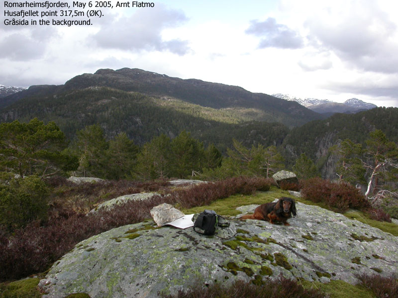
Husafjellet (M711: 318m, Ø.K: 319m) has a primary factor of 151m towards the higher Gråsida (661m). The saddle is found in Dyrskardet pass between Husafjellet and Dyrskardfjellet. Ref. Økonomisk Kartverk (5m contours), you cross the 170m contours on the high route, but not 165m. The saddle height has been interpolated to 168m.
Notes: Class ratings are in reference to YDS. Click here for more information.
The trails described below are not necessarily the *easiest* trails to this mountain.
|
Store-Aurdal - Husafjellet (summer/autumn)
|
|
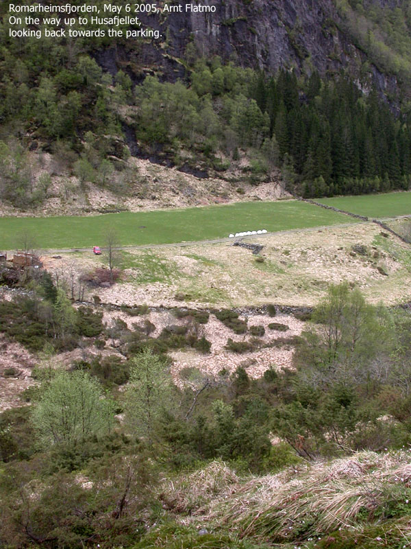
From Bergen, follow highway E39 northbound (Førde/Ålesund). Cross Nordhordlandsbrua bridge and pay toll on the north side (NOK 45,- for passenger cars per May 2005). From the toll station, follow highway E39 for additional 32,7Km. Turn left onto an unsigned gravel road (Store-Aurdal). There is a road junction in the very beginning. Consider parking here or turn right. If you plan to park higher up in the Store-Aurdal valley, continue for 500m until you reach another road junction. The road to the left leads to a stone quarry (private property). Go right. Drive additional 600m, pass a stone fence and continue yet another 100m. You should be able to find parking on a turf on the left-hand side of the road. There may be a wood stack just ahead of you.
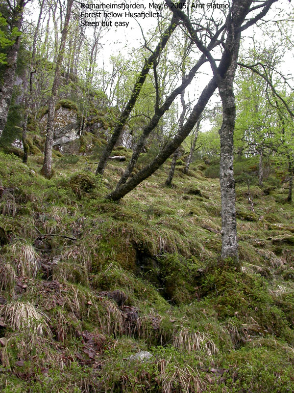
The route description is easy; Cross the stream and head straight up. Head for the small spruce forest and stay on the right-hand side of this forest to avoid some cliffs above. This course should lead you to point 317,5m (Økonomisk Kartverk map). The 318m (319 on Ø.K.) is 150m further south. There are no cairns. On both high points, a few rocks marked the point. Descend your ascent route.
|
Trip report May 6 2005It was Friday afternoon, and after some rain it seemed to clear up. The mixture of deep blue sky and what I perceived to be big white cumulus clouds always brings out the walker in me, and I decided to pay Husafjellet by Romarheimsfjorden an evening visit. On my way northbound after work, the clouds were now changing into low-level, nimbus-type clouds. The first rainshower came as I passed Nordhordlandsbrua bridge, but I wouldn't really call it *rain*. Moisture, perhaps. But not rain. I parked the car at exactly the same spot in Store-Aurdal where my friend Ketil and I had parked when we hiked Rundesteinen recently. I looked up the steep hillside and wondered what kind of evil the mountain Gods had planned for me. I put my dog ("Troll") in the backpack from the very beginning. This was a steep hill. There's no way a 11,5 years old dachshund would even THINK of walking up here. I grabbed my ice-axe (you never know..) and was on my way 17:00PM. The hill was indeed steep, but unproblematic. I followed a track (sheep or deer) upwards until I reached the distinct spruce forest. The track looked like a trail inside the forest, but suddenly disappeared. I always follow a general rule when hiking unfriendly forests - keep a straight line. Due to some cliffs, I had to move slightly right to get out of the forest, but within minutes after leaving the forest, I was on what I believed had to be the high point. The time was 17:25PM and the GPS stated that the height was 318m (same as on the map), but also told me that I was 150m north of the summit. I let Troll out of the backpack and we headed over to the other high point. My GPS stated that this point also was at 318m elevation, and I couldn't tell which of the two was the highest, but various pictures show that the southernmost point is the highest. We went back to the first high point and had a quick lunch. Not fully earned after 30 minutes of walking, but for the dog it is a ritual. And in the middle of the fiest, we were blessed with sunshine. The dog walked all the way down, even though some parts must have been to him what Store Skagastølstind is to humans. The descent took only 15 minutes and I still had the feeling of "just parking the car" when I drove out of Store-Aurdal valley. Some serious rainshowers came 5 minutes later, suggesting our timing was excellent.
|
Move cursor to read notes, and click on the images to see full version.
Some of the thumbnails may have been cropped to fit the format.


No Javascript:


No Javascript:
Other hordaland mountains
 Other Lindås K. mountains
westcoastpeaks.com
Other Lindås K. mountains
westcoastpeaks.com

