
|

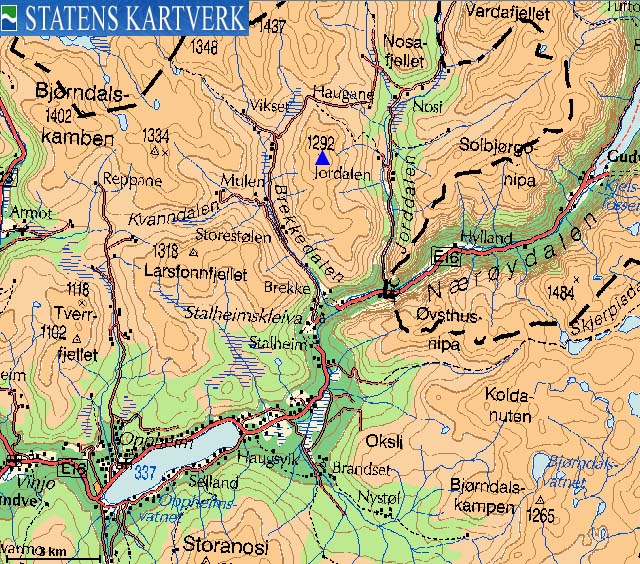
Vetlafjellet ("Little mountain") is located between the valleys Brekkedalen and Jordalen - two well known valleys in the Vikafjellet - Nærøyfjorden region. The mountain is a long ridge, stretching 6,5Km from Tverralsdkaret in the north to Sivlesøyni in the south (near highway E16). Vetlafjellet is the northern part of this ridge, while Sivlesnipa (1240m) is the southern part. "Smalaskaret" (1155m) is the pass between these two tops. Only Vetlafjellet is considered as an independent mountain on this web-site.
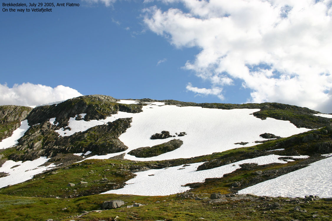
Access during summer and autumn is quite easy, as you can drive all the way up to
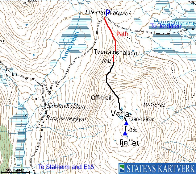
Tverraldskaret pass (approx. 1245m) on a toll road (gravel). You can follow a path from the
pass, but the path disappears as the terrain gets rocky. All in all, Vetlafjellet is one of the
easiest mountains in this region. The views are, as from most tops in this region, excellent.
Primary factor:
Vetlafjellet (M711: -, Ø.K: Highest contour is 1290m) has a primary factor of 342m towards the higher Fyresnipa (1465m) The saddle is found in Tverraldskaret pass ("Tverelmskaret" on Økonomisk Kartverk). Ref. Økonomisk Kartverk (5m contours), you cross the 950m contours on the high route, but not 945m. The saddle height has been interpolated to 948m.
Comments:
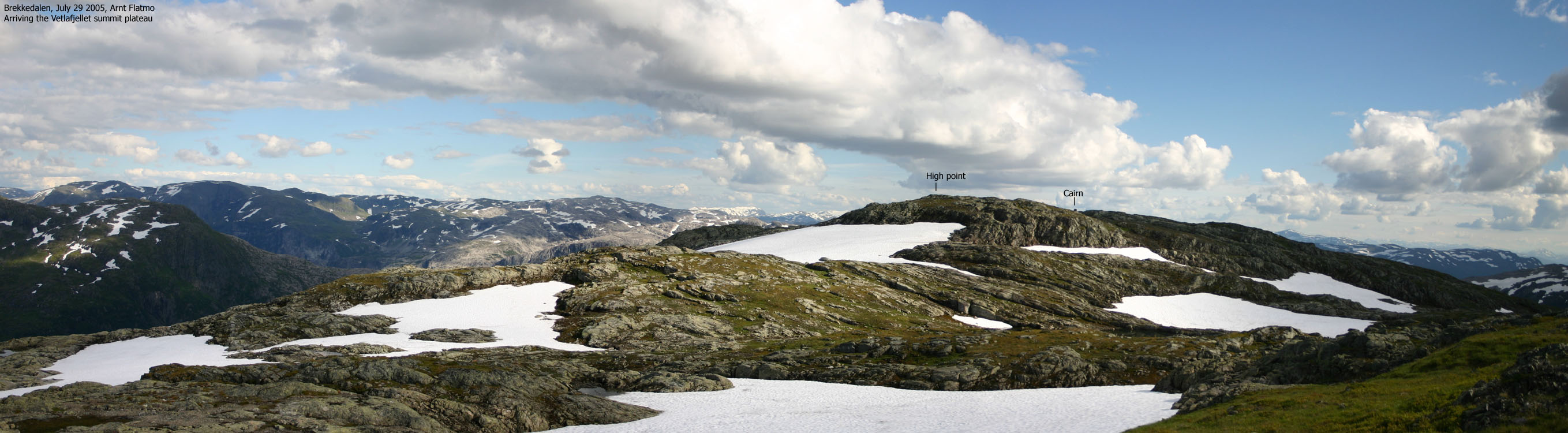
On the 1316-I Gudvangen map, the height is 1286m (1286,45m on Ø.K.). This is the trig. point (cairn). The high point is located 117m further northeast. The highest contours on Ø.K. are 1290m, and they are tiny. My Garmin GPS map says this point is 1290m, and this is the height I have chosen to use. My GPS reported 1296m on this point. After correcting for error margins, I would suggest that 1292m-1293m is a reasonable estimate. However, I have chosen to stick with the height on the Garmin map. I have also noticed that Norgesglasset (3Km zoom) shows 1292m.
Notes: Class ratings are in reference to YDS. Click here for more information.
The trails described below are not necessarily the *easiest* trails to this mountain.
|
Jordalen - all tops round trip (summer/autumn)
|
|
From Bergen, follow highway E16 towards Voss. From the traffic light in Voss, follow E16 up to the RV13/E16 junction (1,3Km). Turn left towards Oslo and follow E16 31,9Km. Turn left towards "Stalheim". Drive 1,4Km and just after having passed Stalheim hotel, turn onto the road up Brekkedalen. Follow this road 8,7Km and park at the Tverraldskaret pass. Do not block for passing traffic.
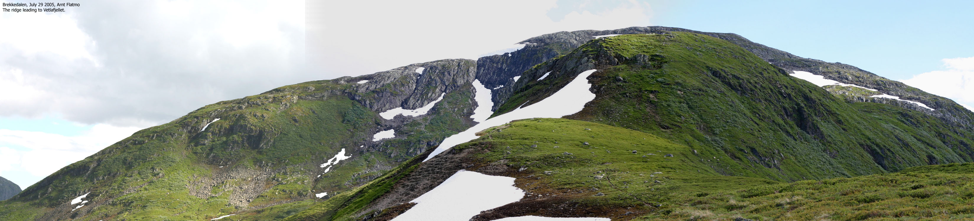
Follow a path from Tverraldskaret up the distinct Tverraldshalsen ridge. The slope angle increases as you walk up "Reinsgrindane", but the terrain levels out above this part. As you head towards the base of the mountain, the path fades out. Hike off-trail from here. You will first arrive a point that exceeds 1280m before you descend and head for the Vetlafjellet cairn (large cairn). You pass the high point along the way, 117m NE of the summit cairn. The high point is not marked.
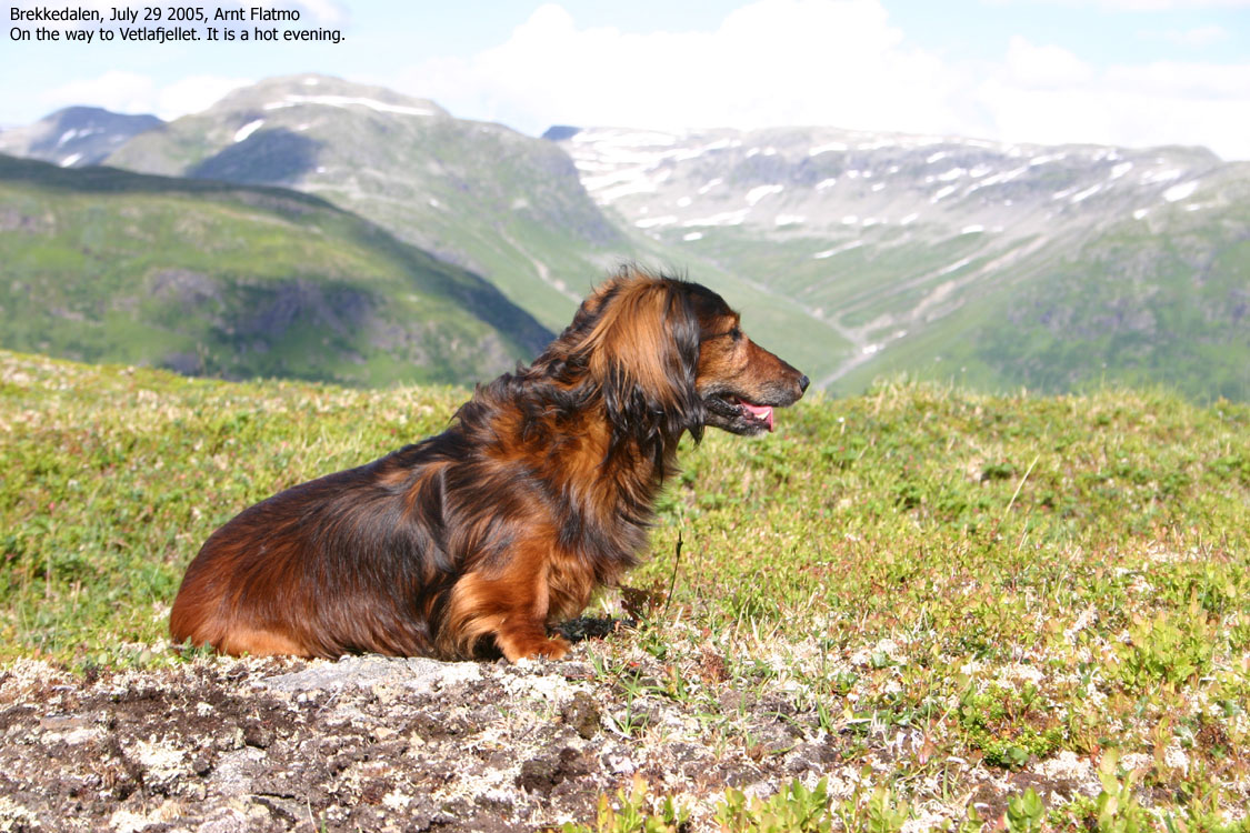
It was the last working day before the summer vacation. I finished at work a bit early and headed for Brønnøysund. This is where my dachshund "Troll" would spend his summer vacation. When facing a 14 hour long car drive, it is important to make a few stops along the way.
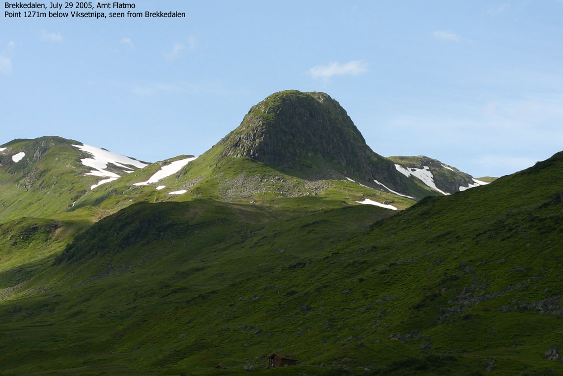
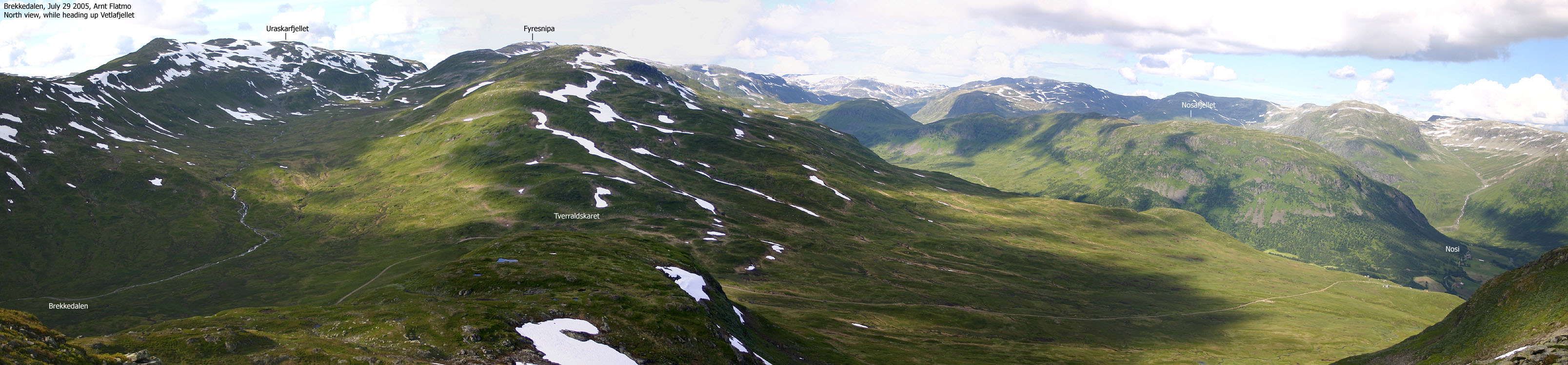
From my hike across Fyresnipa and some other tops last week-end, I had the chance to take a good look at Vetlafjellet. From the Tverraldskaret pass, it shouldn't take more than one hour up to the top. Excellent as an afternoon walk. Tverraldskaret is approx. a 2,5 hour drive from Bergen p> By 17:05PM, the dog and I was ready to hike from Tverraldskaret. We followed a path across the lower ridge (Tverraldshalsen) but lost it when we got to the base of the mountain. I put Troll in the backpack and hiked directly up a steep boulder field which seemed like a short-cut. After passing a "false summit", we reached the cairn 18:10PM.
The cairn did not define the high point, which I found approx. 117m further to the northeast. It was quite obvious when I passed it, as the cairn seemed to be at a lower position. We went back to the high point and had a short break before we headed back down. On the way down, I noticed cows heading slowly up towards the pass. I speeded up the descent, remembering how the car looked like last week-end (side-mirror on the ground and marks all over the car).
By 18:50PM, we were back at the car and had beaten the cows by a few minutes. We had to wait for some road work in Brekkedalen to be completed. While waiting, a local farmer (whom I also met last week) told me about two eagles who had attacked and eaten a lamb up in Tverraldskaret. Next stop was Kula and Litlhornet in northern Norway. On the way across Sognefjellet, I took these pictures of Hurrungane.
Move cursor to read notes, and click on the images to see full version.
Some of the thumbnails may have been cropped to fit the format.
To Vetlafjellet


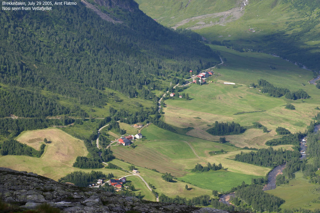
Views


Descent


No Javascript:
1 2 3 4 5 6 7 8 9 10 11 12 13 14 15 16 17 18 19 20 21

No Javascript:
Other hordaland mountains
 Other Voss K. mountains
westcoastpeaks.com
Other Voss K. mountains
westcoastpeaks.com

