
|

Veranuten seen from the air(No Javascript) |
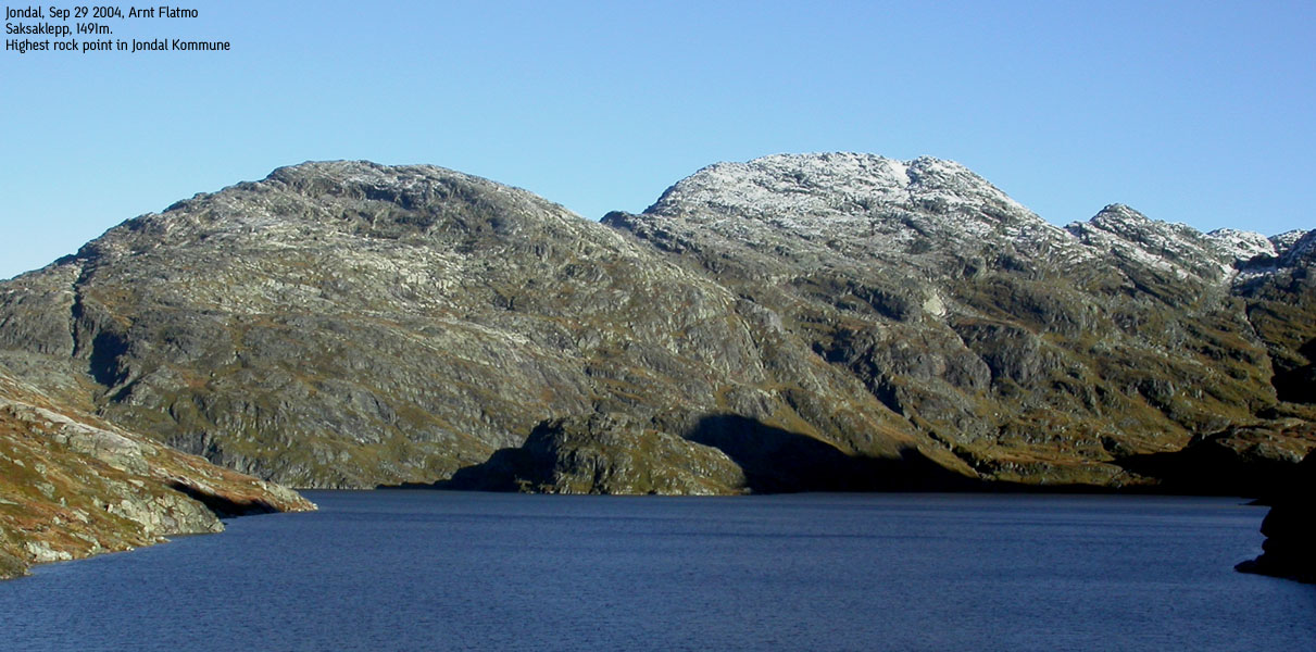
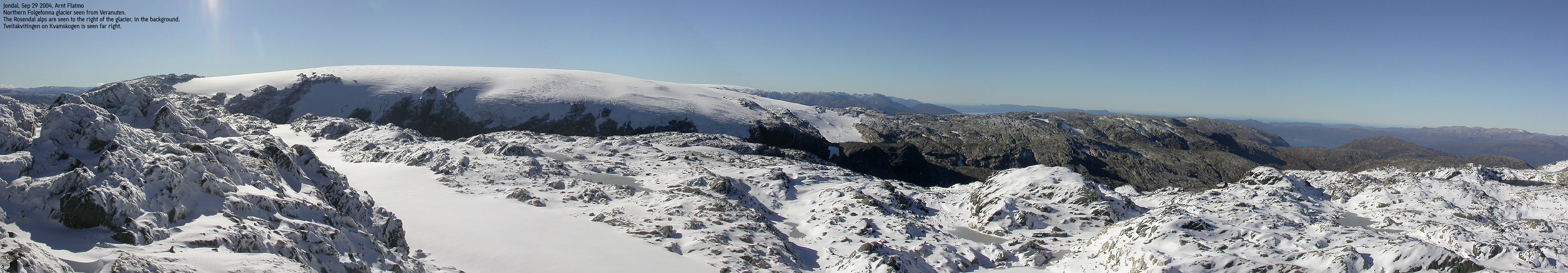
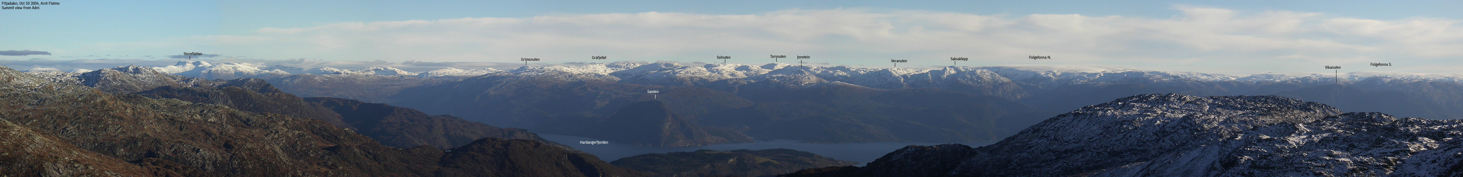
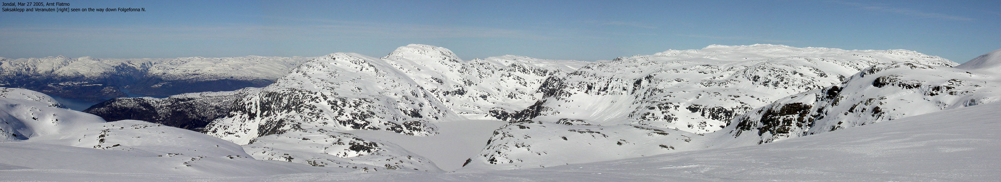
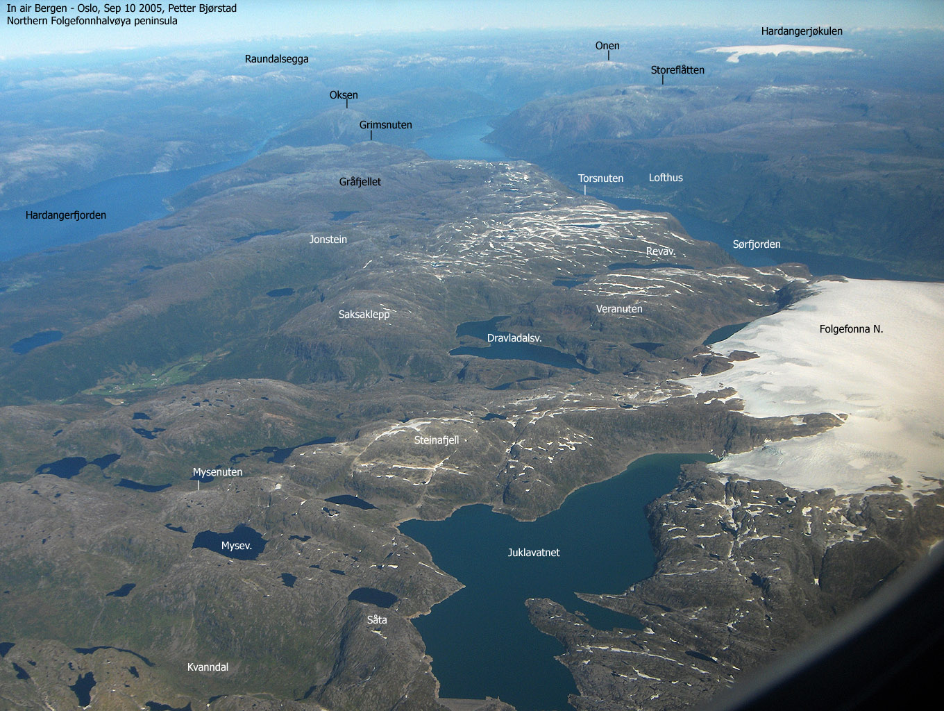
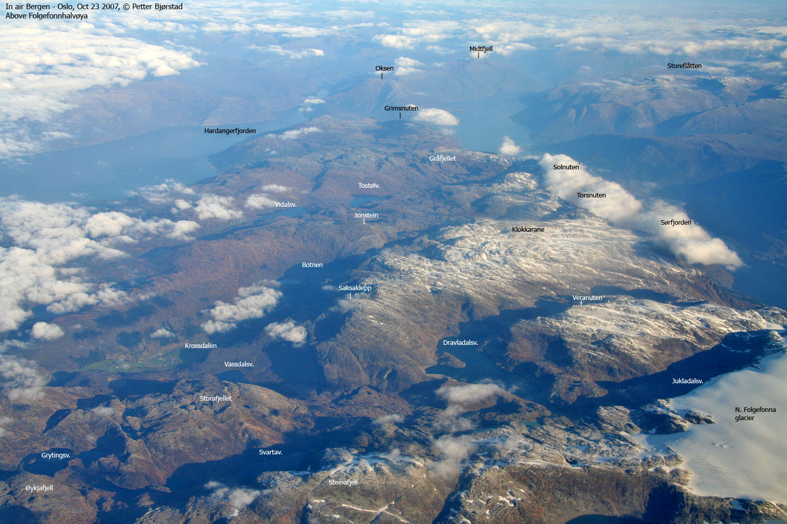
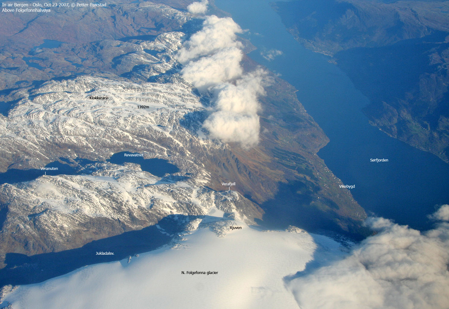
Veranuten (1513m) is the third highest independent mountain on Folgefonnhalvøya, if the three glaciers are not counted. Torsnuten (1572m) is the highest mountain, Solnuten (1551m) comes in second. There are higher rock points, such as Rjuven (1574m) and Holmaskjera (1565m), but these are nunataks on the glacier and not ranked as independent mountains.
Veranuten connects to the northern Folgefonna glacier through a high saddle (approx. 1370m) between Rjuven and Verafjell. The Folgefonna high ridge is very narrow on this saddle. Lake 1351 below the saddle drains to Hardangerfjorden. If the water level rose 20m, it would also drain to Sørfjorden.
Veranuten bids you no technical difficulties on the easy route, but it is important that you are mindful about your route. A series of cliffbands can look intimidating from above, and it is very convenient to remember where you ascended. Veranuten is also very accessible in the summer/autumn due to a very high trailhead (990m) which can be reached by car. The popular Folgefonna summer ski-center is located in the very neighbourhood.
Primary factor:
Veranuten (745m) has a primary factor of 143m towards the higher N. Folgefonna glacier (1643m). The saddle is found between Verafjell and Rjuven. Ref. the M711 map (20m contours), you cross the 1380m contours on the high route, but not 1360m. The saddle height has been interpolated to 1370m.
Notes: Class ratings are in reference to YDS. Click here for more information.
The trails described below are not necessarily the *easiest* trails to this mountain.
|
Sandosen - Verafjellet (summer/autumn)
|
|
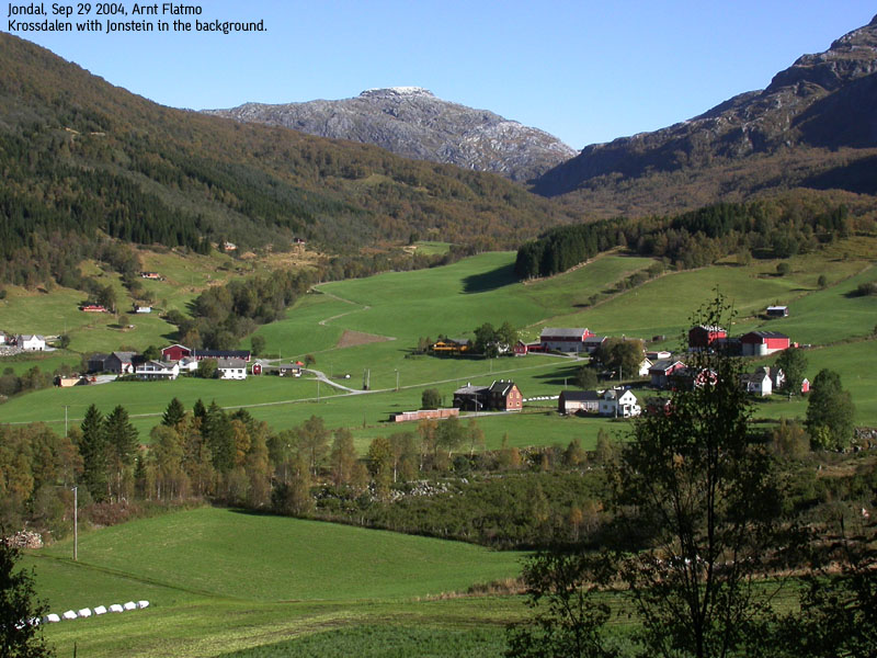
From Bergen, follow highway E16 towards Oslo. At the Trengereid junction, turn right onto highway 7. Follow highway 7 all the way to Norheimsund by Hardangerfjorden. Turn right onto highway 49 and drive to Tørvikebygd (approx. 12,3 from the junction in Norheimsund) where you take the ferry to Jondal.
From the Jondal main junction, go straight ahead and follow signs towards "Folgefonna". After 7,9Km, turn right (signed "Folgefonna"). 100m later, pay road fee (self-serviced). Fee for passenger cars per Sep 2004 was NOK 60,-.
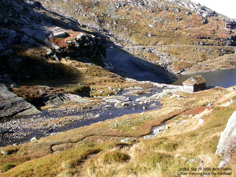
Follow the road towards Folgefonna ski-center, but approx. 8,2Km from the toll booth, turn left onto an unsigned gravel road. Follow this road down to road end at Sandosen. Plenty of space to park down there.
From the parking, follow a visible trail towards a cabin on the other side of the river coming from lake Jukladalstjørni. You cross the river by the cabin. The crossing is easy when there isn't much water in the river. If there is, the crossing isn't necessarily trivial. Alternatively, look higher up for a place to cross.
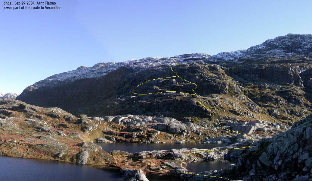
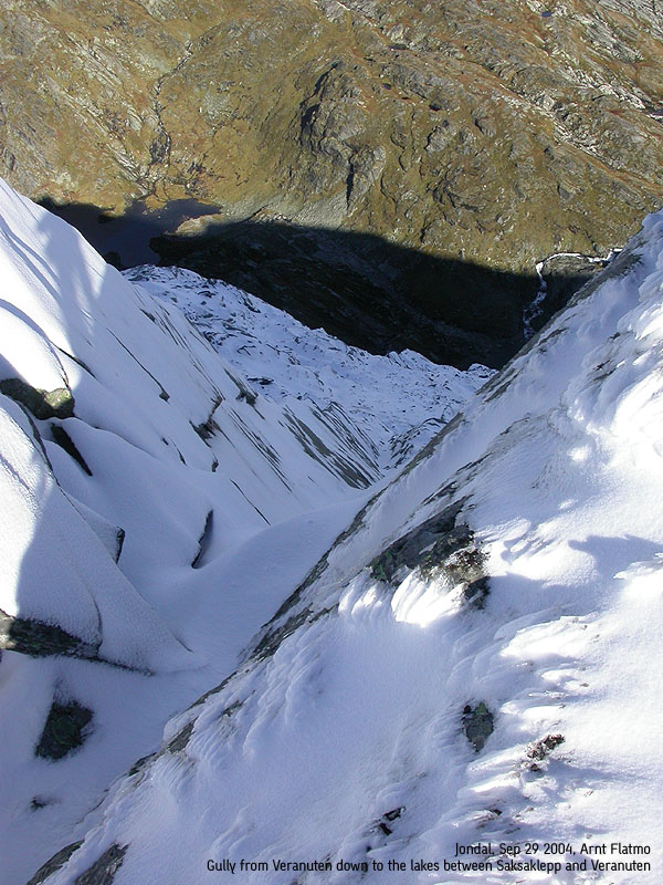
A visible trail continues from the cabin and runs up a distinct gully. Descend to ponds on the other side, and pass between two ponds. Turn right and cross between two other ponds. Between the 1100m and 1200m contours, cliffbands dominate the terrain. Notice a grassy pitch that traverses upwards. Either scramble (easy) straight up to the beginning of this pitch, or follow a visble path to the left. This path bypasses the cliff and comes back around at the beginning of this pitch.
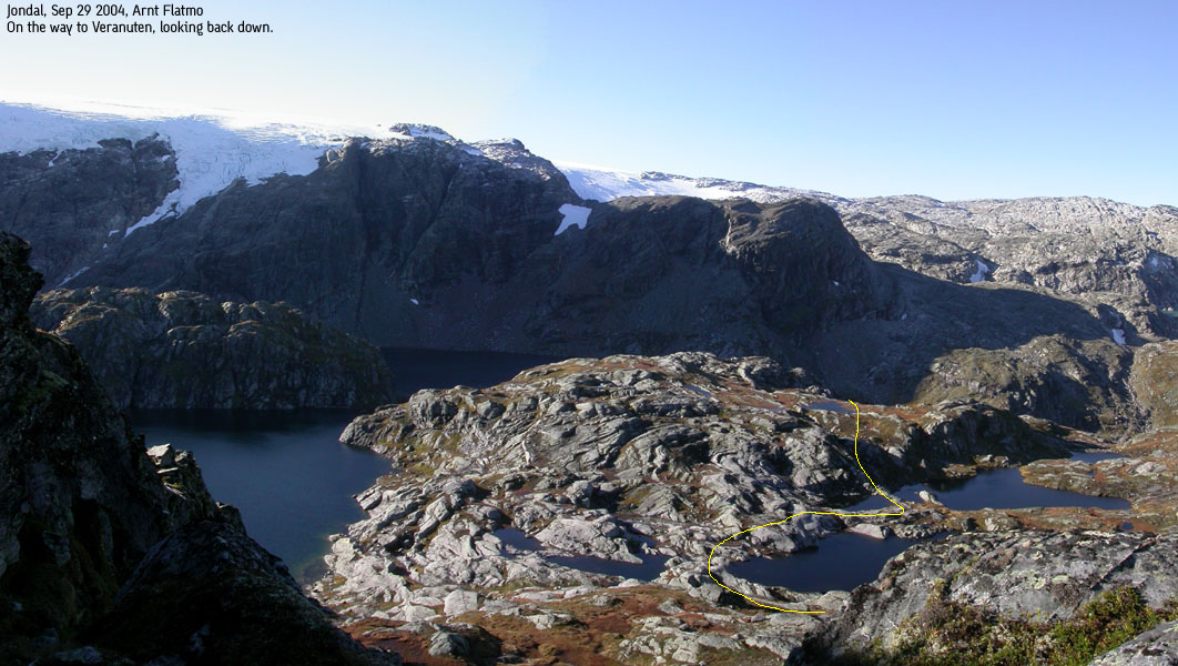
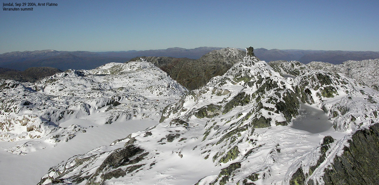
On top of these cliffs, you arrive at a small pond. Go left and follow cairns upwards. The general direction is northeast until you have passed the 1440m contour. Don't rely on the cairns, as they tend to be broken here and there. From 1450m, set eastbound course and climb Veranuten from the northwest. There are some cliffs below the summit, but it is easy to find a route up here. In general, this is a rough plateau, where you have to switch back and forth between humps and bumps. The summit is marked by a proper cairn. Descend your ascent route.
|
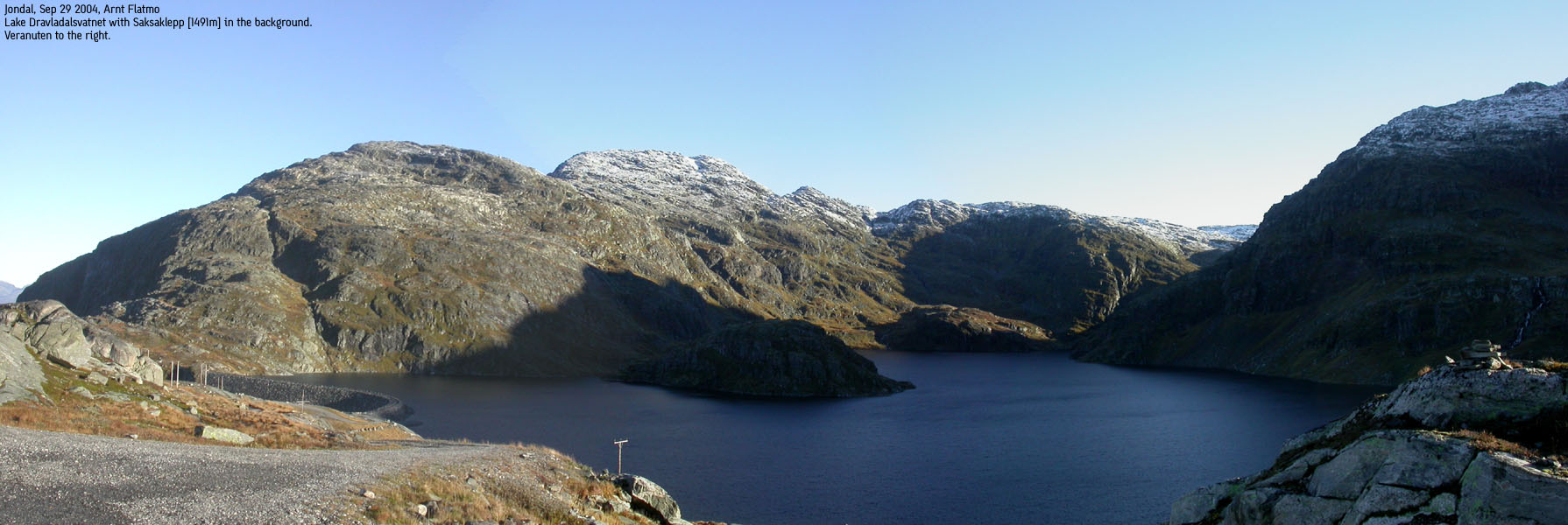
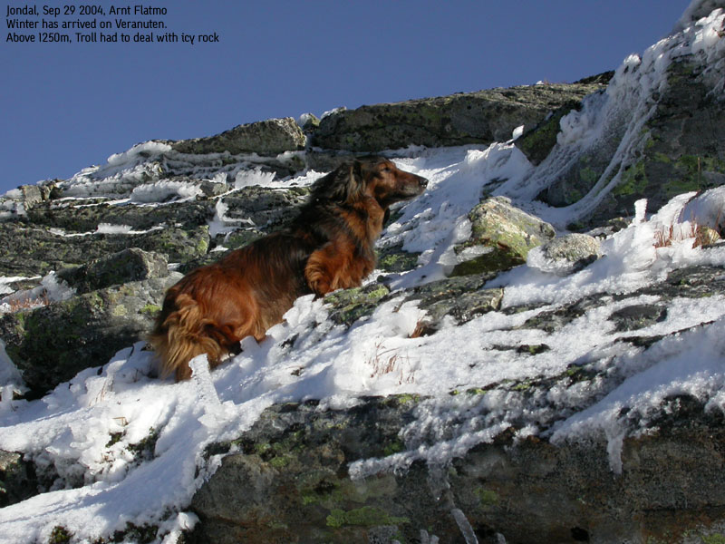
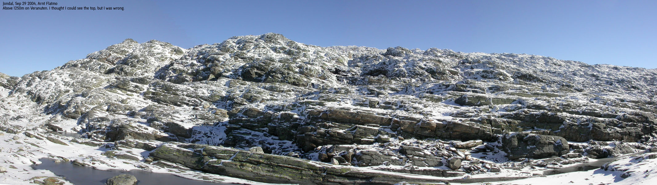
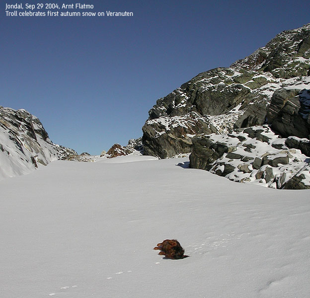
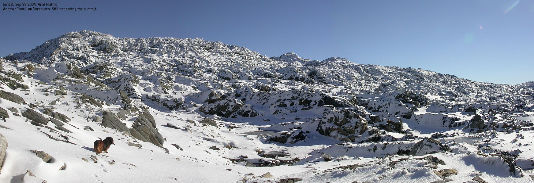
Trip Notes Sep 29 2004After weeks and weeks of rain, the weather forecast promised a few sunny days, starting this Wednesday. I was literally starving for a sunny hike, and decided to take a vacation day. I left Bergen early morning and took the 08:40 ferry to Jondal. It was 7 deg. C. in Bergen. On top of Kvamskogen, it was 0 deg. C. I turned a bit worried as I would be driving all the way to 1000m above sea level. With summer tires. I pictured a narrow and icy road on the way towards the Folgefonna ski-centre. The worries were not called for, as the temperature gradually increased the higher up I came. I drove all the way to the ski-centre and took a look at the glacier. I had some vague plans about walking from Veranuten to the ski-centre via the northern Folgefonna glacier. Although not much, but a notable amount of fresh snow had fallen, and I wonder if walking on the glacier was such a good idea after all. I then drove down to Sandosen and parked the car. Sandosen was windy, and I remembered my last trip up here. On my way to Saksaklepp, I parked down by lake Dravladalsvatnet, and the wind was so strong that I wasn't able to open the car door. Instead of turning the car around, I left the car on the passenger side. The wind at Sandosen was nowhere near as strong as back then, but my ambition of crossing the glacier sunk even lower. I could only imagine the wind on the glacier. The wind didn't bother me much, but the dog is a bit more exposed, stuck in the backpack on the potential walk across the glacier. I decided I would go for Veranuten and then perhaps go for Samlen down by Hardangerfjorden later on. We left the trailhead 09:50AM. After crossing the river, Troll decided that he wouldn't walk any longer, and the weight of the backpack increased significantly. The hike upwards was interesting. I frequently lost sight of the trail and cairns, and had to focus on where a good route would be. I never got really lost from the main route, as cairns popped up now and then. At 1280m, we entered snow. From here on, the hike was so nice it is hard to describe. Troll decided that snow was fun and ran back and forth up the mountain. We had shelter from the wind, the weather was gorgeous, and the views got better by the minute. We reached the summit 11:30AM. I noticed a helicopter flying around in circles between Veranuten and the glacier. After a while, this became a bit annoying. So far away from civilization, on this perfect day. Only to listen to the penetrating sound of a helicopter. I didn't let myself be bothered too much, as we left the summit after 10 minutes. We followed the same route back down, Troll walking all the way, and reached the car 13:00PM. Next stop: Samlen.
Pictures from the Sep 29 2004 hike
Move cursor to read notes, and click on the images to see full version.
No Javascript: 1 2 3 4 5 6 7 8 9 10 11 12 13 14 15 16 17 18 19 20 21 22 23 24 25 26 27 28 29 30 31 32 33 34 35 36
|


No Javascript:


