
|


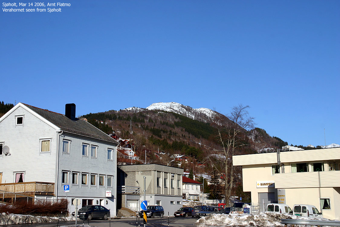
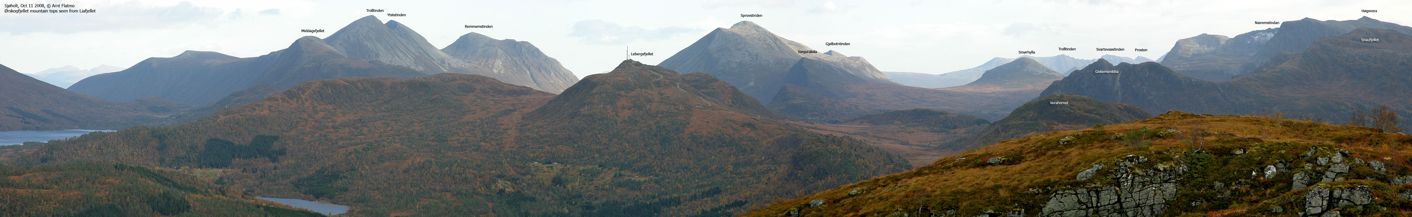
Verahornet is located above the place Sjøholt - Ørskog kommune's administration centre. The top gives a good view towards Haram and Ørskogfjellet, as well as towards Storfjorden. The route described on this web-page is best enjoyed in summer. If you want to ski Verahornet, I recommend you ski along the mountain road that leads to Lebergsfjellet and then head Verahornet's northeast ridge. See the Lebjergsfjellet page for information about the trailhead.
Verahornet is described on Økonomisk Kartverk as a "haug" - hill, and it is fair to wonder how the hill earned its proud suffix "horn". There is absolutely no difficulties involved in ascending this hill, and there is absolutely no exposure.
Verahornet (M711: 518m, Ø.K.: 518,35m, UTM 32 V 389081 6931332) has a primary factor of 295m towards the higher parent mountain Lebergsfjellet (628m). The defining saddle (approx. UTM 32 V 388832 6931619) is found between Verahornet and Knippingen. Ref. Økonomisk Kartverk (5m contours), the saddle is within the range 335-340m, interpolated to 338m.
Notes: Class ratings are in reference to YDS. Click here for more information.
The trails described below are not necessarily the *easiest* trails to this mountain.
|
Egge - Verahornet (all seasons)
|
|
Access
From Ålesund, follow highway E136->E39 towards Åndalsnes. From the E136/E39/Olsvika roundabout near Breivka, follow E39 27,5Km to the "Solnørdal" junction in Sjøholt. Turn left here, and then immediately right before you turn left on "Solnørdalvelgen" road. Follow this road 1,2Km (from highway E39) and turn right onto an unsigned road just after you've passed a watertank-looking building on your left-hand side.
Follow the road up Egge, and after 1,1Km you have a small parking area (by a birch tree) on your left-hand side. Parke here.
The route
Disclaimer; I -assume- that there is a summer trail all the way to Verahornet. It looked as if there was.
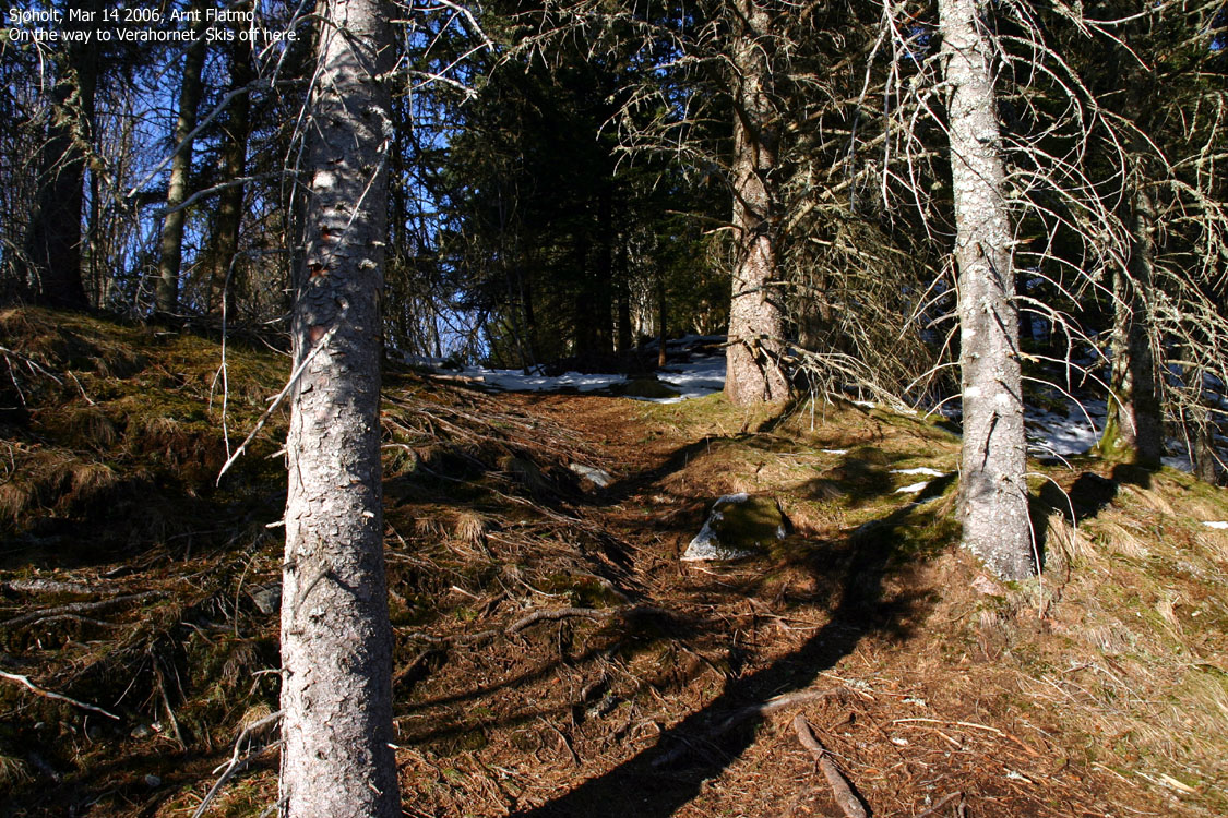
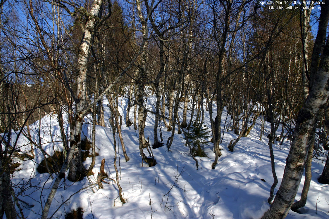
Go to the barn and head left towards the forest ridge. You should find a trail here, or in winter - a narrow corridor that allows you to ski this ridge (with some swearing along the way). After a while, you head into a birch forest which has more leveled terrain, but greater density of trees.
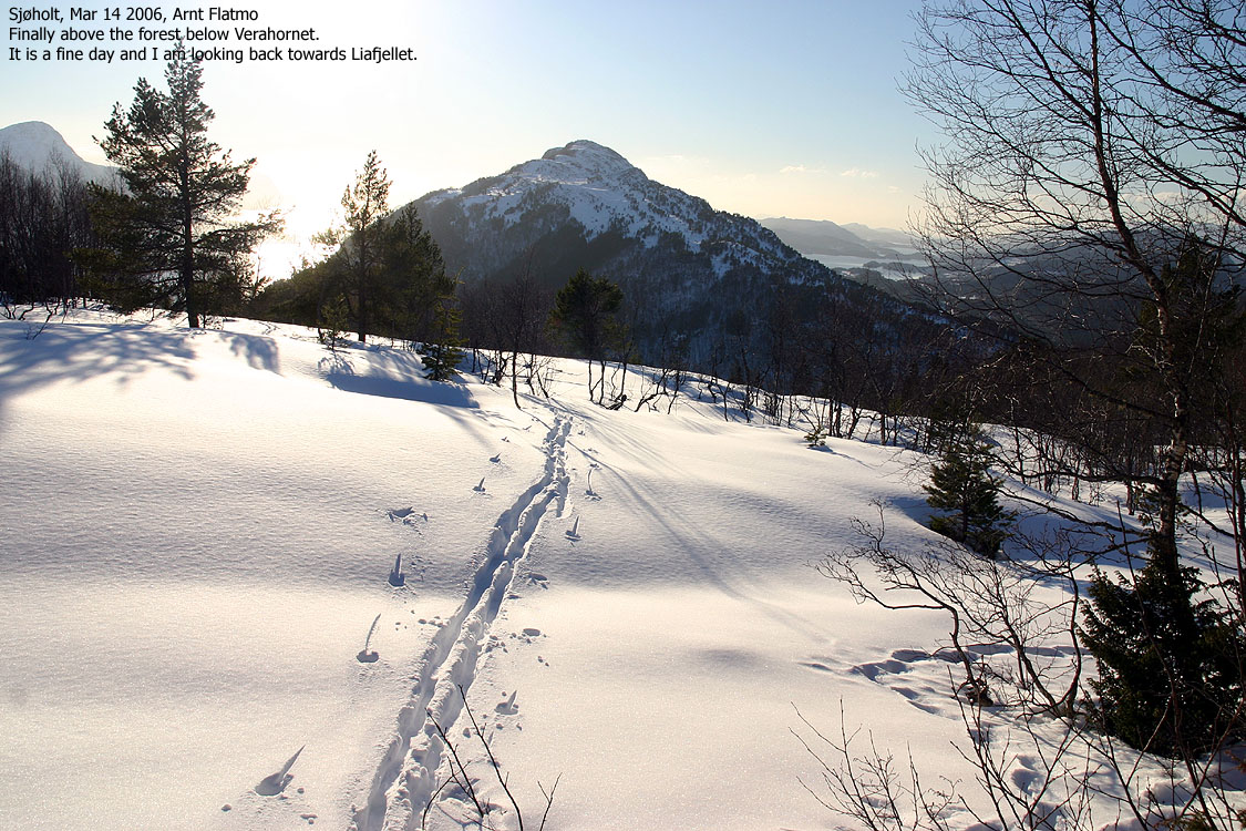
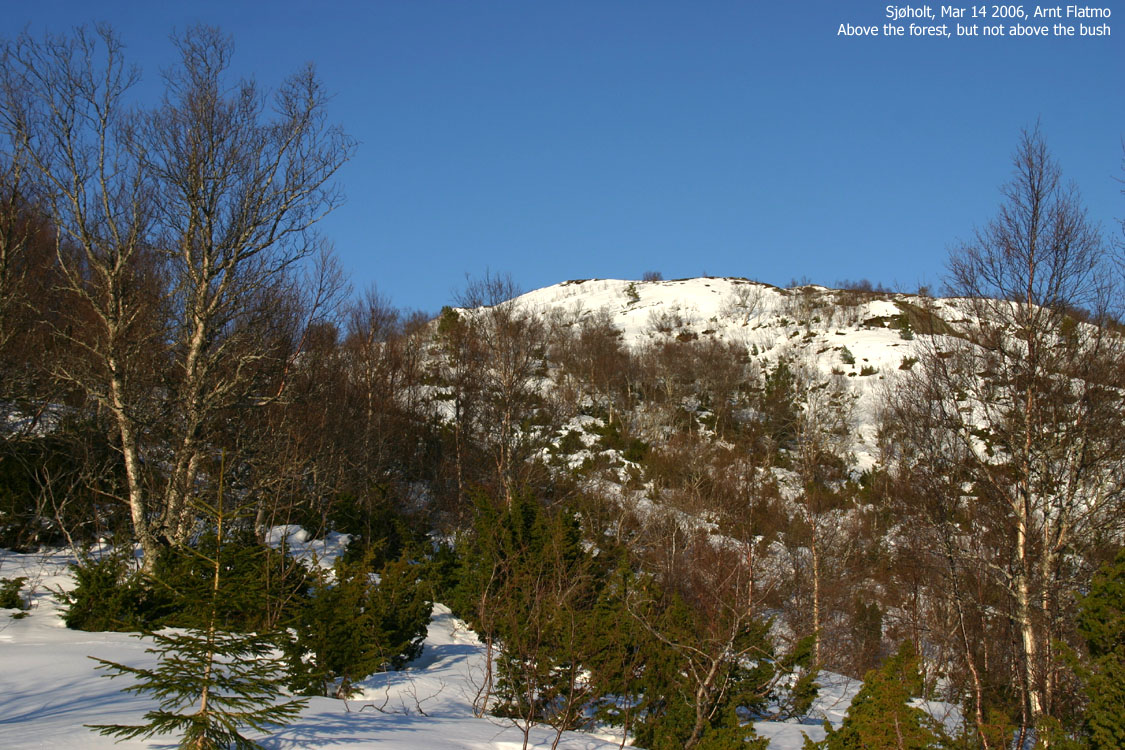
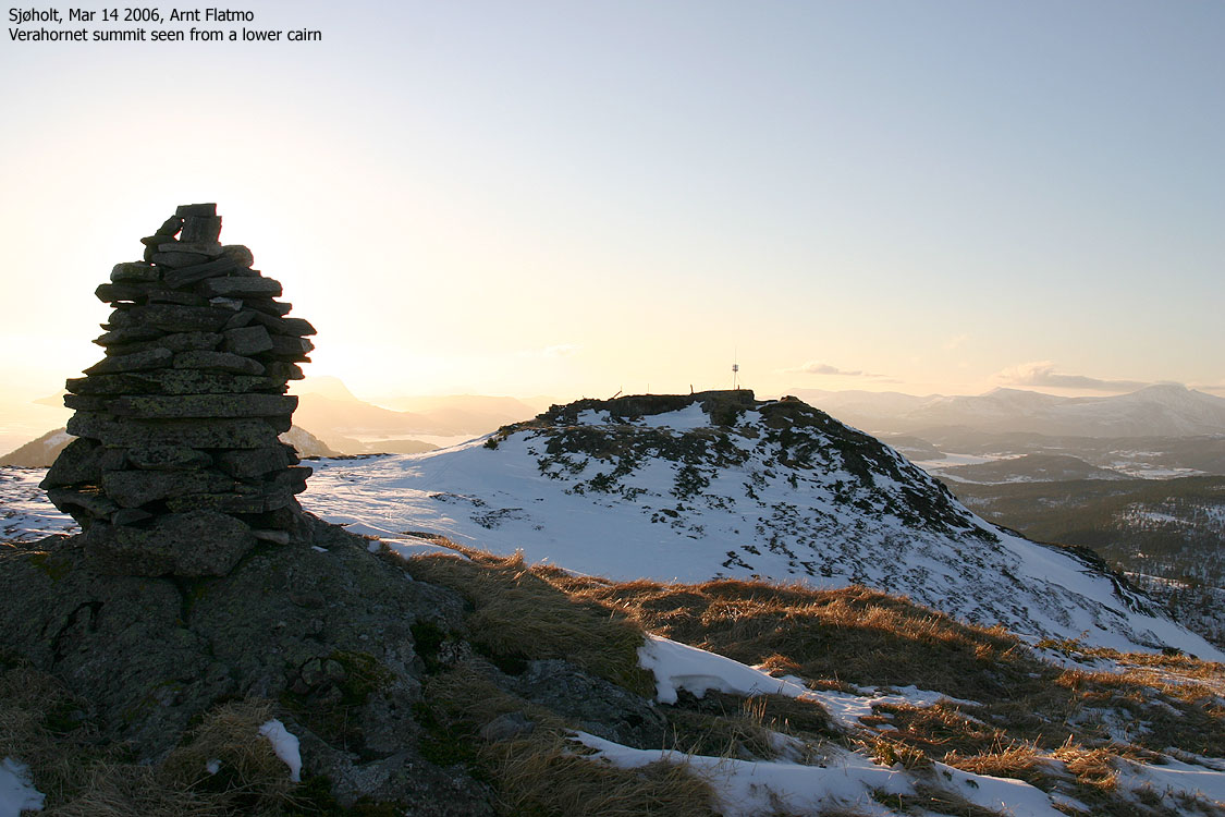
When you are out of the birch forest, you get Verahornet in view. You have to pass a "band of bush" before you reach the mountain foothills. When you are close to the mountain, approach it from the southwest and head up to the summit cairn and trig. point.
This was a gorgeous afternoon which invited for a short trip. I traded the last working hour for an hour later in the evening (software programmers' privelege) and drove up to Sjøholt, where I had to ask around in order to find the trailhead.
I found my way up to the Egge farm and after talking to the owner, I located the forest path. The skis had to come off after a few minutes, but I could soon put them back on. Skiing in this forest was very cumbersome, but I managed. When I reached the birch forest, the sun shone through, and neither forest nor bush could annoy me. This was a great way of spending the afternoon.<
Below Verahornet, I let my dog "Troll" out of the backpack, hoping the snow (which was getting its afternoon crust) would carry him. It didn't, but he decided to give the hill a go anyway. I had started out from Egge 16:25PM and reached the top 17:20PM. Troll ran up to the summit cairn and barked for lunch. Odd, normally he's just whining.
Skiing down in a graceful manner was almost impossible due to the hard crust, and later, the bush. Troll was trailing behind and put significant effort into coping with the deep, powder snow. Skiing upwards was easy, but going down was a different ballgame with trees everywhere. But we reached the trailhead 18:05PM, safe and sound. Farewell to Verahornet, a very nice "afternoon top".
Because of the grey weather, all pictures (except one) have had contrast modifications.
To Verahornet


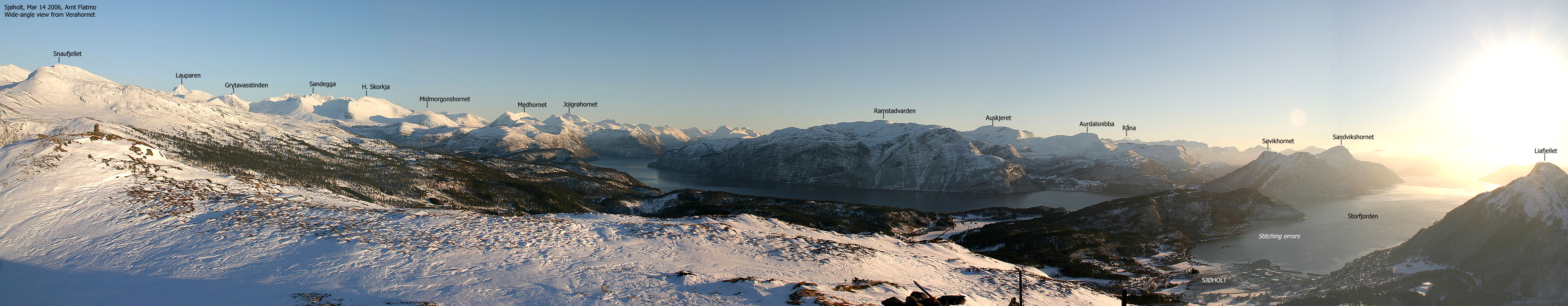
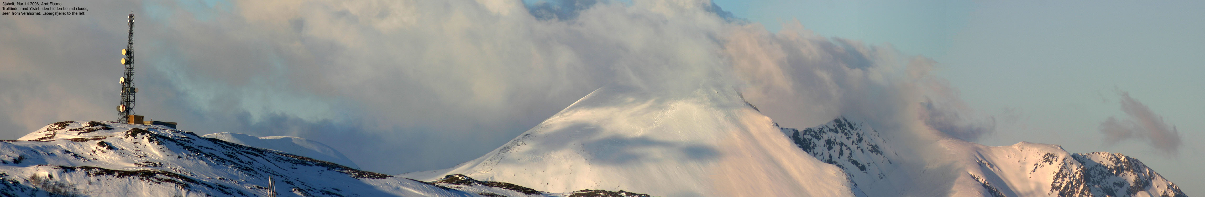
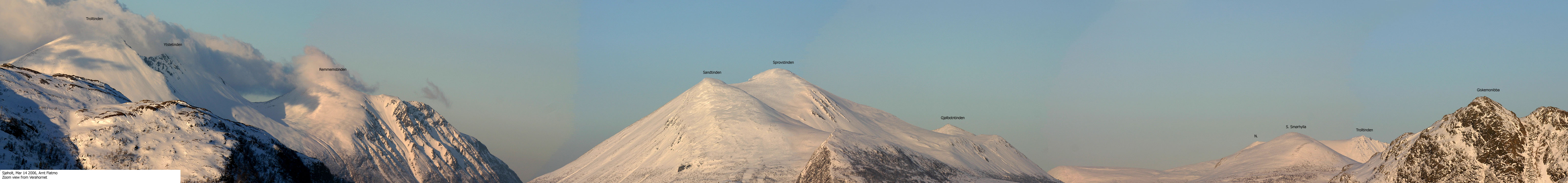
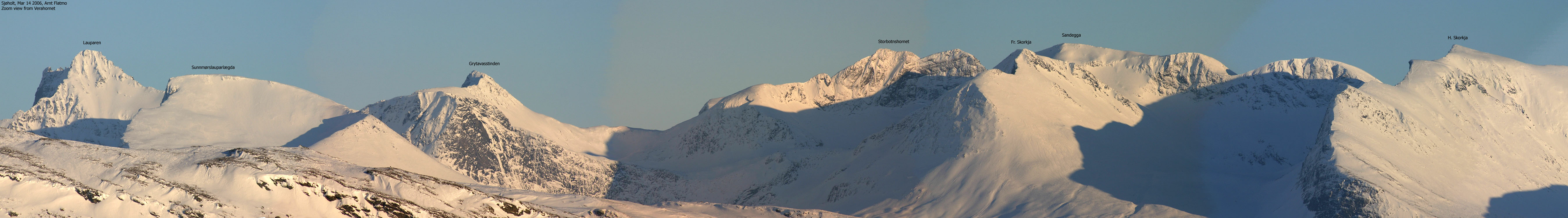
Wide-angle panoramas from Verahornet, 2 parts


50mm panorama from Verahornet

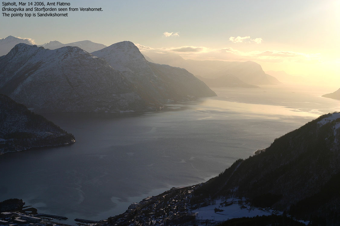
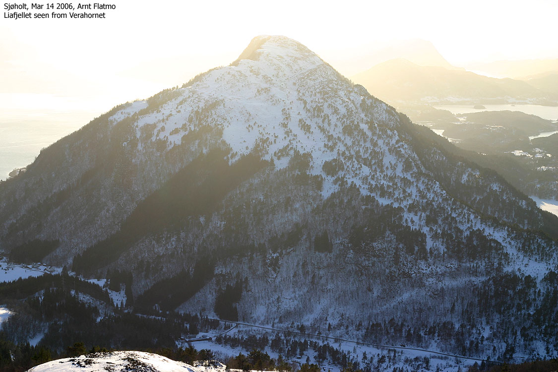
Other summit pictures


Descent


No Javascript:
1 2 3 4 5 6 7 8 9 10 11 12 13 14 15 16 17 18 19 20 21 22 23


No Javascript:
 westcoastpeaks.com
Other Møre & Romsdal mountains
Other Norwegian mountains
westcoastpeaks.com
Other Møre & Romsdal mountains
Other Norwegian mountains

