
|

Verafjellet seen from the air(No Javascript) |
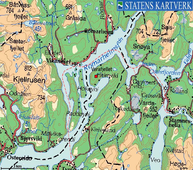
Verafjellet is located on the northwest side of Osterøy island. With boat from Vike, access is fairly easy. With no boat available, this mountain will seem utterly remote. The mountain *may* also prove to be challenging, as there are steep cliffs that needs to be passed between Bjørnakanten and Verafjellet.
The route description provided below is not complete, as I was recommended not to walk the full route in winter. Instead, I was given a short boat ride, and I reached Verafjellet from the south. So, without a boat, it is therefore recommended that this mountain is hiked in dry rock conditions, and by fit hikers, used to manoeuver in cumbersome terrain. The summer route gives a (total) vertical ascent of more than 1100 meters! Which other hill, barely exceeding 300m elevation, requires such an effort?
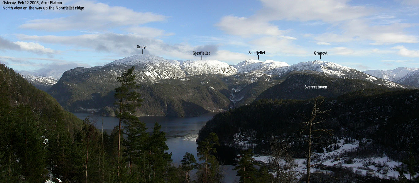
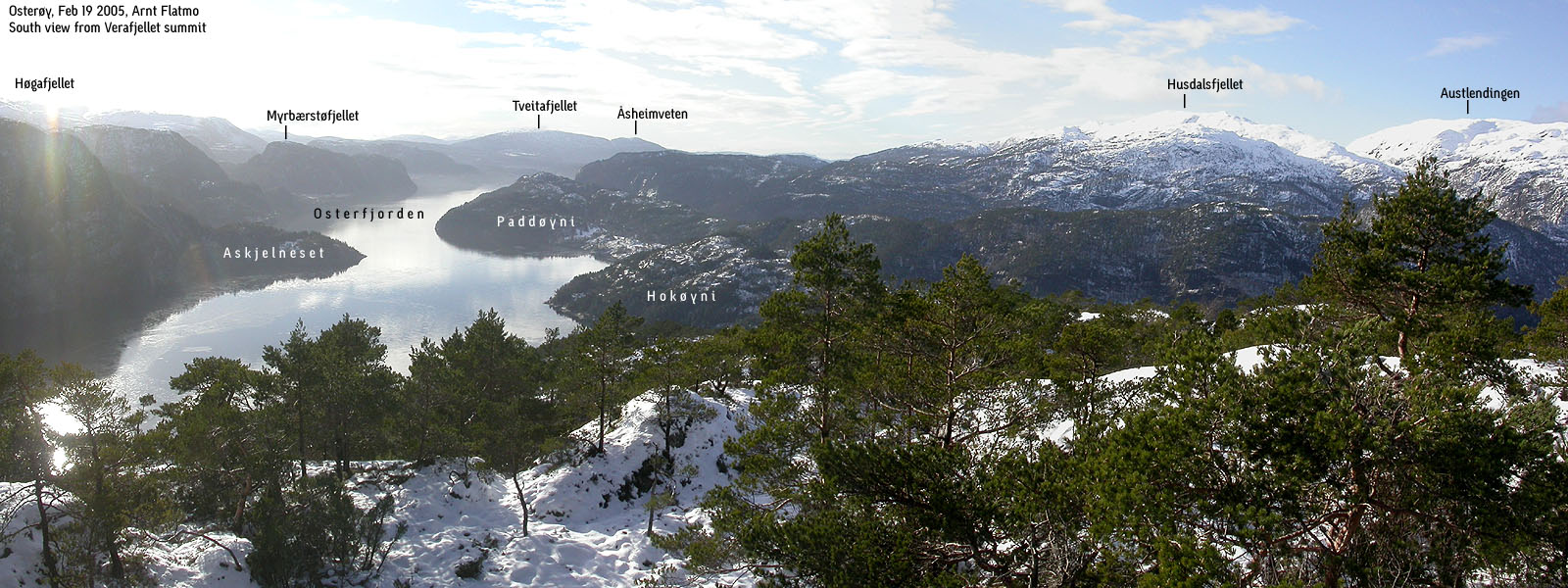
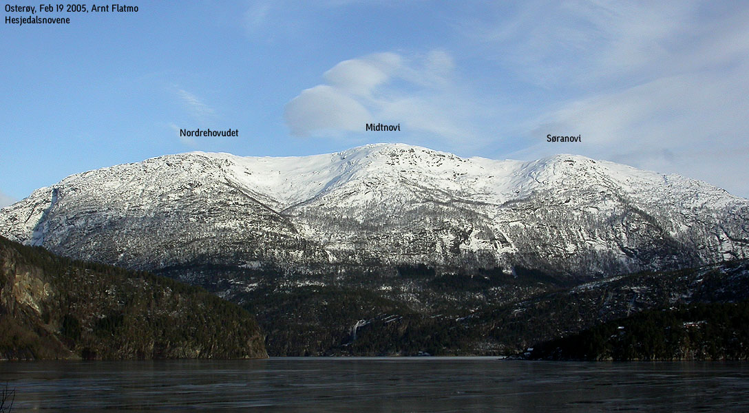
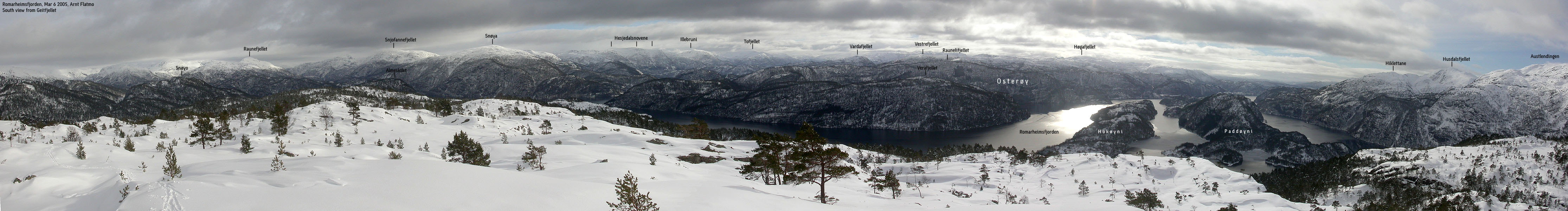
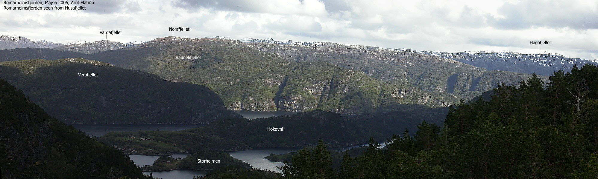
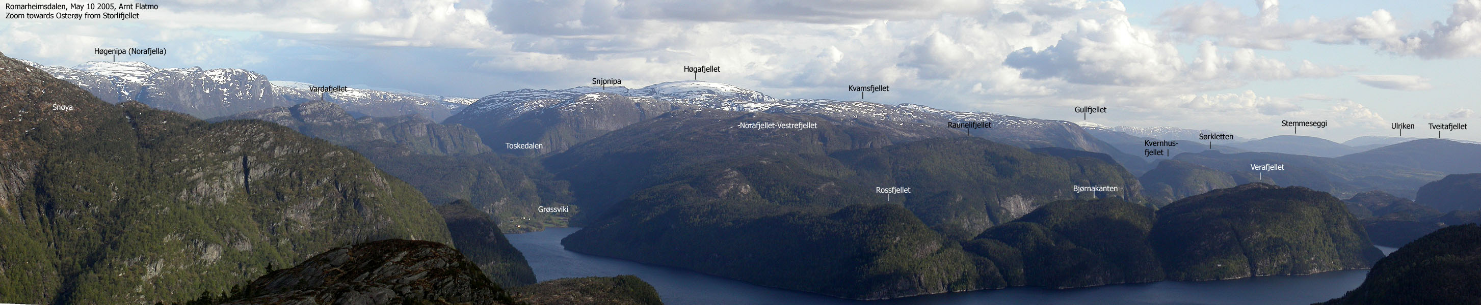
The views from Verafjellet are surprisingly good. From the summit, you have a clear view towards Austlendingen, mountains above Romarheimsdalen valley, and the mountains above Hesjedalen and Straume. In addition, you see a number of hills and mountains further south - southeast on Osterøy.
Verafjellet (M711: 314m, Ø.K: -) has a primary factor of 221m towards the higher Fløyfjellet (359m) The saddle is found just east of Bjørnakanten. Ref. Økonomisk Kartverk (5m contours), you cross the 95m contours on the high route, but not 90m. The saddle height has been interpolated to 93m.
Notes: Class ratings are in reference to YDS. Click here for more information.
The trails described below are not necessarily the *easiest* trails to this mountain.
|
Grøssviki - Verafjellet (summer)
|
|
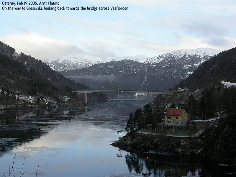
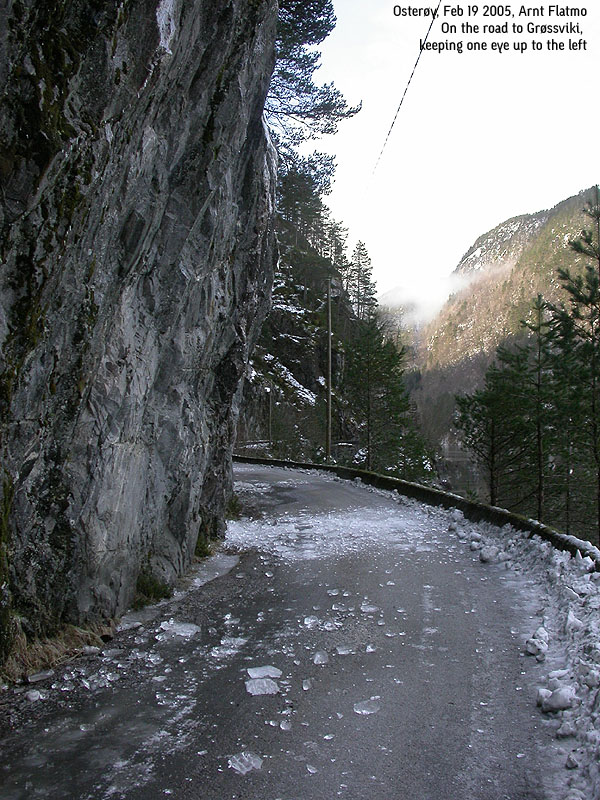
From Bergen, follow highway E16 towards Oslo and Voss. Pass Dale (approx. 50Km from Bergen), and 2,7Km after Dale, turn left towards "Romarheimsdalen/Mo". Follow this road for approx. 11,7Km. Cross the bridge across Veafjorden (signed Gammersvik) After Gammersvik, you reach the houses at Grøssviki. Head up the curved road towards Toskedalen, and in a sharp left curve, 7,6Km from the bridge across Veafjorden, and 19,2Km from highway E16, locate a forest road to your right. Park here. (The left curve is the first sharp curve as you start on the road to Toskedalen)
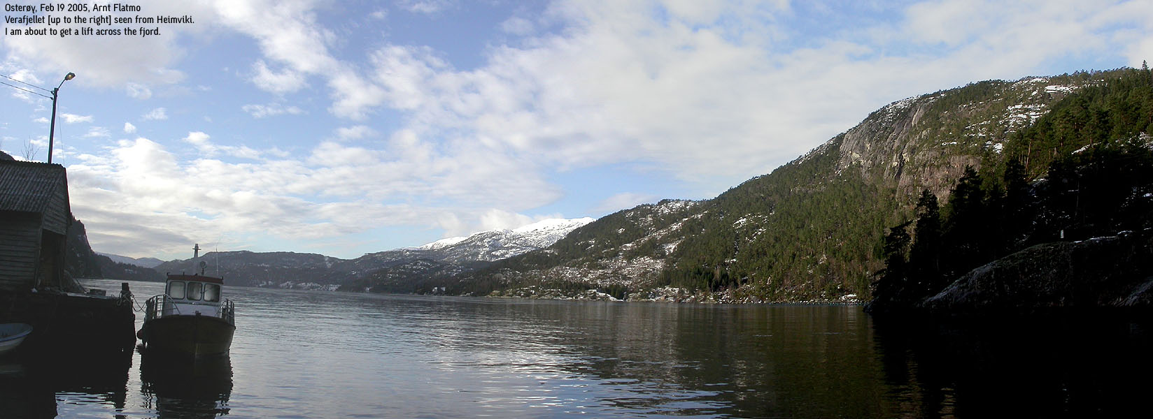
A boat, carrying mail, is departing from Vike harbor every day. If you aim to reach this mountain via boat from Vike, talk to the people at the grocery store in Vike.
To Heimviki
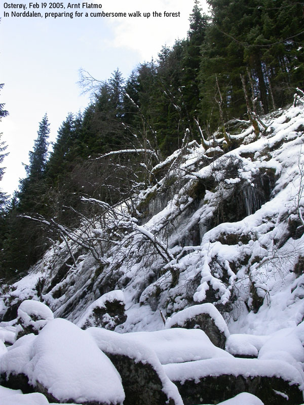
Follow the forest road northbound, then northwest. The road then curves and heads southbound. When the forest road has leveled out, leave the road and head up into the forest. Try to locate a "corridor" in the terrain, with a long cliffband on the north side. This "corridor" runs across the Norafjellet north ridge and will take you to a path that descends into Norddalen valley.
At approx. 220m elevation in Norddalen, head up the Raunelifjellet north ridge, and keep a northwest bearing. This direction will take you to a pass (approx. 330m elevation) on the Raunelifjellet ridge. Descend northwest to a distinct, large valley, and follow this valley all the way down to Heimviki. There are steep parts in this valley, but if you look for the best options, you will not run into any particular challenges.
Down in Heimviki, find the farm road and walk down to the houses.
To Verafjellet
This description is quite simplified, as I have not walked it. Follow a forest road that climbs up towards Bjørnakanten. Head southwest towards the pass between Bjørnakanten and Verafjellet. Apparently, there are only 1-2 places that allow for descent, and the terrain is in general steep and unfriendly. Once down in the pass, there should be no more problems towards Verafjellet.
Return the same way you came.
|
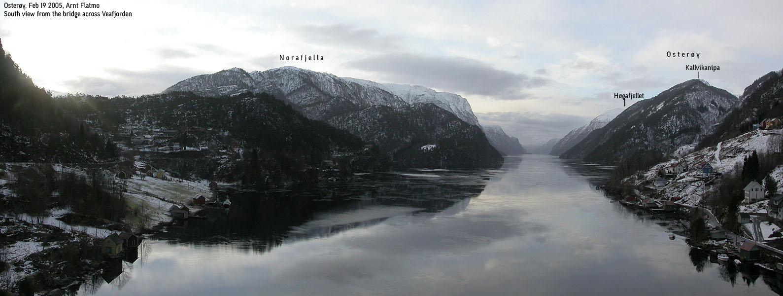
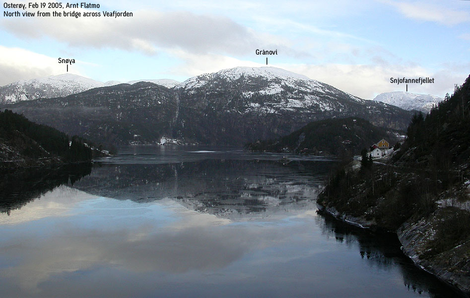
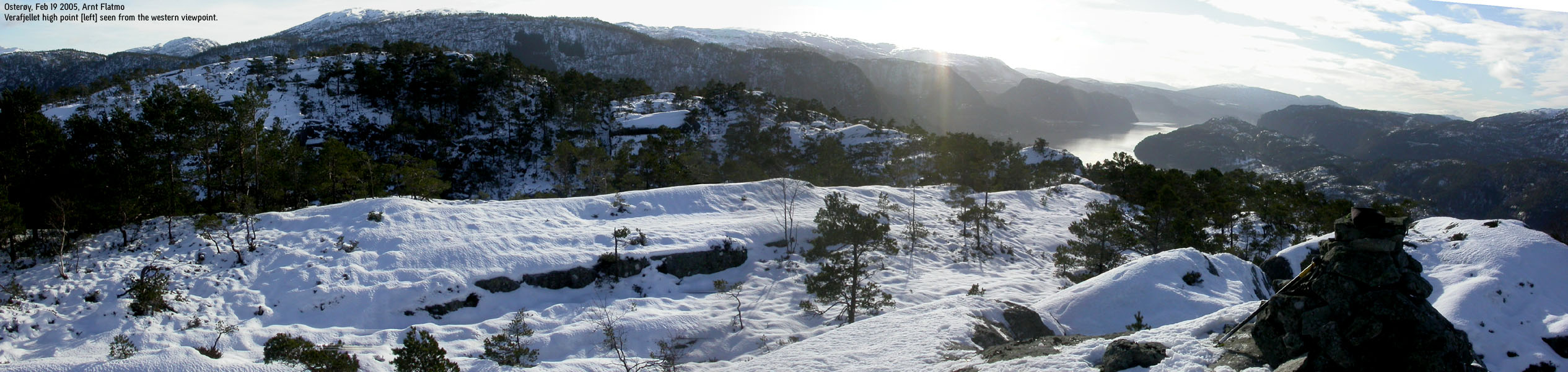
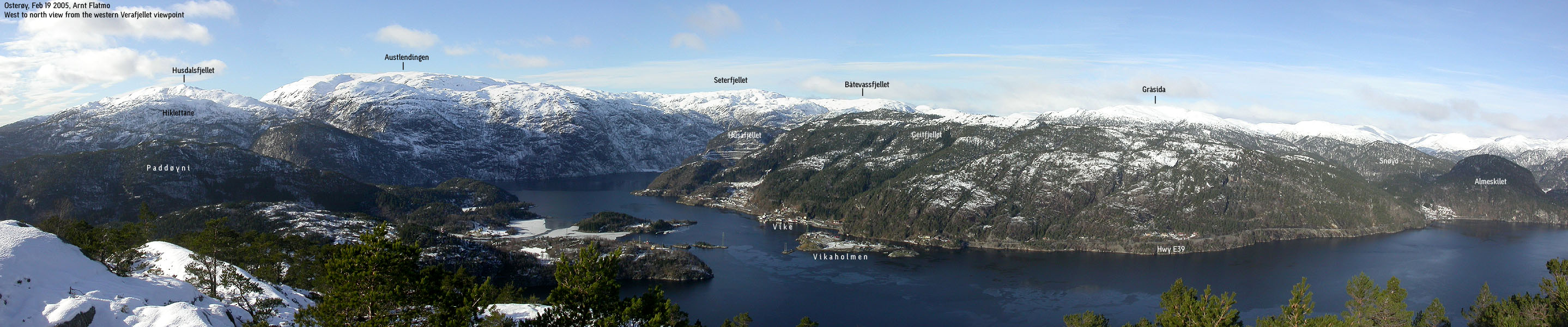
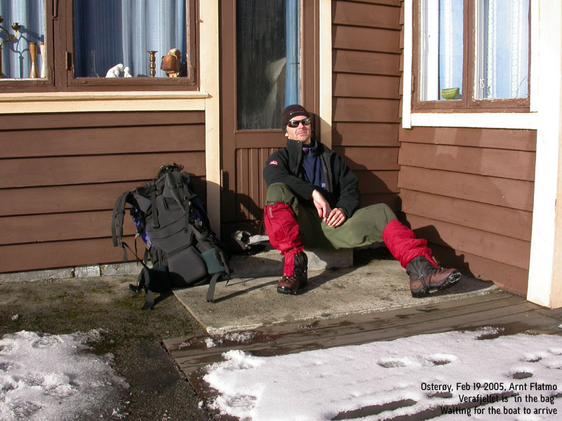
Trip report Feb 19 2005While most sane people spent this sunny Saturday either going on the winter holiday, or skiing in the high mountains, I chose a remote, low hill on Osterøy. First of all, I had been wanting to collect this very last hill on Osterøy island (and Osterøy Kommune) for a long time. I knew that the hike would be very strenuous, and I was not looking forward to carry the dog up and down the forest hills. But since Troll now was spending the week-end with some friends, my backpack was considerably lighter. So, while I really wanted to visit a much higher mountain, I decided to go for Verafjellet.After I passed the bridge across Veafjorden, I found the road to Grøssviki to be insanely icy. In addition, crushed icicles were all over the road, for several kilometers. When I arrived Grøssviki, I was forced to park there. There was no way I could drive further on the road leading to Toskedalen. No big deal, only 800m extra walking (both ways), and by 09:50AM, I was on my way upwards. It was indeed helpful that I knew the first part of the route, from my previous Raunelifjellet hike. This was infact my fourth visit to this area. In addition to Raunelifjellet, I had hiked Vardafjellet, Kallvikafjellet, Pina, Snjonipa and Kvamsfjellet from this side. But now there was snow, making the hike more strenuous than last time. It wasn't much snow, but the hard crust gave in when I walked. The rhythm became robotic, and I would have been better off with twice as much powder snow. I still managed to keep a good pace, and reached the Raunelifjellet ridge at 11:00AM, after a steep hike up from Norddalen valley. From this position, Verafjellet looked far away. I began the descent towards Heimviki. The plan was to follow a large valley, whose stream was running out in Heimviki. I was a bit too far north, and decided to make a shortcut towards this valley. This shortcut led me into steep and nasty terrain, and I had to climb down some sections in order to reach the valley. I was mighty happy about bringing the ice-axe along. It came in very handy. I reached Heimviki 12:25PM, and met Tore Heimvik. I had spoken with Tore on the phone, about 6 months earlier. The original plan was to reach Verafjellet by boat from Vike. Tore told me back then that he was willing to give me a ride, but I never found the time to follow up the plan, back then. Tore now told me that he did not recommend that I tried to reach Verafjellet via Bjørnakanten. Apparently, there are sharp cliffs above the pass, and the only possible routes were too icy to mess with. Instead, he offered me a boat lift to the other side of Heimvikvågen. The route from the south side was trivial. By 11:45PM, I was standing on the other side, and Tore headed back to Heimviki. He would return in a couple of hours to pick me up. I headed up the mountain, keeping a western bearing. This would get me to the ridge, and then I would head northbound towards the top. This "wrong-way" route made me impatient, and I changed my course to northbound. This led me to some impressive cliffs, and all sorts of trouble. But eventually, I found a corridor that led me up to the high ridge. I reached the 314m summit 12:25PM. I took a well earned break for lunch (which was only a chocolate bar), before I moved on to the western viewpoint, approx. 310m elevation. I found the views from the mountain to be quite good, despite the modest elevation. After a round of pictures, I headed down the mountain, and was back at the drop-off point 13:10PM. I didn't expect Tore to return before 14:00PM. I killed time scouting for a way along the shoreline, should he happen to forget about me. I hadn't brought a cellular phone, so my evening plans were all in the hands of Tore. He did probably spot me, walking restless back and forth on the other side, because he was on his way already by 13:40PM. Back on the other side, I thanked him for his kind gesture, and after a small chat, I headed upwards 14:00PM. I had expected to be more tired on the long walk back up to the Raunelifjellet ridge. But the thought of dry clothes, a warm car and more chocolate helped me to keep up the pace. I reached the car 15:30PM, which meant that I had kept the same pace as when I headed from Grøssviki. The hike had taken 5,5 hours, and I had climbed 1050m vertical meters in total. An insane number for a 314m high mountain. On my way back to Bergen, passing Hesjedalen, I decided to come back here the day after. If I was able to drive all the way up to Hesjedalen (icy roads), I would ski to Storfjelli, 1115m. Enough walking.
Pictures from the Feb 19 2005 hike
Move cursor to read notes, and click on the images to see full version.
No Javascript: 1 2 3 4 5 6 7 8 9 10 11 12 13 14 15 16 17 18 19 20 21 22 23 24 25 26 27 28
|


No Javascript:
Other hordaland mountains
 Other Osterøy K. mountains
Other Vaksdal K. mountains
westcoastpeaks.com
Other Osterøy K. mountains
Other Vaksdal K. mountains
westcoastpeaks.com


