
Norwegian Mountains, Møre og RomsdalBlåtinden, 1214m
|
| Fylke/Kommune : | Møre og Romsdal/Ørsta | ||||||||||
| Maps : | 1219-III Hjørundfjord (Statens Kartverk, Norge 1:50 000) | ||||||||||
| Primary factor : |
Blåtinden: 642m Veirahaldet: 172m Stokkehornet: 46m |
||||||||||
| Hiked : | Veirahaldet: June 2006, Dec 2008, Blåtinden: Oct 2009 | ||||||||||
| See also : |
| ||||||||||
| See also : | Other Ørsta mountains |

Blåtinden and Veirahaldet seen from the air
(Click for larger image)
Veirahaldet is one of the most popular skiing mountains in Ørsta kommune. This is an easy mountain to reach on skis and on foot, and in winter - many use the ski-lifts from the Bondalseidet skiing centre to get an easy start. "Veir" is local dialect for weather. "Hald" means to hold. The book "Sunnmøre" (Kristoffer Randers) explains that this mountain "holds off the weather". More precisely, "vedrhald/verhald" is a mass of clouds with trailing winds, where the clouds lower the wind-speed.
Blåtinden connects to Veirahaldet through a sharp and "unfriendly" ridge. The normal route to Blåtinden runs from Lake Trollvatnet and straight up, and is considered to be a more advanced hike/ski-trip than Veirahaldet. The steepest section above Trollvatnet is approx. 35 degrees, and one has to consider the avalanche hazard. If the snow is hard, ice-axe and crampons are necessary. This is indeed true for most mountains, the summit of Veirahaldet included.
The normal starting point for both mountains is the Bondalseidet skiing-centre, but some also approach Veirahaldet from the west. This page also describes a marked path from Tvergrova. If your goal is Blåtinden, then the Tvergrova route is slightly shorter than the one from Bondalseidet.
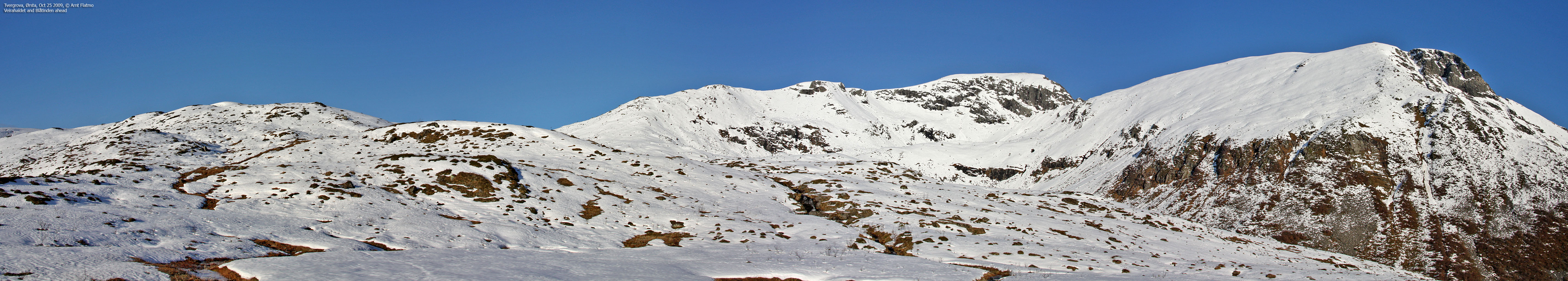
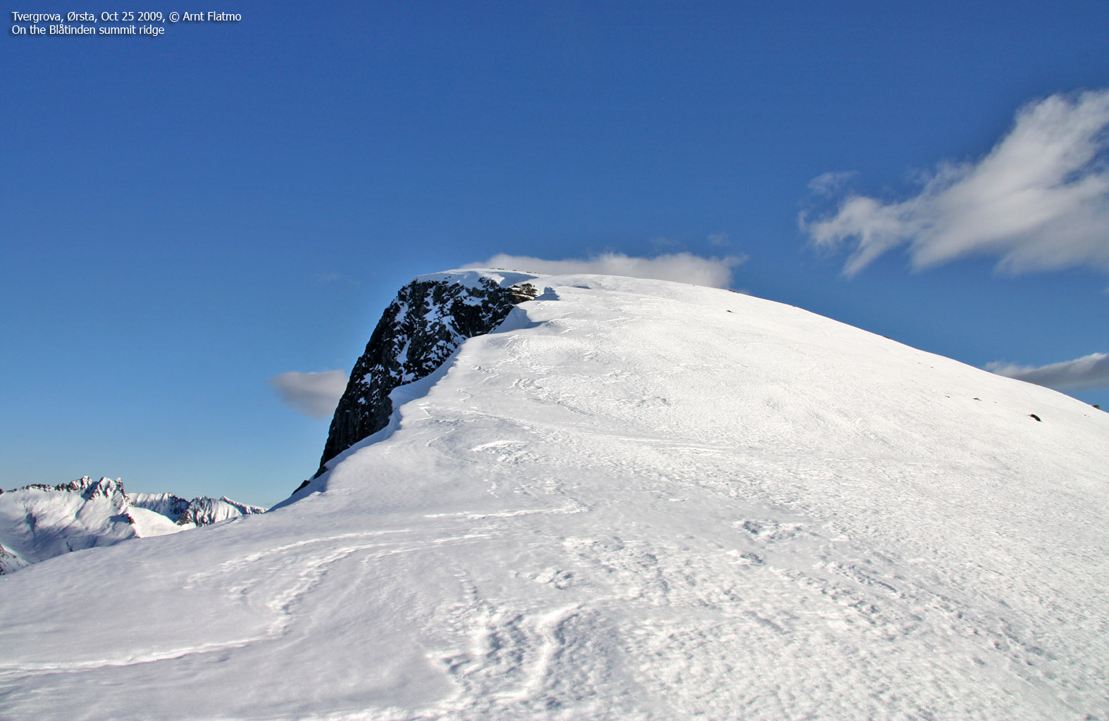
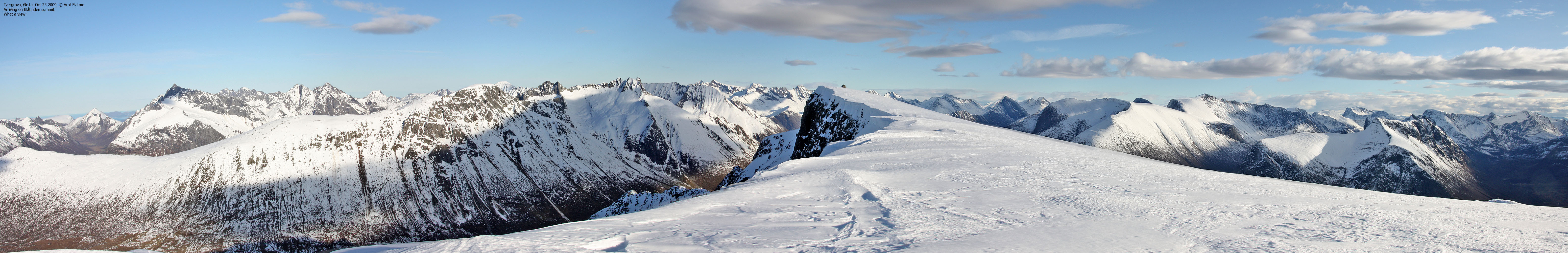
Both Blåtinden and Veirahaldet are fantastic viewpoints. Most of the central peaks in the Sunnmørsalpane mountain range can be seen from these two summits.
Stokkehornet is a popular top, located on Blåtinden's northeast ridge. The normal starting point is in Frølandsdalen and the route is described on this page.

Blåtinden and Veirahaldet
(Click for larger image)
Blåtinden (Norge 1:50,000: 1217m, Økonomisk Kartverk: 1214m, UTM 32 V 360458 6897230) has a primary factor of 642m towards the higher parent mountain Hellefjellet (1239m). The defining saddle (approx. UTM 32 V 360334 6899098) is found at Frølandseidet (west of Frølandssætra). Ref. Økonomisk Kartverk (5m contours), the saddle is defined through a fixed point - 572m.
Veirahaldet (Norge 1:50,000: 1206m, Økonomisk Kartverk: Highest contour is 1205m, UTM 32 V 359371 6897290) has a primary factor of 173m towards the higher parent mountain Blåtinden. The defining saddle (approx. UTM 32 V 359657 6897086) is found between the two tops. Ref. Norge 1:50,000 (20m contours), the saddle is within the range 1030-1035m, interpolated to 1033m.
Stokkehornet (Norge 1:50,000: -, Økonomisk Kartverk: Highest contour is 920m, Internet sources: 924m, UTM 32 V 361681 6898034) has a primary factor of 46m towards the higher parent mountain Blåtinden. The defining saddle (approx. UTM 32 V 361376 6898053) is found between the two tops. Ref. Norge Økonomisk Kartverk (5m contours), the saddle defined through a fixed point - 878m.
Google's interactive map. You can zoom, pan and click on the markers.
|
|
|
Notes: Class ratings are in reference to YDS. Click here for more information.
The trails described below are not necessarily the *easiest* trails to this mountain.
|
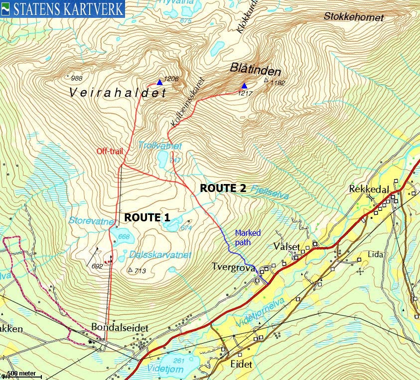
Route 1: Bondalseidet - Veirahaldet (summer/autumn)
|
|
Access
(all distances are approx. distances)
Ålesund is the nearest larger city. From Ålesund, follow highway E39 towards Bergen/Volda to the ferry at Solavågen. Take the ferry over to Festøya. Turn right in the direction of Volda. Follow highway E39 approx. 35,5Km to a junction in Ørsta. Turn left onto road RV655 (towards Sæbø). Drive approx. 13Km to Bondalseidet (do not turn left towards Follestaddalen along the way) and turn left towards "Skisenter". 500m up the road, you will find parking.
The route

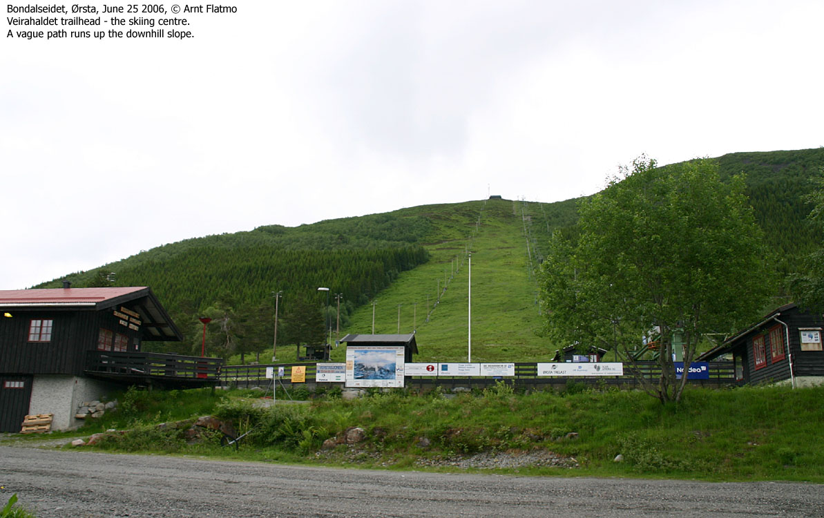
Bondalseidet skiing-centre
(Click for larger image)
The route to Veirahaldet is very easy. Hike below the lower ski-lift (a vague path runs up the hill) to Eitrefjellet. Descend to - and pass Lake Storevatnet (either side is fine) and follow the upper ski-lift (Nottane) to its end at 860m elevation. Continue north/northeast up to the ridge and follow the ridge (across boulder) to the summit. Descend your ascent route.
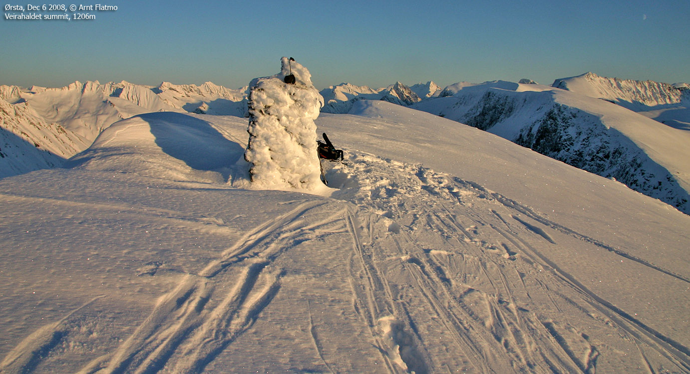
Note that in spring, cornices and the mountain snow blend together, and can be dangerous in fog. Make sure that you are ON the ridge proper on your way to the summit. The summit is marked by a proper cairn.
|
Route 2: Tvergrova - Blåtinden (summer/autumn)
|
|
Access
(all distances are approx. distances)
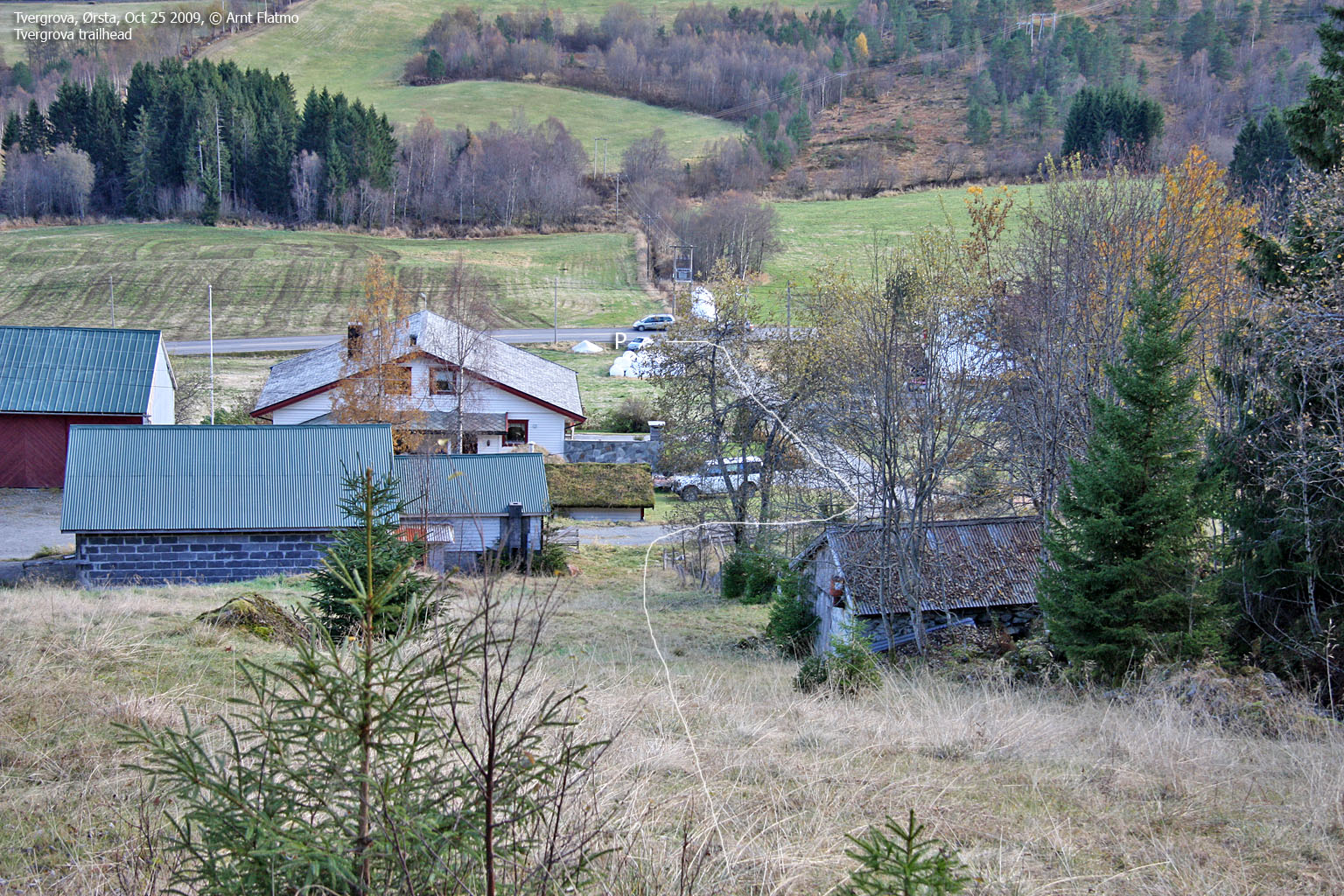
Ålesund is the nearest larger city. From Ålesund, follow highway E39 towards Bergen/Volda to the ferry at Solavågen. Take the ferry over to Festøya. Turn right in the direction of Volda. Follow highway E39 approx. 35,5Km to a junction in Ørsta. Turn left onto road RV655 (towards Sæbø). Drive approx. 13Km to Bondalseidet (do not turn left towards Follestaddalen along the way) until you see the "Skisenter" signpost. Drive additional 2km in the direction of Sæbø, locate a road going up to your left and find parking at the bottom of this road.
The route

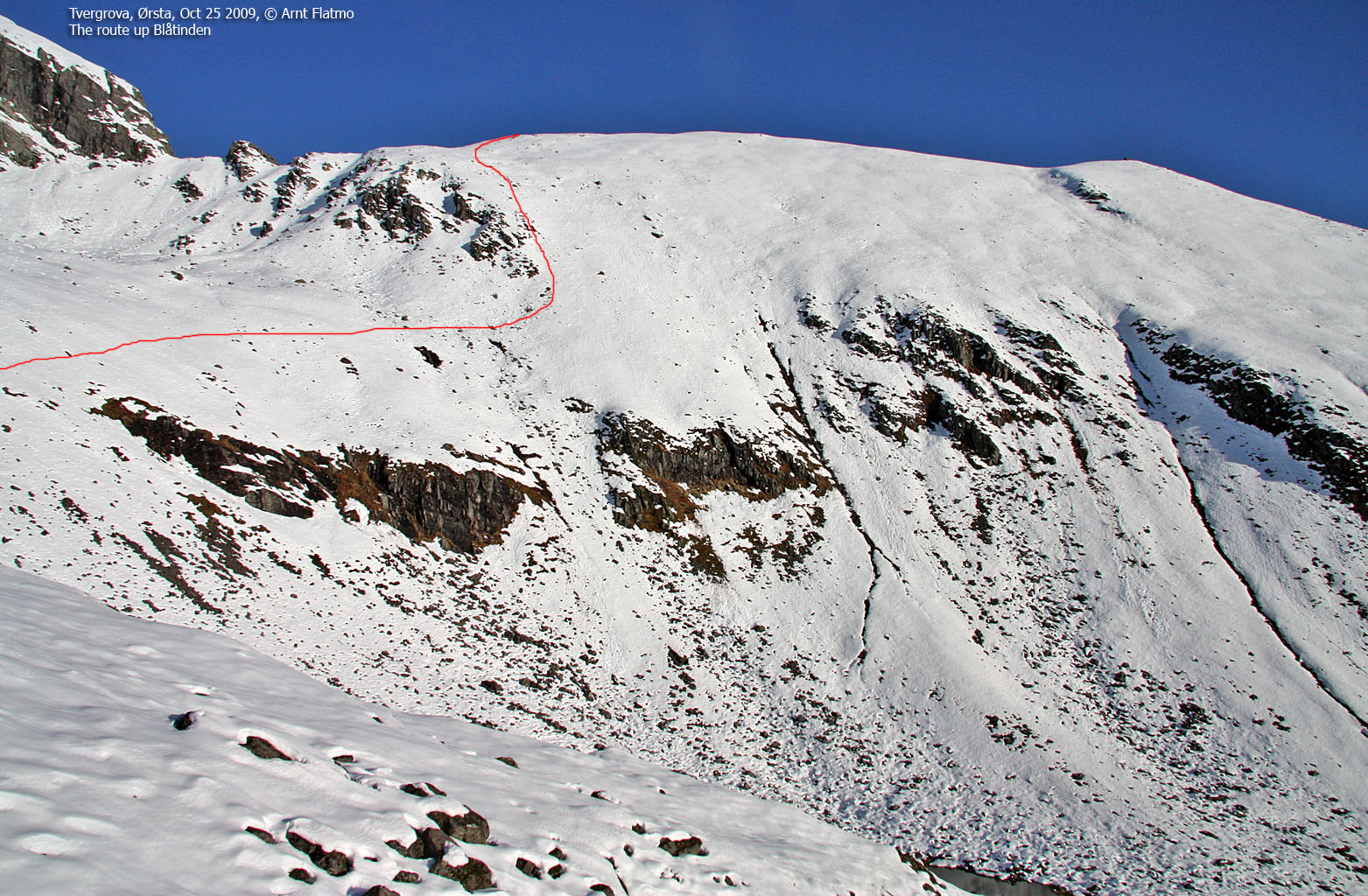
The route from Tvergrova
(Click for larger image)
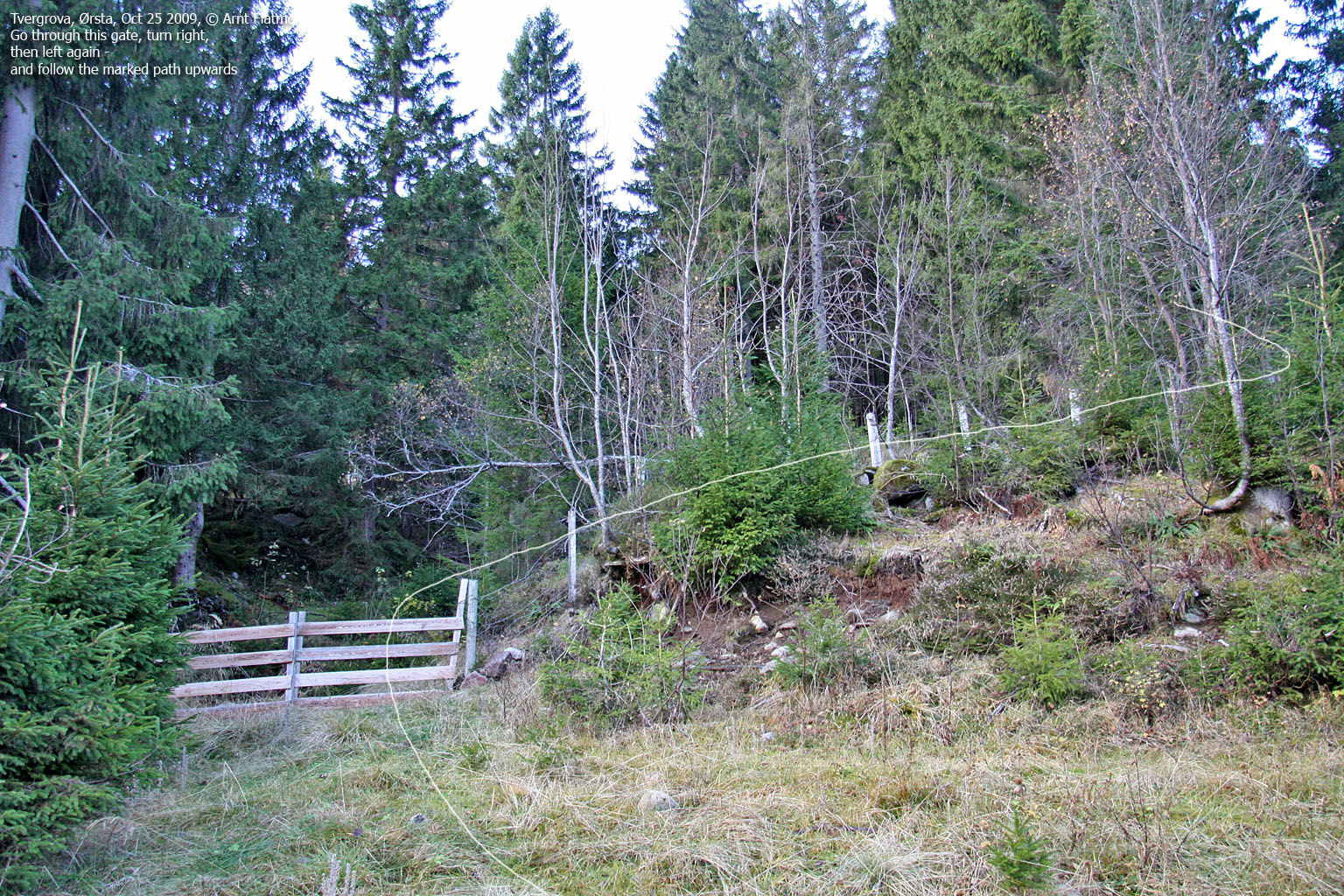
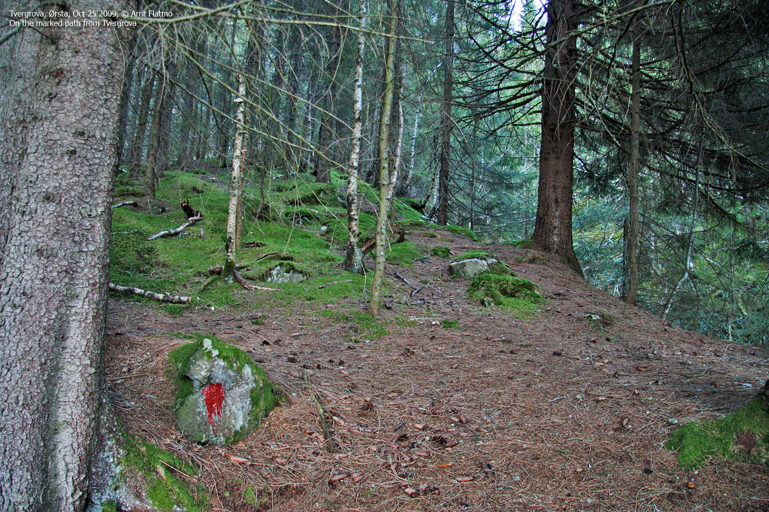
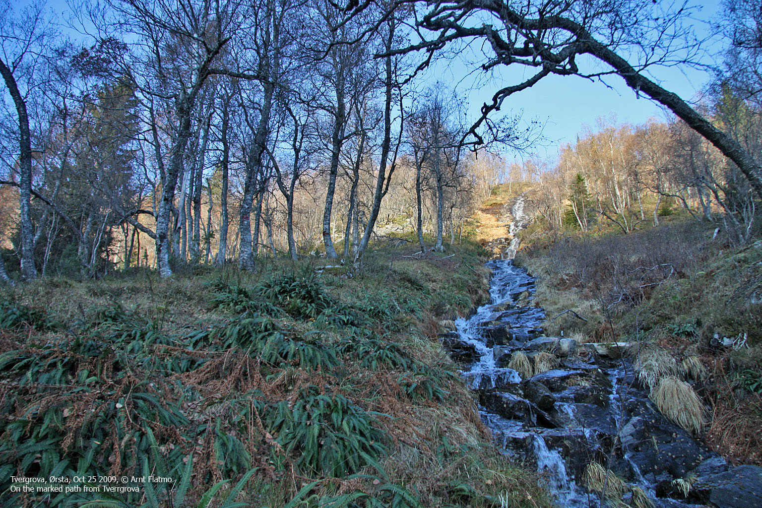
Walk up the road and head up a field behind the uppermost house. Go through a gate, turn right, then left after 50 metres. Follow a forest path (marked with red paint), which crosses the creek after a little while. The path continues more or less along the creek (you have to cross it one more time) until you top out on the plateau below Veirahaldet and Blåtinden. The marked path ends here.
Aim for the ridge south of Trollvatnet (you can't see this lake until you get there), turn right and head up Blåtinden - staying right of the pinnacles on the Veirahaldet - Blåtinden saddle. Follow the ridge up to the summit cairn, marked by a medium-sized cairn.
|
Route 3: Frølandsdalen - Stokkehornet (summer/autumn)
|
|
Access
(all distances are approx. distances)
The starting point for this description is Ørsta. Follow RV 655 in the direction of Sæbø/Hellesylt. Pass the Ørsta skiing centre. On your way down Bondalen in the direction of Sæbø, look for the "Stokke - Olagarden" signpost. Turn left here (N62.18348 E6.38303). Then drive (unpaved road);
The route

The route from Frølandsdalen
(Click for larger image)
Follow the path (partly marked with sticks higher up) south until you reach the ridge. Then follow the path west up to the Stokkehornet viewpoint cairn at N62.18955 E6.35482 (approx. 835m). This is where the visitor's register is located. You will pass a steep section along the way, and the path runs on the left-hand side here. Although some may feel that the route is a bit airy, there are no direct dangerouse sections.
From the viewpoint cairn, continue 0,7km west along the ridge. The high point is not marked, other than by a few rocks. You might see a cabin (N62.18883 E6.35153) on your way to the high point.
Descend your ascent route, or continue in the direction of Blåtinden. This route looks quite advanced with some tricky pitches. It is also possible to descend into Frølandsdalen. Pass the low point between Stokkehornet and Blåtinden, locate a cairn and see if you can find a way down here. Note that it is very steep so you need to make sure that you won't stumble or slide!
 westcoastpeaks.com
Other Møre & Romsdal mountains
Other Norwegian mountains
westcoastpeaks.com
Other Møre & Romsdal mountains
Other Norwegian mountains


