
Norwegian Mountains, Møre og Romsdal
Vardehornet on foot, Mar 15 2008
To the main Vardehornet page.

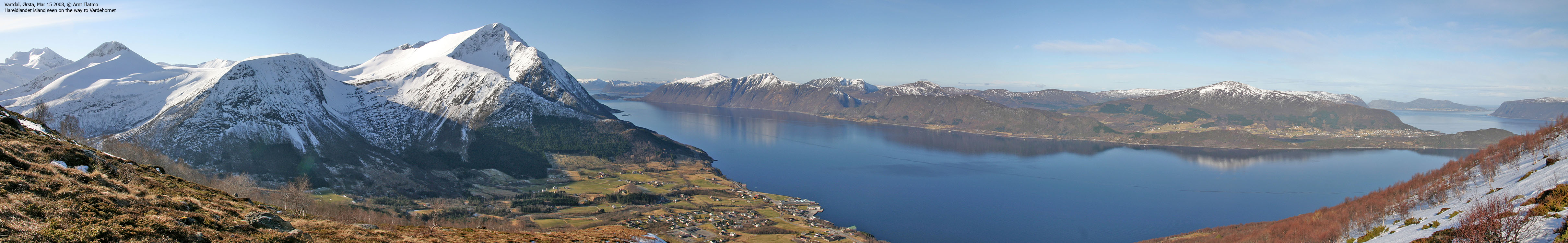
On the way to Vardehornet
(Click for larger image)
What??
I accepted that the nice weather period was officially over, now that the weather forecast announced snow > 300m for this Saturday. But when I woke up, the weather was nothing but brilliant. The decision to go to Vardehornet was made in a split second, and I threw most of my hiking and skiing gear into the car. Driving the car roof down was of course mandatory, and with the limited trunk space that goes with this kind of luxury, my dog Troll had to share the passenger side with a pair of skis, a pair of snowshows, skins, crampons, a full backpack and more. But having spent half of his life inside a backpack, he's quite used to confined space.
Brrr...
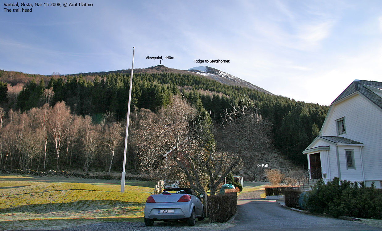
I had forgot to mind the temperature. Will it was nice in the sun, it was equally cold in the shadow (0-1 deg. C). The ferry ride over to Festøya was a cold one, but luxury calls for some sacrifice. I didn't know anything about any routes to Vardehornet, so I had to ask around. Already at the first doorbell, I learned what I needed to know. A nice chap explained everything in detail.
Puh...
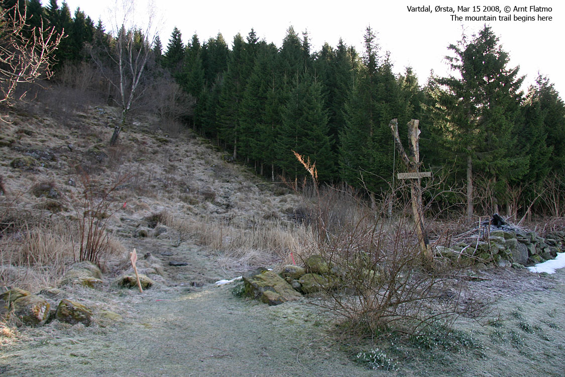
I left the trail head 10:06AM. Based on the view upwards, I decided to leave the skis in the car. I was now carrying a dog, a pair of snowshoes, crampons, heavy photo equipment, poles and more. I had put on extra clothes at the trail head, and after 10 minutes of walking, I was dripping wet from sweating.
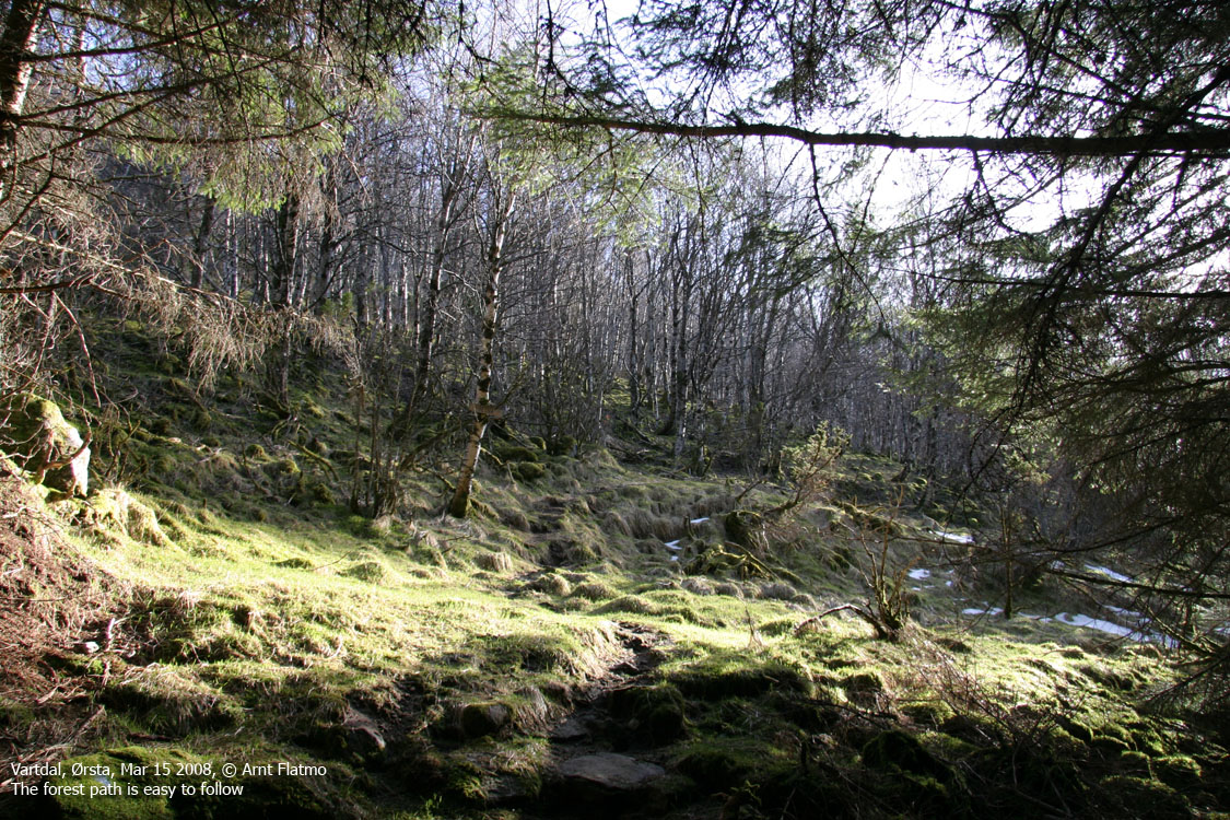
To "kill" time during ascent, I try to be mindful about my upward progress. Starting out from 50m elevation at 10:06AM should - in average - lead me up to 550m elevation within the hour (when I carry a heavy backpack, that is). The clue is not to look at the watch in the meantime. I can then claim "an extra point" if I made it on schedule. That doesn't mean that even if I get higher in that given hour, you will hear me shouting; disappointed!!!

Vardehornet
(Click for larger image)
To the top
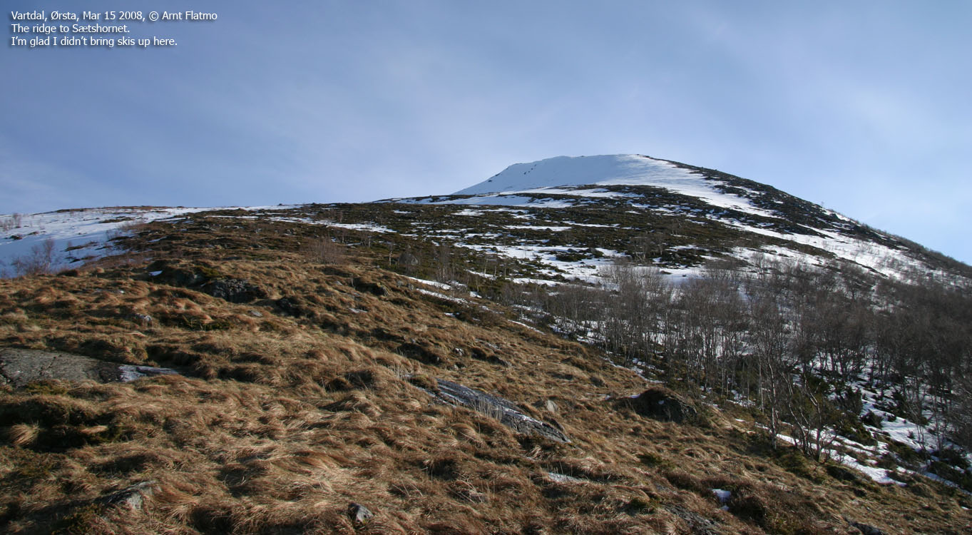
11:06AM, I passed 620m elevation and was now on firm snow. That meant that Troll could do some walking on his own, which he did. Once the mountainside got steeper, I had to carry him again, but he walked the remaining kilometer from Sætshornet to Vardehornet, which we arrived at 12:01PM.
What a day and what a view. The pictures speak for themselves. Days like these just come around way too seldom! Troll was resting on top of my backpack, wrapped in a blanket. He looked peaceful. I envied him the moment, although I just don't have the patience to spend time on a mountain top.
The hill between Sætshornet and Vardehornet was 50% firm snow and 50% blue ice. Since the blue ice was covered with a think layer of snow, we never knew whether we would slip or not. I've been to icy mountains many times, but it has been a different kind of ice. This was just like walking on an icy lake. I had a vague plan about making it all the way to Fossholtinden, but got discouraged. In addition to the icy surface, the pockets with snow were already turning soft, and it would be a strenuous walk.
Isflåna and descent
As some kind of substitute for Fossholtinden, I walked over to Isflåna for additional views along the way. The saddle between the tops allowed me to go to the very edge above Årskogdalen without having to worry about cornices. Instead of taking a direct route back to Sætshornet, it was easier to follow my tracks back up to Vardehornet. That way, I see if I was walking on ice or not. So, 12:55PM, I passed Vardehornet for the second time.
Troll walked all of the way down to the trail head, which we
reached 14:13PM. Back home in Ålesund, I considered going up to another mountain
- the beautiful day and all - but chose not to. I don't want my readers to think
I'm an oddball ![]()


