
This route is described as route 1 on the Uksenøya main page.
It was the third day in a row with gorgeous weather. As the new appartment was sort of under control, it was time for the third trip in three days. I had some afternoon appointments, and was limited to the nearby mountains. As I had visited the Giske and Sula high points the two previous days, I decided to visit the highest point in Ålesund kommune. The primary reason was that this mountain would take me closer to some high and distinct tops further north that I hadn't been able to identify.
I drove to Vasstranda, and headed up a forest road that was outlined on my city map. The dog ("Troll") and I left the car 10:55AM, but I had to carry Troll the remaining 4,5Km to the summit. I had the skis in the car, but for some reason, I decided to leave them there. For the first kilometer, this seemed like a good idea, but from then on, skis would have been the best choice. On my hike to Sulafjellet the day before, skis weren't really necessary, but the snow conditons were different here.
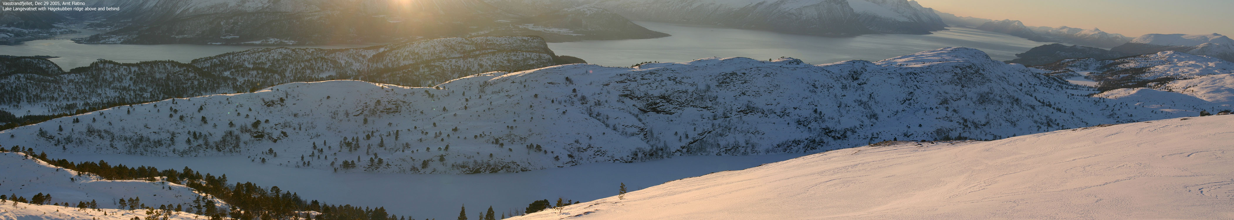
We reached Lake Langevatnet 11:35PM after a fairly easy hike in tracks up the forest road. From the lake, I aimed directly for Ursfjellet's southwest ridge, and although I had to break trail in powder snow, the hard snow below held my weight. Up on the ridge, the snow became softer and thus, deeper. However, the snow depth wasn't a big issue until I reached the mountain plateau, where I sunk to knee-depth in soft snow. A man without skis on this mountain was ridiculous.
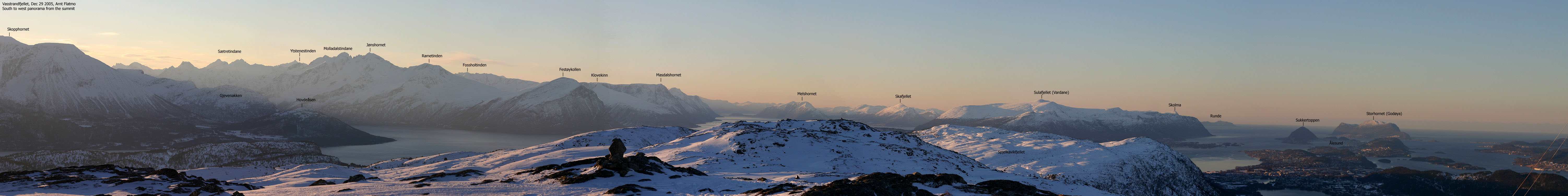
I reached the Ursfjellet summit 12:20PM and discovered that my wide-angle lens was no longer present in my backpack pocket. I figured I would locate it on my way down, and shot a round of pictures with my remaining lenses. I was now confident that I would be able to identify the high and distinct mountains towards the north. Troll had been able to walk for the last kilometer thanks to ski-tracks, and cried out for lunch. There were none, as I had forgotten it in the car.
When it was time to head back down, Troll took off like a rocket. I was unable to stop him, and soon he was just a dot in the horizon. I still wonder what got into him. Troll stopped when there were no more ski-tracks (they headed south) and I put him back into the backpack. Soon after, I found my lens partly buried in the snow. Another mental reminder; secure stuff! It felt strange to be on this mountain utterly alone on this wonderful day. As I passed point 548m, I saw a group of skiers coming up from the south (Magerholm).
After a quick hike down the ridge, we were back at Lake Langevatnet and Troll walked the remaining distance back to the car. We reached the car exactly 13:55PM, meaning the hike had lasted 3 hours for nearly 10Km.
To Ursfjellet


Summit panoramas


Descent


No Javascript:
1 2 3 4 5 6 7 8 9 10 11 12 13 14 15 16 17 18 19 20 21 22 23 24
 westcoastpeaks.com
Other Møre & Romsdal mountains
Other Norwegian mountains
westcoastpeaks.com
Other Møre & Romsdal mountains
Other Norwegian mountains