
|


Varden (The Cairn) is - bar none - the most popular (independent) mountain in the Tomrefjorden region. The top is very accessible due to a high trailhead and a short and easy trail, and the summit logbook reveals that the top had 1000 visitors in 2005. Varden may very well be the most visited mountain in the whole of Vestnes kommune.
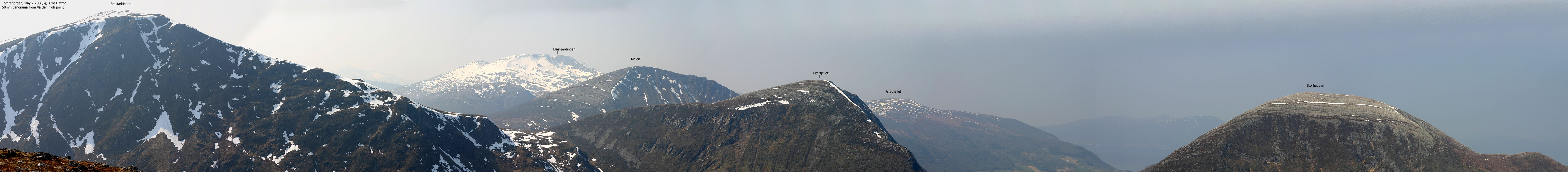
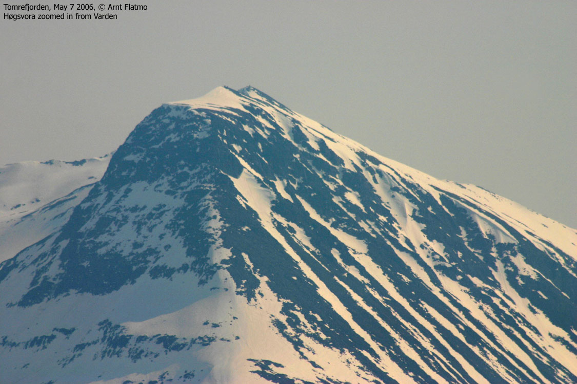
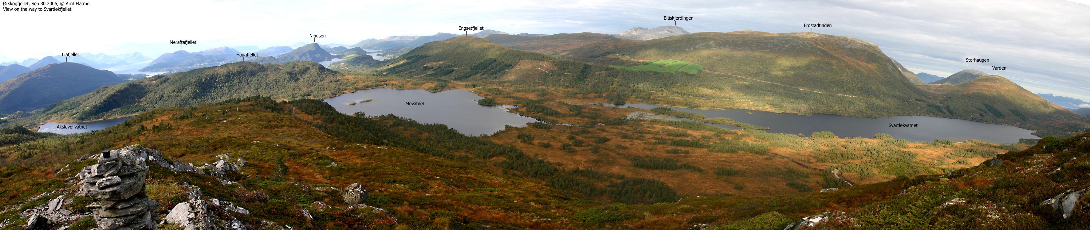
When I started to look around for pictures of the top (seen from other angles), I was frustrated. It was not seen on the zoom panoramas, only the top was seen on the 50mm panoramas and it became too anonymous on the wide-angle panoramas. At last, I found a picture taken from Høgsvora, that at least showed parts of the mountain. In other words, Varden is not a very dominating mountain. I used to think of it as "the hidden peak", tucked away between Frostadtinden, Melen, Oterfjellet, Storhaugen and Trolltinden (Brustinden). It was the last mountain in this region I learned to recognize from distance and various angles.
Still, it is a nice top to visit, and even if you can't see for miles and miles, the nearby Haram, Vestnes and Ørskog mountains are good views in their own rights. Shame on the person who named the top "Varden". Not only because there are already dozens and dozens of other tops with the same name, but mostly because it is boring and obvious. "Tomranipa" would have been a good name.
Varden (M711: 645m, Ø.K.: 643m, UTM 32 V 390770 6938779) has a primary factor of 272m towards the higher parent mountain Frostadtinden (807m) The defining saddle (approx. UTM 32 V 389736 6938453) is found between the two tops, on the south side of Lake Litlevatnet (Frostadvatnet on Ø.K.). Ref. Økonomisk Kartverk (5m contours), the saddle is within the range 371-375m, interpolated to 373m.
Note 1: Opposed to normal, I have NOT used the Ø.K. height (643m), as my GPS reported 648m as an average over 20 minutes.
Note 2: 645m is the high point. The summit cairn is found at 634m (Ø.K.), 118m E of the high point.
Note 3: On the M711 map, Litlevatnet seems to drain two ways. Ø.K. reveals that it drains north, and that is why the saddle is defined on the south side.
Notes: Class ratings are in reference to YDS. Click here for more information.
The trails described below are not necessarily the *easiest* trails to this mountain.
|
Tomrereset - Varden (summer/autumn)
|
|
Access
From Ålesund, follow highway E136->E39 eastbound towards Åndalsnes. You pass the place Sjøholt, drive across Ørskogfjellet, down Skorgedalen valley to the Molde/Åndalsnes junction just before you reach Tresfjorden. Turn left towards Vestnes and follow highway E39. At Vestnes, turn westbound onto highway RV661 and drive towards Tomrefjord. At Tomra, turn left onto a road marked "Seterveg". The distance from the Molde/Åndalsnes junction is 18Km.
Alternative route:
From Ålesund, follow highway E39 towards Åndalsnes. From the E16/E39/Olsvika roundabout near Breivka, follow E39 13,3Km. Turn right onto highway RV661 (Skodje/Brattvåg/Vatne) and drive the remaining 17,5Km up Vatnedalen valley and down to Fiksdal. Turn right in the Fiksdal junction and drive 7,3Km until you see the "Seterveg" roadsign on your right-hand side.
Follow the "Seterveg" road 2,8Km up to the Tomrereset parking area. You will see the "Varden" trailsign here. This is also the trailhead if you want to access Sandfjellet (Middagsfjellet) from the southwest.
The route
The path is visible all the way to the top. From the trailhead, it passes Tua (366m) on the south side, descends (slightly) into Hesteskaret pass and then gradually climbs towards- and later on Varden's east ridge. The summit cairn is NOT located at the high point. Proceed 118m westbound to reach the high point.
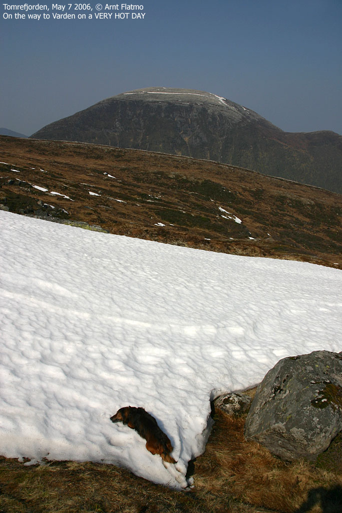
I felt lazy this Sunday morning. I had visited the magnificient top Skårasalen the day before, and didn't feel fully charged when I awoke. I had helped the neighbour with some labor the evening before, and there were beer later on. It was a "steaming" hot and hazy day, and I tried to convince myself that there is no shame spending the day at home. The Skårasalen pictures needed attention, and I had done quite a bit of hiking and skiing recently.
By noon, I couldn't play games anymore, and headed towards Tomrefjorden. Varden would be an easy hike, and I would be back home "before tea". My dachshund "Troll" and I left the trailhead 14:05PM, and the dog was quite willing to walk. Weird, given the heat (and this was the month of May! In Norway!). We reached the top 14:45PM and after lunch, Troll went to sleep.
I noticed the gravel road heading SW from Tomrereset and called a friend to find out if I had just discovered the fast way home. It turned out that I hadn't, but we had a long and good talk nevertheless. After the conversation, I laid down on the grass, and the dog came and rested his head on my chest. It was summer.
While enjoying the sunshine, I was thinking back to my first visit to Tomrefjorden back in 1999 or 2000. A couple of colleagues and I headed to this "nowhereland" to install a large computer on a seismic vessel that stopped by Tomrefjorden for a few days. We took a taxi from Vigra to Tomrefjorden, and while it was mostly dark, I remember thinking that I had not seen mountains (or at least contours) like this. The next morning, my first views were Varden, Trolltinden and Storhaugen. I explicitly remember thinking "I should be back one day and visit these mountains". Well, within the timeframe February 19 to May 7 2006, all of these tops had been visited, so the mission was certainly accomplished.
By 15:45PM, one hour after arriving the high point, we dragged ourselves down to the cairn and continued resting. I signed the summit logbook. I was visitor #81 in 2006. I noticed that there had been 1000 visitors in 2005. The last entry was Dec 29. I wondered if there had been people within the last two days that didn't sign in, leaving the round number alone. By now, the sweater had come off. It was an incredible hot day. A couple of hikers came and went, and I joined the last one for descent. We were back at the car 16:10PM and my very nice day in the Tomrefjorden region had come to an end. On my way back to Ålesund, I had a four-letter word (with double e's in the middle) stuck in my mind...
To Varden
Note:: Varying picture quality due to broken auto-focus.


360 deg. wide-angle panorama from the high point

50mm panoramas from Varden


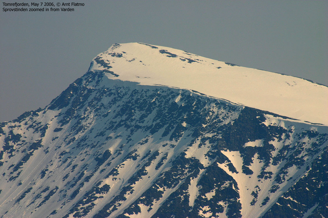
Zooms from Varden


Descent


No Javascript:
1 2 3 4 5 6 7 8 9 10 11 12 13 14 15


No Javascript:
 westcoastpeaks.com
Other Møre & Romsdal mountains
Other Norwegian mountains
westcoastpeaks.com
Other Møre & Romsdal mountains
Other Norwegian mountains

