
Norwegian Mountains, Møre og RomsdalTussen, 705m (Tusten)

Tussen
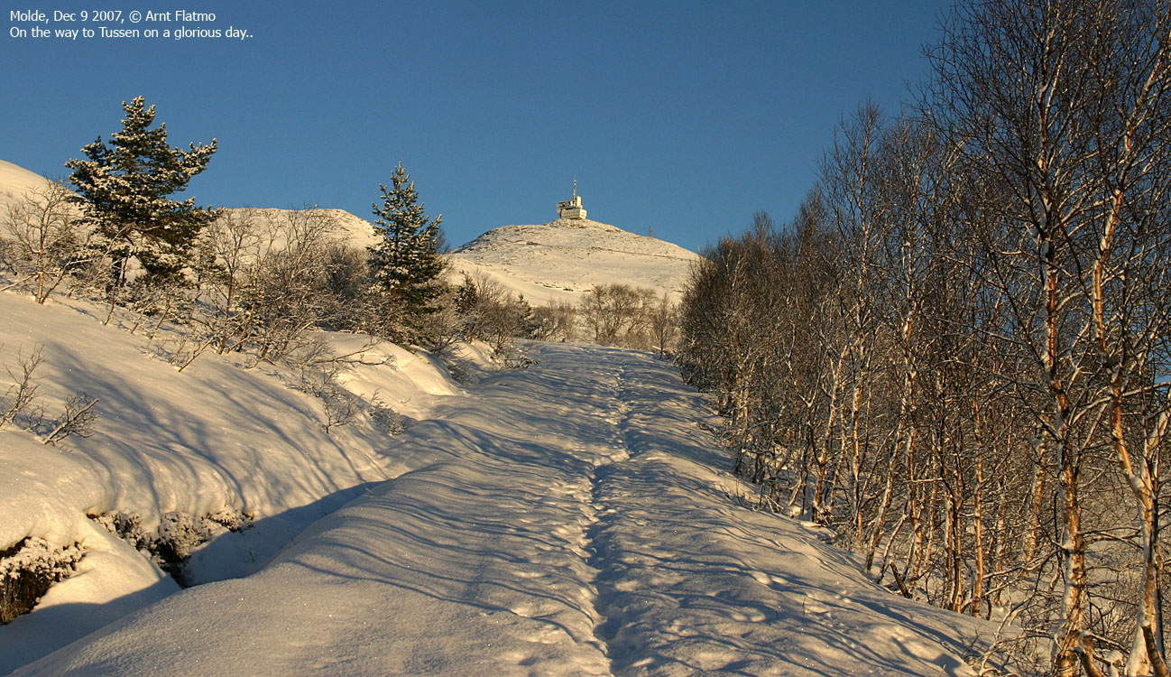
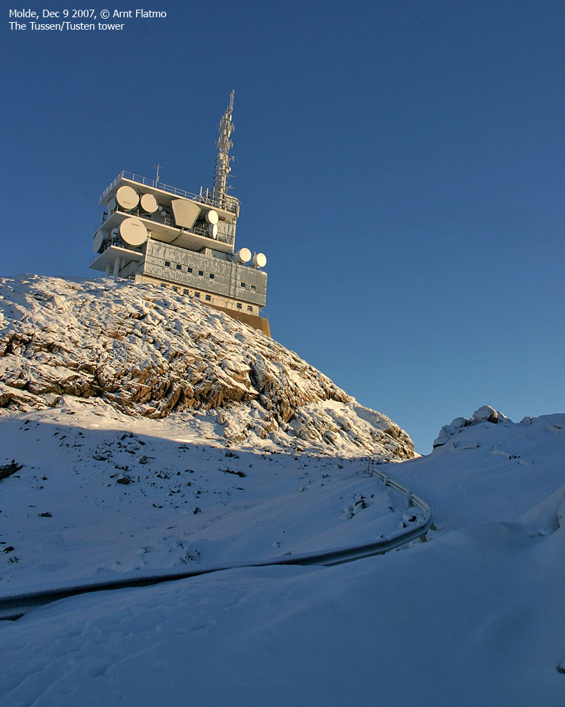
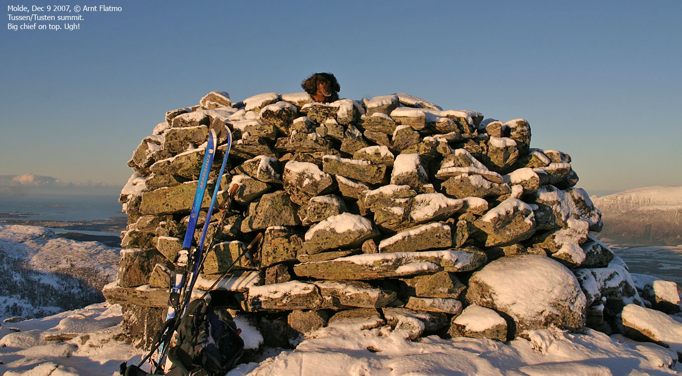
IntroductionTussen is a top along the Molde/Fræna border, and directly above the city of Molde. The mountain is best known for the ski-centre at the mountain foothills, and the downhill slopes from the top. The ski-centre is called Tusten, while the mountain is called Tussen on the public 1:50,000 map. Tussen is the name that is used on this site. The correct name is Tusten, but when spoken, the 2nd 't' is replaced with 's'. A mountain service road leads up to the large building at 670m elevation. The summit is located 360m to the north. The optimal winter round trip is to ski the mountain road and descend the downhill slopes. While you also can reach this mountain on path from the north (Malmfjorden), the normal route is up along the mountain road. This is the route described on this page. The view from Tussen summit are phenomenal. From the east to the west, you have a clear view towards Sunndalen, Romsdalen, Vestnes and Haram mountains (to name a few regions). Even Store Smørskredtind (Ørsta) can be seen 70Km to the southwest. Primary factor:Tussen (Norge 1:50,000: 705m, Økonomisk Kartverk.: 704,53m , UTM 32 V 410783 6962491) has a primary factor of 487m towards the higher parent Skårsfjellet (755m). The defining saddle (approx. UTM 32 V 414619 6963966) is found at the southwest end of Lake Skarvatnet. Ref. Økonomisk Kartverk (5m contours), the saddle is within the range 215-220m, interpolated to 218m.
Google mapGoogle's interactive map. You can zoom, pan and click on the markers.
Trail descriptions
Notes: Class ratings are in reference to YDS. Click here for more information.
The trails described below are not necessarily the *easiest* trails to this mountain.
Access (all distances are approx. distances) From the city of Molde, follow highway E39 eastbound. Approx. 4Km east of Molde, turn left onto highway RV64 (Eide/Elnesvågen). Drive 2Km up Årødalen valley and turn right (Eide/Årødalen) just before the tunnel (toll road) through Tussen. Drive 400m and turn left (Nordbyen/Skitrekk). Continue 450m and turn right (Skitrekk). You're now on the road to the ski-centre. Drive 500m up to the upper parking. The route From the ski-centre, follow the mountain road which takes you up to the building at 670m elevation. From this building, head 360m to the north to reach the high point, which is marked by a large cairn. Descend your ascent route, or follow the downhill slopes back to the trailhead.
Trip reports and pictures
|


