
Norwegian Mountains, Møre og RomsdalTaksetnakken, 408m (Storenakken)
|
| Fylke/Kommune : | Møre og Romsdal/Vanylven | ||||||||||
| Maps : | 1119-III Vanylven (Statens Kartverk, Norge 1:50 000) | ||||||||||
| Primary factor : | 99m | ||||||||||
| Hiked : | Sep 2009 | ||||||||||
| See also : |
| ||||||||||
| See also : | Other Vanylven mountains |

Taksetnakken
(Click for larger image)
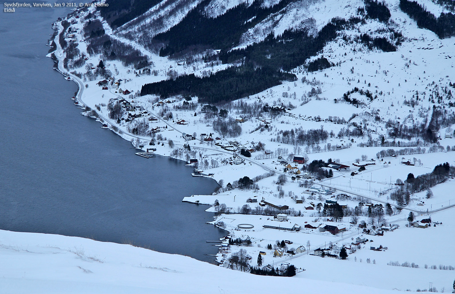
Taksetnakken (aka Storenakken) is a forest hill / small mountain by Eidså, and as the above picture shows - it falls "into the shadow" of the higher Svartetua. Nevertheless, this is a short and nice hike, and you'll get a good view towards Svartetua, the Storebøra massif (across Syvdseidet), Vorakinna and Syvdsalpane.

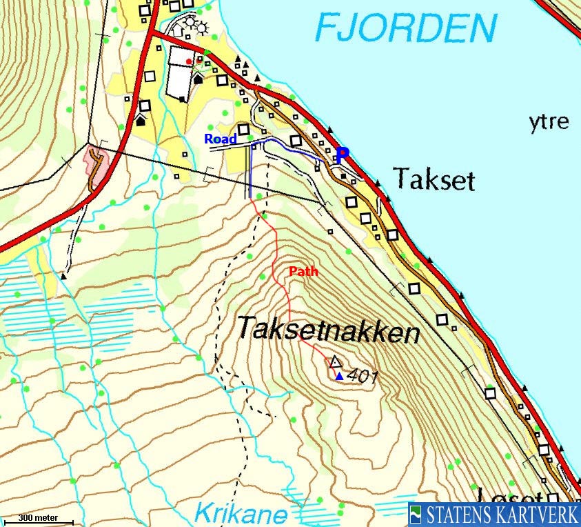
The south ridge route
(Click for larger image)
Taksetnakken (Norge 1:50,000: -, Økonomisk Kartverk: 408m, UTM 32 V 327183 6889950) has a primary factor of 99m, towards the higher parent mountain Svartetua (842m). The saddle (approx. UTM 32 V 327451 6889347) is found in the saddle (Løsetskaret) between Taksetnakken and Svartetua. Ref. Økonomisk Kartverk (5m contours), the saddle height is defined through a fixed point - 309m.
GPS measurement read 411m (on the ground), averaged over a 5-minute period (error margin +/- 1,6m). Note that map point 401m is not the high point.
Google's interactive map. You can zoom, pan and click on the markers.
|
|
|
|
Route 1: Eidså - Taksetnakken
|
|
Access
(all distances are approx. distances)
The nearest larger city is Ålesund. From Ålesund, follow highway E39 towards Bergen, and then RV61 towards Hareid. Take the Sulesund - Hareid ferry, and from Hareid, follow RV61 (roughly) 42Km to Årvika, 5,1km from Larsnes.
Take the Årvika - Koparneset ferry, and follow RV61 6,6km to Eidså. Turn left towards Syvden and drive 500m. Turn right onto a side road, and follow it 400m. There is a gravel road on your right-hand side which is the beginning of the route. There are a few large garage buildings on the left-hand side. Find parking outside the fence.
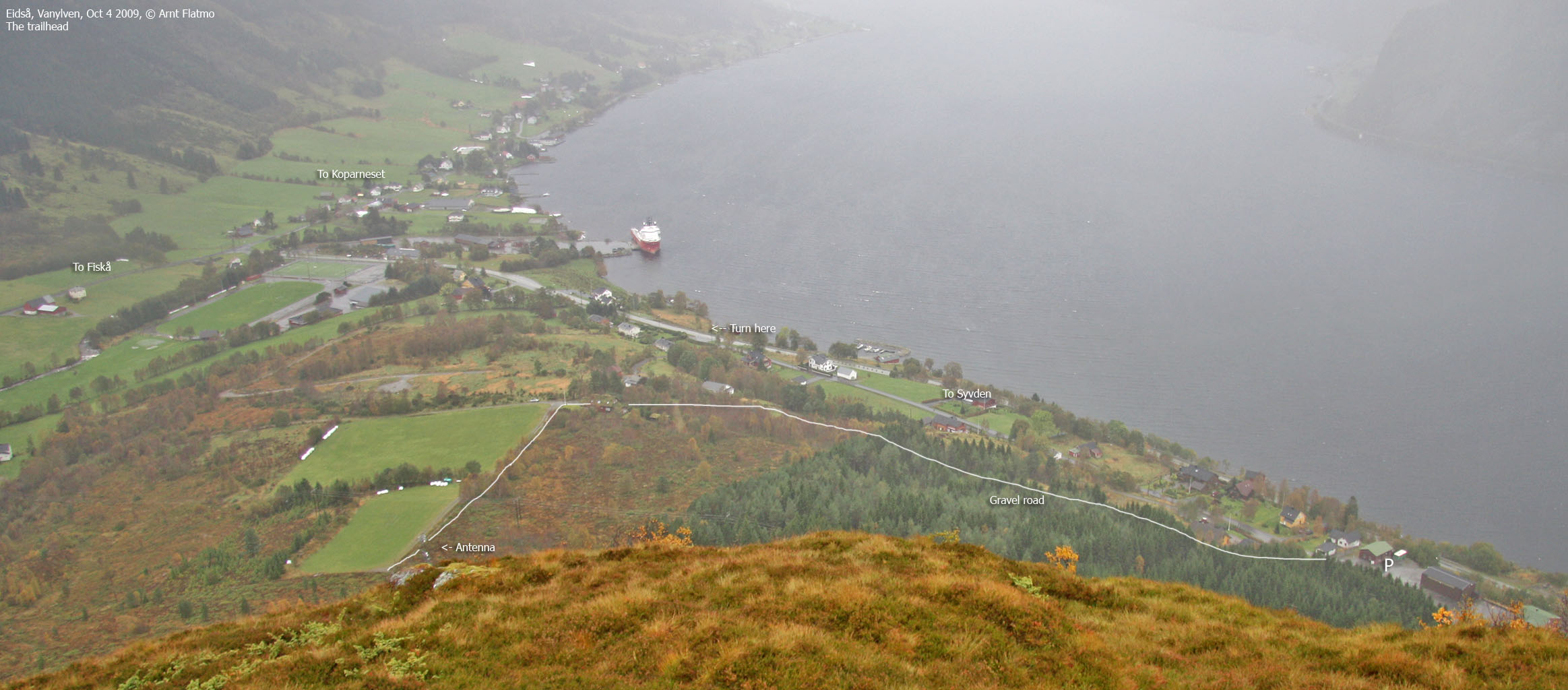
The trailhead
(Click for larger image)
The route
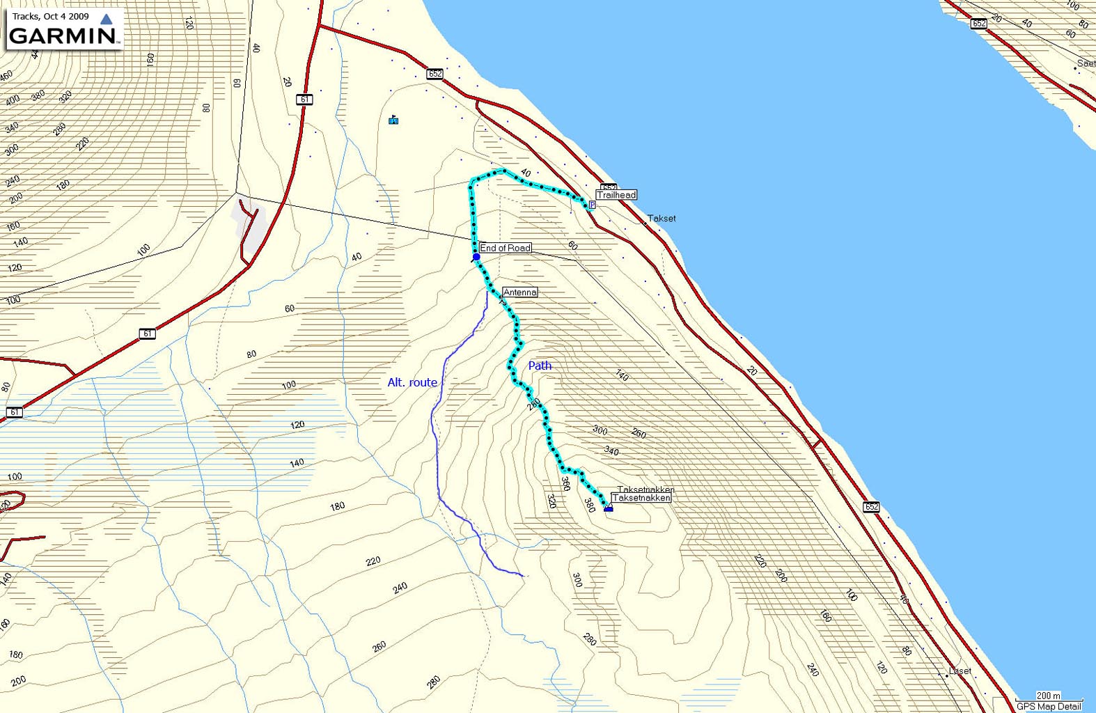
Follow the gravel road 350m to the top of the hill. Turn left by a house and follow another road 200m along a field. From the end of the road, follow a forest path up to the antenna. Just before the antenna, you cross a wider path that runs up the west side of the mountain, and possibly - continues all the way to the top.
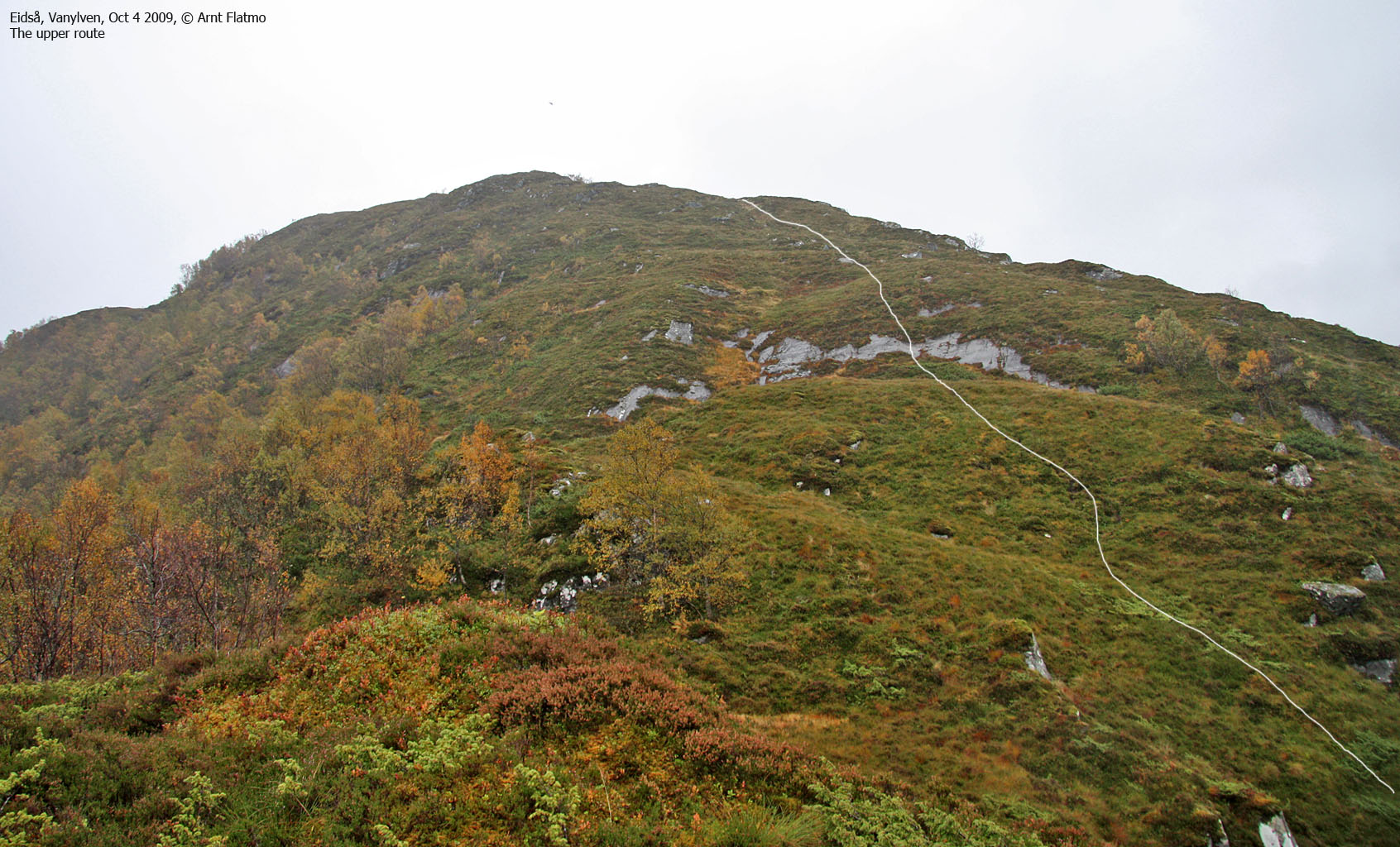
From the antenna, the path continues into the forest and then up Taksetnakken's south ridge (bypassing a steep ridge section). The path runs across sections of boggy terrain.
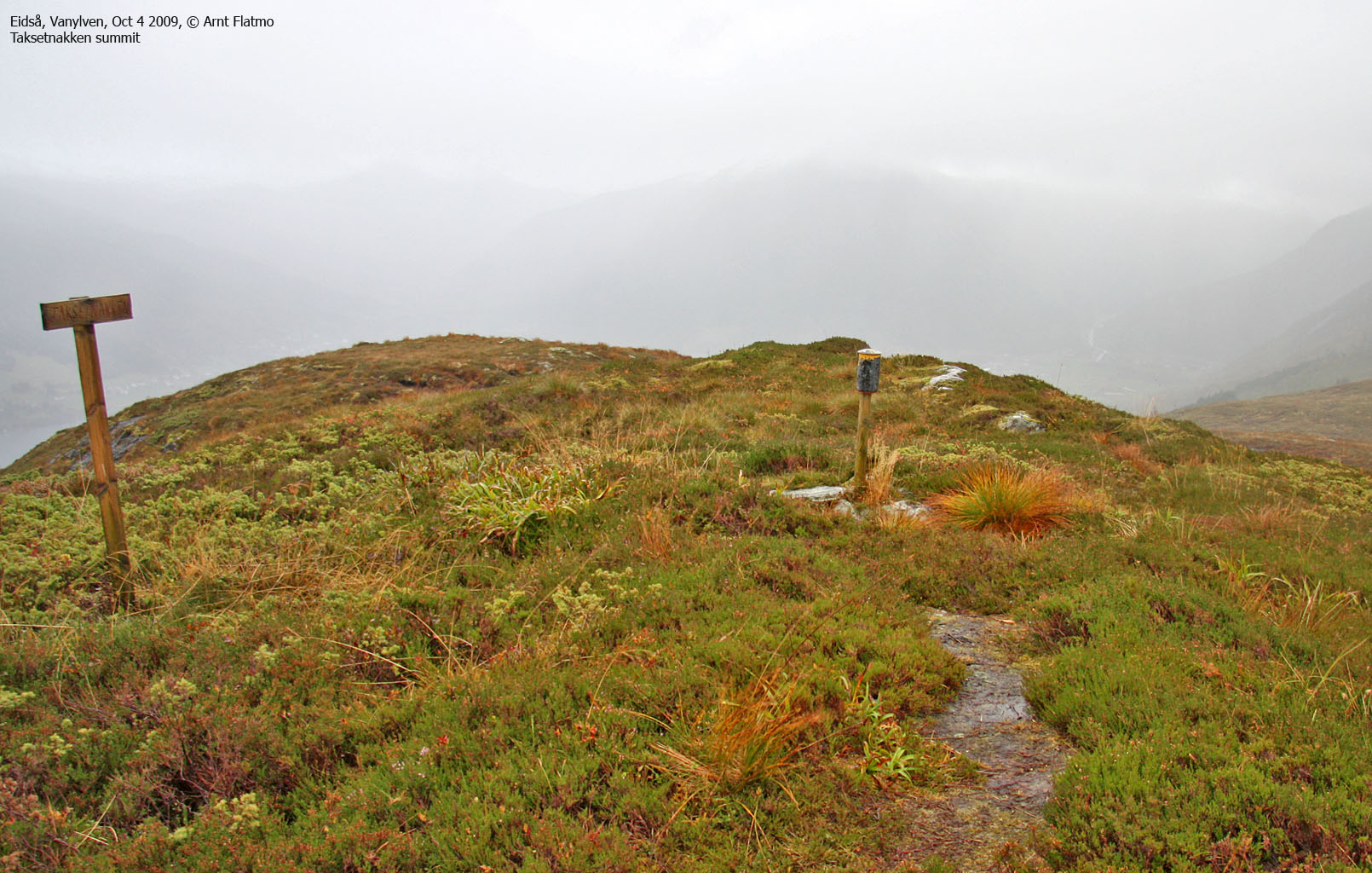
The top of Taksetnakken is marked by a signpost and a canister for the visitor's register.
(Screenshot of a GPS track here)


No Javascript:
|
|


