
Norwegian Mountains, OpplandSøre Svartkampen, 1369m
|
| Fylke/Kommune : | Oppland/Sel | ||||||||
| Maps : | 1718-III Skåbu (Statens Kartverk, Norge 1:50 000) | ||||||||
| Primary factor : |
Søre Svartkampen: 634m Nordre Svartkampen: 55m |
||||||||
| Hiked : | Sep 2009 | ||||||||
| See also : |
|
||||||||
| See also : | Other Oppland mountains on westcoastpeaks.com |

Nordre Svartkampen
(Click for larger image)
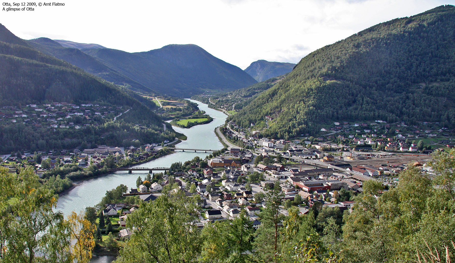
Søre Svartkampen is the highest top in the mountain range between Otta and Vågåvatnet (on the south side of highway RV15. RV51 (Lemonsjøen) and RV257 (Heidal-Sjoa) define the southern boundary of this region. In other words, Svartkampen is the dominating top in quite a large area.
This mountain can be reached via many routes, but many choose Espesætrin as the starting point. This page will describe an easy route via Sveasætri, starting at 740m. It follows a forest road for 2km, after which it joins a path from Sveasætri til above the tree line - where the path fades away. But by then you're so close to Svartkampen that it very likely won't matter.

Søre Svartkampen seen from Nordre
(Click for larger image)
Svartkampen is a first class viewpoint towards the Rondane peaks, which can be seen approx. 25-30km to the northeast. To the southwest you see the eastern Jotunheimen range, with distinct tops such as (a.o.) Glittertinden, Nautgardstinden, Surtningssue and Besshøe.
Søre Svartkampen (Norge 1:50,000: 1366m, Økonomisk Kartverk: 1369,09m (UTM 32 V 523963 6844352) has a primary factor of 634m towards the higher parent Trollhøi (1370m). The defining saddle (approx. UTM 32 V 511717 6851599) is found in Rinndalen, between Rudihøe and Bringsfjellet. Ref. Økonomisk Kartverk (5m contours), the contours are confusing. There are 5m contours on the mountain, but 10m contours towards Lake Bjølstadvatnet. Following the 10m contours from the lake and up, the saddle is within 730-740m, interpolated to 735m.
GPS measurement read 1373m (on the cairn, ~2,5m high), averaged over a 5-minute period (error margin +/- 1,9m)
Nordre Svartkampen (Norge 1:50,000: 1358m, Økonomisk Kartverk: highest contour is 1355m (UTM 32 V 523442 6844959) has a primary factor of 55m towards the higher parent Søre Svartkampen. The defining saddle (approx. UTM 32 V 544608 6864079) is found in the saddle between these two tops. Ref. Økonomisk Kartverk (5m contours), the saddle is within the range 1300-1305m, interpolated to 1303m.
GPS measurement read 1361m (on the cairn, 2m high), averaged over a 5-minute period (error margin +/- 1,4m).

Below Nordre Svartkampen
(Click for larger image)
Google's interactive map. You can zoom, pan and click on the markers.
|
|
|
|
Route 1: Heidal - Svartkampen (summer/autumn)
|
|
This route description is valid per September 2009
Access
(all distances are approx. distances)
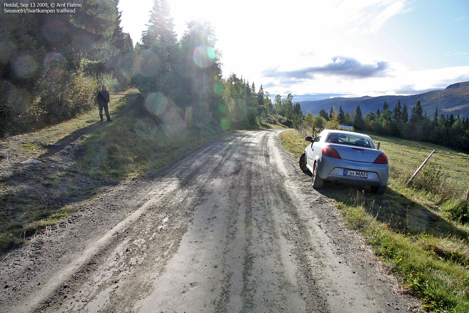
The nearest bigger village is Otta. From the E6/RV15 junction, follow E6 south 11,4km to Sjoa. Turn right by the gas station and drive 5km up Heidal along RV257. Turn right onto Øverbygdsvegen (signposted) and follow this road (turns into a gravel road) 6km until you see a forest road (closed by a gate) on your right hand side. Find parking alongside the road.
The route
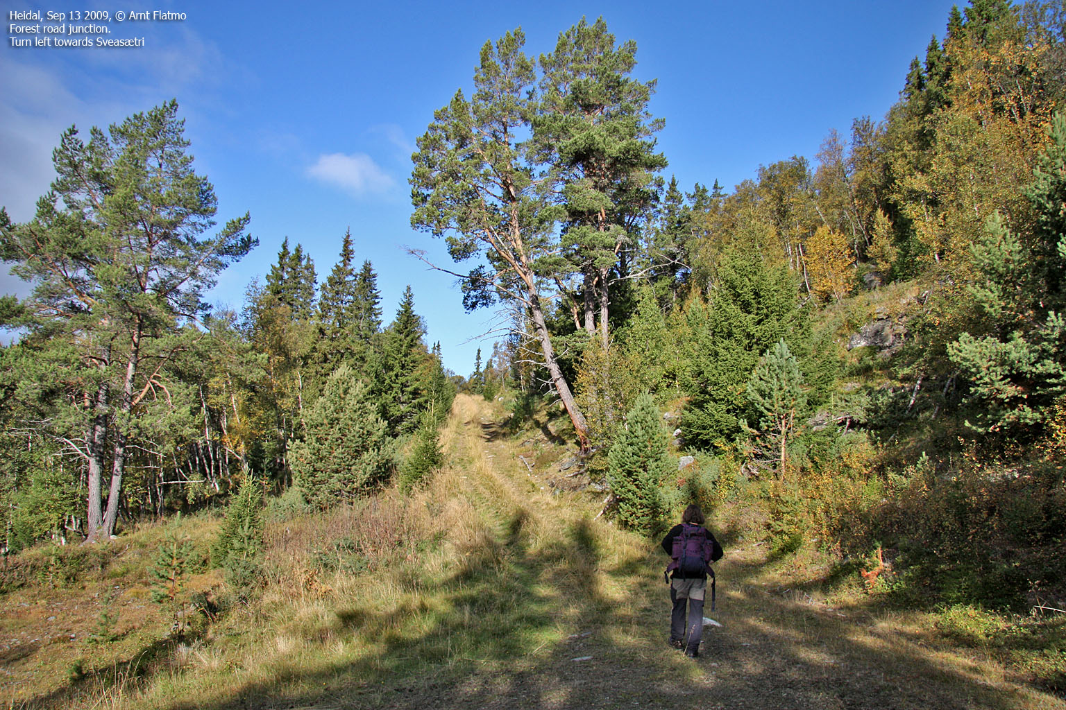
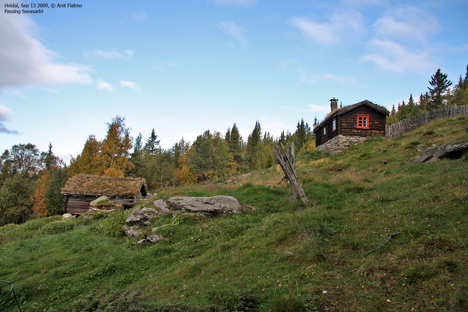
Follow the forest road 1,3km up to a junction. Turn left and follow the forest road 600m up to Sveasætri. Locate a path in front of the cabin and follow it upwards (with a creek on your left-hand side).
After 400m, the path forks and it is not easy to see the vague path that runs in the direction of Svartkampen. Whether you find the path or not, the general direction is east. As you rise above the tree line, you can choose to hike directly up Nordre Svartkampen, which is straight ahead of you. Alternatively, continue along the meadow and hike up to the pass between the two tops. There is a visible path between the two summits.
Søre Svartkampen is marked by a proper cairn. Nordre Svartkampen has a summit marker, and a tall cairn 400m to the southwest.
 westcoastpeaks.com
Other Oppland mountains
Other Norwegian mountains
westcoastpeaks.com
Other Oppland mountains
Other Norwegian mountains


