
|

Svartetjørnfjellet to the left(No Javascript) |
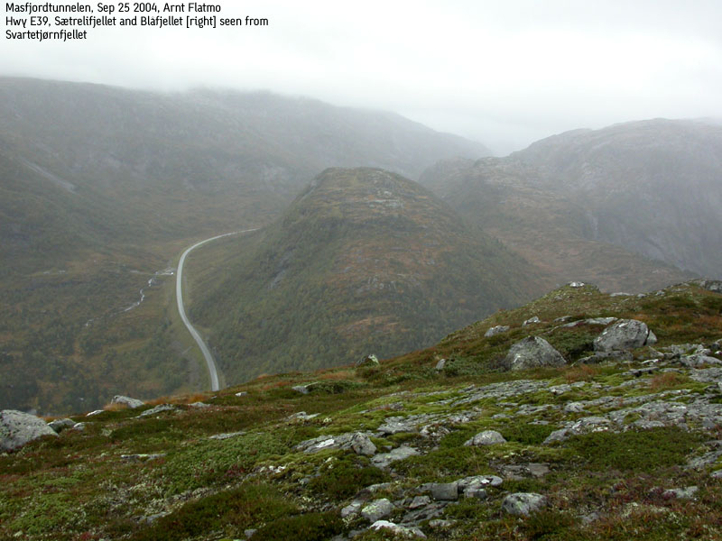
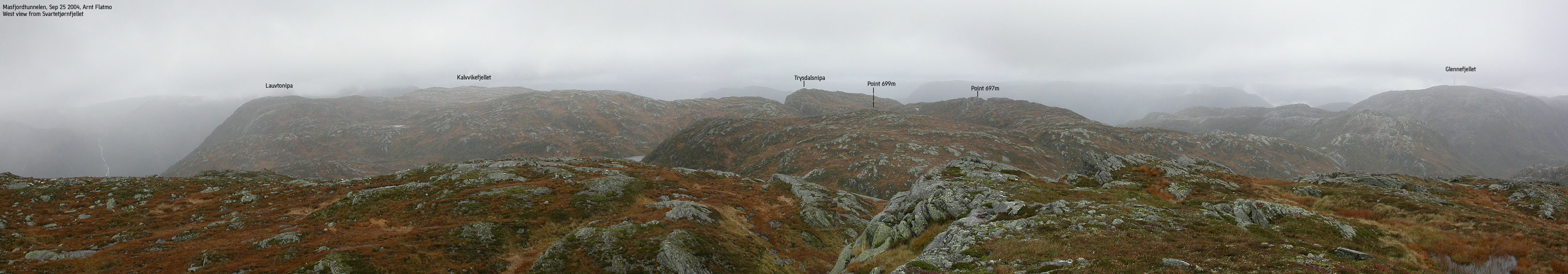
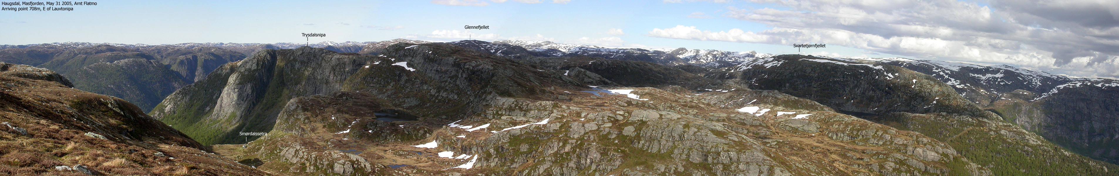
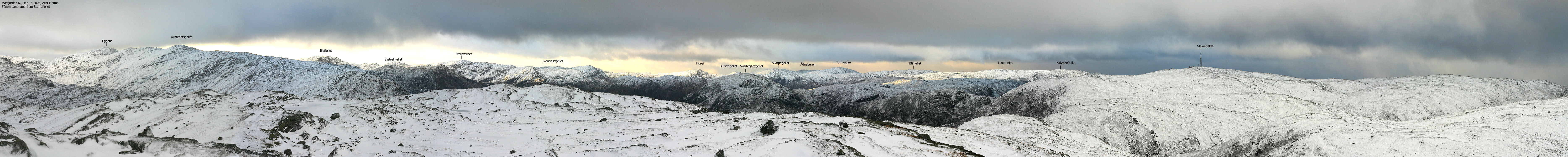
Svartetjørnfjellet is located above Masfjordtunnelen, part of highway E39 between Bergen and Sognefjorden. Along with the neighbour mountain Lauvtonipa, Svartetjørnfjellet marks the beginning of a long ridge that stretches from Matrefjorden and deep into Stølsheimen. The name of the mountain is related to Svartejørna - a small lake at the foot of the mountain, south of the summit.
The mountain is very accessible. Thanks to a path and short distance from the trailhead, it is possible to reach the summit within the hour if you keep a decent walking pace up the mountain.
The views are a bit limited, as there are higher mountains all around. A hike up here can be extended to the neighbour mountains Lauvtonipa or Glennefjellet. This involves more off-trail walking, but the terrain is quite friendly.
Primary factor:
Svartetjørnfjellet (745m) has a primary factor of 172m towards the higher Glennefjellet (792m). The saddle is found between Kletten and Svartetjørnfjellet. Ref. Økonomisk Karverk (5m contours), you cross the 575m contours on the high route, but not 570m. The saddle height has been interpolated to 573m.
Notes: Class ratings are in reference to YDS. Click here for more information.
The trails described below are not necessarily the *easiest* trails to this mountain.
|
Lake Storevatnet - Svartetjørnfjellet (summer)
|
|
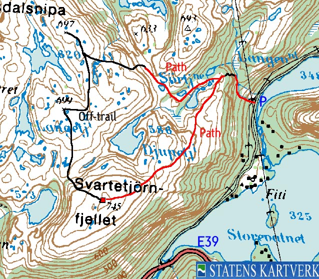
From Bergen, follow highway E39 northbound (Førde/Ålesund). Pass Nordhordlandsbrua bridge about 30 minutes north of Bergen. Toll fee for passenger cars per Sep 2004 is NOK 45,-. Go through the Eikefet tunnel and drive up the long Romarheimsdalen valley. From the top of this valley, you have Glennefjellet in view ahead of you. Drive down Haukelandsdalen with lake Storevatnet on your right hand side. Just before the tunnel that runs down to Matre, exit to the right - "Haugsdal" (this exit is 51,3Km from the Nordhordlandsbrua toll booth). Drive under the highway and at the first junction, exit right. Follow this road for approx. 1,7Km. You should have a power mast just up to the left. The path runs under this mast. Find parking nearby.
Locate a path that runs under the power mast. The path continues up along the waterfall, on the left hand side. Above 420m, the terrain leves out. Follow the creek until you enter a meadow. Turn left and find a good route up the ridge that leds to Svartetjørnfjellet. You should be able to see a path once on the high ridge. This path, more or less visible can be followed all the way to the top. There are no obstacles along the way.
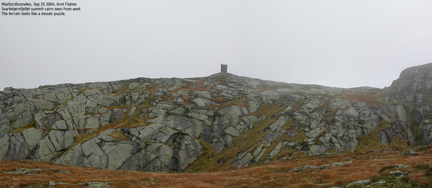
The summit is marked by a proper cairn. Ascend your descent route, or define your own route back to the trailhead.
|
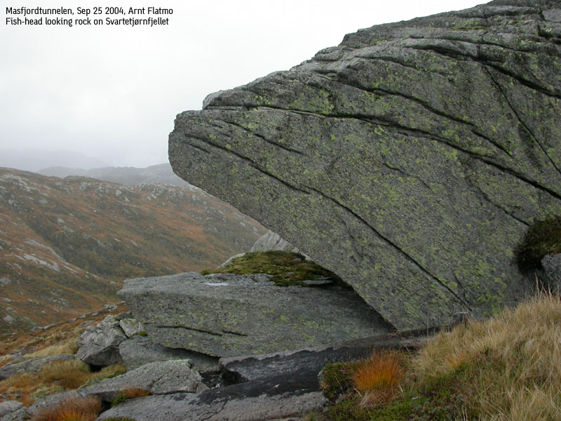
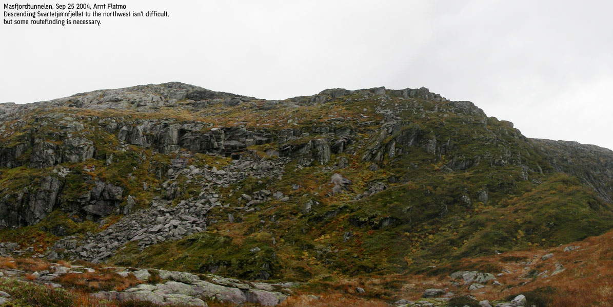
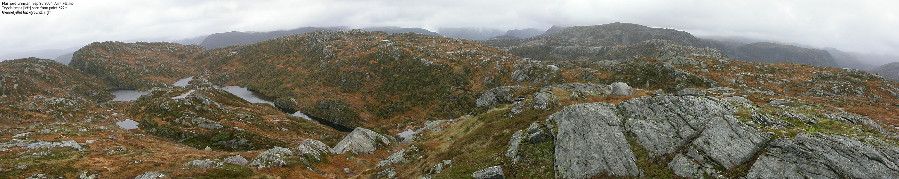
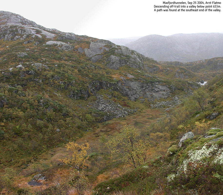
Trip Notes Sep 25 2004Another grey and depressing week-end day in Hordaland this autumn. The initial plan was to hike across Svartetjørnfjellet and Lauvtonipa. I knew the path up to the meadow from a previous trip, so I didn't have to spend any time trying to find a route. On top of Svartetjørnfjellet it started raining just enough to take the fun away from the hike. Instead of following the trail back, I paid points 699m and 697m a quick visit before scrambling down to a narrow valley between this mountain and Kletten. From this valley, I was able to follow a path back to the meadow where I started the ridge hike to Svartetjørnsfjellet. We (Troll and I) left the car 11:15AM, reached Svartetjørnfjellet 12:05PM, point 699m 12:35PM and point 697m 12:55PM. By 13:30PM, we were back at the car. Troll walked where the terrain allowed for it. I saw quite a lot of sheep along the way and reported this to a local farmer on the way home. I didn't know if they had begun bringing down the sheep yet. If so, I assumed it would be useful information.
Pictures from the Sep 25 2004 hike
Move cursor to read notes, and click on the images to see full version.
No Javascript:
|


No Javascript:
Other hordaland mountains
 Other Masfjorden mountains
westcoastpeaks.com
Other Masfjorden mountains
westcoastpeaks.com


