
Norwegian Mountains, Møre og Romsdal
Sunndalsnipa on foot from Grøndalen, June 20 2009
To the main Sunndalsnipa page (maps, route descriptions, other trip reports, etc.)

Sunndalsnipa
(Click for larger image)
As I left home on this Saturday morning, I had absolutely no idea about where I would end up. The weather was a bit funny; the sun was shining, but there were obviously rain showers roaming around in the region. I decided to drive with the roof down, and ignored a shower as I passed Volda.
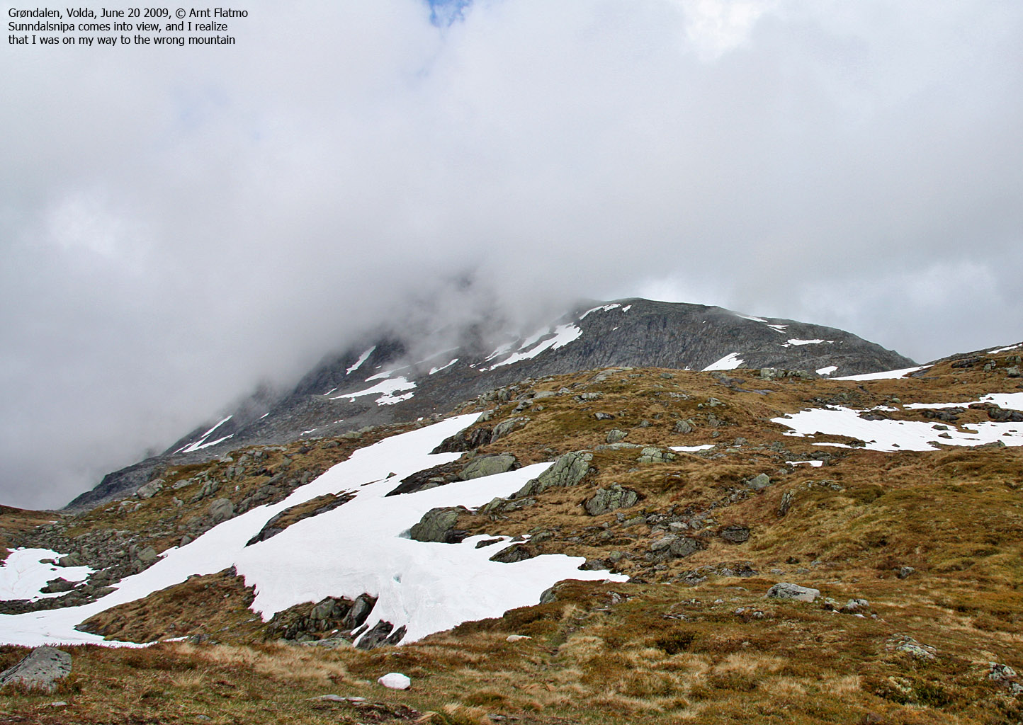
I started thinking about Otredalsfjellet, but when I saw Sunndalsnipa only partly wrapped in fog, I began to focus on this mountain instead. I drove up to Grøndalen, and as the weather was still quite OK, I decided to give Sunndalsnipa a try.

Sunndalsnipa
(Click for larger image)
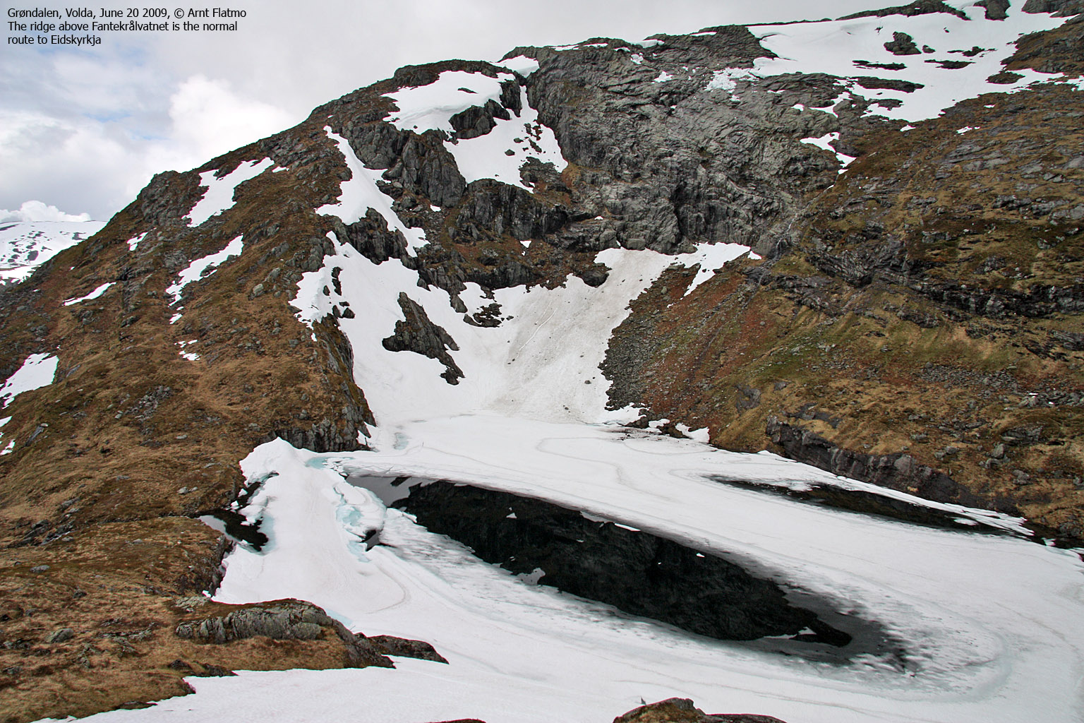
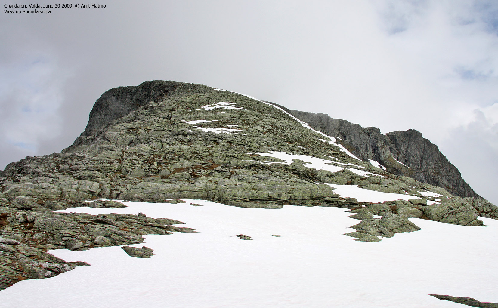
I located the path starting at Grøndalsstølen and followed it up to Fantekrålvatnet. Along the way, I had been looking towards a snowy mountain with a long ridge - assuming it was Sunndalsnipa. At Fantekrålvatnet, I was just about to turn left and hike up a steep ridge when another mountain appeared up to my right. As I knew that there shouldn't be "anything high" up to my right, I had to check the GPS. And sure enough - I was on my way to Eidskyrkja...
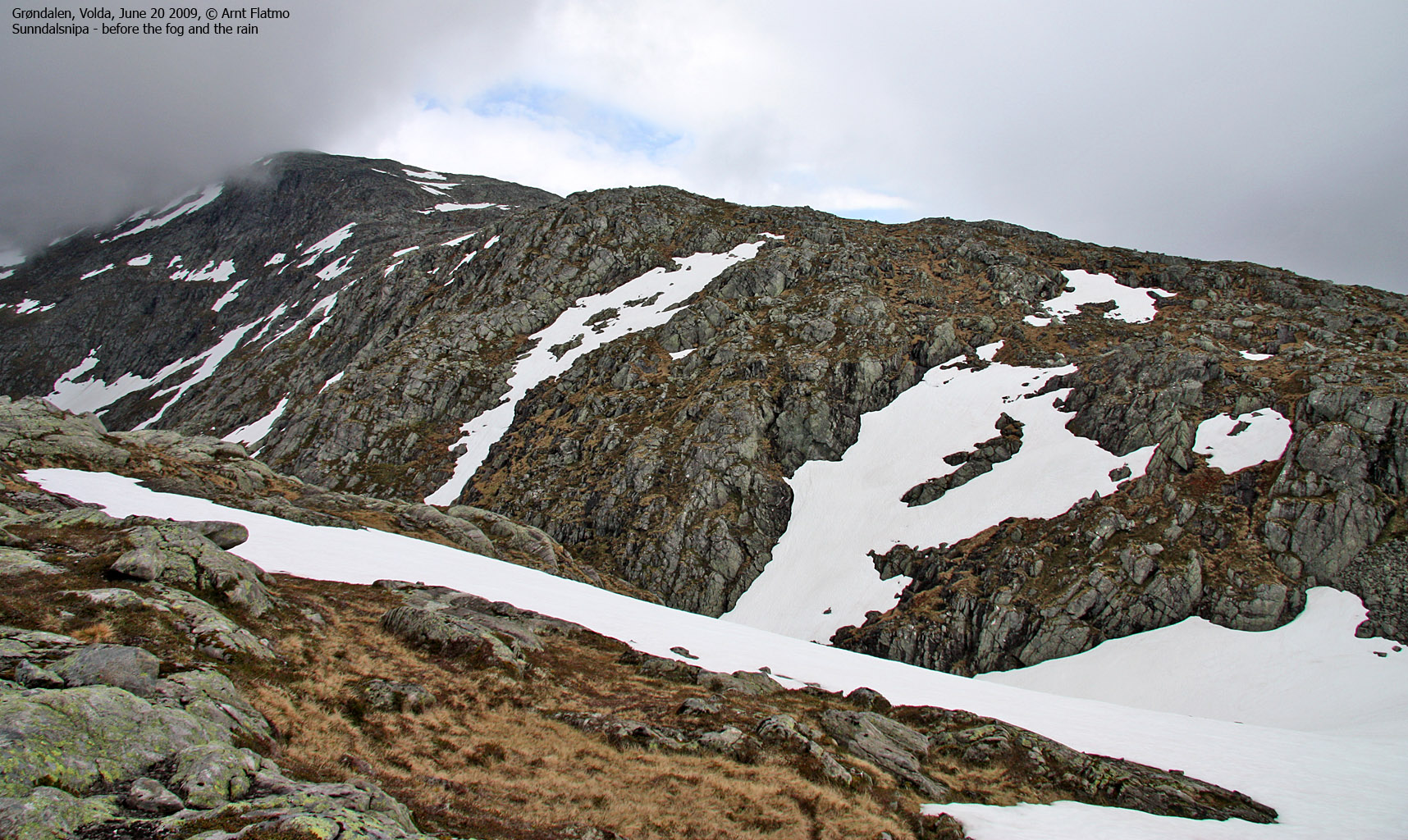
After adjusting my course from west to east (!), a full bag of miserable weather (fog and rain) came in through Sunndalen. I tried to find something positive in this, and was thinking that after the rain shower, I would enjoy sunshine on the summit. I noticed one or two hikers heading up Eidskyrkja, before the fog took away most of the views.
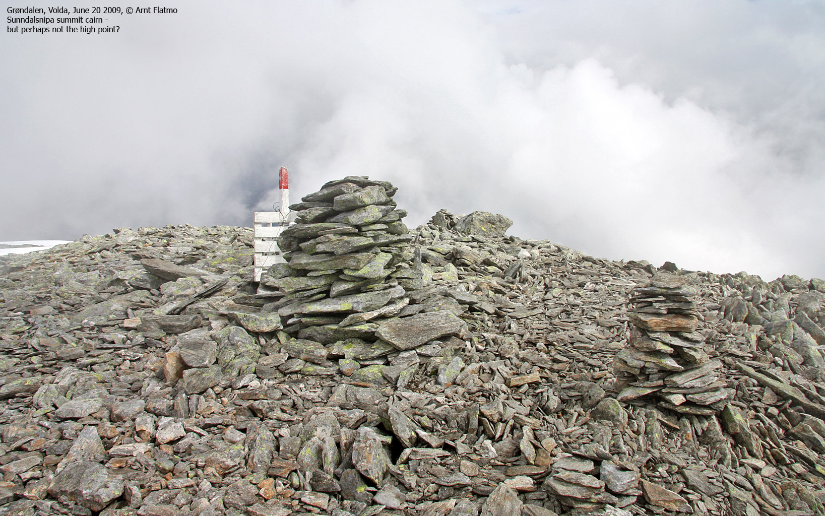
When I reached the vast summit plateau, it was snowing (!) lightly. But I could see a spot of blue sky above, and by the time I reached the summit cairn (1pm - exactly 2 hours after heading out), the weather was quite ok - except for the fog that kept hitting on the mountain. Hah! Bonus! I hadn't taken one step in snow before I reached the summit plateau, but on the plateau there was still quite a lot of the stuff. But it carried my weight and never became a concern.

Just below Sunndalsnipa summit cairn
(Click for larger image)
After a short visit down to the viewpoint just north of the summit cairn, I began my descent down the mountain. The weather remained stable, and I had a nice hike down the south ridge. Rather than following the path in the forest, I decided to hike Litlevassdalsegga and hoped that I could find a non-aggravating route down to Grøndalsstølen.
When I reached the Litlevassdalsegga cairn, I could see that I had a lot of forest between myself and the trailhead. And then it started to rain. At first, I fought my way down a ridge with low birch of the unpleasant sort. Then I headed into thicker forest, where I had to test every step I made.
Suddenly, I found myself between a lamb and the mother, and they hadn't noticed me. I sat down and yelled me-eeeeee. I got an immediate response from both sides. I varied my sheep-voice repertoire, and got variations in return. At moooooh stage, the mother simply had to find out what was going on, and came along with "what the.. ?" written all over her face. Then the lamb appeared too, and I decided to leave them alone.

Looking back on Sunndalsnipa
(Click for larger image)
I was back at the trailhead 2:50pm, 3h:50m after heading out. It was raining when I got into the car, but after having driven 10 meters (!), it was no longer raining and the road was dry. I could then enjoy a drive back home with the roof down, and one more time ignoring the rain shower that seemed to be permanently stuck above Volda.


