
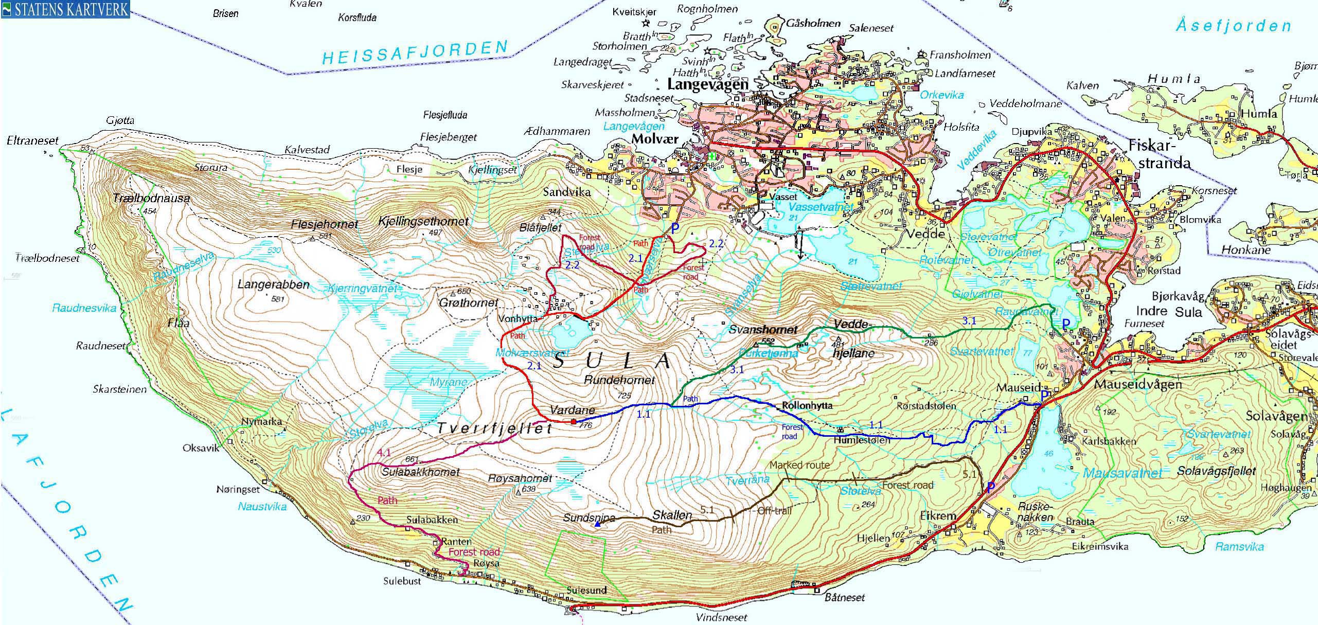
Click here for the main Sulafjellet page.


Svein A. Myhre suggested a trip this Thursday afternoon. The original plan was a ski-trip to Dalmannshornet, but as the week progressed, it boiled down to a short hike in the nearby region. On my to-do list was Sulafjellet from Sulesund. This was a good suggestion, as Svein hadn't done this route either, He brought along his son Mathias (10,5 yrs) and I brought along my dog "Troll" (approx. 91 years old). This was actually my fourth hike to Sulafjellet in 10 days (check the main Sulafjellet page for the previous trip reports and pictures).
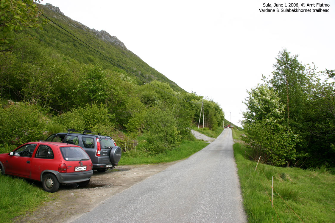
Based on the map, we were both under the impression that we could drive all the way the Sulabakken farm, and begin the hike at roughly 200m elevation. I arrived a little bit earlier than Svein, and located the trailhead using the GPS. I was surprised to see that there was only a path on the GPS map. A local told me that we had to park along the main road and walk upwards. There was a gravel road, but only for 50m. The road up to Sulabakken was only a narrow, old forest road.
We left the trailhead 16:35PM. Troll always present himself from his best side when we have company, and walked like he had never walked before. Besides the good company, hiking with others always means that I don't have to carry this little four-legged fur. Troll chose Svein as his favorite person for the day, and was stuck like glue to him for the rest of the hike. Except for a few moments where he got busy with scent from deer having crossed the road. We caught a glimpse of two in the forest, but they were gone in an instant.
The path led us into a large meadow on the north side of Sulabakkhornet. While the original plan was to visit the top and then Sulabakkhornet on the way down, we changed the plan as Mathias was a bit tired. We took an off-trail shortcut up the plateau between Vardane and Sulabakkhornet, before turning south towards Sulabakkhornet where we took a break. The time was now 18:15PM. It was a bit windy, but we found a large rock that provided shelter.
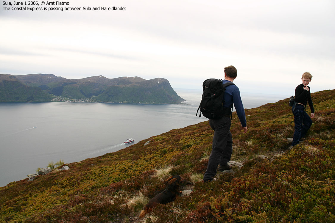
We descended on path down to the cabin below Sulabakkhornet and then joined our ascent route. We were back at the trailhead 19:20PM. There was light rain in the air, but I didn't sense any drops before I saw them on my car window on the way back to Ålesund. Although the route from Sulesund didn't offer any higher trailhead than the other routes, it was still a nice route and a nice hike. Highly recommended.
Map: We followed route 4.1 on this trip

To Sulabakkhornet


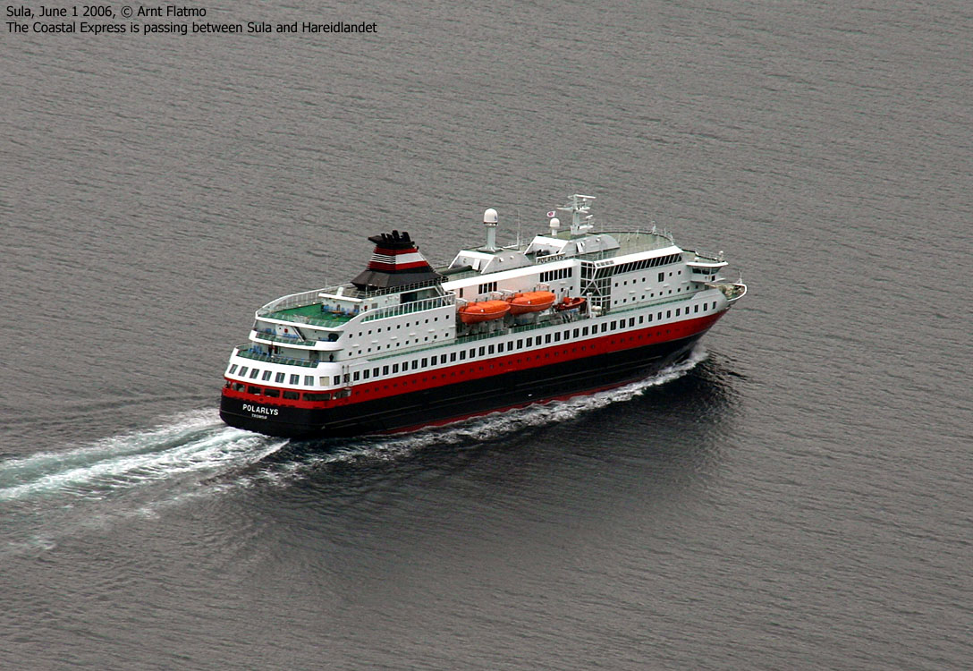
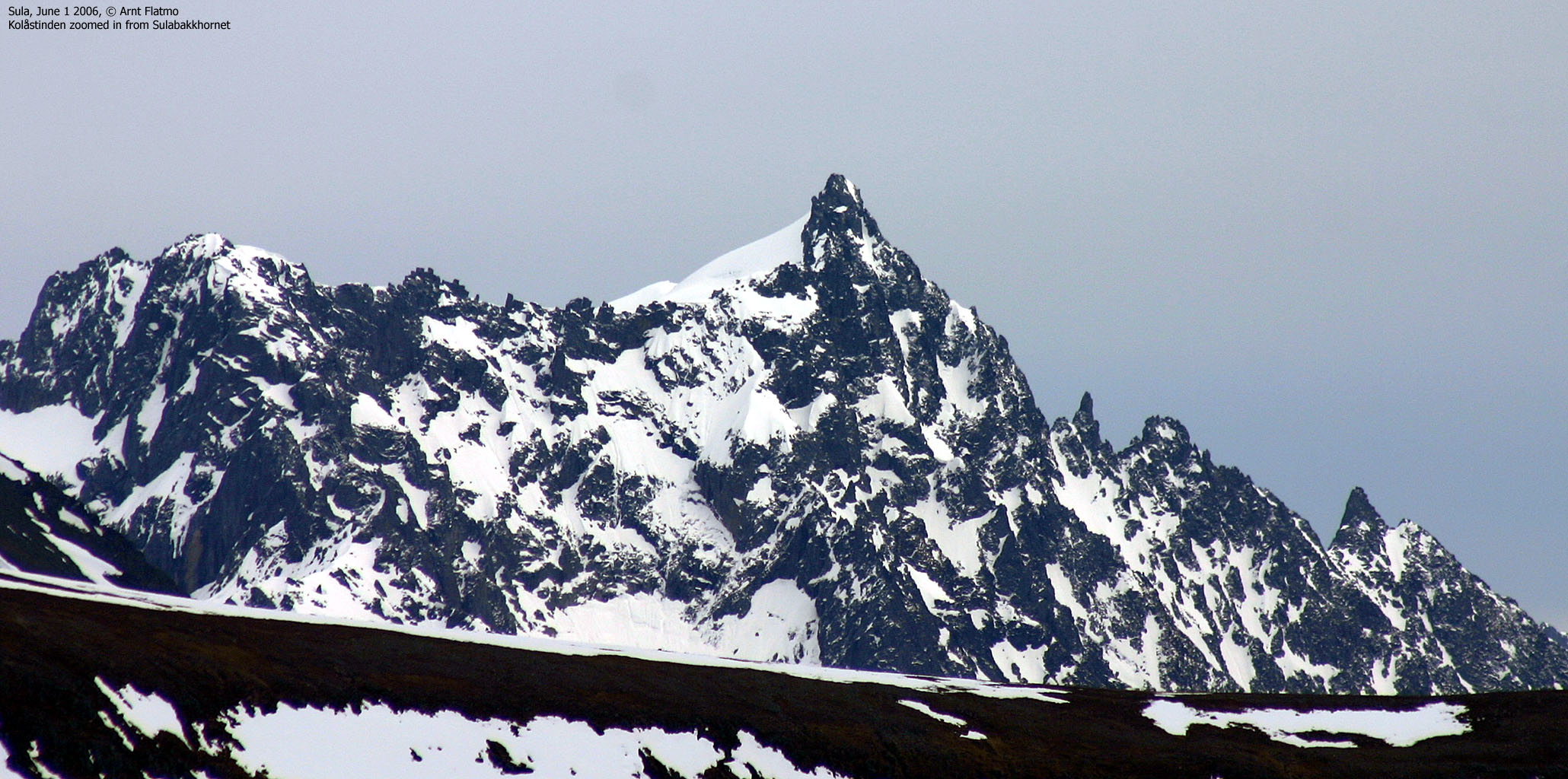
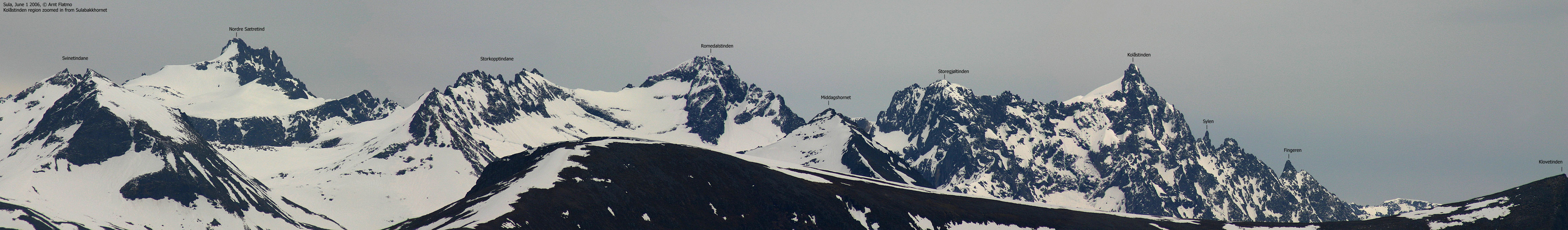
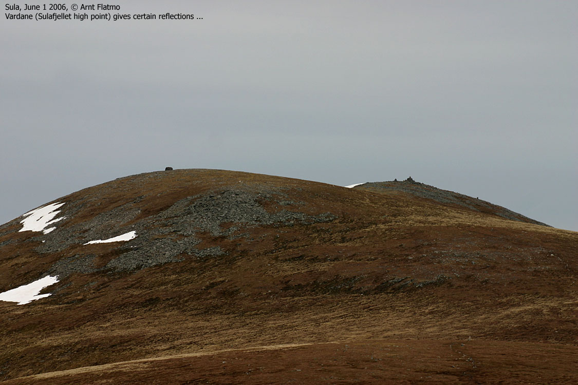
Views from Sulabakkhornet


No Javascript:
0 1 2 3 4 5 6 7 8 9 10 11 12 13 14 15 16
 westcoastpeaks.com
Other Møre & Romsdal mountains
Other Norwegian mountains
westcoastpeaks.com
Other Møre & Romsdal mountains
Other Norwegian mountains