
|

Storehorga seen from near Eikelandsosen(No Javascript) |
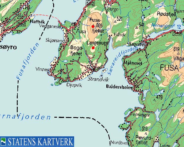
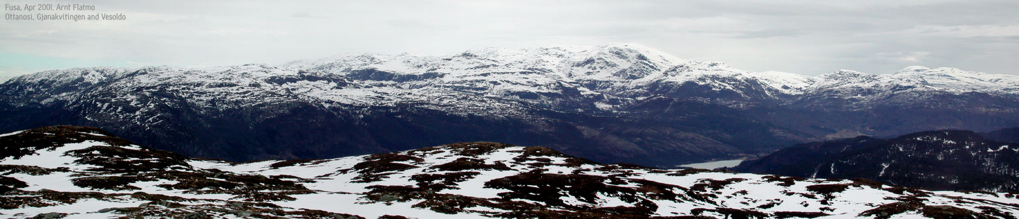
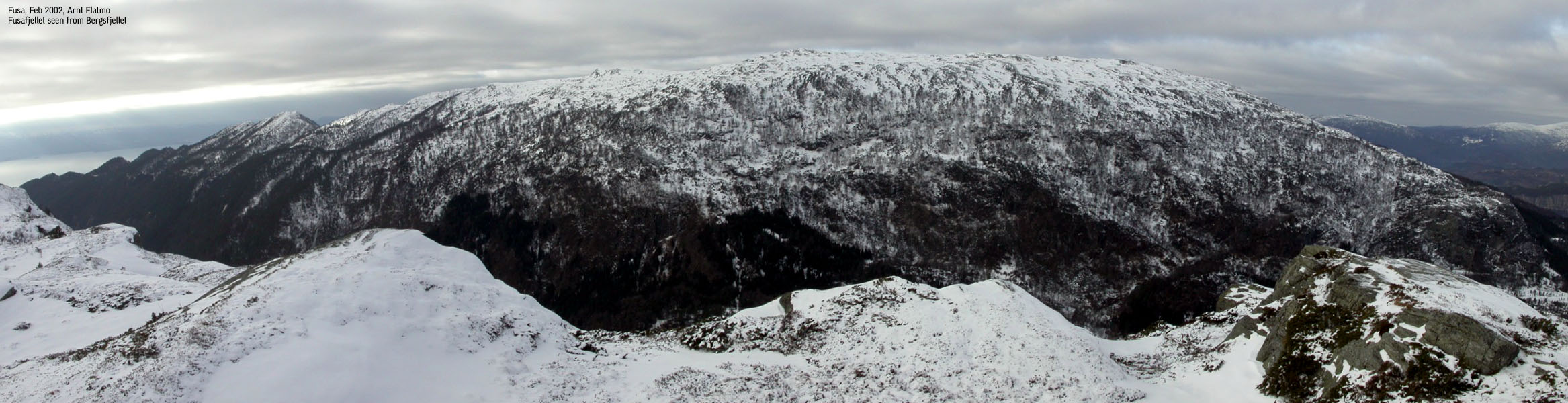
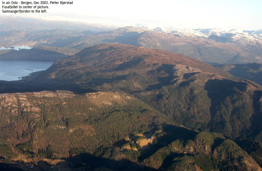
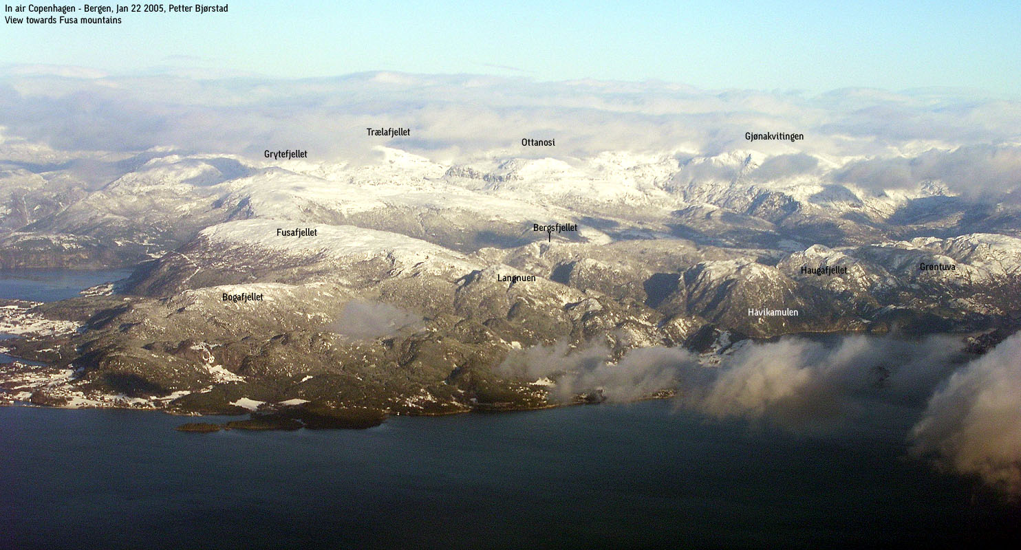
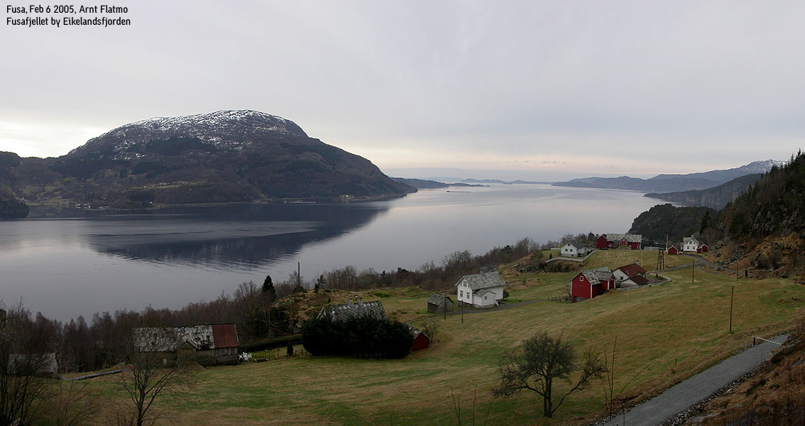
Storehorga/Fusafjellet dominates the large peninsula between Eikelandsosen and Kilen. From the 665m summit, you have to descend down to 86m at a pass east of lake Vengsvatnet, in order to get to a higher mountain (Ottanosi, 976m). This indicates that Storehorga offers great views, and the view is well known to the people located on this peninsula. Thanks to good forest roads and trails, the hike up to Storehorga is quite easy on a nice day.
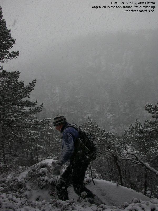
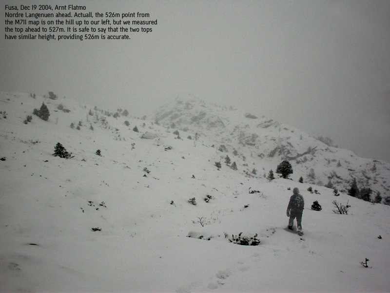
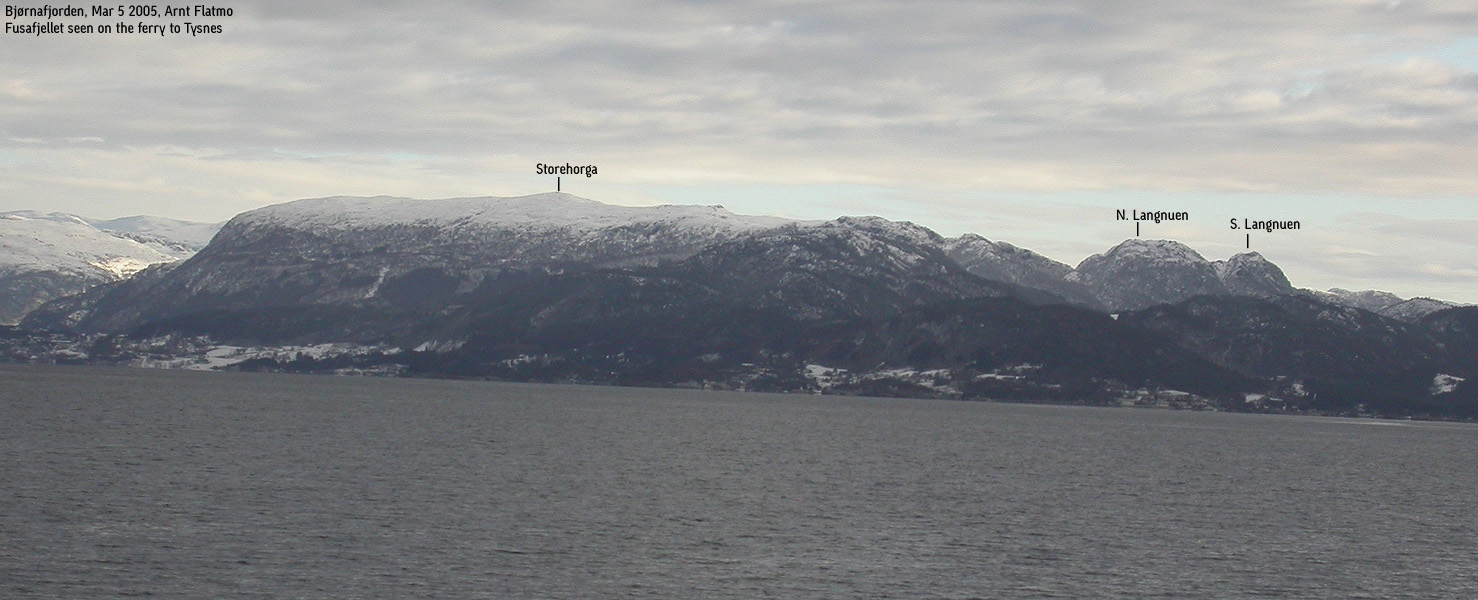
Two other tops - Langenuen and Bogafjellet are lower tops that connect to Storehorga. I will mention Langenuen on this page. Refer to the Bogafjellet for more information about this top. The Langenuen mentioned on the M711 map is the southernmost, and the lower of the two Langenuen tops. On Økonomisk Kartverk (5m contours), the northernmost top is named "Nordre Langenuen". This top has three summit humps of similar height - 526-527m.
A number of trails run up towards Storehorga, but the primary trailheads are Fusa and Strandvik. An old mail road (Gamle Postvegen) runs between Fusa and Strandvik, and offers a convenient journey up through the lower forest. In addition to the route described on the Bogafjellet page, you can reach Bogafjellet where the old mail road begins to descend towards Strandvik. Langenuen is best reached when you are on the Storehorga high plateau. Refer to the Dec 19 2004 trip report (below) for a different, and much more cumbersome route to Langenuen from where the old mail road begins to descend towards Strandvik.
Storehorga (M711: 665m, Ø.K: 664,68m, N60 12.142 E5 39.658) has a primary factor of 579m towards the higher Ottanosi (976m). The saddle is found E of lake Vengsvatnet. Ref. Økonomisk Kartverk (5m contours), I have used a fixed point (86m) as the defining saddle.
Nordre Langenuen (M711: 526m, Ø.K: - highest contour is 525m, N60 10.876 E5 39.763) has a primary factor of 93m towards the higher Storehorga (665m). The saddle is found in Svingardalen valley. Ref. Økonomisk Kartverk (5m contours), you cross the 435m contours on the high route, but not 430m. The saddle height has been interpolated to 433m.
Notes: Class ratings are in reference to YDS. Click here for more information.
The trails described below are not necessarily the *easiest* trails to this mountain.
|
Fusa - Storehorga (+ Langenuen) (summer/autumn)
|
|
From Bergen, follow highway E16 towards Oslo. At the E16/RV 7 junction (roundabout) at Trengereid, turn right onto RV 7. Follow RV 7 to the RV 7/RV 48 junction after Bjørkheim (approx. 13,9Km from the Trengereid junction). Turn right onto RV48 and follow this road to Eikelandsosen. Turn right onto highway RV552 and drive to Fusa (distance will follow later). Look out for a "Gml Postveg" sign next to a rack of mailboxes on the left hand side of the road.
Alternative: From Bergen, follow highway E39 southbound towards Osøyro. From Osøyro continue towards Hattvika (4,6Km) and take the Hattvikka - Venjaneset ferry. From Venjaneset, drive approx. 1,3Km and turn left in the "Strandvik/Håvik" junction and drive along highway RV552 for approx. 2,2Km. Look out for a "Gml Postveg" sign next to a rack of mailboxes on the right hand side of the road.
Follow a small road leading to Gamle Postvegen (the old mail road) from the trailsign. Pass between a few buildings and join Gamle Postvegen which comes up from your left. From what I can tell, it is possible to drive up this road for approx. 700m. To do so, you will have to drive a few meters (in the direction of Eikelandsosen) from the "Gml Postveg" trailsign. My recommendation is that you leave you car down by RV552 and walk the mail road.
At approx. 130m elevation and 1Km from the trailhead, you reach a trailfork. The "Storehorga" trailsign points in both directions, but the old mail road runs up to the right. Follow the rightmost trail (the old mail road) until your reach another trail fork and a mailbox. Turn left here (if you go to the right, you are heading for Strandvik. Note that there is yet another trail towards Storehorga on the route towards Strandvik)
At the next trail fork, continue straight ahead. The leftmost trail runs downwards and joins the old mail road where the Storehorga sign was pointing both ways. There is also a path forking off to the right, but you should continue straight ahead.
Next, you run into a 4-way trail fork. Turn right here, and 50m later, another trail (unmarked per 2001) runs up to your right. Follow this trail. After a little while, the trail narrows. There is occasional red paing on the way towards Storehorga. This trail runs at the foothills of a steep wall. Follow the trail until you reach Storehorga summit.
If you aim to include Langenuen on your hike, walk southbound from Storehorga to Svingardalen valley. Follow the valley eastbound as it descends, and look for a doable route up to N. Langenuen, which is up to your right when you look down Svingardalen. Follow a ridge all the way up to the two summit humps and decide which one you think is the highest. The route from Storehorga to N. Langenuen point 526 is roughly 3,5Km. Return your ascent route.
|
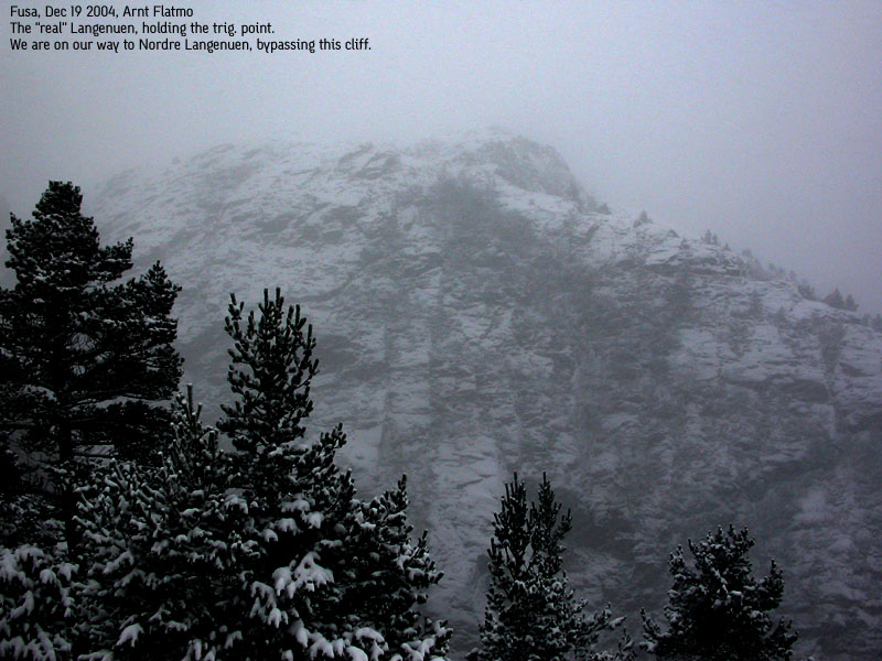
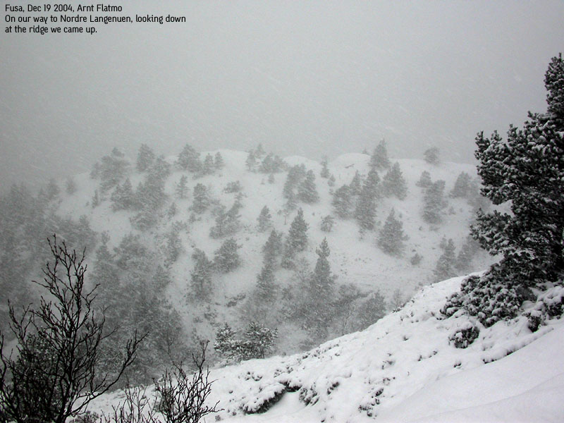
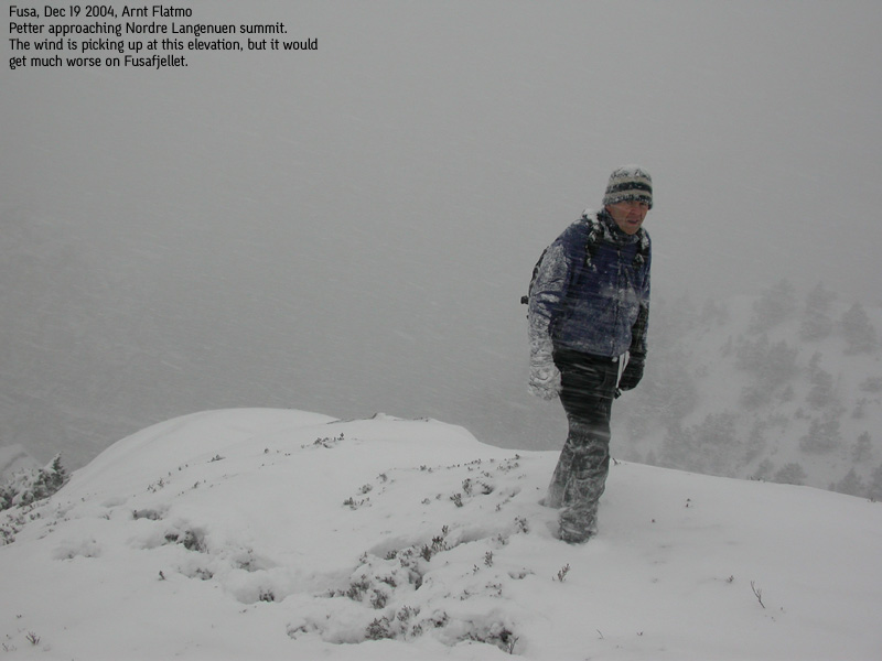
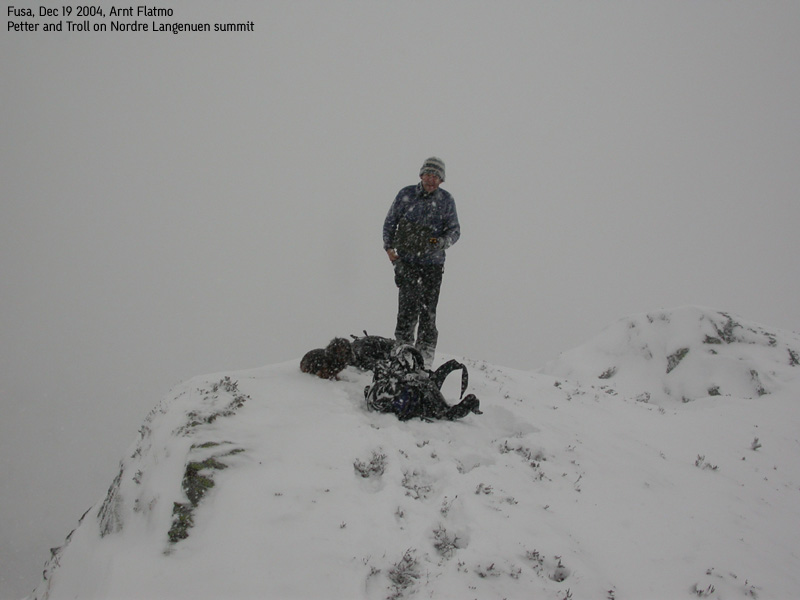
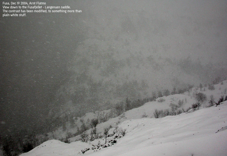
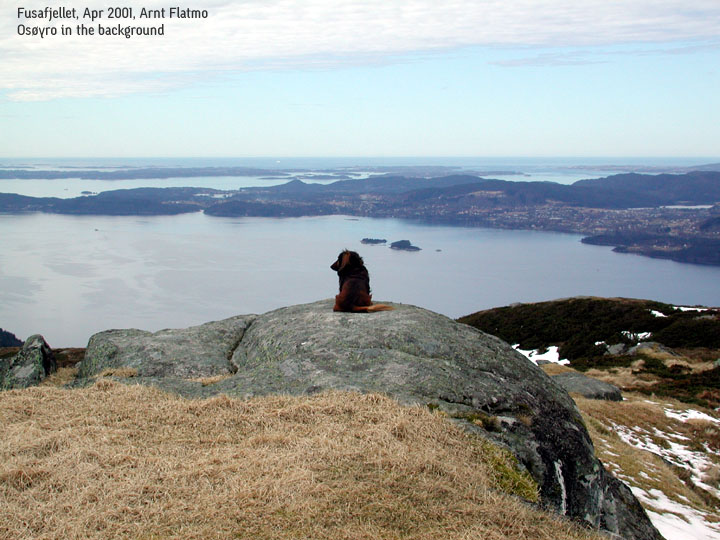
Trip report Dec 19 2004What a hike this turned out to be! My friend Petter Bjørstad joined in for this Sunday hike. The original plan was to do Senafjellet (Fusa), but the plan was changed to Langenuen and Storehorga. I had been wanting to do Langenuen and update my Storehorga page also. I had already been to Storehorga a few years earlier, but knowing that Petter likes mountains with a high primary factor, this was a good choice for both of us.It was snowing when we left Bergen. We took the Hattvika - Venjaneset 10:00PM ferry, and Storehorga was visible from the ferry. I didn't expect this would last long, having encountered the waves of snow on my Aksla hike the day before. I had brought the dog along, but expected to carry him all the way. The weather forecast was mixed. But strong winds and snow had been promised. We left the trailhead in Fusa 10:25PM. "Gamle Postvegen" (the old mail road) had surprisingly little snow, and Troll could easily walk upwards. We had agreed to do Langenuen first, and the plan was to find an off-trail route through the forest. At the mailbox junction, we followed "Gamle Postvegen" instead of turning left towards Storehorga. Just as the forest road began to descend towards Strandvik, we found another trail towards Storehorga. We followed this trail for a couple of minutes before we went off-trail into the forest. I put Troll in the backpack, quite happy with him walking all the way up to now. The plan was to reach Øykjadalen in a fairly easy manner, and hike this valley upwards to Svingardalen and ascend Langenuen from there. The forest was however more tricky than we had expected, and we had to descend up to 100m before we were able to turn into Øykjadalen. Visibility was quite low due to the snowfall, but we got a glimpse of the steep side up to Nordre Langenuen. We decided to try a direct attempt. After ascending a short distance, the direct route was blocked by cliffbands. We walked around (to the east) until we came to the south end of the N. Langenuen ridge at 400m elevation. The route upwards was quite exciting. Light scrambling was needed here and there, and the mountain looked awesome from our position. We could see (S.) Langenuen further to our right, with a deep valley inbetween. We passed a hump that seemed smaller than a hump further ahead, and 12:35PM, we reached what we believed to be N. Langenuen summit. The other hump was actually the one that holds the height on the M711 map, but ref. Økonomisk Kartverk, both humps have the 525m contours as the highest contour, and all in all, the two humps had the same height. We felt the wind to be quite strong on N. Langenuen and moved quickly onwards. We had to descend down to Svingardalen valley, and found a (steep) route that did the job. After measuring the height on top of the pass (approx. 433m), we continued upwards towards Storehorga. Visibility dropped quickly, the wind increased and after a while, we had to put on proper winter clothing. I started feeling bad for the dog, taking severe whipping from the wind. His face turned more and more icy by the minute. Across the high plateau meadows, we stomped into one pond after the other. Everything was frozen below my knees, and the water didn't seem to penetrate through the boots. The snow was amazingly deep at times, reaching up to our hips. Good for me, Petter was breaking trail most of the way. I really didn't feel like breaking trail while carrying 9Kg extra (the dog), and I guess Petter understood this. We tried to follow the high terrain whenever possible, and the number of non-optimal route selections were few. The term "strong winds" was now an understatement. I estimated the wind-speed to be up to 30 meters per second, in the gusts. It was a nasty blizzard, and I didn't want anything but to get the hell off the mountain. Troll's face was now an unbelievable sight. I should have taken a picture of him, but I was too damned cold. The dog had his face out of the side of the backpack, and I decided to lock him completely inside. The backpack was way too small for him and there was a lot of motion in the backpack as we moved on. I felt sorry for him, but he would be much better off, protected from the blizzard. After a few minutes, things seemed to settle in the backpack. At last, by 14:30PM, we found the summit. Oddly enough, neither of our GPS devices showed the height (665m) stated on the map. My GPS showed the highest value - 664m. And I normally subtract 5-6 meters from the value displayed. 5 minutes earlier, it had started to clear up, and we failed to see any higher point. We were standing next to a large cairn, with a mailbox. We agreed that this had to be the Storehorga high point. "Clearing up" didn't mean that the winds got any weaker. On the contrary. We took a compass course and headed directly down the mountain side. This quick exit meant that we had to get involved with a lot of bush, and a cumbersome forest. But there were no complaints. Anything was better than the winds raging on the plateau. After bush and a birch forest, we followed a stream down along an incredible steep forest and finally joined a forest road that took us back to "Gamle Postvegen". At 15:30PM, the hike was over. We were soaking wet and still cold, but after getting the car on the road, life became a whole lot better. It was raining in the lowlands and the weather was what we call "shitty". In light of this, it was a good utilization of a bad weather's day.
Pictures from the Dec 19 2004 hike
Move cursor to read notes, and click on the images to see full version.
No Javascript: 1 2 3 4 5 6 7 8 9 10 11 12 13 14 15 16 17 18 19
|


No Javascript:


No Javascript:
1 2 3 4 5 6 7 8 9 10 11 12 13 14
Other hordaland mountains
 Other Fusa mountains
westcoastpeaks.com
Other Fusa mountains
westcoastpeaks.com


