
Norwegian Mountains, Hordaland
Storeflåtten and Vatnasetenuten, July 13 2003
To the main Storeflåtten page (maps, route descriptions, etc.)
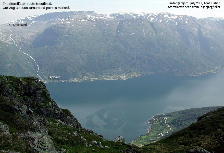
The route from Bjotveit
(Click for larger image)
This mountain had been on my mind for quite some time. But now as I was collecting the mountains with a high primary factor in Hordaland, the mountain presented itself as #38. By reaching Øyefjellet on Varaldsøyna the day before, I had completed the top 30. Now I could focus on the top 40. As the weather forecast promised a gorgeous day, the destination for this beautiful Sunday was quite obvious. I had done 1600m+ ascents before (Folgefonna and Skåla on skis). In addition, I had done 1600m+ as total on a number of hikes. Still I wanted to prepare to the fullest. I had some experience with headache on very hot days. Probably because I didn't pay much attention to lesser "important" things such as sunscreen, water and food. After a good breakfast, I stuffed the backpack with various food, bisquits and chocolate bars. And a couple of extra lunchboxes for Troll. I expected to carry him most of the way, but you never know. Sometimes he's just full of surprises.
I left Bergen 07:00AM and had a hard time deciding whether I should take the Kvanndal - Utne - Kinsarvik ferry (closest, but longest) or the Bruravik - Brimnes ferry. I finally decided on Kvanndal, and caught the 08:50AM ferry. We arrived Kinsarvik 09:40AM, and after some looking around for the trailhead, we were on our way by 10:20AM. I had decided on this trail by looking at the map, but as ususal, I rang the nearest doorbell to gain some additional useful information. This could be unmarked trail junctions, river crossings, etc. A very, very senior citizen opened the door. I explained that I was heading for Storeflåtten, and .. I knew it was coming .. then he pointed towards the mountain and said "Up there". When I normally ask "how can I park without disturbing anyone", people normally tell me that I can park on the property. I didn't dare ask, and parked down by the highway.
Troll walked willingly the first few hundred meters. Not of courtesy to me, but this is the normal distance for marking the territory properly. Then he sat down and stared at me in his usual manner. "We done yet?". Not by a longshot, and he entered the backpack. 5 minutes later, I let him out with the optimistic "look, look" and pointed up the valley. He took off, as if it was a all-time-big bone waiting up in the valley. Once he gets going, he usually goes on. As we hiked up the narrow path with the high grass, I smiled when looking back. The grass was silently moving, like a ghost was walking on the path.
The river down to my left was roaring, and I was curious about crossing the second river near the Y river junction higher up. The crossing was quite uneventful, and I could focus on the hike up to the lake. The trail switchbacked gently. I didn't feel I used any energy on the hike. I had been drinking 3 liters of water, and was a bit annoyed about all the unscheduled stops along the way. By the lake, a family was spending the day at their hut. This was their paradise, and what a paradise it was. But my goal for the day was throning 750m above the lake, and it was time to move on. Inspired by the lush life by the lake, Troll declined from any further walking. I walked to the far end of the lake, and then some. I felt the need for a rest and some food intake. We had been walking for three hours (including the stop by the hut), and we were only at 1000m. I realized it would be a long day.
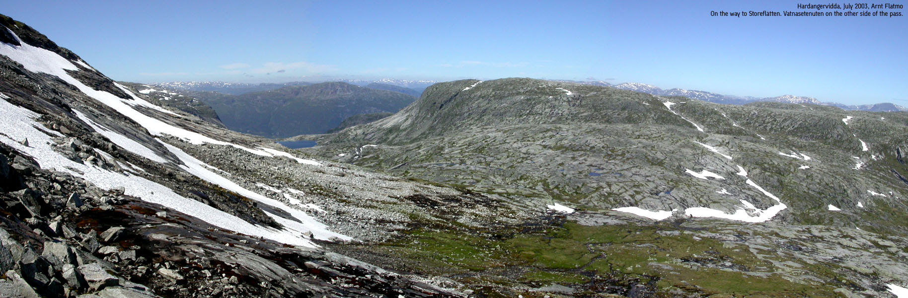
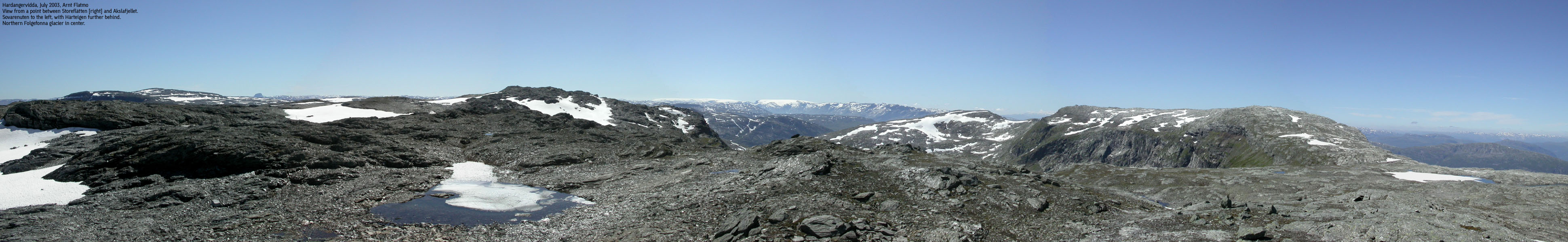
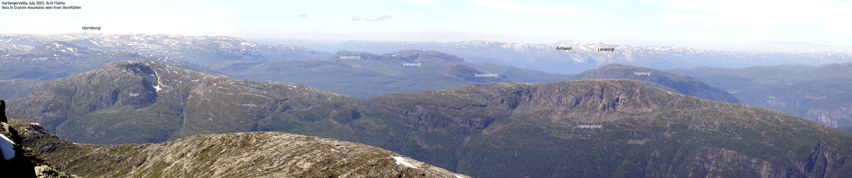
At the pass between Vatnasetenuten and Storeflåtten, I left the "T" trail. Suddenly, the Hardangerjøkulen glacier was there, bang in my face. And the Rembesdalskåka icefall, which I had never seen before, even if I have crossed the glacier. I had 550m vertical meters ahead of me, but I've been in that spot many times before. Just let your mind drift, and start walking. In "no time" we were up on the high ridge, and I had the most incredible views. For the first time, I saw the rise of Folgefonna, from Torsnuten. In the SE, Hårteigen appeared as (as always) the undisputed majesty of the enormous Hardangervidda plateau. After a 50m vertical descent, I could start on the final ascent to the summit. Troll had grown tired of the free ride, and wanted out. Disregarding the sharp ridge terrain. 15:05PM, we arrived the Storeflåtten summit. The views were simply astounding. I knew each and every mountain in the horizon. Oksen, Ingebjørgfjellet, Midtfjellet, Skorafjell, Vassfjøra, Horndalsnuten, Olsskavlen, Onen, Hardangerjøkulen, Høgahorgi, Grønahorgi, Lønahorgi, Kvitanosi, Grim. The list goes on. I was right at home. This was my playground. The summit register revealed that no one had been up here for three months. Last entry was early April, and they have probably skied. This is most likely a great ski trip. My friend Petter has skied this mountain, but came over Bunuten. He told me a story about almost falling off the mountain, into Hardangerfjorden. This is serious landscape.
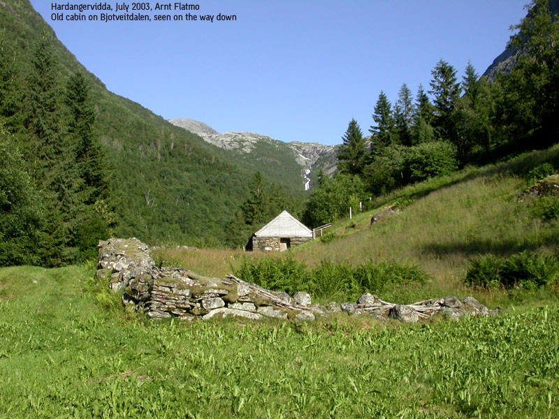
We left the summit 15:30PM, and I felt good. I decided to include Vatnasetenuten on the way home. I also considered Akslafjellet. This was just a longer hike, without much vertical gain. As it would get late enough in the evening without this point, I decided to drop it. The primary factor would only be 88m and Akslafjellet was not on my list of separate mountains. I took a shortcut towards the Vatnasetenuten - Storeflåtten saddle, which included a long, hilarious slide on snow. I finally got to use my ice-axe, which I had carried for the entire hike. I felt like being one of the Norwegian skiing pioneers, except for the skis and the stick. Due to the rapid descent, I reached Vatnasetenuten summit 17:05PM. By now, I had started to think about which ferry I should take, and mentally, the hike was over. I took a shortcut down to the lake, and passed the cabin 18:00PM.
Troll walked all the way down the valley, and we reached the car 19:05PM. The descent was quite uneventful except for the river crossing. I picked up Troll and balanced across the slippery rocks. At the very last rock, I slipped, fell and lost the dog. I managed to save him from a bad fall. Instincts are a true mystery. As I managed to land under him, I almost hit him in the head with the ice axe. Only his sharp reflex saved him from an unpleasant encounter with heavy metal. He gave me a serious look and a deep noise, and then decided to cross the river by own means. He was well ahead of me the entire route down the valley. At the car, I decided to drive towards Brimnes, and happened to be the last car onboard the 19:30PM ferry. Within seconds, a long queue piled up behind us. The drive home was all pleasant. No queues (despite the full ferry) and with a magnificent peak fresh in mind.


