
Norwegian Mountains, NordlandNordre Snøfjellet, 1007m
|
| Fylke/Kommune : | Nordland/Brønnøy | ||||||||||
| Maps : |
1825-I Tosbotn (Statens Kartverk, Norge 1:50 000)
1825-IV Velfjord (Statens Kartverk, Norge 1:50 000) |
||||||||||
| Primary factor : |
Nordre Snøfjellet: 437m Søre Snøfjellet: 195m Aunfjellet: 99m |
||||||||||
| Hiked : | S. Snøfjellet, Aunfjellet (Aug 2005), N. Snøfjellet (July 2009) | ||||||||||
| See also : |
| ||||||||||
| See also : | Other Nordland mountains on westcoastpeaks.com |

Nordre & Søre Snøfjellet
(Click for larger image)
Snøfjellet ("the snow mountain") is part of a vast mountain region that rises from Tosenfjorden, stretching to the east towards highway E6. Snøfjellet has two tops - the northern (1007m) and the southern top (885m) and the old trade-route between Tosbotn and Sausvatn runs between these two tops.
This region grows gradually in elevation - from Straumsfjellet (742m), via Snøfjellet S (885m), Snøfjellet N. (1007m) and Breidvasstinden (1224m) before reaching the even higher Langskardfjellet/Blåfjellet massifs. Further to the east is the Børgefjell mountain range, with highway E6 in-between
This web page will describe the route from Borkamo to Lake Leiråvatnet, from where you can easily get to the top of Nordre & Søre Snøfjellet. Also described is the onward route from Søre Snøfjellet (across Aunfjellet) to Sausvatn.

Borkamo trailhead and N. Snøfjellet
(Click for larger image)
Nordre Snøfjellet (Norge 1:50,000: 1007m, Økonomisk Kartverk: -, (UTM 33 W 400102 7250995) has a primary factor of 437m towards the higher parent Breidvassinden (1224m). The defining saddle (approx. UTM 33 W 401725 7252793) is found between N. Snøfjellet and Bjørnstokken. Ref. Norge 1:50,000 (20m contours), the saddle is within the range 560-580m, interpolated to 570m.
GPS measurement read 1010m (on the ground), averaged over a 5-minute period (error margin +/- 1,1m).
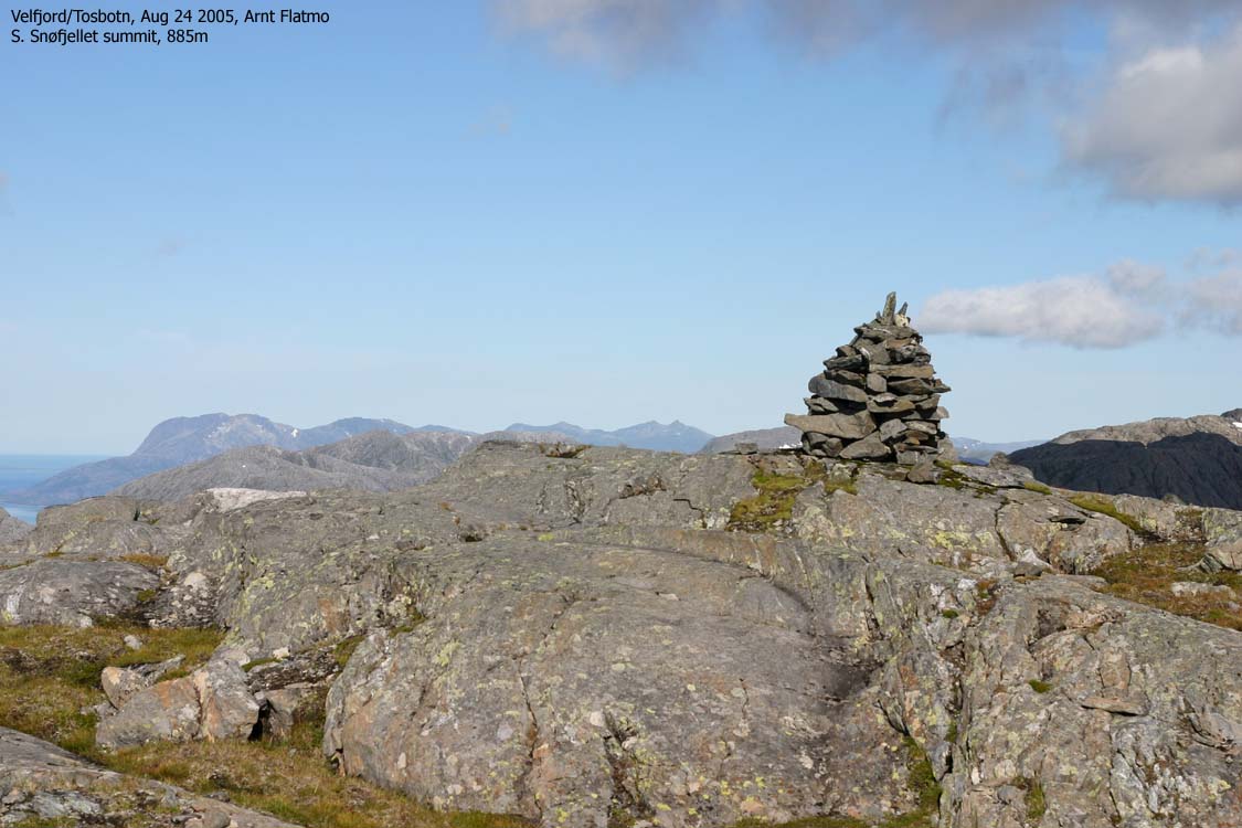
Søre Snøfjellet (1825-I: 885m, Økonomisk Kartverk: -, (UTM 33 W 398760 7246917) has a primary factor of 195m towards the higher N. Snøfjellet (1007m). The saddle is found between the two tops, in a pass between Lakes Toshølvatnet and Leiråvatnet. Ref. Norge 1:50,000 (20m contours), you cross the 700m contours on the high route, but not 680m. The saddle height has been interpolated to 690m.
GPS measurement read 885m (on top of the cairn), averaged over a 10-minute period (error margin not recorded),
Aunfjellet (1825-I: 769m, Økonomisk Kartverk: -, (UTM 33 W 396514 7247649) has a primary factor of 99m towards the higher S. Snøfjellet (885m). The saddle is found between the two tops, along the mountain plateau. Ref. Norge 1:50,000 (20m contours), you cross the 680m contours on the high route, but not 660m. The saddle height has been interpolated to 670m.
GPS measurement read 774m (on top of the cairn) averaged over a 10-minute period (error margin not recorded)
Google's interactive map. You can zoom, pan and click on the markers.
|
|
|

Routes to N & S Snøfjellet
(Click for larger image)
|
Route 1: Borkamo - S. Snøfjellet - Aunfjellet - Sausvatn (summer/autumn)
|
|
This route description is valid per Aug 2005
Access
(all distances are approx. distances)
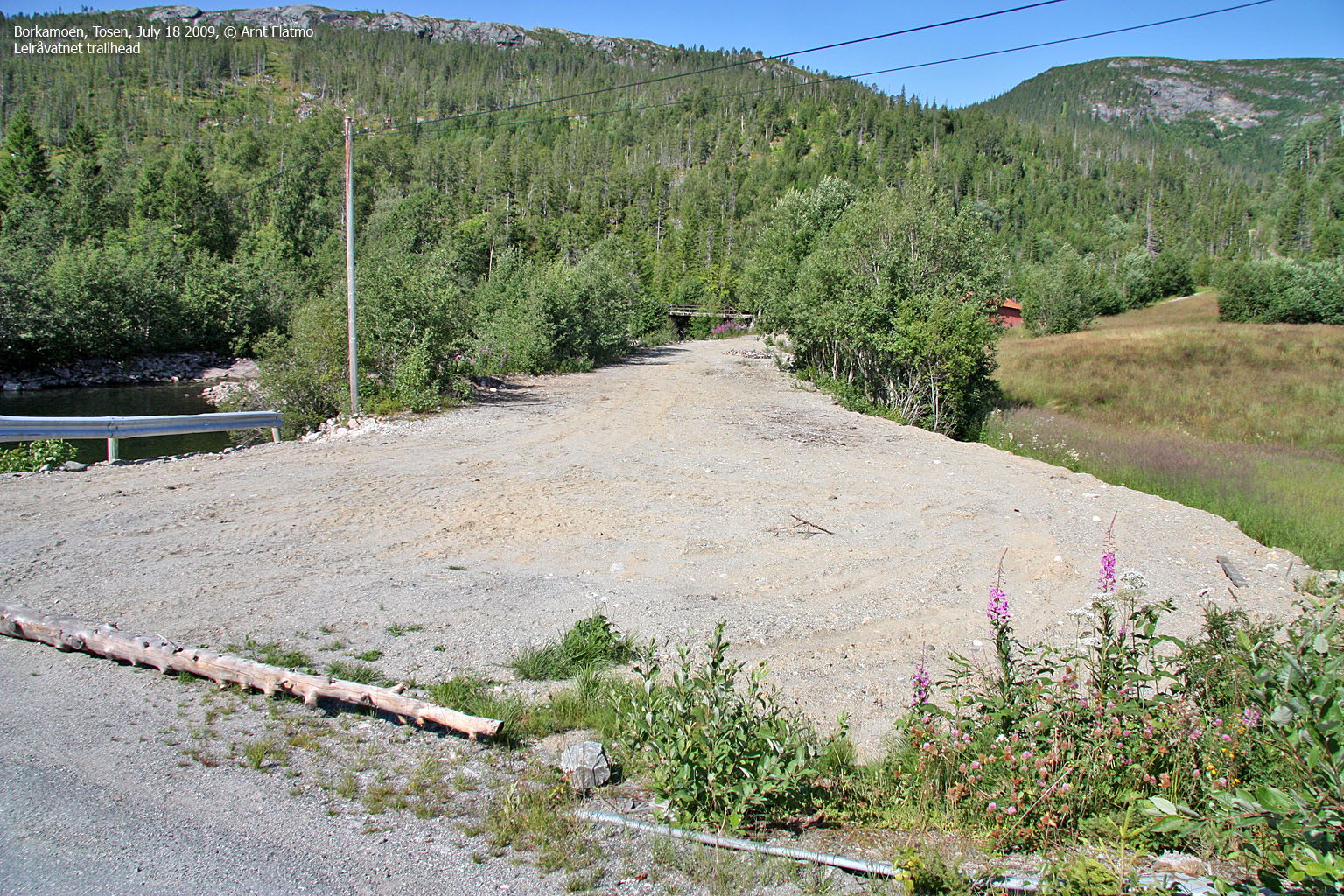
The starting point is Brønnøysund. Follow highway RV17 towards Vennesund. At Skillvika (10 minutes outside Brønnøysund), turn left onto highway RV76. Drive 60,9km to Borkamo and find parking near the bridge (UTM 33 W 403198 7246469) across Leiråa river - either along the main road or along the forest road (if open).
The route
Leiråvatnet:
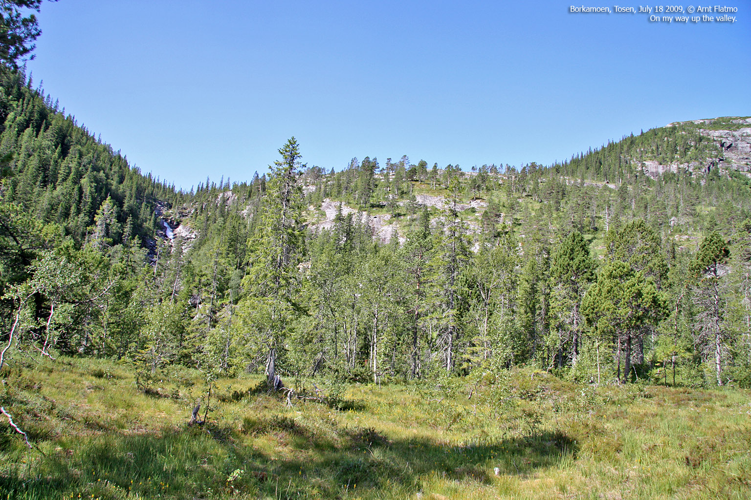
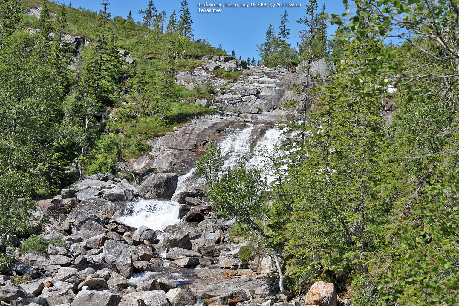
Follow the forest road up along Leiråa river. You reach a fork (UTM 33 W 402779 7247029) after 700-800m. Turn left and leave the forest road (which continues up to your right). Follow a vague and partly marked path up the valley, still with Leiråa down on your left-hand side. The path is particularly vague up Kringlotheia, where it also runs across slab rock.
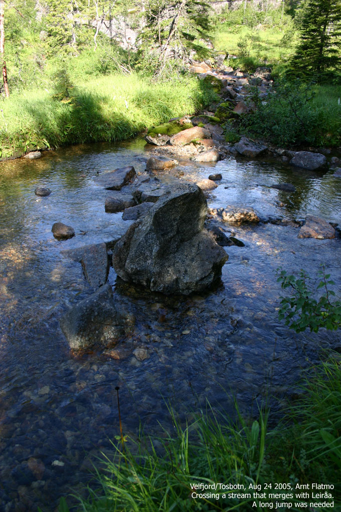
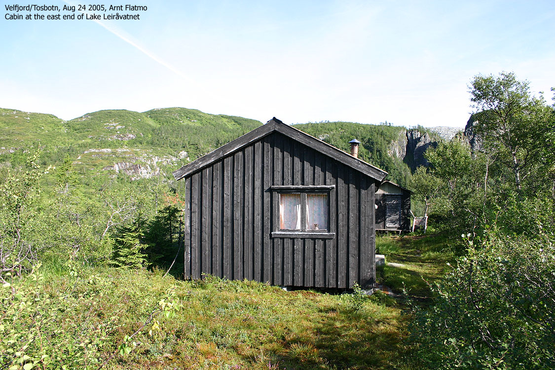
Continue west into the valley. You cross the river once (on rocks) and follow the path up to a cabin at UTM 33 W 401294 7247149. Proceed to the southeast end of Lake Leiråvatnet.
Søre Snøfjellet:
At Lake Leiråvatnet, ford the dam. Crossing is easy provided that the current isn't strong. Cross one more stream before you ascend S. Snøfjellet's southeast ridge. You will run into some slab sections and small cliffs the higher you get, but all obstacles are easy to bypass. You will pass a viewpoint cairn before you reach the summit cairn at 885m elevation. A trigonometric point can also be found here.
Aunfjellet:
Proceed west/northwest towards Aunfjellet. To save yourself from additional vertical gain, shift from left to right and vice versa as the terrain changes. Aunfjellet summit is marked by a cairn on the north side of the summit plateau.
To Sausvatn:
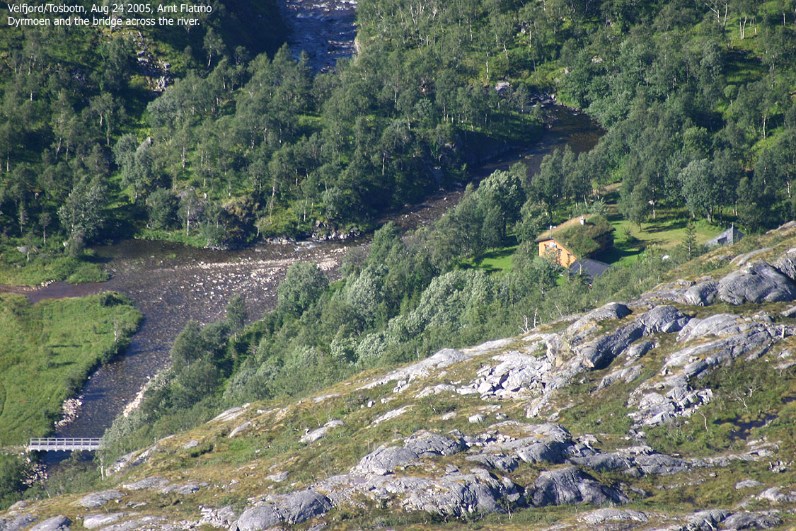
Descend Aunfjellet's northwest ridge. If you stay too far east, you will run into awkward slabs. If you stay too far west, you will run into cliffs. The route in-between is however quite easy. Descend to the western drain of Lake Toshølvatnet. Cross just west of the lake (you might get wet if the river is wild) and locate a visible, but narrow cairned path that takes you down to the forest road by Dyrmoen.
From Dyrmoen, locate the bridge 100m southeast of where the terrain vehicles ford the river. Head back to the forest road which will take you all the way down to Lake Sausvatnet via Austdalen.

The route down Austdalen
(Click for larger image)
|
Route 2: Borkamo - N. Snøfjellet (summer/autumn)
|
|
This route description is valid per July 2008
Access
(all distances are approx. distances)
Same access as for S. Snøfjellet. See route #1 above.
The route
Leiråvatnet:
Same access as for S. Snøfjellet. See route #1 above.
N. Snøfjellet:
From the southeast end of Lake Leiråvatnet, head north towards N. Snøfjellet. Aim for the narrow valley where the river/creek from Lake 589m flows. Continue straight ahead towards the summit, which is marked by a small cairn and a (fallen) trigonometric point.
Descend your ascent route, or descend southeast to the 780m contour west of point 780m. Then proceed south/southwest back to Leiråvatnet.

Nordre Snøfjellet
(Click for larger image)
 westcoastpeaks.com
Other Nordland mountains
Other Norwegian mountains
westcoastpeaks.com
Other Nordland mountains
Other Norwegian mountains


