
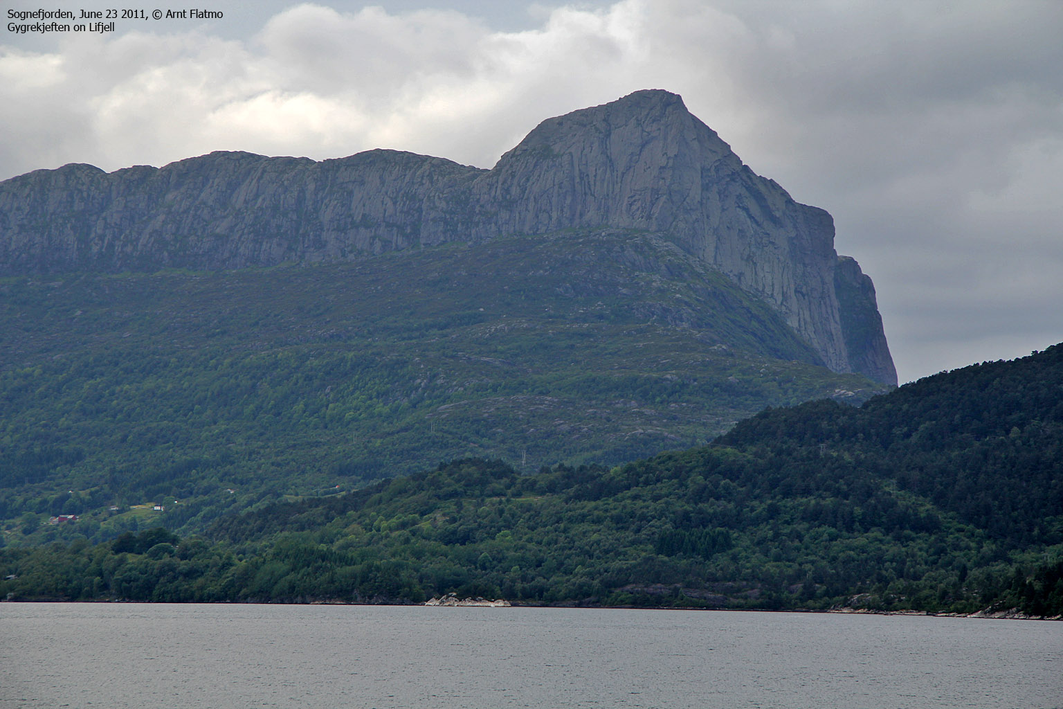
Norwegian Mountains, Sogn og Fjordane
Krakhellenipa (569m), Ulvegreina (448m), Dumbetinden (459m), Hardbakkefjellet (232m), Husefjellet (168m) - June 24 2011
To the main Solund page (maps, route descriptions, other trip reports, etc.)

Solund scenery
(Click for larger image)
Back again...
After 7 years, I was back in Solund, this time together with Anne. I still remember well the rush project in 2004 where I had to drive from Krakhella, locate the Krakhellenipa trailhead, hike the mountain (carrying my little dog) and return to the ferry in 2h:20m. Of course, this was close to impossible. I got to the top of Mednipa and had to turn around immediately. Bad planning, indeed, but now I was back - with a vengeance...
We had reserved a room at Fjordstue Bed & Breakfast near Hardbakke, but it was only for rent for one night. We assumed that it would be easy to find accommodation elsewhere for the two following days. The room was nice and breakfast was served in the (Dutch) owners' kitchen and living room area. Quite intimate. Perhaps a bit too intimate for my taste...
Krakhellenipa (569m) ...
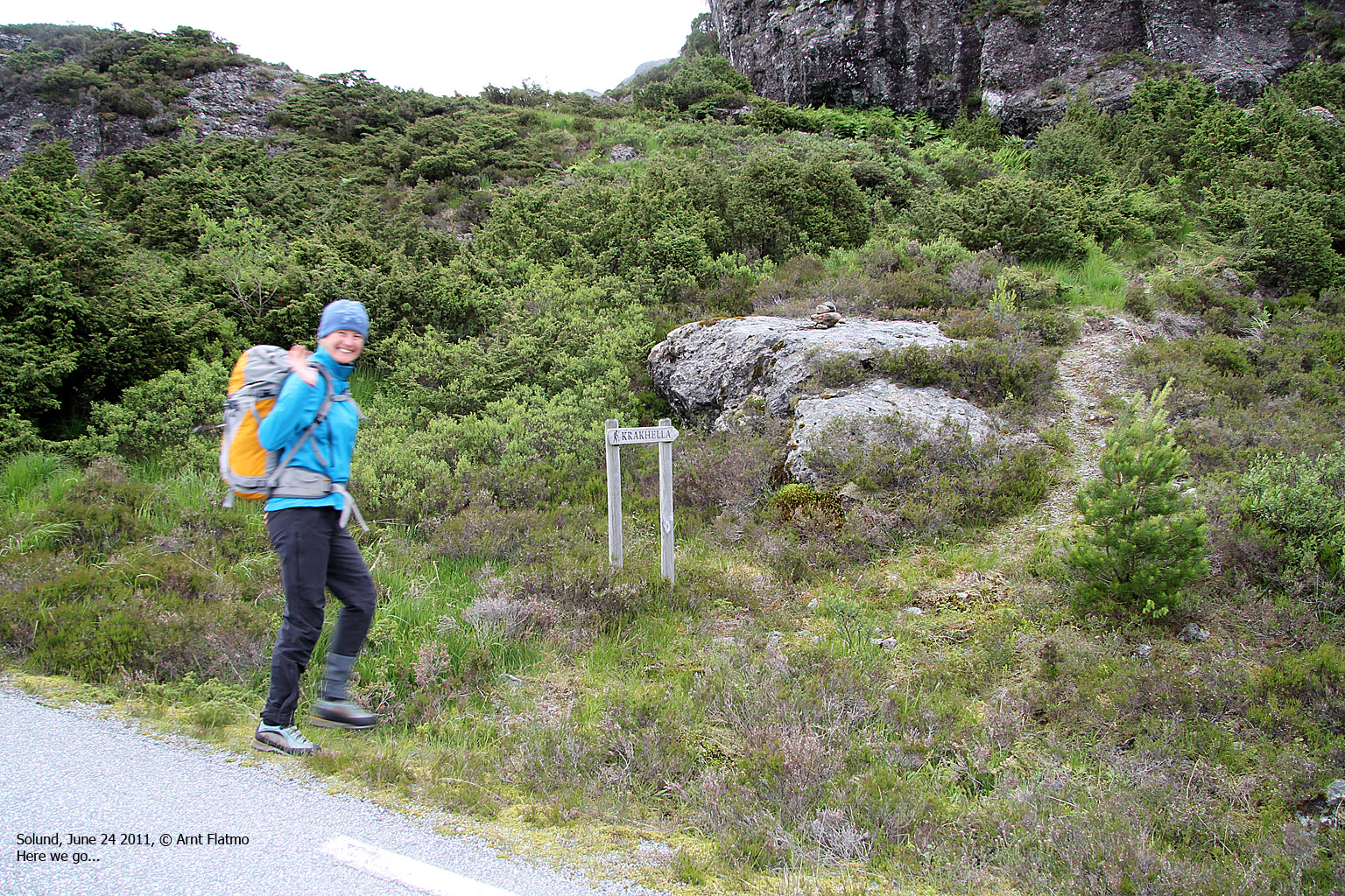
The next morning, we checked out of the B&B place and started calling the other places that offered accommodation on Sula island. None of them had any rooms available! As there was nothing more we could do regarding this matter, we sat course for the Krakhellenipa trailhead. Perhaps a solution to the problem would present itself during the day. And if it didn't, we could always put up a tent or even go to the DNT cabin at Råkeneset cabin.
Although I did remember where I started in 2004, we soon ended up getting a bit lost. The marked path we were on led us back to the road (!), but eventually, we found a path that led us up the mountain. It was a cloudy and very windy day, but as we reckoned that it was raining everywhere else - that was OK. After all, we had chosen Solund this weekend based on the weather forecast.

On the way to Krakhellenipa
(Click for larger image)
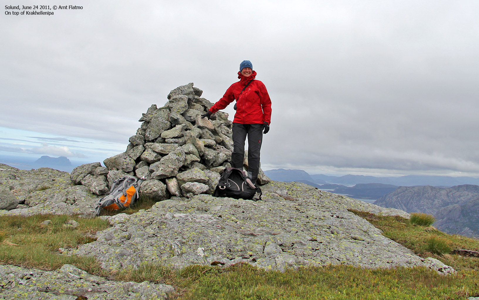
Now that we had found the route, the rest of the hike went well. The terrain was quite dramatic and it felt good to be back - especially now that I was in the process of finally bagging this mountain. We reached the top 12:38pm - close to 2 hours after leaving the car. Because of the strong wind, it was very difficult to take pictures. Most of them were taken in shelter behind the summit cairn.
The coastline view really blew us away. In 2004, I just didn't have the time to enjoy the views, but now I paid attention to every detail I could see. The north view was just amazing, and I can't wait until I get to visit Alden, Kinn, Batalden, Tvibyrge and the other cool islands.
After a short stay on the summit, we headed back down. Anne got a phone call - thanks to a cancellation, we now had a room for two nights at the Internatet motel in Hardbakke. Good news! We returned to the car 3h:10m after leaving. Next stop; Ulvegreina and Dumbetinden.

Descending Krakhellenipa
(Click for larger image)
Ulvegreina (448m) ...
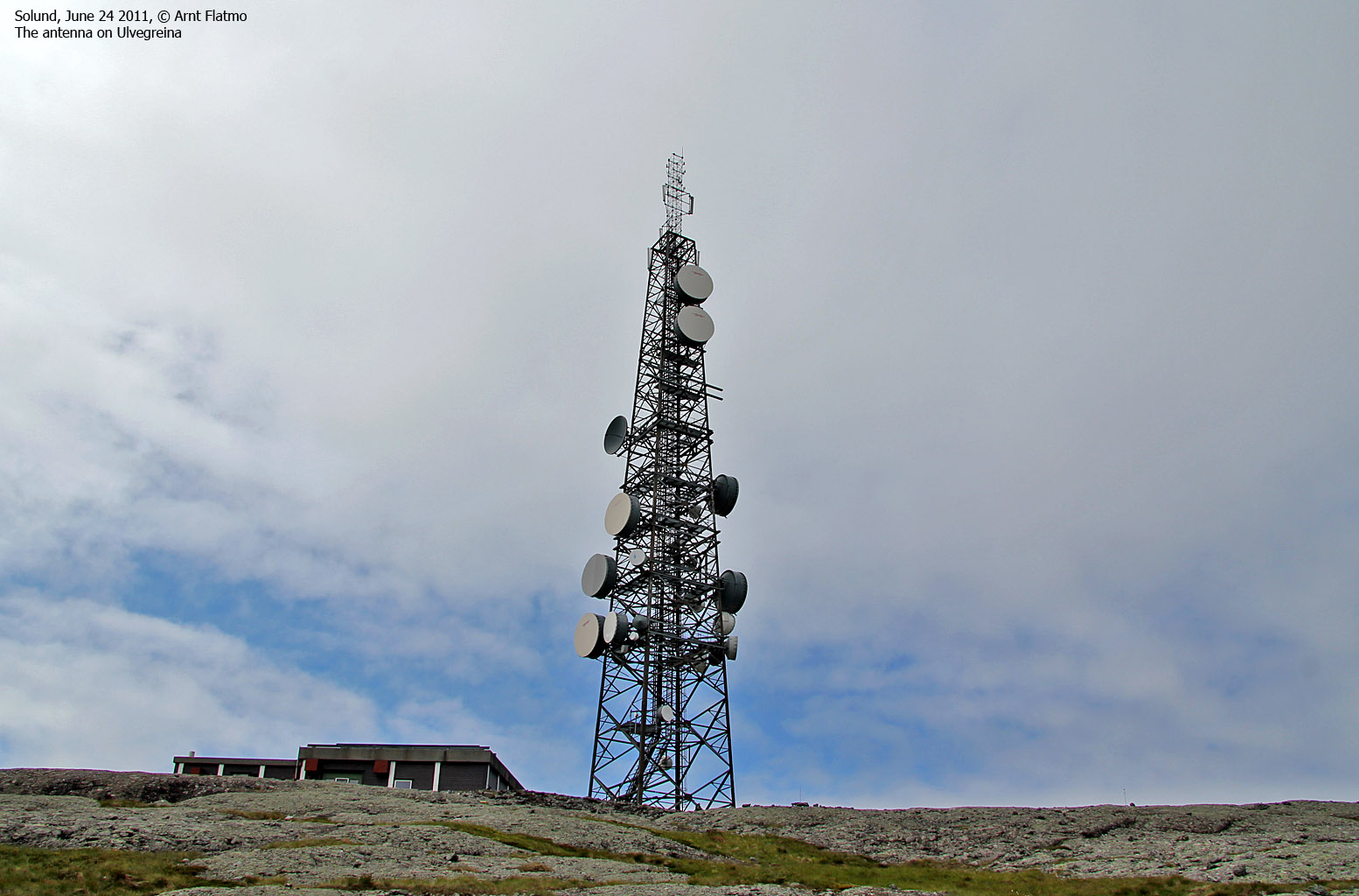
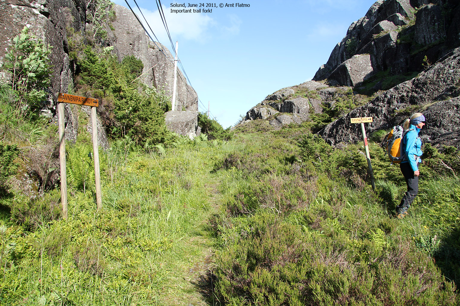
has a mountain service road all the way to the summit ridge, and we hoped that it was open to the public. We wanted to return to Hardbakke before it was too late in the day - to buy some food for the weekend. We drove the road to Eide, and as we arrived at the Ulvegreina road junction - we saw that the road was closed by a gate. $£$#!! Now we had a 3,5km hike ahead of us (one way) - on a rather boring mountain road!
But then we noticed that the gate wasn't locked. It was very tempting to just open it and drive up the mountain. But we decided to be good citizens and drove to Kråkevåg to see if we could acquire some kind of permission. From the landowner, we learned that the company that maintains the installation on top of the mountain had recently lost the key and were forced to open it the brute force way. And the landowner was more than happy to grant us permission to drive up the road. This was most excellent news, and we parked the car at the Dumbetinden trailhead - just below the Ulvegreina antenna. At 2:50pm, Anne and me enjoyed the views from Ulvegreina.

On Ulvegreina
(Click for larger image)
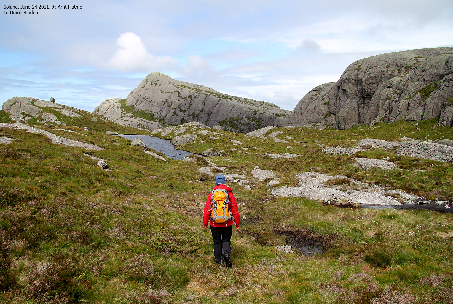
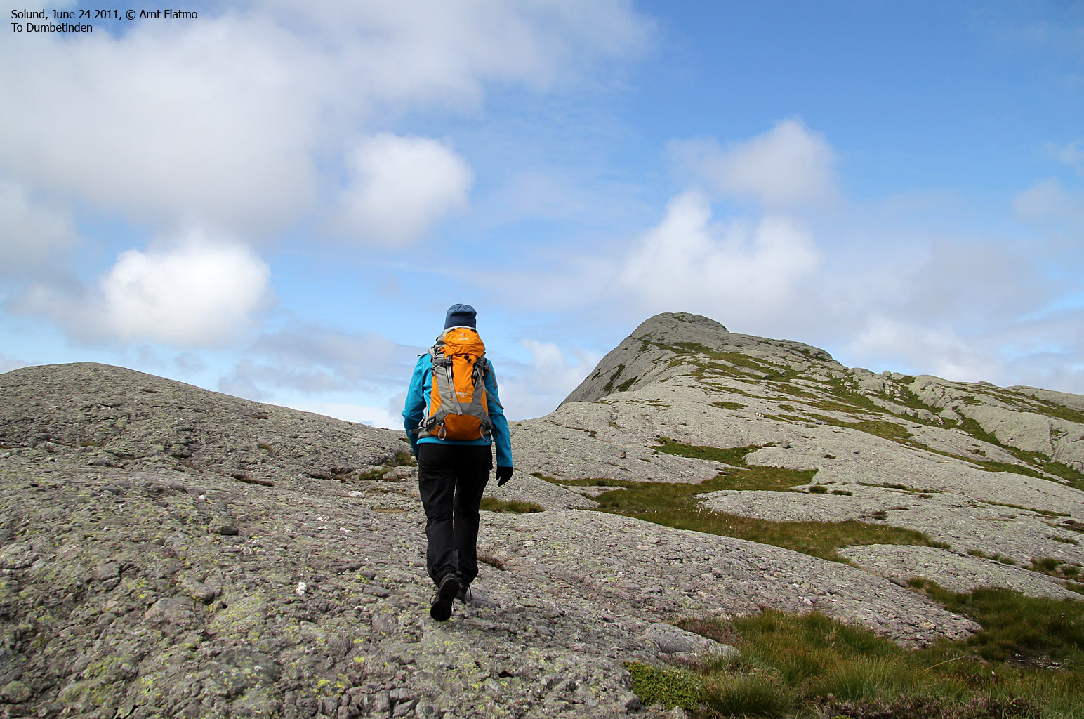
Dumbetinden (459m) ...
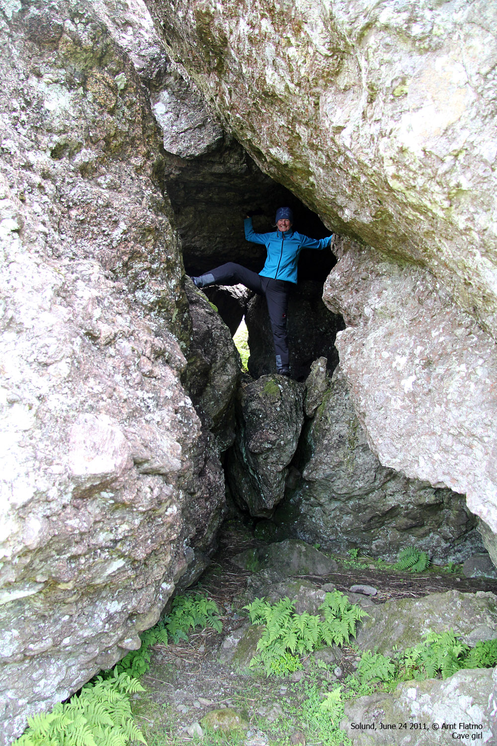
is a quick hike from the road to Ulvegreina. We followed a vague, yet visible path across a valley and up Dumbetinden's south ridge. We took a pause in the valley to scramble and climb inside a cave - formed by some huge rocks. A small flock of sheep kept us company on the south ridge and we reached the top 3:45pm - 35 minutes after heading out.
We tried to descend the north ridge and return on the distinct ledge west of the south ridge, but it was impossible to find a safe route down. We returned to the top and descended our ascent route - returning to the car 4:22pm.

On Dumbetinden south ridge
(Click for larger image)
Base-camp Hardbakke
We then drove to Hardbakke and checked into the Internatet motel. The apartment was small, but adequate. The standard was good, and this would serve as a good base-camp for the next two days. We shopped groceries at the local store and were in good shape for a Solund weekend - and the coastal top towering above our apartment - Hardbakkefjellet aka Ravnenipa.

Internatet at Hardbakke
(Click for larger image)
Hardbakkefjellet (Ravnenipa) (232m)
After a late lunch, it was time for our 4th coastal top for the day - Hardbakkefjellet. We located the trailhead near Nordre Hop on the northeast side of the mountain and headed out 6:02pm. We followed a forest trail to the pass between Hardbakkefjellet and Trettesfjellet where the mountain path begins. The day - which had started out a bit grey and windy, was now a gorgeous one.
The hike up the mountain was fun and included some minor scrambling. We reached the top 6:55pm and the view was excellent. By now, I was completely in love with Solund and wanted to visit all of the coastal tops I could see. Of course, this was not possible within the time we had to our disposal, and - without a boat or kayak. But there will always be a time for returning to this paradise.
After a nice stay on the top, we returned the way we came and returned to the car 7:30pm. After 4 tops and 1000 vertical meters, it would have been natural to call it a day, but there was still time and spirit for one more top - Husefjellet on Steinsundøyna.

Hardbakke seen from Hardbakkefjellet
(Click for larger image)
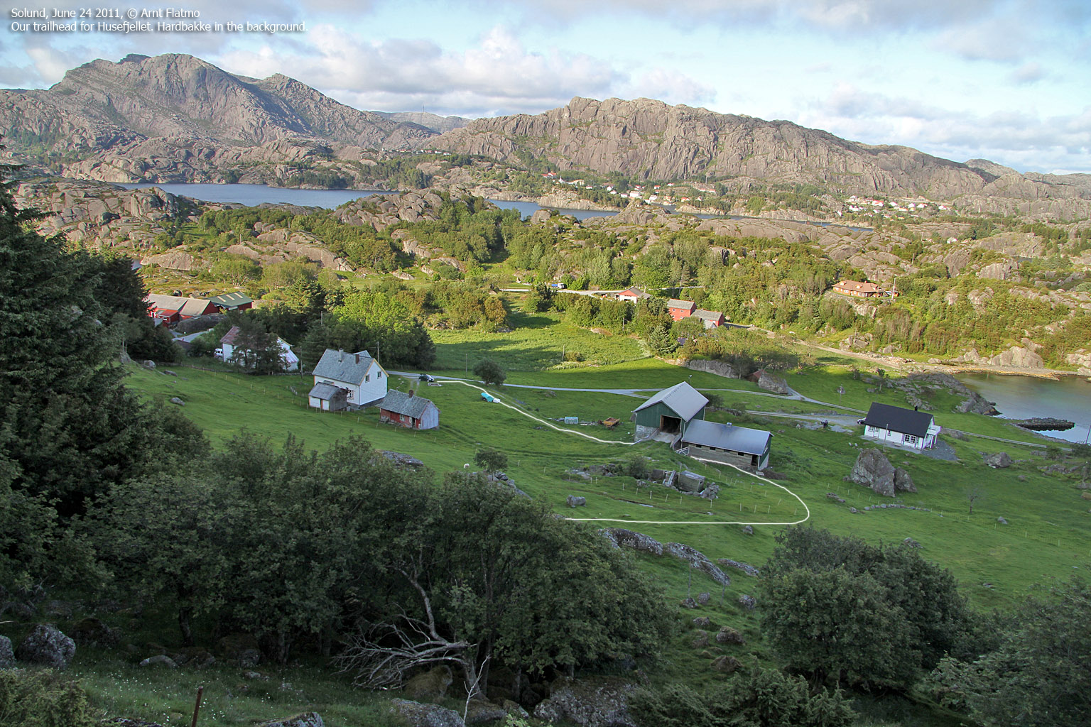
Husefjellet on Steinsundøyna (168m)
The plan was to ascend this mountain from the north, but while studying the north ridge, our confidence dropped. We drove to Steinsund and talked to a local farmer who pointed out a good route up the south ridge. After a 25 min. hike, we reached the top 8:15pm and had a very good view towards Ytre Sula, Steinsundøyna and the Hardbakke region.
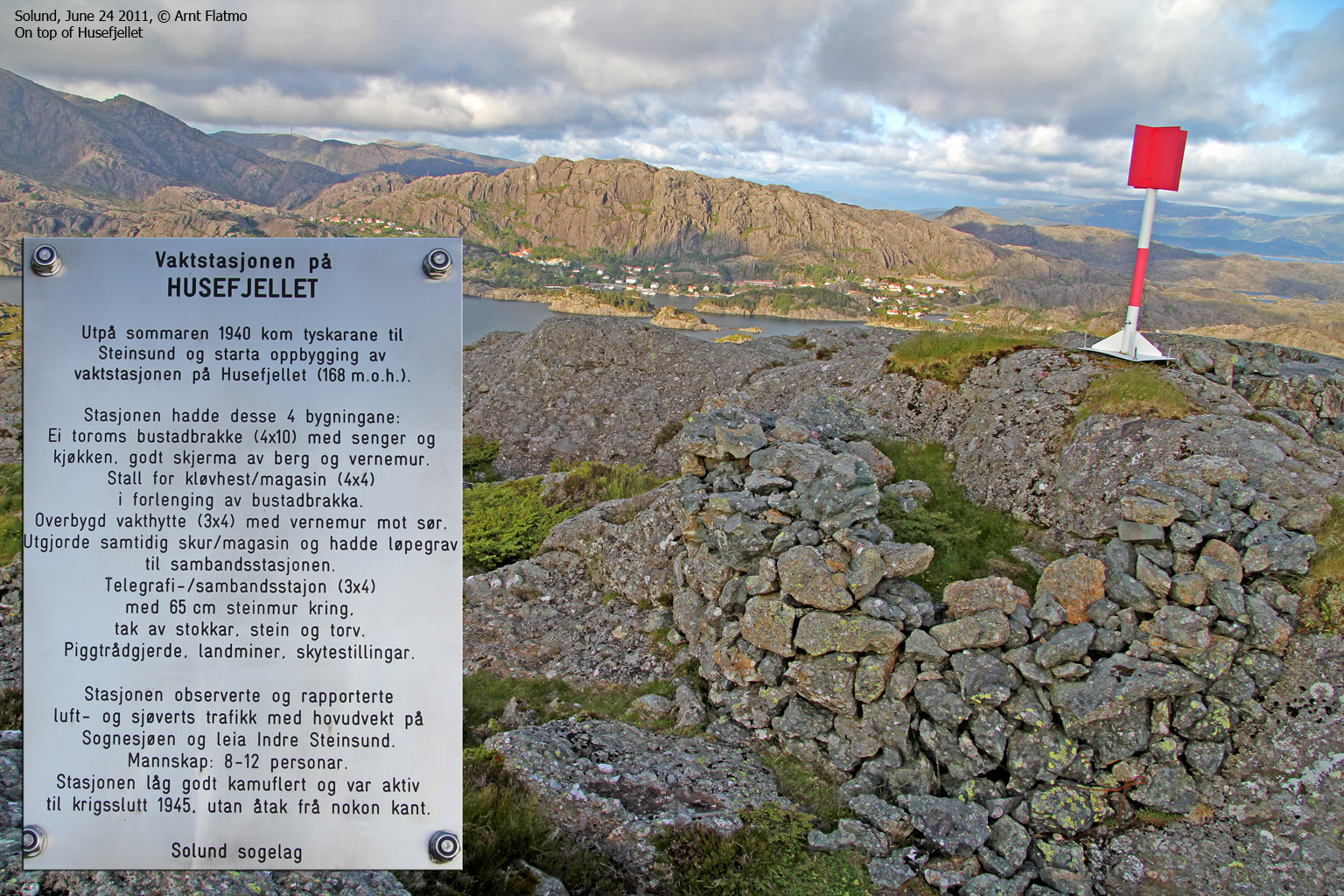
| On
top, we found reminders from World War II. The German occupants built a
signal station on top and had an unobstructed view towards the Indre
Steinsund shipping lane and Sognesjøen. A dozen people were stationed up
here and their primary task was to report enemy planes and suspicious
boat traffic.
There is a a plaque near the summit, and you can read the text (in Norwegian) in the column to the right. |
Vaktstasjonen på Husefjellet Utpå sommaren 1940 kom tyskarane til Steinsund og starta oppbygging av vaktstasjonen på Husefjellet (168 m.o.h) Stasjonen hadde desse 4 bygningane: Ei toroms bustadbrakke (4x10) med senger og kjøkken, godt skjerma av berg og vernemur. Stall for kløvhest/magasin (4x4) i forlenging av bustadbrakka. Overbygd vakthytte (3x4) med vernemur mot sør. Utgjorde samtidig skur/magasin og hadde løpegrav til sambandstassjonen. Telgrafi-/sambandsstasjon (3x4) med 65cm steinmur kring. tak av stokkar, stein og torv. Piggtrådgjerde, landminer, skytestillingar. Stasjonen observerte og rapporterte luft. og sjøverts trafikk med hovudvekt på Sognesjøen og leia Indre Steinsund. Mannskap: 8-12 personar. Stasjonen låg godt kamuflert og var aktiv til krigsslutt 1945. utan åtak frå nokon kant. Solund sogelag. |
We took the same route down the mountain and returned to our room at Internatet 8:45pm. It was high time for dinner. And perhaps a glass wine or beer - to celebrate a wonderful day in Solund. Anne served a delicious meal and we fell asleep early this evening. Day 2 would also be a busy one. Better get some rest...

The route up Husefjellet
(Click for larger image)
Pictures
The pictures were taken with a Canon EOS 550D + Canon EF-S 17-85mm IS USM F 4-5.6 and Canon EF 75-300mm f/4-5.6 IS USM + a Canon Powershot G12


