
|

Soleibotntindane (right), late evening(No Javascript) |
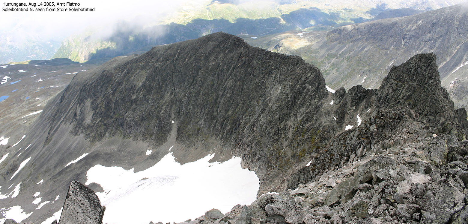
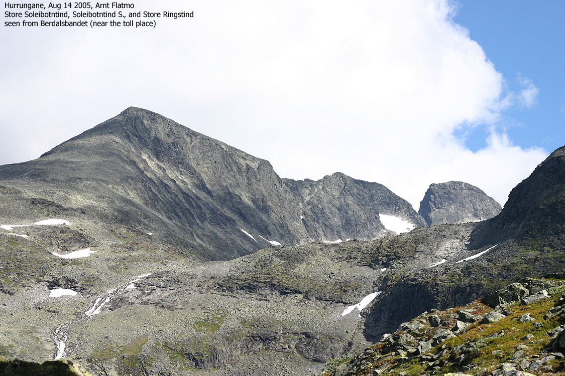
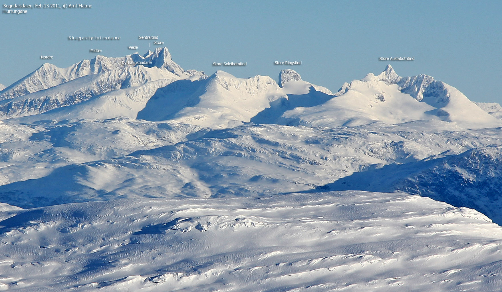
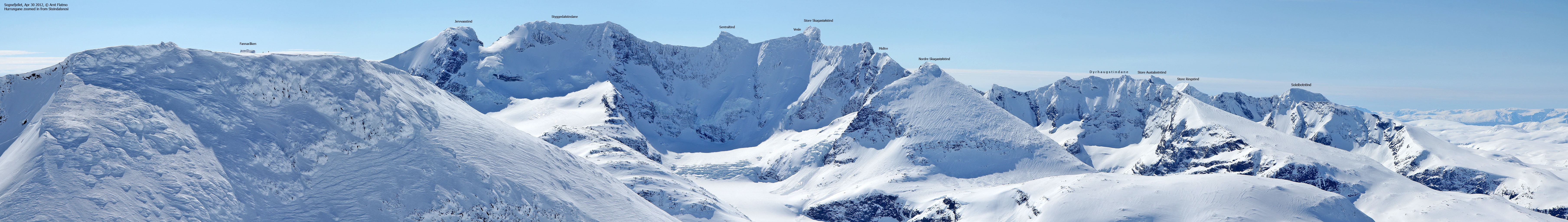
Store Soleibotntind is located in the Hurrungane mountain range on Sognefjellet, and is the highest (2083m) of the Soleibotntindane peaks. Soleibotntinden N-1 (2030m), Soleibotntinden S-1 (2020m) and Soleibotntinden S-2 (2049m) are satellitte peaks with a primary factor of 50m or less.
Store Soleibotntind is one of the easiest peaks to reach in Hurrungane. The walk from the road is short, the mountain has no exposed sections or any difficulties along the easiest route. Expect up to 3 hours from where Tverrelvi river crosses the Turtagrø - Øvre Årdal road.
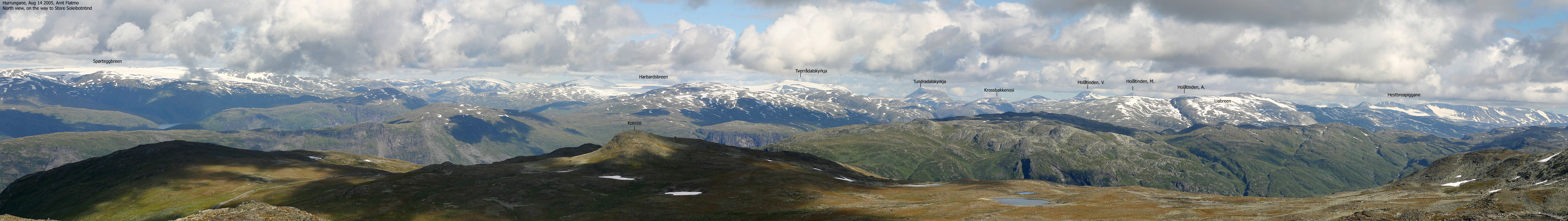
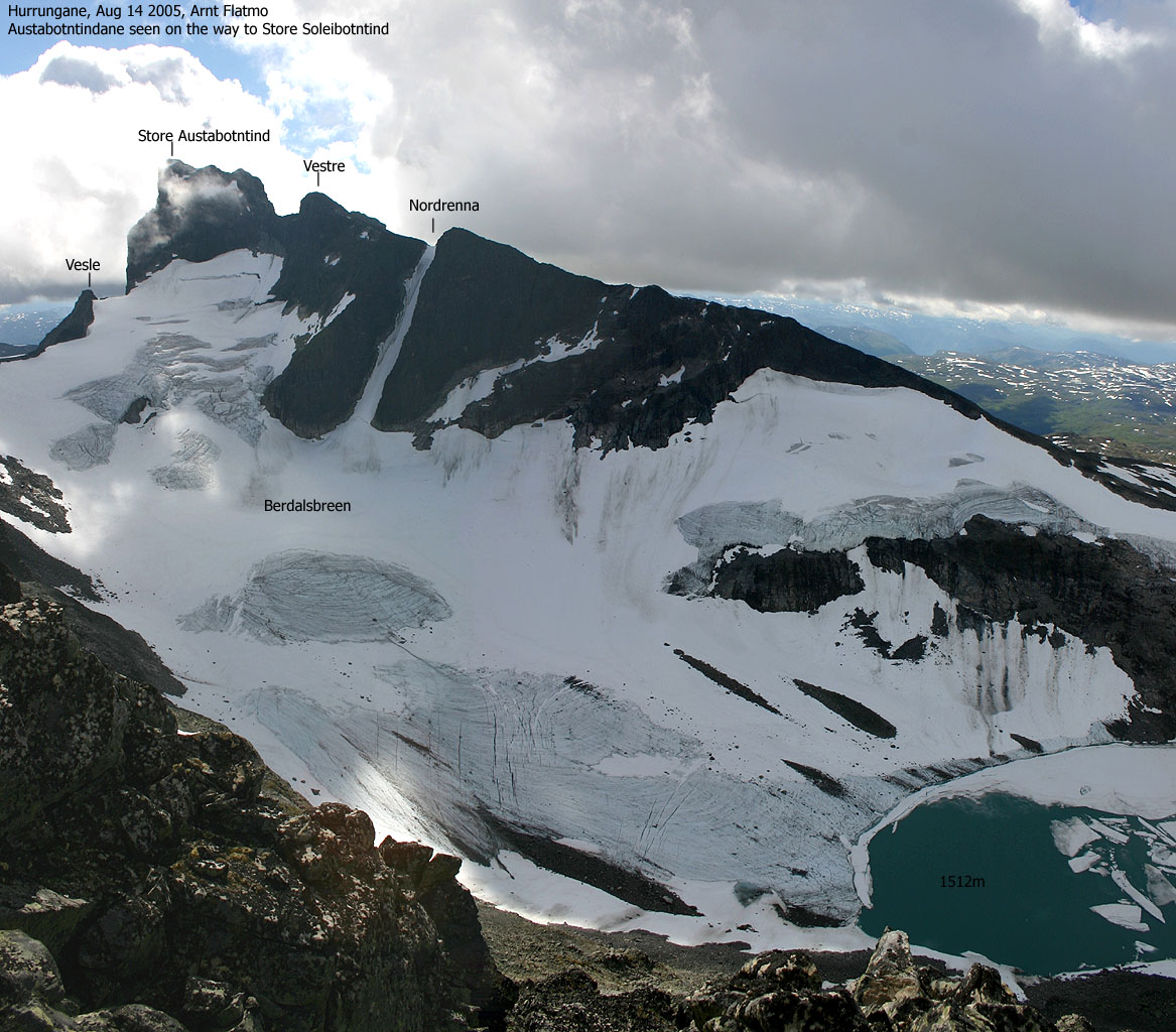
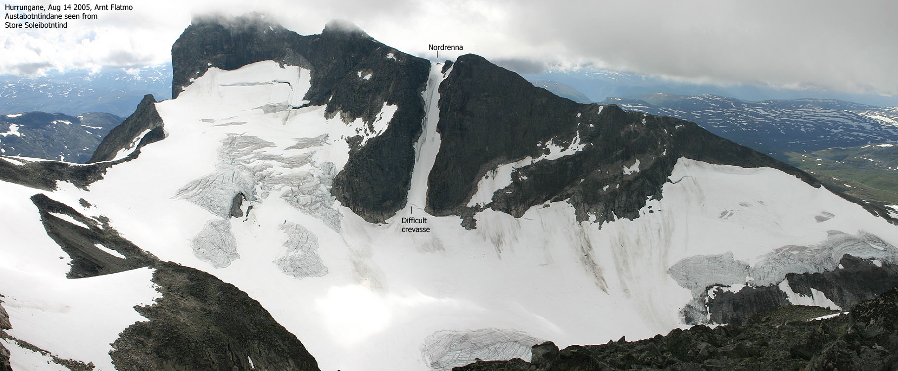
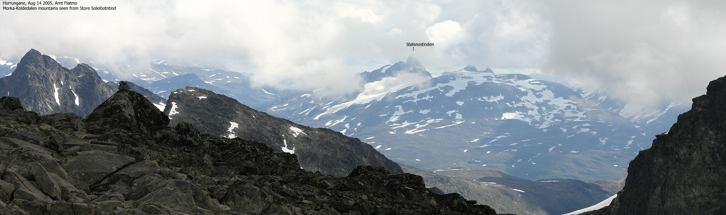
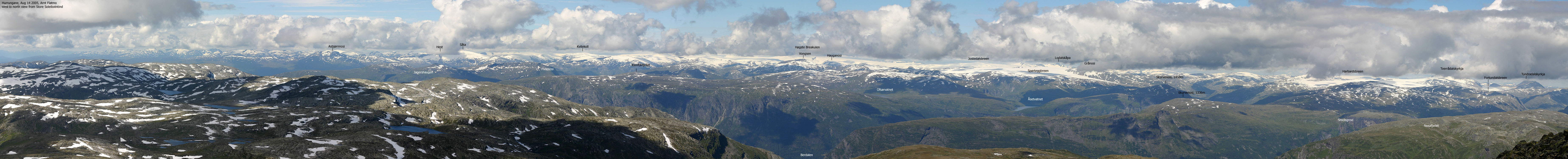
The views from the summit are quite good and you have a clear view towards Dyrhaugstindane, Ringstindane and Austabotntindane. Store Skagastølstind also presents itself with pride from this angle. The east-to-north views are also good, and you see a string of tops and glaciers reaching from Sognefjorden to Hestbreapiggane. You can see Jostedalsbreen almost in its full length from here, including Spørteggbreen and Harbardsbreen glaciers.
Store Soleibotntind (M711: 2083m, Ø.K: -) has a primary factor of 173m towards the higher Store Ringstind (2124m). The saddle is found between Soleibotntinden S-2 and Store Ringstind. Ref the 1517-IV map, you cross the 1920m contours on the high route, but not 1900m. The saddle height has been interpolated to 1910m.
My GPS reported 2091m over a 10-minute period, on point 32 V 435242 6813219.
Notes: Class ratings are in reference to YDS. Click here for more information.
The trails described below are not necessarily the *easiest* trails to this mountain.
|
Berdalsbandet; - Store Soleibotntind (all seasons)
|
|
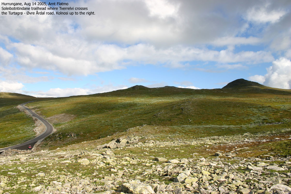
Locate Tverrelvi river on the road between Turtagrø and Øvre Ådal, approx. 9Km from Turtagrø. There is parking for 5-6 cars alongside the road.
Get on the south side of the river and locate a visible path that heads in the southeast direction. This path is hard to follow, so don't spend energy trying to follow it. The easiest route is to follow the river into Soleibotnen and get on the Bukkanosi ridge before you reach lake 1422m. If you see obvious short-cuts, follow them. Once you are on the Bukkanosi ridge, follow it upwards. The last 400 vertical meters are boulder. A path is visible from distance, but you may end up managing without it. There is loose gravel on the path, which is only good while descending. The summit is marked by a mailbox and a visitor's register.
You can follow the same route in winter (the road is closed then), but stay away from the cornices facing Soleibotnen. Accidents have happened here.
You may also visit the satellitte peaks from the main peak, but be prepared for scrambling, exposed terrain and loose rock.
This morning, I headed down from Skagadalshytta with my friend Bjørn Eirik Hanssen. We had climbed Store Skagastølstind the day before and went separate ways at Turtagrø. While Bjørn headed towards Oslo, I wanted a short hike before continuing to Bergen. Store Soleibotntind was a good candidate and I drove down to the Tverrelvi trailhead.
A mountain guide had given me a bag of sandwiches at Skagadalshytta, as one of his clients had turned around. With a tasty breakfast, made at Turtagrø the same morning, I headed towards Store Soleibotntind 10:20AM. The route seemed quite obvious and it was just a matter of moving on and enjoy the day. Fog came and went, but I expected to get some good views from up there.
I met Anita Vik from Stamnes, coming down the mountain. We started talking and found that we had common friends. She said there wasn't anyone else on the mountain, so I assumed she was the first visitor this Sunday. But when I arrived the summit 12:20PM, I noticed that a person had spent the night up here. This person was Sveinung Klyve, which I knew. I had been on a ski-trip with Sveinung to the second highest mountain in Voss earlier in the year, and knew that Sveinung enjoys taking sunset and sunrise pictures from mountain tops. I left him a voice message and assumed he had left early. It turned out that he was walking about down in Ringsdalen when I was on the summit.
I headed down to the pass towards Soleibotntind S-1, but turned around before I reached the pass. Loose gravel on slanting rocks in exposed terrain was not something I wanted to get involved it. Not without a rope. Besides this, the route looked like fairly easy scrambling. The satellitte peaks (both the northern and southern) were quite cool to look at. Perhaps I should come back one day, carrying a rope.
I headed back up to the summit, signed the guestbook, took some pictures and headed back down. I was back at the car 14:30PM and sat course towards Bergen. A fine week-end in Hurrungane had come to its end.
Move cursor to read notes, and click on the images to see full version.
Some of the thumbnails may have been cropped to fit the format.


No Javascript:
1 2 3 4 5 6 7 8 9 10 11 12 13 14 15 16 17 18 19 20 21 22 23


No Javascript:
Other hordaland mountains
 Other Norwegian mountains
westcoastpeaks.com
Other Norwegian mountains
westcoastpeaks.com

