
For Information, maps, trailhead and route descriptions, click HERE.
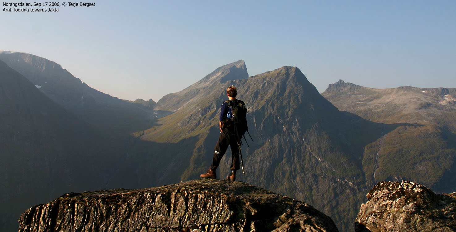
After a fine trip to Jakta the day before, I woke up in my tent in Norangsdalen 07:30AM. After breakfast, I rigged down the tent and was all done 10 minutes before my colleague Terje Bergset came driving down the valley. Well *before* on-time.
To Slogen
We drove down to the Slogen trailhead and were ready to start hiking 08:45AM. Although we crossed a long acre, I decided to carry my dog "Troll" in the backpack. I told Terje that I expected that we would reach the top in 3 hours, after the 6-5-4 scheme (600m the first hour, etc.) After the tough Jakta hike the day before, the "juice" wasn't present. It would be a hard hike, and besides, we had to carry water. I carried two 0,5L bottles. One for the dog, and one for myself. Well knowing that this was way too little.
At 600m elevation, we had walked exactly one hour. To my great surprise, there was a "water" sign, and a few meters away from the path, we found a tiny creek. The water was quite welcome, as it was a hot and simply OUTSTANDING morning. We had enjoyed shade in the forest, but were now moving into the sunshine. I let Troll walk for a little while, but I had to lift him (awkward path) more than he walked, so I put him into the backpack again.
At approx. 900m, we passed a small top and had a 300m steep hill ahead of us. This hill led us up to Slogen's east ridge, where we would join the "trade route" from the Patchell hut. We could see a group of 3 hikers high on the east ridge. We expected to see more people during the day.
Terje, with "juicy" legs and no dog to carry, didn't complain about the pace. I know he wouldn't mind a faster pace, but I was in no shape to walk any faster. I felt a certain fatigue sneak in. We joined the east ridge (approx. 1200m) 10:55AM, which meant we were fairly "on-schedule". I felt far from strong when I looked up the remaining 360 vertical meters.
As we approached the summit, the mountain looked awfully steep. The hikers ahead of us seemed to, carefully look for ways to advance. This didn't match the perception I had. I didn't know anything about the route, other than that thousands of people visit this peak each year. I enjoy scrambling, but not while carrying a dog.
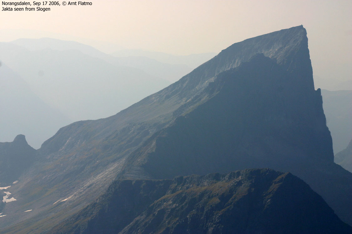
Upon closer contact with the mountain, there were no problems. Advancing up the ledges (almost like wide stairs) was trivial, when the best route was chosen. We arrived the summit 11:45PM, which means it took us exactly 3 hours to the top. It was nice to arrive the summit. Not because the ascent was over, but because it was a beautiful place to be. I had imagined that the summit was smaller, but at least 20 people could find their spots up here. Terje knew one of the hikers that arrived just before us and they chatted while I took pictures. Unfortunately, the air was quite hazy, and in order to document the views, I would have to rely on the Jakta pictures from the day before.
A long chain of hikers were on the way up the east ridge. According to the logbook, roughly 100 people had been here the day before, and it was obvious that at least 50 would visit Slogen today. We could have been sitting up there for hours, but as more and more hikers arrived the summit, we decided to head back down. It seemed like Terje was very happy about being up here. All worth the drive from Ålesund. It was the first Slogen visit for the both of us, and now we spent time looking towards Store Smørskredtind - a mountain that is #1 on the to-do list, but it might not happen in 2006. Perhaps next year. We had already done 7 hikes together in 2006, and I've learned that Terje certainly knows how to handle himself in steep terrain.
Another colleague of us - Torill Berg - reached the top of Store Smørskredtind just as we were leaving Slogen. What a "crazy" summer/autumn for her; Emdalstindane, Store Skagastølstind, Romsdalshorn, Råna, Bergetindane, Blåbretinden, and MORE. And it might be accurate to say that she had never ascended a truly demanding mountain before the summer of 2006. It's called progress.
Descent
We left Slogen 12:35PM and I struggled for a while to find the best route down the ledges. They were all slanting, and awkard to descend. Without an unstable backpack, this would have been easy, but I decided to descend closer to the east face. I found a convenient route that made the descent trivial.
I let Troll out of the backpack and except from a few slightly airy places, he walked all the way down. The water-hole at 600m elevation was once again a GREAT place to visit, and thirst was satisfied. Terje has knees that cause him grief upon descent, and we took it nice and easy down the mountain. We were back at the trailhead 15:00PM. I wished that I could just drive back up in Norangsdalen and camp one more night, but reality has no mercy. Back in Ålesund, I was able to stay up until 21:30PM, but going to bed was nowhere near as nice as falling to sleep in the tent in Norangsdalen, the night before.
To Slogen


Wide-angle views from Slogen


50mm views from Slogen, 2 parts


Other pics from Slogen


Descent


No Javascript:
1 2 3 4 5 6 7 8 9 10 11 12 13 14 15 16 17 18 19 20 21 22 23 24 25 26 27 28 29 30 31 32 33 34 35
 westcoastpeaks.com
Other Møre & Romsdal mountains
Other Norwegian mountains
westcoastpeaks.com
Other Møre & Romsdal mountains
Other Norwegian mountains