
|

Sletteggi seen from Unneland road |
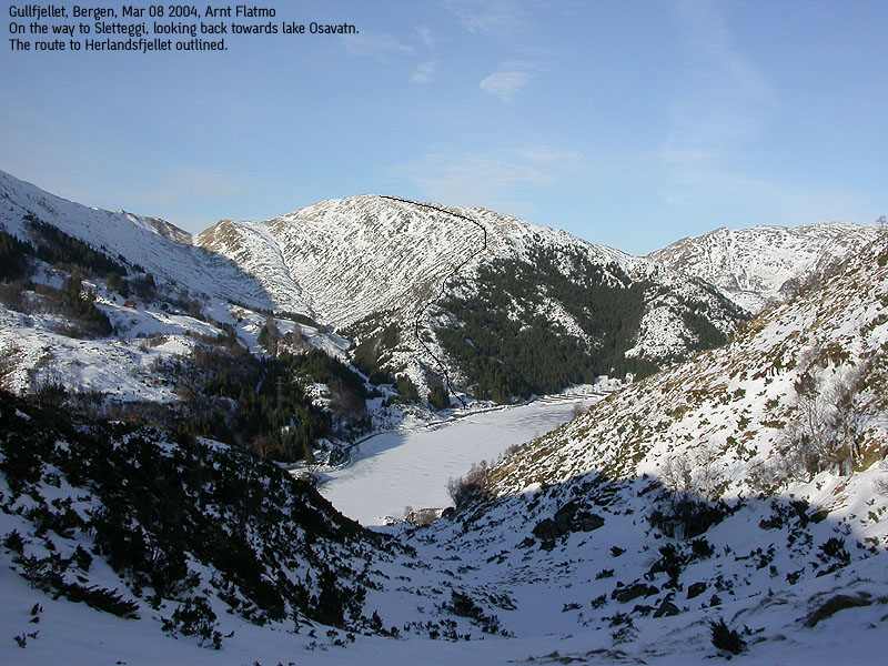
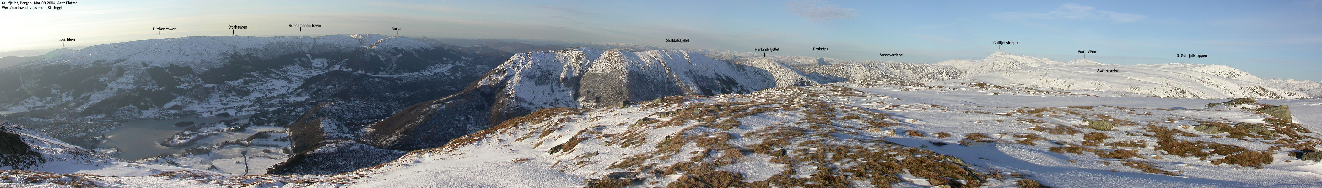
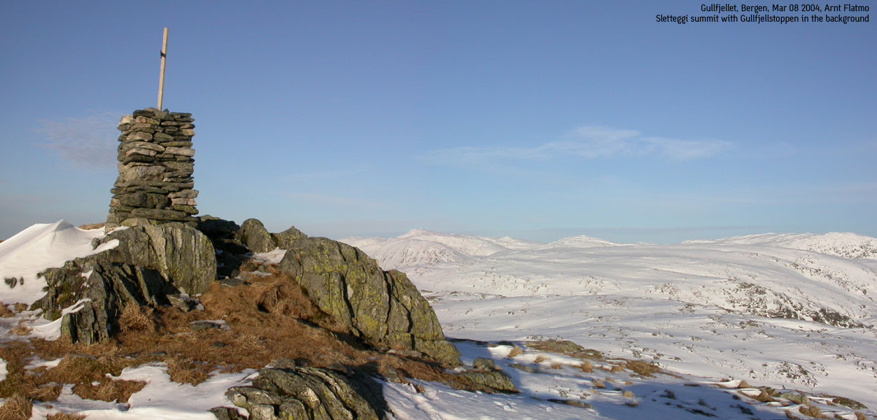
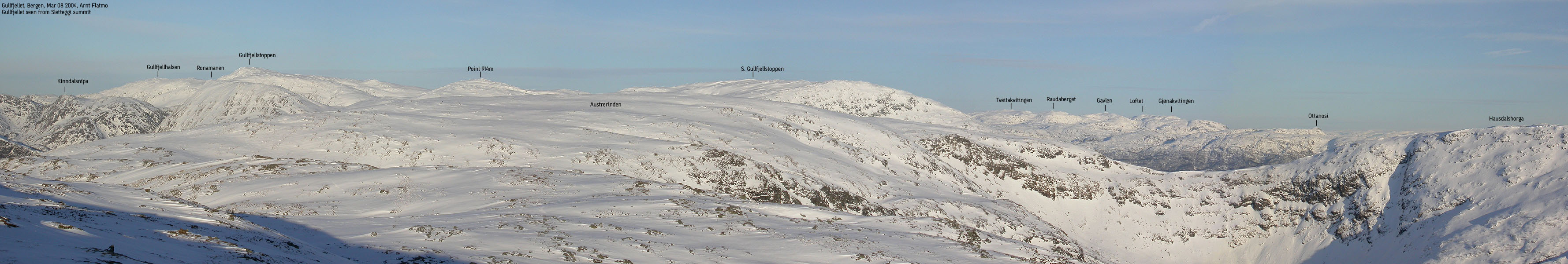
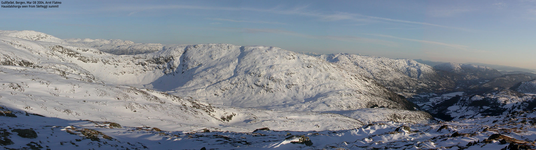
Sletteggi (also known as Sletteggen/Slettegga/Storlitoppen) is a top on the high ridge that runs from Gullfjellet to Livarden outside Bergen. The ridge is popular in all seasons. The cross-country ski trip between Livarden and Gullfjellet is a classic. From the summit of Sletteggi, one have unspoiled views towards Bergen mountains, Gullfjellstoppen and Mønuken. Sletteggi is easily accessible from lake Osavatnet, and a cairn trail (Vasslia valley/Norrønabakken hill) will take you all the way to the top.
Sletteggei (M711: - Ø.K: Highest contour is 740m) has a primary factor primary factor of 91m towards the higher Austefjellet/Austrerinden/Austlirinden (808m) The saddle is found between the two tops. Ref. Økonomisk Kartverk, you cross the 655 contours on the high route, but not 650m. The saddle height has been interpolated to 653m.
Note: Class ratings are in reference to YDS (Yosemite Decimal System).
|
Lake Osavatnet - Sletteggi (summer/autumn)
|
|
Access
On highway E16 from Bergen, between Nesttun and Indre Arna, take the first exit (right) towards Bjørndalen/Unneland. Drive 1,9Km and exit right at the Unneland road junction. Follow the road upwards for 3,5Km and enter a small parking area just before a bridge. You are now at lake Osavatnet (the main Osavatnet parking is on the far side of the lake) Note that this area sometimes is closed, and then you need to find parking nearby which without causing problems for other traffic.
The trail
In summer/autumn, you are likely to find a number of fences that are used to gather sheep. The gate to the trail is on the far side of the fences, and you have to make your way through or around. In the period when sheep are gathered, try to make your way *around*.
Go through the gate and find a nature trail (rock) that takes you up to the first cairn on the ridge above you. After cairn #2, the trail descends a bit before it climbs up the Vasslia valley.
In winter, follow a narrow track along lake Osavatnet for 100m and turn right at the end of the ridge. Follow a small valley upwards. You merge with the cairn trail at the point where the cairn trail descends down to the valley.
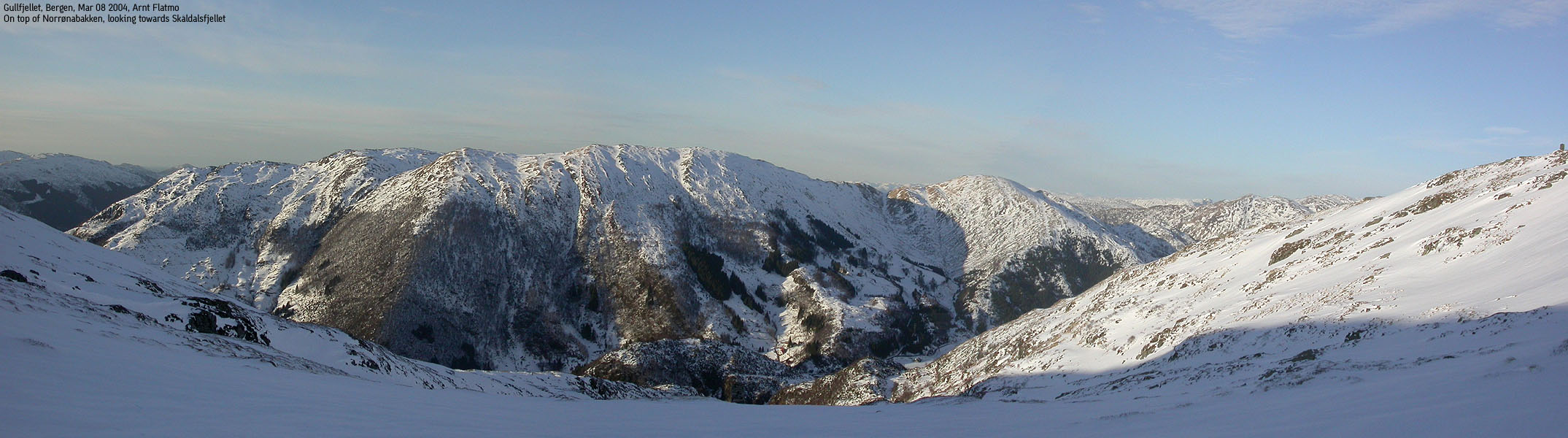
At the top of the Vasslia valley (Norrønabakken hill), go right and follow the cairns all the way to the summit (cairn marked '6'). After rain, this trail can be soaking wet. Bring appropriate footwear.
Descend your ascent route, or continue to Austrerinden and follow one of the ridges back to lake Osavatnet.
On a lovely Monday evening, I left Bergen early and was on my way from lake Osavatn 16:05PM. I was hoping for a slope with soft snow up Norrønabakken, but most of the snow was frozen and the entire Vasslia valley was in the shadows. I reached the summit 17:15PM after some technical adjustments on the skis. A little less than two hours later, I was standing on Ulriken summit. This time, with the dog, which was not allowed to come along on the ski-trip to Sletteggi.


No Javascript:
Move cursor to read notes, and click on the images to see full version.
Some of the thumbnails may have been cropped to fit the format


No Javascript:
 Other hordaland mountains
Other hikes in this area
westcoastpeaks.com
Other hordaland mountains
Other hikes in this area
westcoastpeaks.com
