
Norwegian Mountains, Møre og Romsdal
Sandegga (1389m), Apr 22 2012
To the main Sandegga page (maps, pictures, other trip reports)

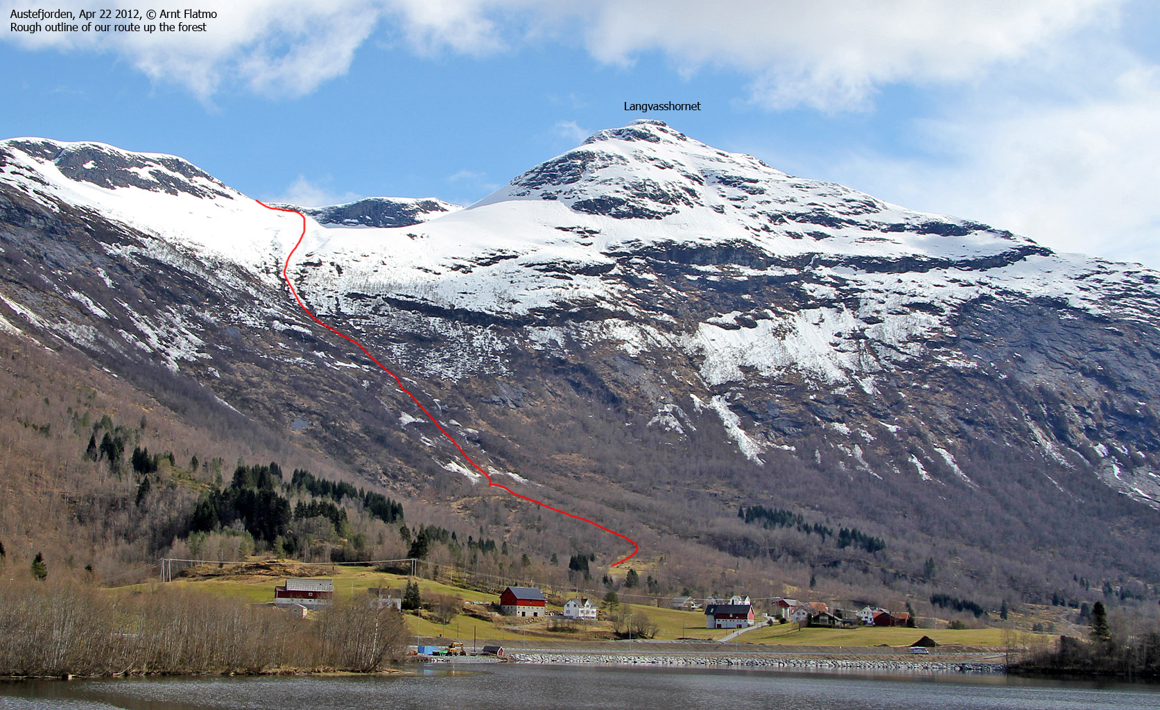
The route, as seen in Google Earth
(Click for larger image)
Finally! The time had come to visit Sandegga!
This mountain had been on my mind for several years, and quite frequently after Anne and me skied to Storetinden in 2011, and I got Sandegga in close view. For now, we settled for a normal ski-trip up to the south top (1389m - and allegedly the highest). A traverse across the summit ridge would have to be a future project.
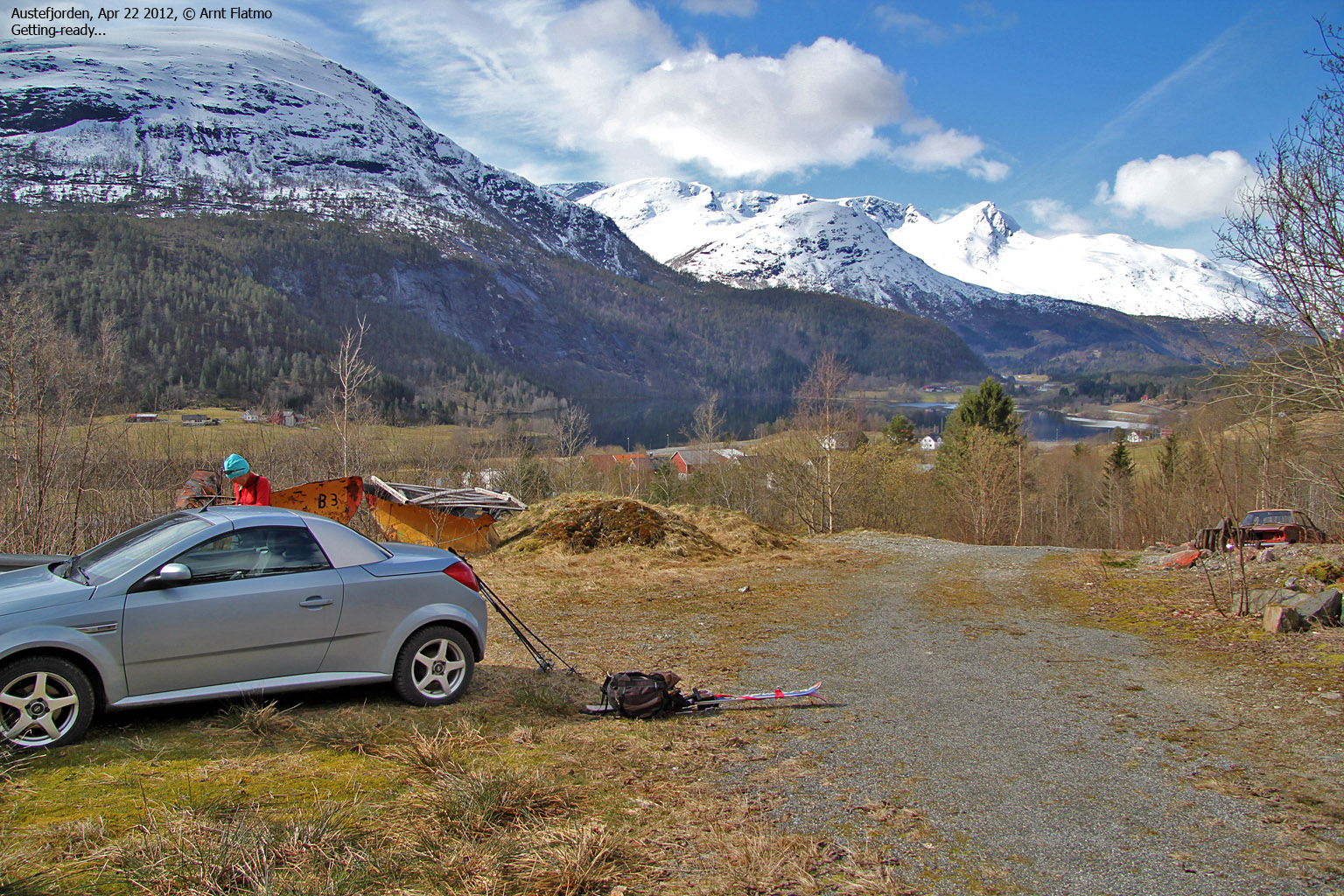
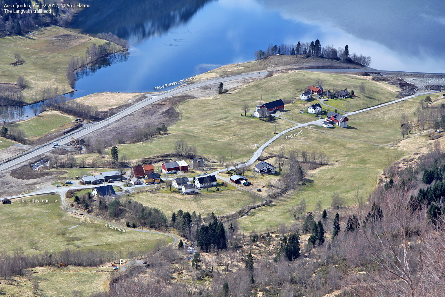
It was a gorgeous day, and we drove (of course) with the roof down on the way from Gurskøya. We learned where to park by asking a local woman who seemed quite sceptical about the concept of skiing Sandegga. Especially this late (!) in the season. But we were mentally locked onto this mountain now, even if it meant carrying the skis for 500-600 vertical meters! And by 12pm (sharp), we were on our way to Sandegga!
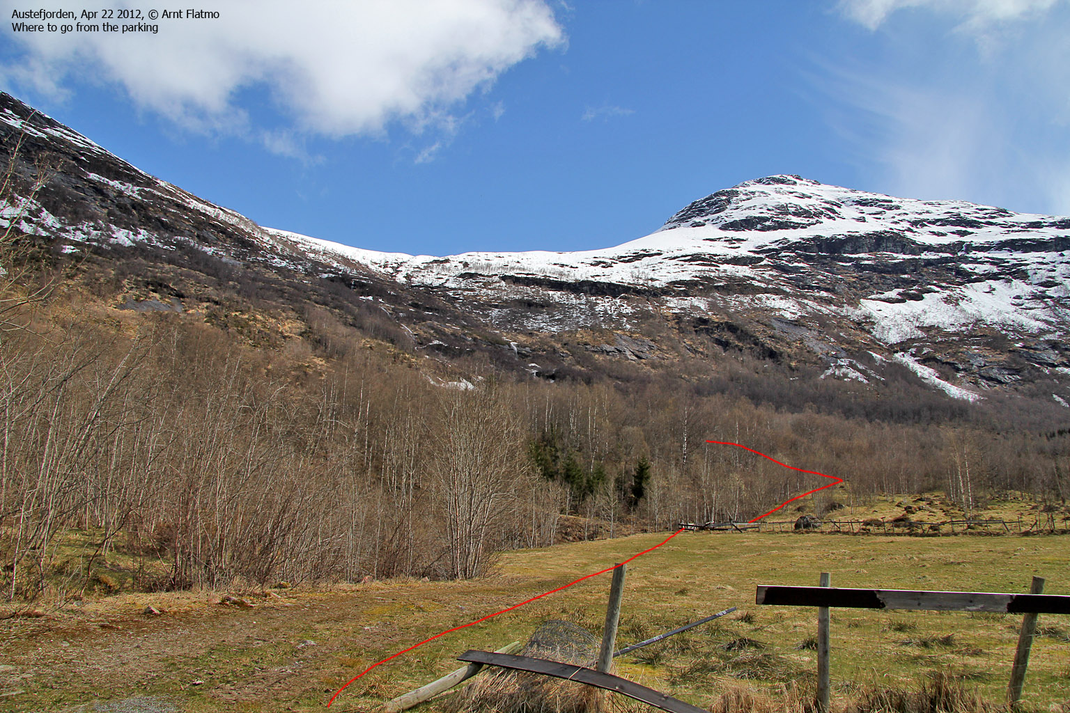
We took a wrong turn very early on (we crossed the creek by the parking), but knowing that the route went between the two creeks, we were back on track in a little while. We followed a visible path for a few minutes until we realized it was just gone in the avalanche zone...

No more path
(Click for larger image)
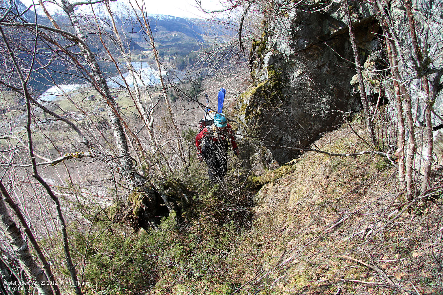
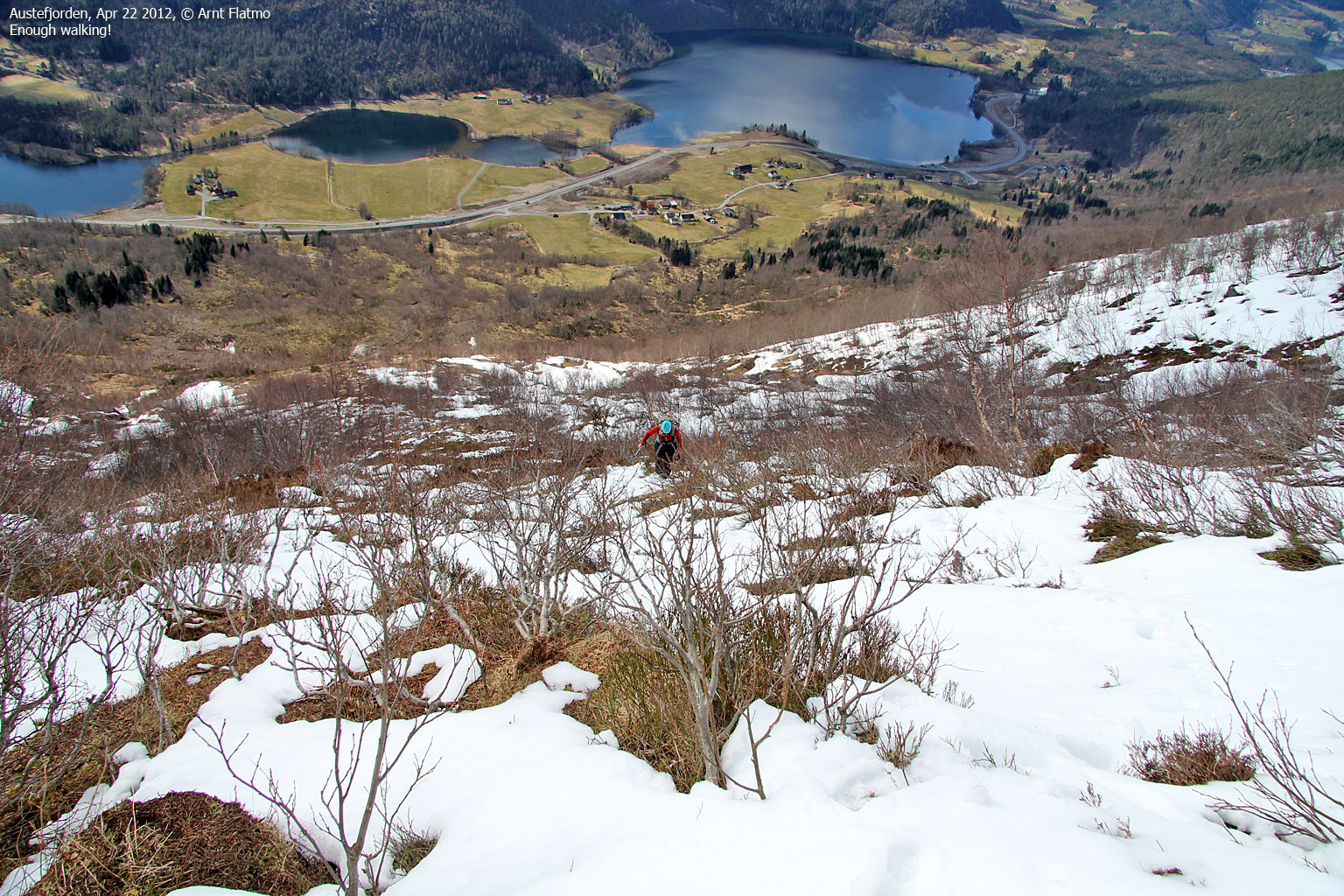
The route got gradually steeper, and as Anne struggled with a bad shoulder, I had to carry her skis. With two pairs of Telemark skis on my back, the trip just got slightly harder...
But eventually - at 560 meters - we could put our skis on. Any discomfort so far was totally forgotten about!

On the way to Sandegga
(Click for larger image)
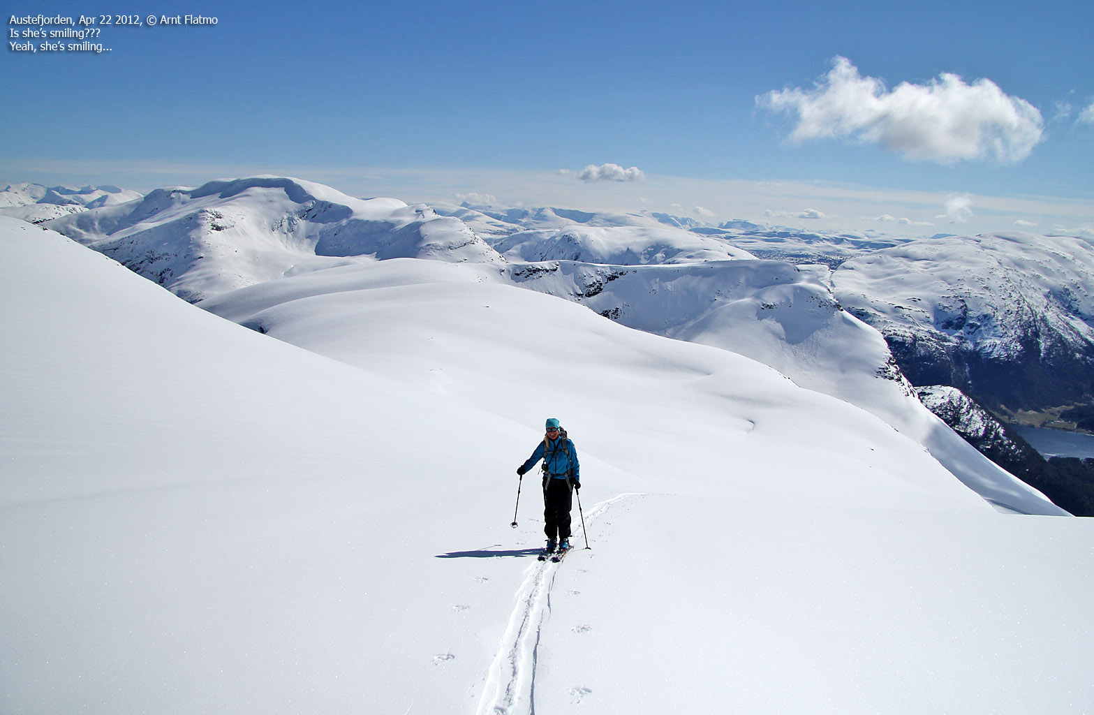
The rest of the trip up the mountain was a long and good memory. The view was astounding. I told myself probably 100 times how lucky I am to be able to do this! Anne seemed to enjoy herself too...

View towards Blåfjellsegga
(Click for larger image)
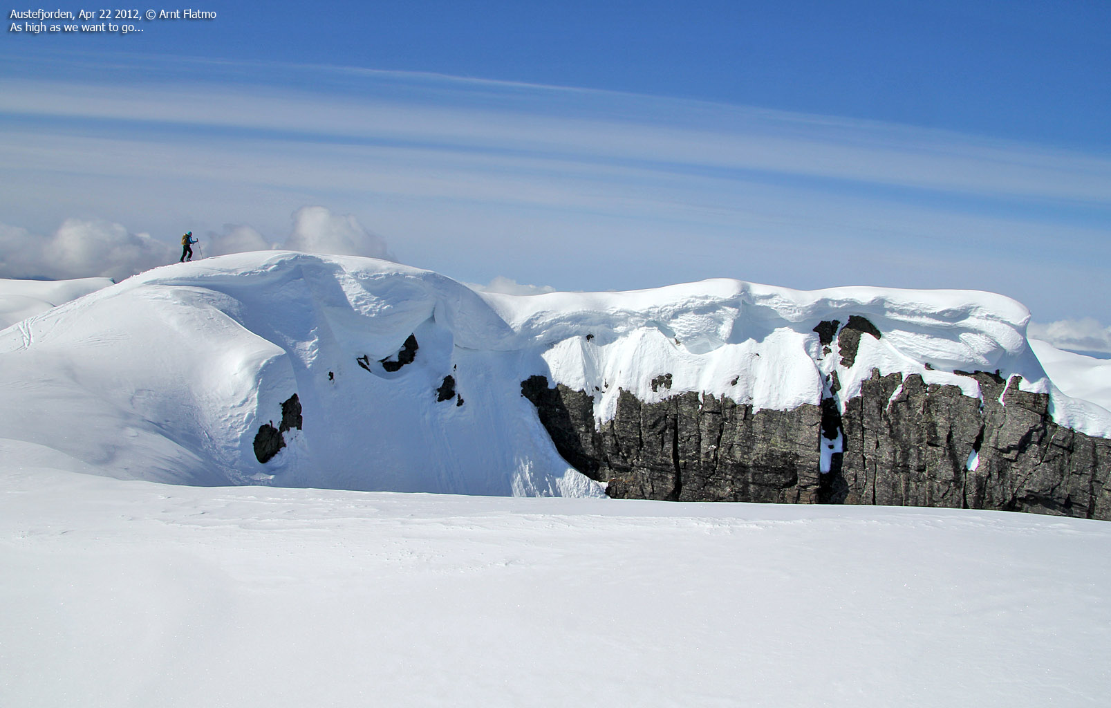
It wasn't easy to tell exactly where on the summit ridge the high point is, but we assumed it was on the far end. And that was a place that none of us wanted to go. That said, I was quite tempted to give it a try, but after a crystal clear warning from Anne, I decided to let it go. For all practical purposes, we were on top of Sandegga and no one could tell us otherwise...
We reached the top 3:40pm - 3h:40m after leaving the trailhead.

On top of Sandegga
(Click for larger image)
After a nice stay on top, we were looking forward to 830 vertical meters of FUN descent! Detailed descriptions are not necessary. It was just as delightful as the pictures show...

Descending Sandegga
(Click for larger image)
It was also tempting to descend via Langvasshornet (1001m). A very inviting ledge seemed to provide an excellent way down from this satellite peak. But as Langvasshornet involves some vertical meters upwards, it was out of the question - simply because I didn't have enough water and was running low enough on steam as it was. I decided to come back for Langvasshornet in the summer.
We returned to the trailhead 5:24pm - 5h:24m after leaving. Bar none, this was the best ski-trip so far in 2012...

Descending Sandegga
(Click for larger image)


")
")


