
|

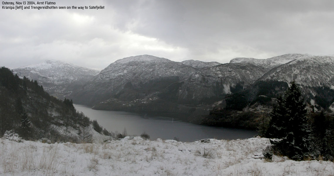
Såtefjellet seen from Gullfjellstoppen(No Javascript) |
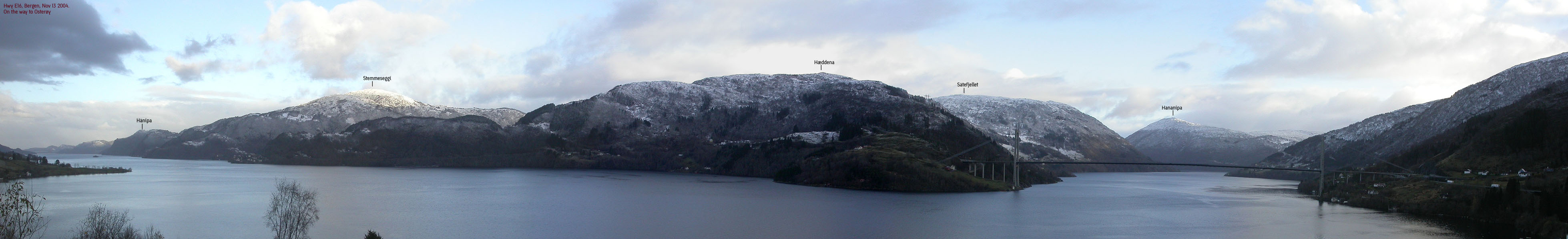
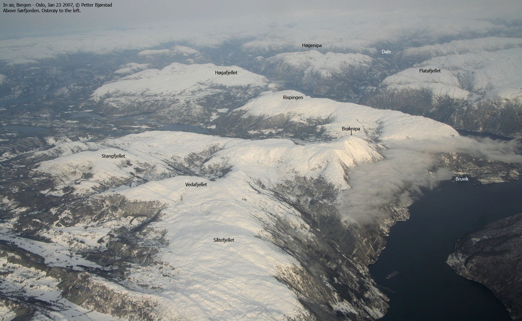
Såtefjellet is located southeast on Osterøy island. It is one of the very first peaks on the mountain ridge that rises from the Osterøy bridge and stretches northbound on the island. Såtefjellet connects to the more known Brøknipa through the high Vindeggi ridge.
There are several ways to reach the top of this mountain. I have chosen a hike from sea level, via Haverdalen. It is also possible to drive up to Haverdalen, should a higher trailhead be more interesting.
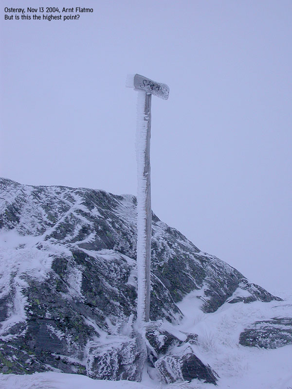
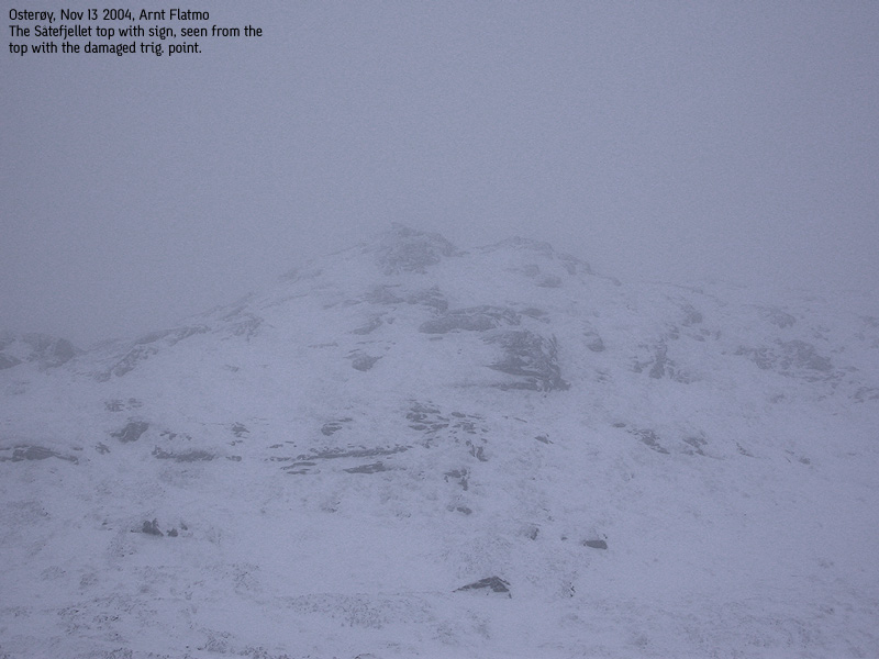
The Såtefjellet summit consists of two tops. The western top holds the "Såta" sign, while a broken trig. point is found on the eastern top. It is the eastern top that is marked as point 666m on the map. It is fully possible that the eastern top is the highest point, but I have not been able to verify this.
Såtefjellet (M711: 666m, Ø.K: 666,45m, N60 27.543 E5 35.798) has a primary factor of 108m towards the higher Vedafjellet (673m). The saddle is found in Flomsdalen valley. Ref. Økonomisk Kartverk (5m contours), you cross the 560m contours on the high route, but not 555m. The saddle height is interpolated to 558m.
Notes: Class ratings are in reference to YDS. Click here for more information.
The trails described below are not necessarily the *easiest* trails to this mountain.
|
Blom - Såtefjellet (late autumn)
|
|
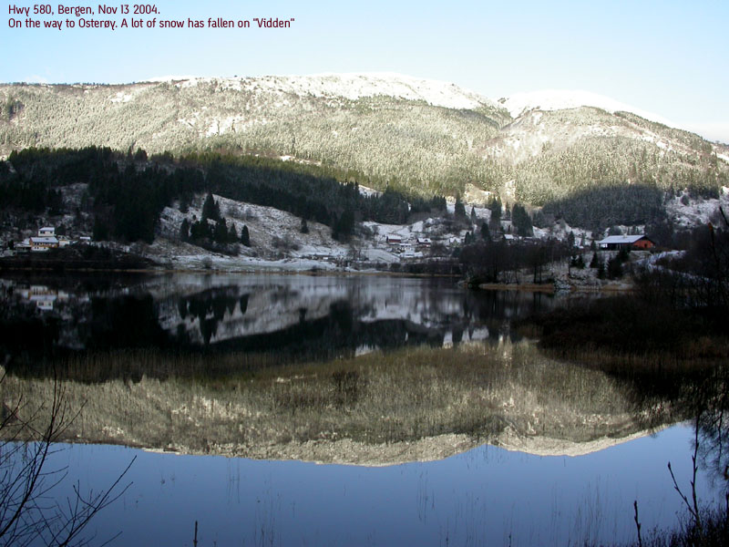
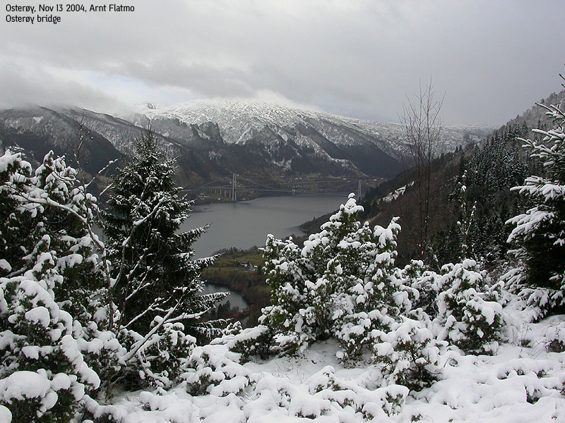
From Bergen, follow highway E16 towards Oslo. Shortly after passing Arnanipatunnelen, turn right towards Osterøy and drive across the Osterøy bridge. Pay the fee at the toll station (NOK 40,- for passenger cars per Nov 2004) Turn right just after the toll station (don't drive towards the tunnel). At the next junction, turn right towards "Bruvik". Follow this road for approx. 2,3Km to Blom. Turn (very sharp) left onto a gravel road that leads up to the nearest houses. Ask for permission to park here, or find parking down by the road to Bruvik.
Follow a forest road eastbound from the lower house. The forest road runs under parts of a barn. At the first forest road junction, go left, pass a cabin and follow a forest trail upwards. The (unmarked) forest trail climbs a distinct forest ridge between Blom and Havrå.
At approx. 240m elevation you see a gate in a fence. Turn left here and climb up the forest to the beginning of a high forest road that you can follow all the way to Haverdalen. I didn't see this trail (snow) on the way up, and went through the gate. This path led me to and old cabin. I passed this cabin and followed a path down to the stream. I crossed the stream and followed the terrain northbound until I ran into the forest road.
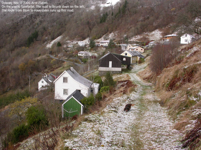
In Haverdalen, go all the way to the wooden fence. Do not go through the fence, but follow the fence eastbound. When you're at the end of the field, walk south a few meters to the start of an overgrown tractor road. The tractor road is blocked by a wired fence. Walk northbound until the wired fence meets the fence across Haverdalen. There is a spot where you fairly easy can cross over the fence here. Climb up a short bush section until you're on the tractor road. Follow the tractor road northbound to a pond. The tractor road ends here. A forest path continues in the same direction for a short while until the trail turns southeast and follows a distinct ridge up the hillside.
On top of this hillside, you're going off-trail. You may see paths here and there, but don't spend time following them. The terrain is both boggy and bumpy. Follow the terrain where you see fit. After you've passed the Vindstallane humps, you may see cairns from the south. This means you're closing in on the main ridge to the summit. As mentioned in the introduction, there are two summit tops. The eastern holds the "Såta" sign, while the western holds a broken trig. point marker. Visit both tops before you descend your ascent route.
It was a lot of weather this mid-November Saturday. It had been snowing quite extensively, and there was frozen snow on the ground outside my house. For various reasons, I wanted to visit a mountain that was not too high and not too far away. As I considered a re-visit to Såtefjellet, I started thinking back on my Jan 2000 hike from Vedo in deep snow. It was foggy above 500m elev. and the wind was screaming in my face. I believed I had reached the summit, but did not have a GPS to prove this. I remember that I saw no summit cairn, and ever since, I always wondered if I really had been to the top. It was time to find out.
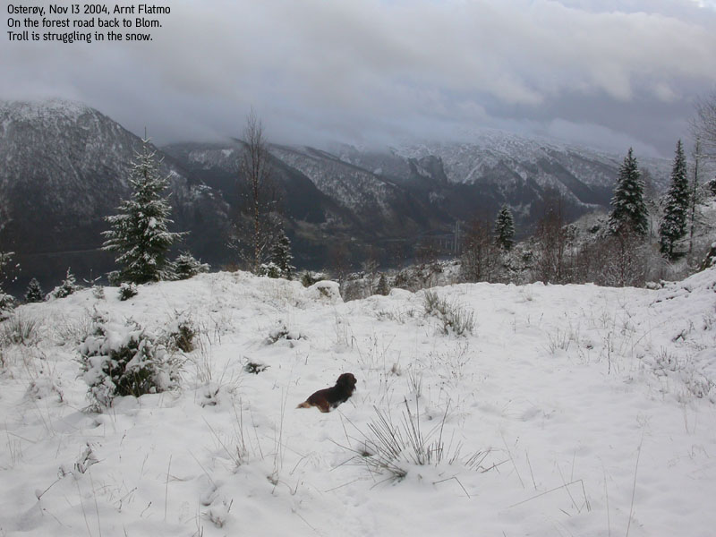
I settled on Blom as the trailhead for the day. I drove up to a house and rang the doorbell. A sweet old lady came out and tried to explain the route upwards. I didn't understand what she tried to explain, and asked instead if I could park by the house. I was granted permission and left the car 10:50AM. Troll seemed to enjoy that there was a thin layer of snow on the ground, and forgot to do his usual sit-down protest. I was able to follow a path that obviously was heading upwards, and looked forward to getting to higher ground.
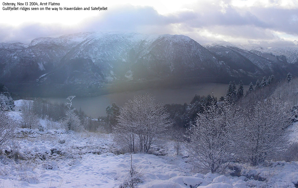
After a short snowfall, we got blue sky. All of the sudden it was a beautiful day. But by looking at the mountains on the other side of the fjord, I reminded myself that things could change quite quickly. I had noticed the density of buildings down at Havrå, and pondered on the reason on my way up the forest. I came to no conclusion before I had to focus on how to get through the forest. There was gradually more and more snow on the ground, and Troll had eventually to be moved to the backpack.
Later on, I discovered that the Havrå buildings are cultural attractions. You can find more information here.
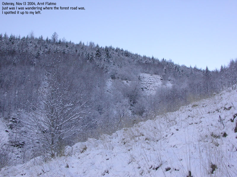
The old lady had talked about a wide forest road that went all the way to Haverdalen. I was heading straight for the valley, but saw no signs of any road. I had run out of a path and had only a lot of forest ahead of me. Then, high up to my left, I noticed something that very well could be a forest road. It was way too cumbersome to get over there, so I manoeuvered myself up through the forest. Fortunately, the forest road changed direction, and within a few minutes, I was on it. 11:45PM, we were on top of Haverdalen.
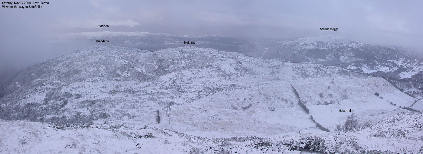
As I gazed up the long hillside, I noticed something that looked like a tractor road on the other side of the field. I had dreaded a major bush-war up this hillside, but the old tractor road was the start of a path that took us quite gently to the mountain plateau. Above 500m elevation, we entered fog. I hadn't bothered to bring along a map, as I had considered this hike to be a "just up the hill" type of hike. Naturally, I had some idea on where the top would be, but had underestimated the distance. The solution was to keep moving to a higher point.
The snow was quite deep - up to the knee in many places, but I welcomed it. It would be much easier to find my way back home. The wind was quite strong, and I chose to walk where the snow was deepest, making sure that some tracks would remain visible upon my descent. By 12:50PM, we were on "Såta". A sign proved this, and since I didn't see any signs back in Jan 2000, I can assume I never reached the true high point. I cursed the fog. This is a great viewpoint, and I knew the panorama I never got to see. I noticed another top further west, and felt that this point was higher. I went over there, and found a broken trig. point marker. This was obviously point 666m, and when I gazed through the fog towards the top I had just left, I wasn't sure which of the two that was the highest. The winds were strong and Troll didn't seem to enjoy life in the backpack. He had ice all over his face, and I wrapped a sweater around him.
My tracks on the high ridge had nearly vanished, but thanks to my "stick to the deep snow" plan, I had no problems following the same route back towards Haverdalen. The hike down the hillside to Haverdalen was a struggle. The combination of melting snow on rocks and leaves on the ground, made the descent a bit spooky. I may do silly things on my hikes, but I very seldom fall. I fell on my back 5 times during the descent to Haverdalen. My knee, which I injured a few weeks back, did not profit from this struggle and turned quite painful. Poor Troll, who took the worst beating from the falls. I promised him extra goodies once we were back home.
Down in Haverdalen, Troll fought to get out of the backpack. Even if there was considerable snow on the ground, he wanted to walk. We followed the forest road all the way down to where it ended, high above Blom. For those who come up from this side, it may seem puzzling that a wide forest road begins 270m above sea level. Well, it doesn't begin here. It starts in Haverdalen and ends here. By 14:20PM, we were back at the car. I was soaking wet and regretted not having brought a change of clothes. Hitting the shower once back home was the week-end highlight.
Move cursor to read notes, and click on the images to see full version.
Some of the thumbnails may have been cropped to fit the format.


No Javascript:
1 2 3 4 5 6 7 8 9 10 11 12 13 14 15 16 17 18 19 20 21 22 23 24 25 26


No Javascript:
Other hordaland mountains
 Other Osterøy K. mountains
Other Vaksdal K. mountains
westcoastpeaks.com
Other Osterøy K. mountains
Other Vaksdal K. mountains
westcoastpeaks.com

