
European Mountains, Poland/Slovakia
Rysy (2502m), July 7 2013
To the main Rysy page (maps, pictures, other trip reports)

Rysy and other high Tatra peaks seen from Kriván
(Click for larger image)
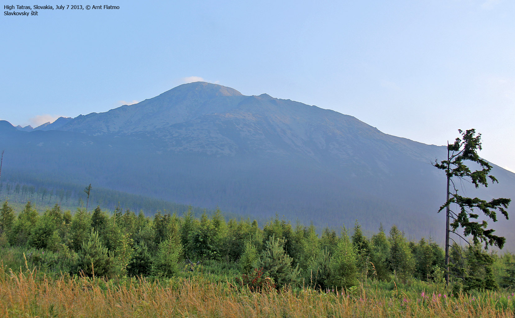
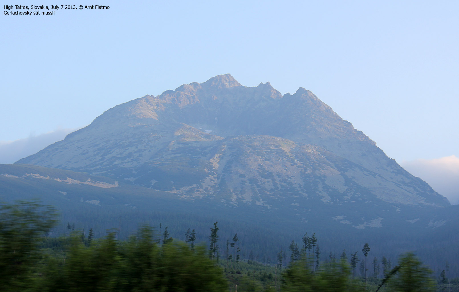
It was our 3rd day in Starý Smokovec - a small village at the southeastern foothills of the Tatra mountains. So far, we had traversed Gerlachovský štít and hiked Slavkovský štít. Today, we the plan was to visit Rysy - the highest point in Poland, with access from the Slovakian side.
")
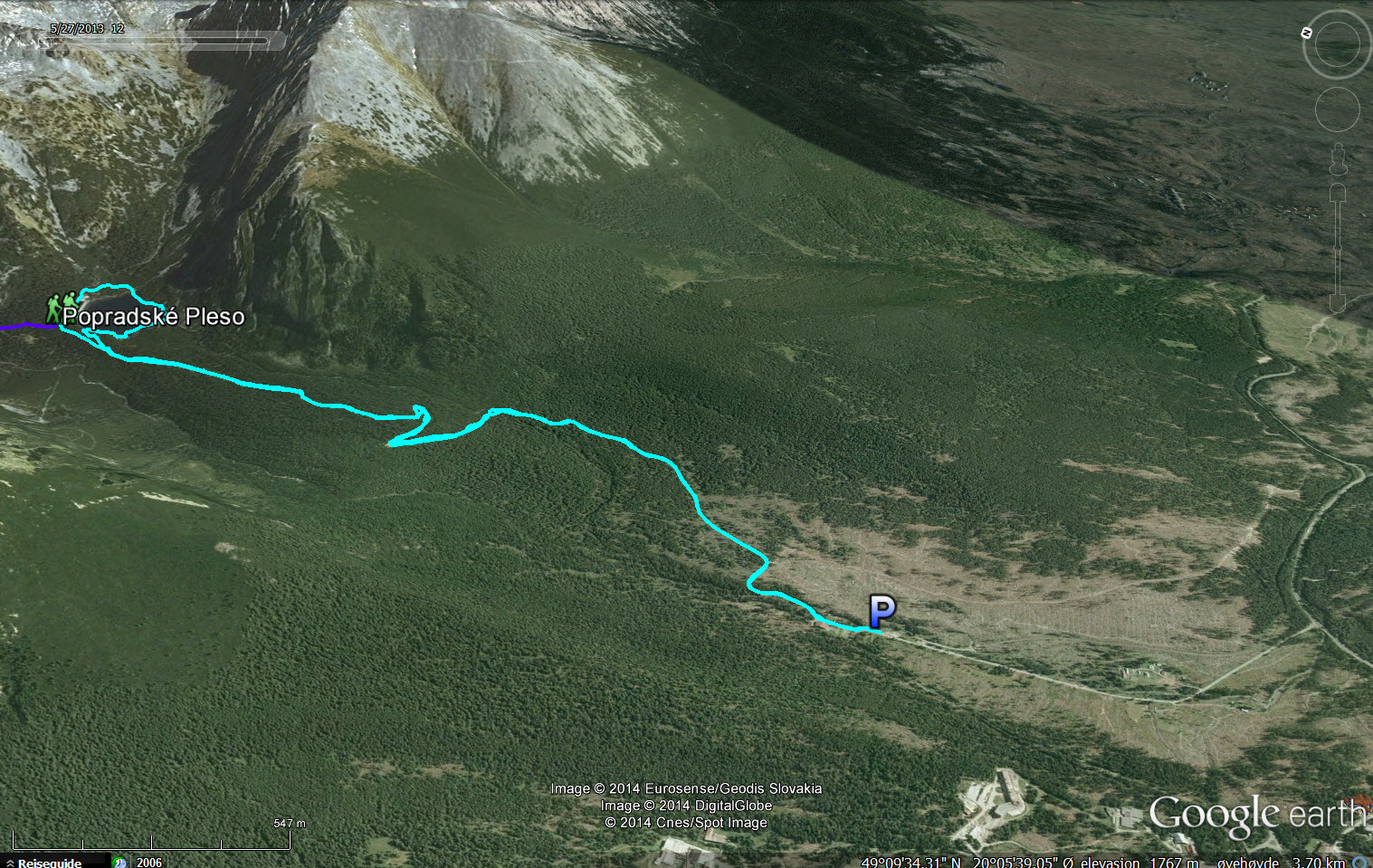
The route (Google Earth)

(Click for larger image)
The high Tatra peaks had been fogged in for the past two days, and it didn't seem that our (lack of) luck would be turning today - either. But no complaints, though! We were in the beautiful Tatra region and we would surely reach Rysy - with or without sight. Our spirit was high!
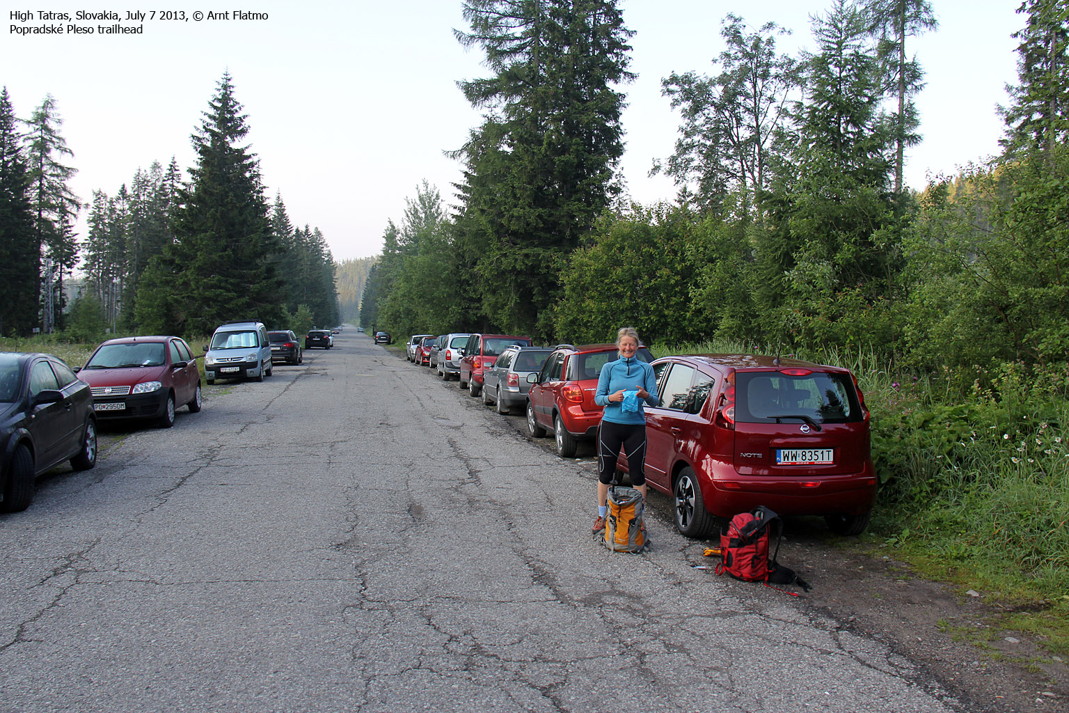
After a detour via Strbske Pleso, we located the Popradské Pleso trailhead and were ready for departure at 6am. When facing a near-20km hike and close to 1300 vertical meters, an early start could be wise. We weren't sure if we should pay for parking, but as we didn't see any signs or ticket people, we just left...

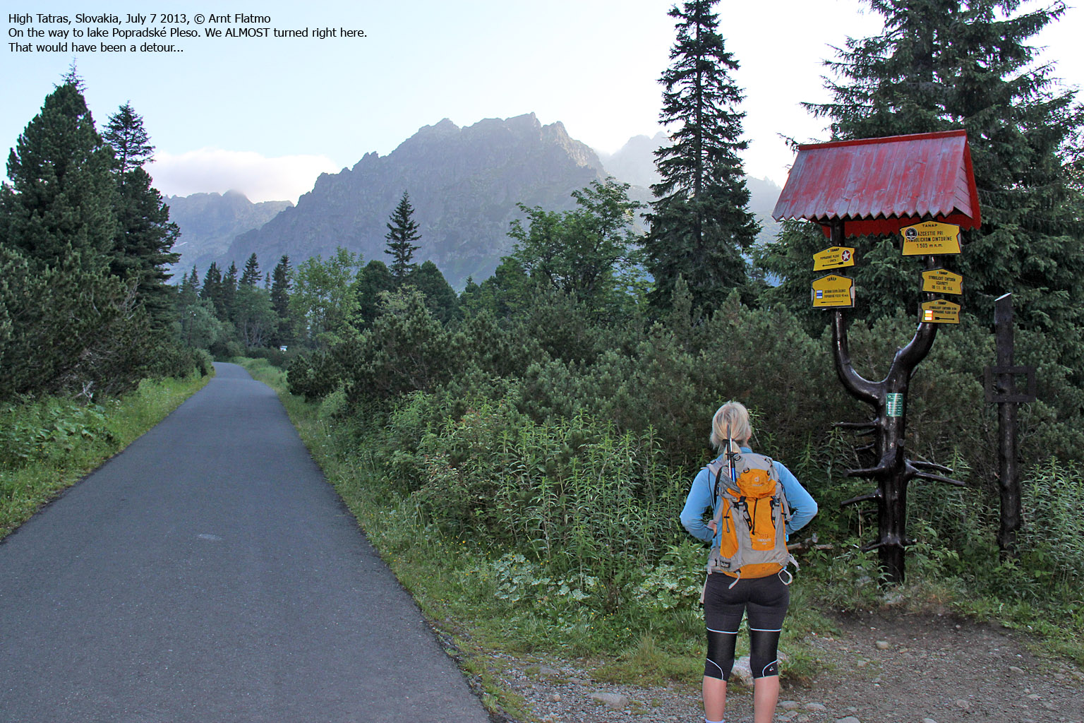
On the way to Popradské Pleso - and Rysy
(Click for larger image)
There were also other hikers on the road and some of them were heading for Koprovsky Peak. We got slightly confused by a trail fork near Popradské Pleso, and left the road. We soon realized that this was a wrong decision and got back on it.
Near the lake, we arrived at another trail fork at 1500m and got on the mountain trailafter concluding that we did not want to carry 5-10kg coal in trade for a cup of tea at the mountain chalet at 2250m. In fact, that was one of the easier decisions I've had to take in my life...
After a 1,2km walk through the forest in Mengusovska valley, we arrived at the next trail fork at 1580m. Here, we had to turn right for Rysy and the view up the mountain was just awesome, even if Rysy was covered in fog.

A wonderful landscape
(Click for larger image)
We felt pretty sorry for the sherpas (just a term - they were not genuine Sherpas) who were carrying 50-60kg of load up to the mountain chalet Chata pod Rysmi at 2250m. I wouldn't have gotten far with this kind of load. I'll be the second to admit it...
The Mengusovska valley was just beautiful and certainly did not deserve to have a peak called Satan (2422m) rising tall and scary above it.
After a series of switchbacks, we reached lake Velke Zabie Pleso at 1921m. From here, we could see that the path continued up alongside the waterfall and that one section looked possibly exposed. We knew that there was one such point, and that surely had to be the one. We took a short break and enjoyed the day before moving on.

Velke Zabie Pleso
(Click for larger image)
The exposed section was well protected by fixed aids and we passed it without any big drama...

The exposed section
(Click for larger image)
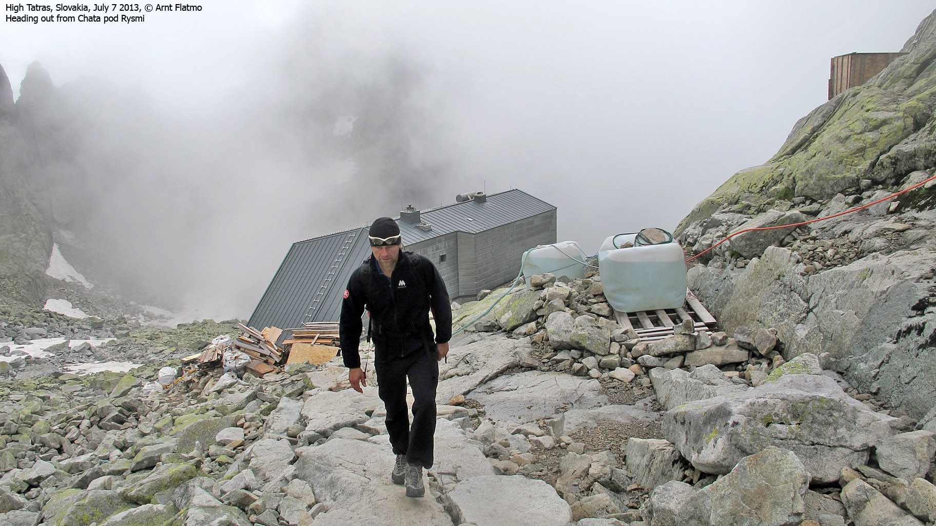
Next stop was the mountain chalet Chata pod Rysmi at 2250m. There were two notable details; the toilet above the chalet and the friendly word of warning...
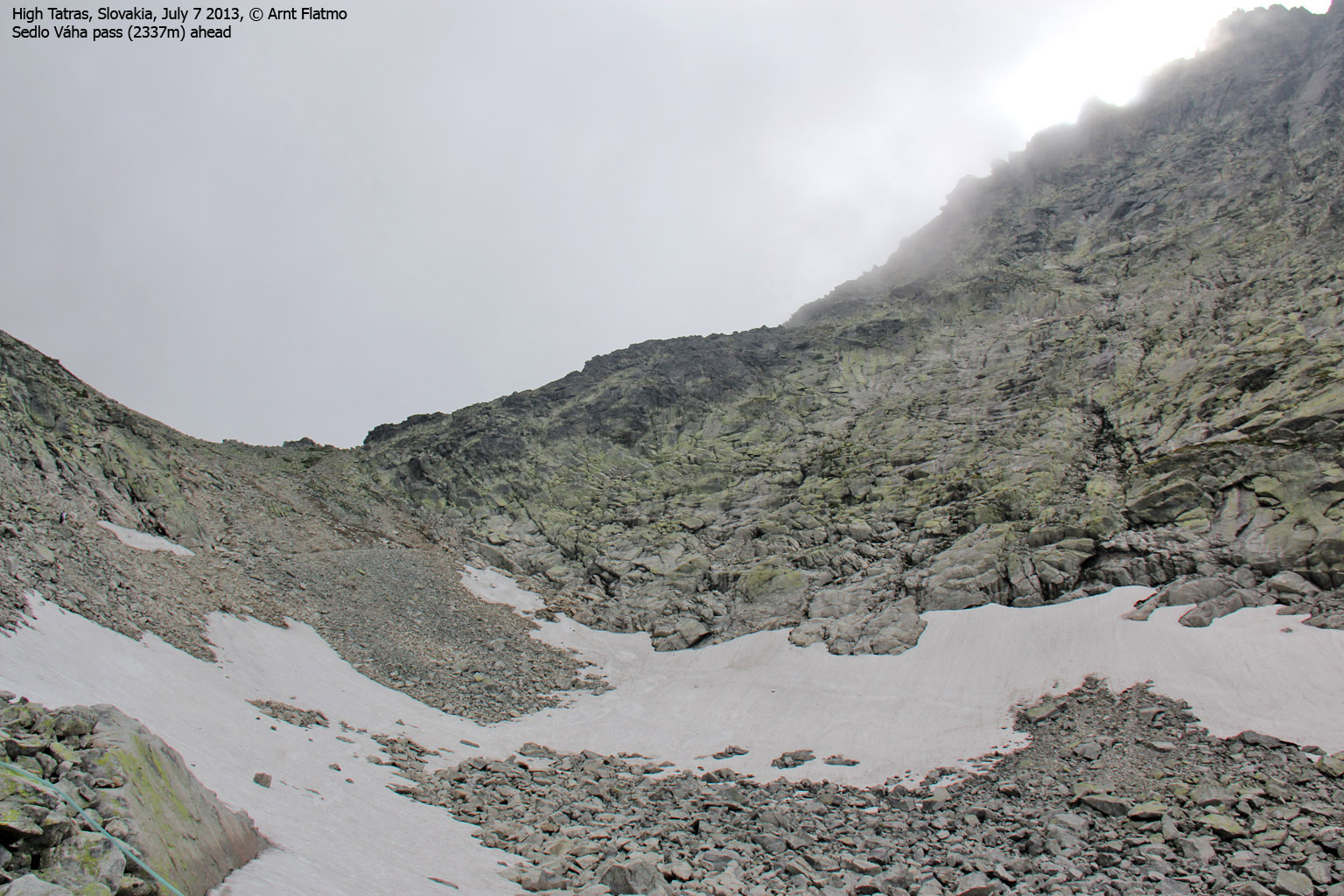
We decided to stop on our way down and continued up to the Sedlo Váha pass (between Rysy and Vysoka) where we turned left and headed into the fog. After 20 minutes (9:30am) we reached Rysy 2499m and the high point of Poland.

On top of Poland
(Click for larger image)
A group of hikers from the Polish side were smoking as their lives depended on it. They had probably deserved it after a long walk from the Polish trailhead. Naturally, I got restless after a couple of minutes and wanted to pay a visit to the Slovakian peak (2503m). Anne followed and the time was 9:46am when we reached the top.
If it hadn't been for the fog, this would have been an awesome place to hang out for a while, but as there were no indications of a fog lift, we headed back down. By now, I had developed a decent headache - most likely because of the altitude. I was not born with mountain genes!
So when we returned to Chata pod Rysmi, I waited outside while Anne explored the chalet and had a cup of tea. And as she had not been carrying coal, she had to pay for it...

At Chata pod Rysmi
(Click for larger image)
At lower elevations in Mengusovska valley, my headache finally let go and I could again enjoy the hike in full. Back at Popradské Pleso, we went down to Horský hotel and enjoyed cold drinks and ice cream.
Afterwards, we followed the east shore of the lake and returned to the trail fork that confused many hours earlier. We returned to the trailhead 1:35pm and looked very much forward to a good dinner in Starý Smokovec.

Horský hotel
(Click for larger image)
Next trip report is Kriván


")
