
For Information, maps, trailhead and route descriptions, click HERE.
This was my fourth and last day in Brønnøysund. The last top visited was Kverntinden. Today, I would do a longer walk and the main goal was Ryptinden. A round trip hike that also included Kråkneshesten seemed to be a good plan. The weather was OK, but nothing more. Rainshowers passed here and there, and a freak raindrop or two came my way.
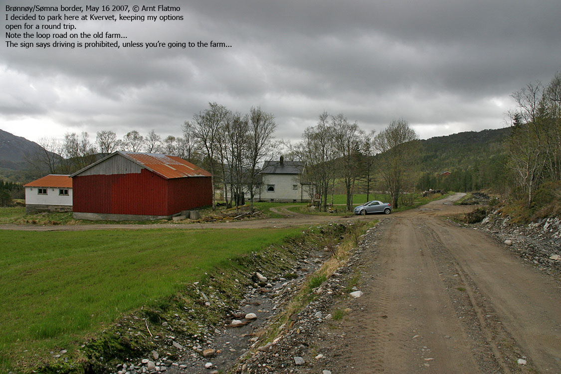
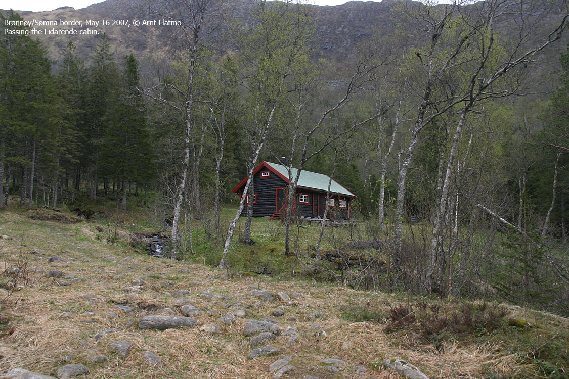
I hadn't prepared much for this hike. My initial plan was to hike up Hestfjellet, but as I approced Nystad, I changed my plan and drove to Kvervet insted. I parked the car when the road got rougher and by 09:45AM, I was on the forest road to the Lidarende cabin. I sort of expected that if there was a path, it would run up to Lake 402m. That didn't quite match my plan for a round trip, and I decided to go off-trail directly towards Ryptinden. The forest didn't seem very dense, and I had no problems finding a good route.
Just before topping out on the ridge between point 587m and Ryptinden, a fox jumped out of a hole, right in front of me. The fox gave me a GOOD scare before I understood what had happened. The fox disappeared before I got the camera ready, and he/she didn't look very happy. I noticed the fox cave and pondered about its location. During rain, water would surely flow down here, straight into the cave. Perhaps that's their concept of running water in the house.
I reached the eastern Ryptinden top 10:50AM. I signed the visitor register in the cairn (70m to the SW) before moving on towards the western top (point 587m). My camera was ready and loaded in case the fox would reappear. I passed point 587m 11:15AM, and took the wrong decision about the route ahead. I wanted to save myself from ascending up the 540m contour, and took a direct route towards the lake. The terrain was cumbersome and partly steep, but nothing out of the ordinary.
I reached Kråkneshesten 11:55AM and enjoyed the views for a while. All of Brønnøysund (and the surrounding area) could be seen from up here. Then I started to ponder about my descent route. A part of me wanted to continue across Storfjellet and Trælneshatten. Hadn't it been for the fact that I visited Trælneshatten back in 2005, and that I didn't recognize Storfjellet ("Big mountain" (!!)) to be a proper mountain, I would have taken this route. Insted, I descended via Kråkneshesten's south ridge.
During descent, I watched 4-5 eagles playing above me. They stayed at a high altitude, and I didn't get any good pictures. A bit disappointed about not getting good pictures of the eagles AND the fox, I decided to return to the trailhead and go home for a tasty lunch. Besides, I had some hiking plans for the afternoon as well. I made a direct shortcut from the south ridge to the trailhead, crossing two forest roads (or a loop) on my way down. As I left Kvervet 12:50PM, I noticed red markers on the lower forest road. It didn't matter much to me, as I figured I had followed the most practical route anyhow.
Later in the evening, I visited Ramntinden.
(Help text (ALT) is available when your cursor is above the thumbnails. Make sure you've got the ALT switch turned on in your browser)
To Ryptinden East


Wide-angle view from Ryptinden

To Ryptinden West (Point 587m)


To Kråkneshesten


Wide-angle and zoom panoramas from Kråkneshesten


Descent


No Javascript:
0 1 2 3 4 5 6 7 8 9 10 11 12 13 14 15 16 17 18 19 20 21 22 23 24 25
 westcoastpeaks.com
Other Nordland mountains
Other Norwegian mountains
westcoastpeaks.com
Other Nordland mountains
Other Norwegian mountains