
Norwegian Mountains, Sogn og Fjordane
|
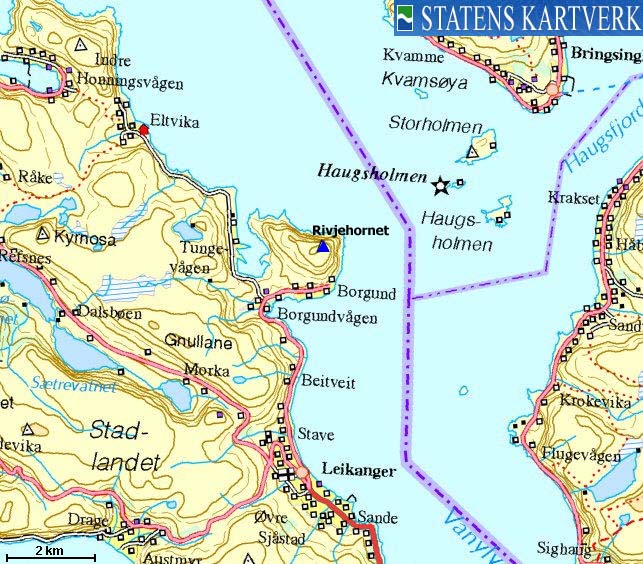
| Fylke/Kommune : | Sogn og Fjordane/Selje |
| Maps : | 1119-III Vanylven (Statens Kartverk, Norge 1:50 000) |
| Primary factor : | 383m |
| Hiked : | Mar 2009 |
| See also : | |
| See also : | Other Sogn og Fjordane mountains |

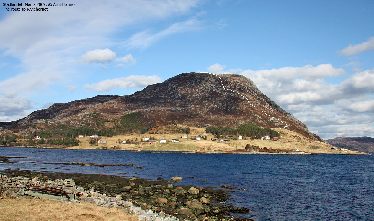
Rivjehornet seen from Sandsøya
(Click for larger image)
Rivjehornet (Revjehornet) is one of the most characteristic tops on the Stadlandet peninsula, and belongs to the municipality of Selje. The eastern ridge is a quite a sight, rising steep and mighty up from the fjord. There are a couple of routes up the mountain, and this page will describe the marked route up the south side, starting at Borgund. This route falls into the "family hike" category. There are no steep sections until you reach the summit cairn, and face a spectacular drop down towards the fjord.

Rivjehornet seen from Vanylvsfjorden
(Click for larger image)
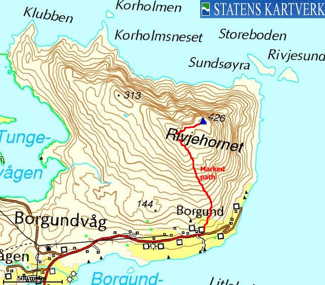
Rivjehornet (Norge 1:50,000: 426m, Økonomisk Kartverk: 426,26m, UTM 32 V 308368 6897926) has a primary factor of 383m towards the higher parent Gnullane (508m). The defining saddle (approx. UTM 32 V 306972 6897015) is found along the road between Borgundvågen and Tungevågen. Ref. Økonomisk Kartverk (5m contours), the saddle is within the range 40-45m, interpolated to 43m.
GPS measurement read 428m (on top of the cairn, 1,5 high), averaged over a 5-minute period (error margin +/- 2m).
Google's interactive map. You can zoom, pan and click on the markers.
|
|
|
|
Route 1: Borgund - Rivjehornet (summer/autumn)
|
|
Access
(all distances are approx. distances)
The nearest larger city is Ålesund. From Ålesund, follow highway E39 towards Bergen, and then RV61 towards Hareid. Take the Sulesund - Hareid ferry, and from Hareid, follow RV61 (roughly) 42Km to Årvika, 5,1km from Larsnes.
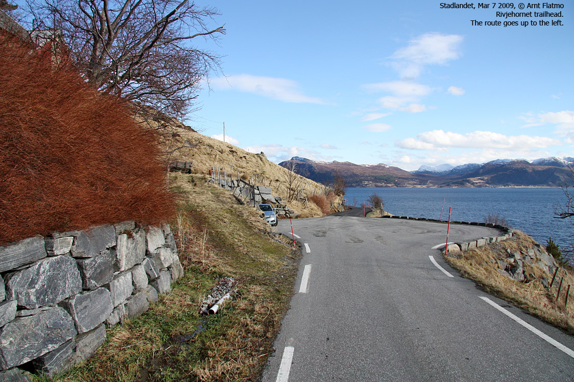
Take the Årvika - Koparneset ferry, and follow RV61 past Eidså, Fiskå, Sylte and Åheim (32km). At Åheim, turn right towards Stadlandet/Vestkapp. Follow RV620 7,8km. Just after Kjødspollen, turn right towards Stadlandet/Vestkapp. Follow RV620 19,8km to Leikanger and turn right towards Eltvik/Borgundvåg. Continue 5km to the Eltvik junction and proceed (to the right) 1,2km to Borgund. Find parking near the turning place (which is not at the end of road!). I suppose one is not supposed to park there, but if there's no sign saying it's prohibited, then use sound judgement and don't block the way for larger vehicles that have to turn around...
The route
The route
(Click for larger image)
Pass the nearest farm on the right-hand side and look for the Revjehornet signpost. The path continues up to a gate (close it, there are sheep on this peninsula) before it runs more or less directly up the ridge. In places, you may lose track of the path. Look for markers above you. The path becomes more pronounced the higher you get.
When you top out on the summit plateau, you'll have the summit 250m to the northeast. You'll have to descend slightly before ascending the final yards to the summit, which is marked by a signpost and a proper cairn.
 westcoastpeaks.com
Other Sogn & Fjordane mountains
Other Norwegian mountains
westcoastpeaks.com
Other Sogn & Fjordane mountains
Other Norwegian mountains


