
|


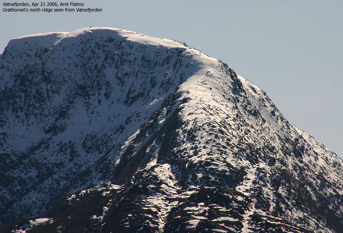
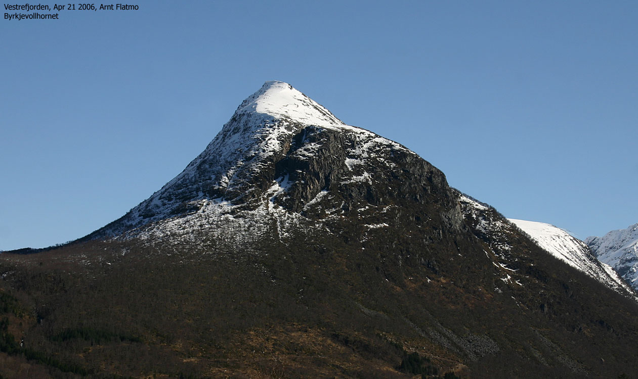
Rekdalshesten (The Rekdal (place) horse) and Urfjellet (Boulder mountain) on the north side, and Byrkjevollhornet and Blåskjerdingen on the south side, define Eikedalen valley, rising up from Vestrefjorden. Rekdalshesten and Urfjellet have a fine appearence when viewed from the north, but look modest and less distinct from other directions. They are however excellent hiking or skiing goals when you feel that Blåskjedingen is a bit "over the top".
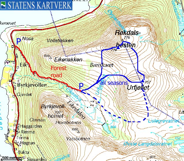
While many hike Urfjellet and Rekdalshesten from Rekdalssetra and up Urfjellet's east ridge, this web page describes an approach from Byrkjevoll.
High points
Both high points belong to Vestnes kommune, although the Haram/Vestnes kommune border across both mountains. The Rekdalshesten trig. point 778m is located on the kommune border, but according to the map, there is a 780m contour just east of the 775m trig. point. Based on my GPS track log, I have set Rekdalshesten's height to 782m. I need to go back and verify this more precise. While being on 778m, I was convinced that the other point was higher, but this feeling changed once I reached the 780m contour. The Rekdalshesten summit is a large plateau which doesn't make it easy to find the high point on sight. In addition, snowdepth will matter.
You will get the same feeling on Urfjellet. I am not sure if the high point is located on the east or west side of the summit 740m contour. The fact that there is a trig. point doesn't mean that point 757m necessarily is the high point. But for now, I assume that it is.
Rekdalshesten (M711: Highest contour: 780m, Ø.K.: -, GPS: 782m, UTM approx. 32 V 383036 6946672) has a primary factor of 250m towards the higher parent mountain Blåskjerdingen (1069m). The defining saddle (approx. UTM 32 V 383495 6944406) is found between Urfjellet and Skjerdinghalsen. Ref. Økonomisk Kartverk (5m contours), the saddle has a fixed elevation: 532m.
Urfjellet (M711: 757m, Ø.K.: - GPS: 782m -, UTM 32 V 383475 6945688) has a primary factor of 107m towards the higher parent mountain Rekdalshesten (782m). The defining saddle (approx. UTM 32 V 383231 6946028) is found between the two tops. Ref. the M711 map (20m contours), the saddle is within the range 640-660m, interpolated to 650m.
Notes: Class ratings are in reference to YDS. Click here for more information.
The trails described below are not necessarily the *easiest* trails to this mountain.
|
Byrkjevoll - Rekdalshesten - Urfjellet (spring)
|
|
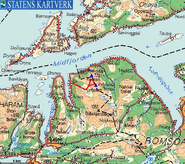
Access
From Ålesund, follow highway E136->E39 towards Åndalsnes. From the E136/E39/Olsvika roundabout near Breivka, follow E39 approx. 13,3Km. Turn left onto highway RV661 (Skodje/Brattvåg/Vatne). After 1,5Km, pay toll at an unmanned toll booth (coins + credit cards + AutoPass). Approx. 9,7Km after you left E39, you reach the RV659 (Brattvåg)/661(Vatne) junction.
Turn right and follow RV661 2,1Km to Vatne. Turn left and continue 16,6Km on RV661 from this junction. You have a forest road on your right-hand side. The snow of the forest road will determine how far you get. If the road is wet, a small-size car might have problems getting up here. There is parking for a few cars at the beginning of the forest road. You also have options to park along side the road along the way.
The route
The route is not dependent of the season. You can either ski or hike this route.
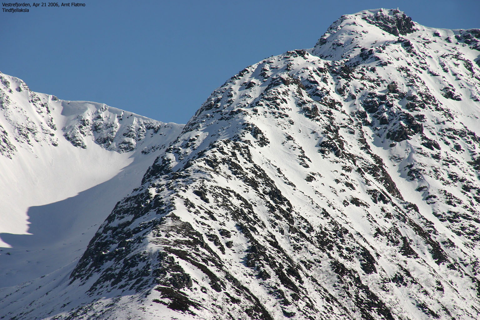
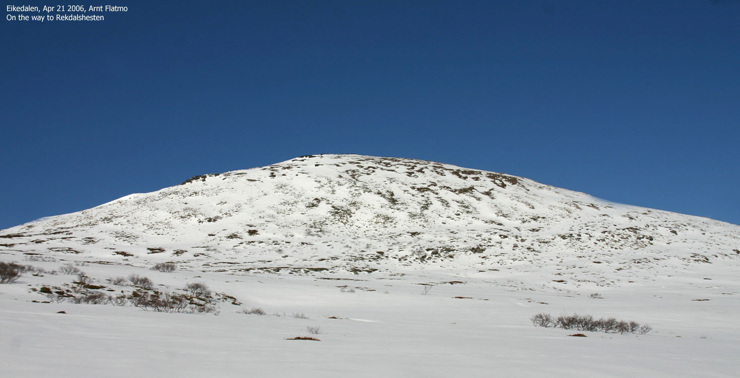
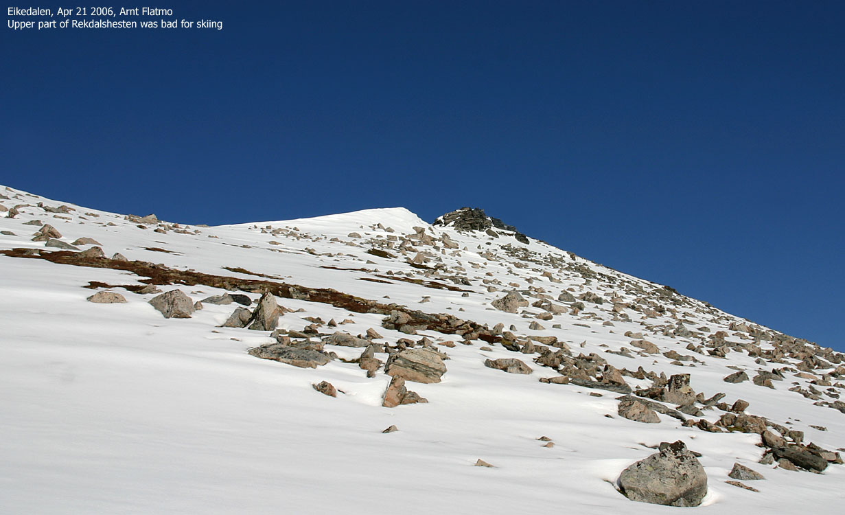
Head up towards Breiskaret, but turn gradually northbound towards Rekdalshesten's west flank. Once on the flank, you have a fine view towards the fjord below you. In winter, be well aware of cornices here. Pass broken cliffs along the flank until you reach the summit plateau and trig. point 778m (I only noticed a small cairn here in mid-April, which may be higher when the snow is gone).
Continue across the plateau and towards trig. point 775m (I didn't see any cairn on this side). Head south towards the Rekdalshesten-Urfjellet saddle (a fine, albeit short ski-descent). Zig-zag up to the Urfjellet summit plateau, and locate the small cairn located on the east side of the plateau.
Either descend down into Breiskaret (a fine ski-descent) or descend Urfjellet's southeast ridge to the Urfjellet - Skerdinghalsen saddle, and then turn right into Eikedalen.


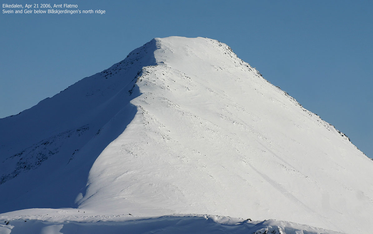
This Friday was simply great. After weeks of rain and with the upcoming cloudy week-end, something had to be done in the afternoon. Svein and Geir had plans for Blåskjerdingen N., but having been to this mountain already (plus that I had upcoming plans for Blåskjerdingen S.) I chose to visit Rekdalshesten and Urfjellet, which I hadn't been to yet.
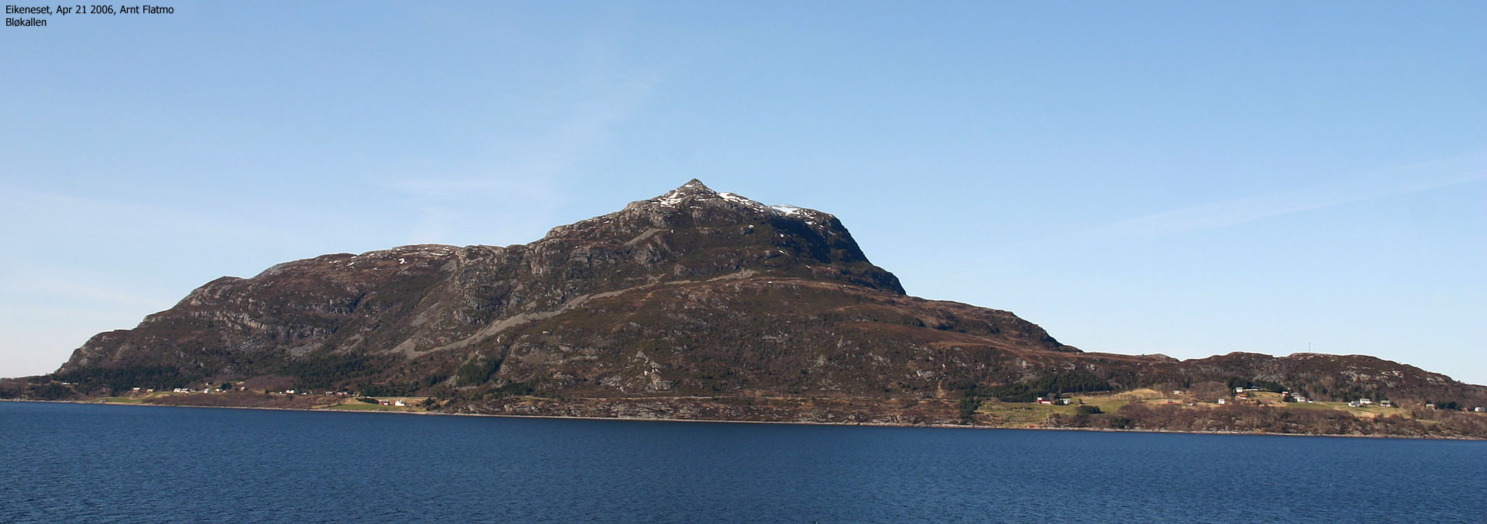
No wide-angle vision
We agreed to meet at Byrkjevollen 16:00PM (Geir coming from Molde). Even though we would split up higher in Eikedalen valley, it's still nice to meet from time to time. I stopped several times for pictures and wanted a picture of Bløkallen before I teamed up with the others. Svein must have wondered when I passed him at the rendevouz point. My eyes were focused on the road and Bløkallen and I did NOT have wide-angle vision at the time.
After getting my Bløkallen picture, I wondered where I was. I had been to Byrkjevollen before, but I didn't recognize anything around me. I switched on the GPS, which told me that I had driven too far. I drove back and teamed up with the others at Byrkjevollen 16:00PM exactly.
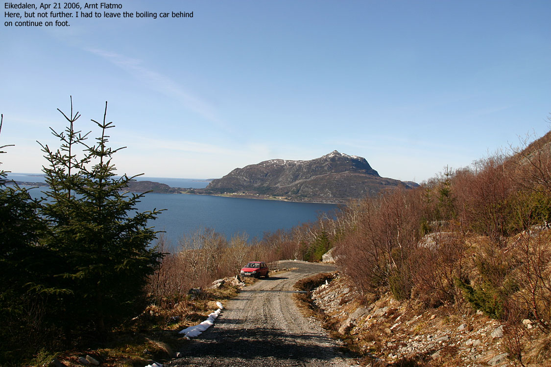
Steaming car
The forest road towards Eikedalsetra could be driven, which was a bonus. The forest road was long and steep, and I was a bit "thrown off" when amounts of hot steam came out from under the hood. I pulled the car over and switched off the engine. There was a leak in the hose and the engine was wet all over the place. I told the others to drive on, and maybe I would catch up with them.
Rekdalshesten
I caught up with the others 16:25PM, and we kept company up to the cabins. I wasn't quite happy with my decision to settle for two lower hills when Blåskjerdingen looked so inviting. But I had recently done this trip, and I knew the others would be enjoy a ski-descent that was steeper than I cared for. I headed up to Rekdalshesten first and reached the top 17:30PM. The ridge ascent was enjoyable although the skiing conditions weren't the best. And 10 minutes were spent halfway, putting band-aids on my feet. I had forgotten socks, and being barefooted in Scarpa T4 isn't clever.
Urfjellet
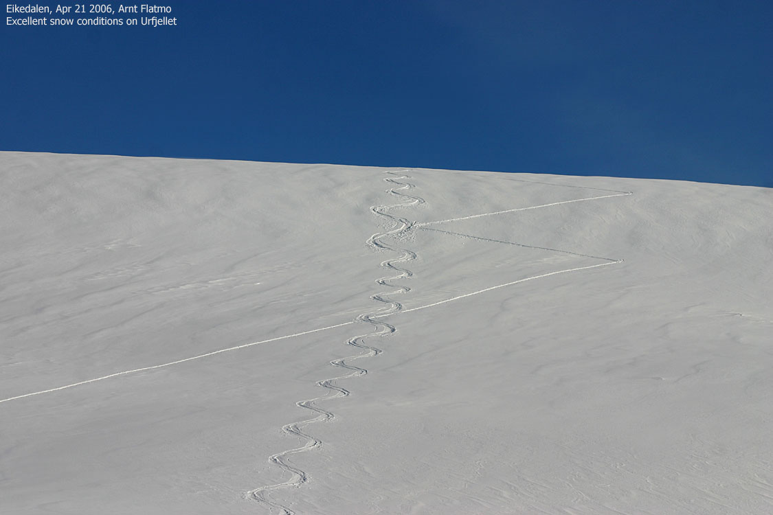
After moving around on Rekdalshesten, getting my pictures, I headed over to Urfjellet. The snow on Urfjellet's north side was very favorable for skiing. I had planned to traverse Urfjellet, but changed my mind because of the snow. I reached the top 18:10PM, just in time to see Svein and Geir reach the base of Blåskjerdingen's northern ridge.
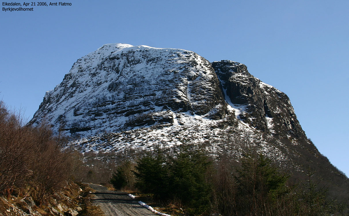
With a healthy car, I would have continued towards Byrkjevollhornet - a mighty fine top NW of Blåskjerdingen. The Rekdalshesten and Urfjellet ascent had taken minimal effort, and I didn't quite feel that I had been "out yet". But in case I needed help with the car, I decided to aquire this in civilised hours of the evening, and headed down.
Skiing down Urfjellet and down to the cabins Eikedalen was big fun. A tiny layer of soft snow on top of the hard crust. It doesn't get better, unless you fancy deep powder.
The car
I was back at the car 18:45PM, curious about its health condition. It started, which was a good sign. I decided to turn off the engine and simply roll down the long and steep forest road. I'd never done that before and felt adrenaline pop out of my ears when the breaks didn't give me the expected feedback. I pulled the handbreak (broken two weeks earlier, but recently fixed), causing enough reduction in speed to allow me to put the car in 1st gear. Safely down on the main road, I put the heater on maximum speed and made sure I didn't stay *below* any speed-limit on my back to Ålesund, attempting to keep the engine as cool as possible.
Altogether, an eventful trip. The car problem was solved the same evening, thanks to my neighbour who *understands* cars.
To Byrkjevollen


To Rekdalshesten


A wide-angle and a 50mm panorama from Rekdalshesten


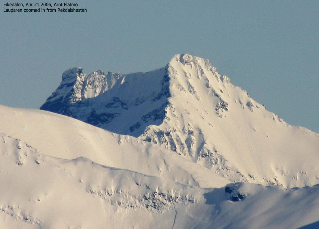
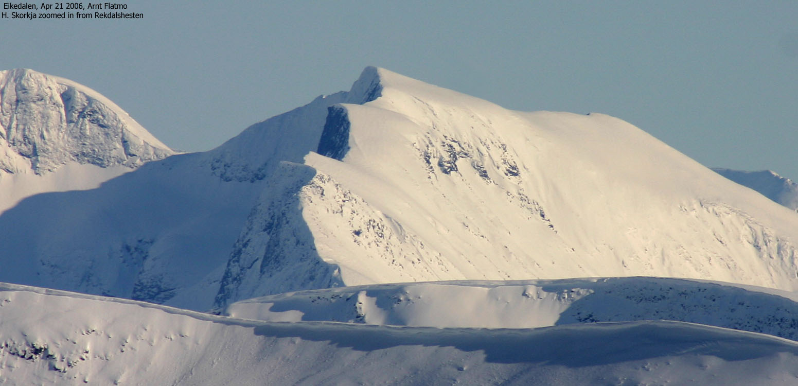
Zooms from Rekdalshesten


To Urfjellet


50mm, Wide-angle and zoom panoramas from Urfjellet


Descent

No Javascript:
1 2 3 4 5 6 7 8 9 10 11 12 13 14 15 16 17 18 19 20 21 22 23 24 25 26 27
 westcoastpeaks.com
Other Møre & Romsdal mountains
Other Norwegian mountains
westcoastpeaks.com
Other Møre & Romsdal mountains
Other Norwegian mountains

