
Norwegian Mountains, Møre og RomsdalRørsethornet, Ræstadhornet, Grøtet, Skåla, Nov 4 2007
This route is described on the Ræstadhornet main page.
Part of the route
Sykkylven or ... ? The plan this Sunday was to go to Sykkylven. The weather in the morning wasn't all bad, and it was supposed to get better during the day. My tentative plan was to traverse across Dravlausnyken, but I skipped this plan when I noticed the amount of snow in the mountains. I was in the mood of something easier than a snow struggle. Since my work on Otrøya wasn't done yet, I decided to go there. Ræstadhornet was next on my to-do list. Yes yes... While waiting for the ferry in Brattvåg, a Polish man approached me. With a very limited English vocabulary, he tried to ask if he could get to Aukra from here. "Yes", I told him. "Two more ferries to go..". I gave him my ferry schedule and encircled the necessary pieces of information. He seemed satisfied. "Are you from Ålesund", I asked. "Yes, yes", he nodded. "Are you going back today?" He answered "Yes" to this question. "Then you should take the Molde - Vestnes ferry upon return", I told him, and showed him on the map. "Yes, yes" he said and nodded. Once on Dryna, I pondered on the conversation. Was there a pattern in his "yes" and "yes yes" replies? Perhaps "yes yes" meant "I have no clue what your asking, but I assume so..". If that was true, then he was NOT from Ålesund. I felt a bit guilty sending him via Molde, now that I wasn't sure about where he was staying. More on that later... Rørsethornet Thanks to the good book Turer for Molde og Omegn (Olsen/Pedersen), I found the Rørsethornet trailhead right away. No ringing doorbells this time. My four-legged buddy "Troll" took a good look at the steep ridge and yawned. "The backpack?", I asked. He nodded. I left the trailhead precisely at noon and reached Rørsethornet summit 13:03PM after a nice 625m vertical ascent. The route ahead (3 more tops) seemed long, but it couldn't be helped. My ferry didn't leave until 17:25PM, and I had many hours to kill. The weather seemed to get better as promised. I was uplifted and enjoyed a beaten-to-death banana. Ræstadhornet Ahead of me was the "famous" Mjåstien - an airy ridge towards Ræstadhornet. The good book promised it would make Besseggen look like a motorway. I had never been on Besseggen, but I know a motorway when I see one. This wasn't a motorway, but I didn't find it particularly airy either. Having walked mountains "constantly" for 9 years, one gets used to steep sides. I'm not saying it wasn't airy, just that I didn't skip any heartbeats this time. Having climbed Stetind this summer, airy is now when I have to choose which side of the ridge I'd like to be on... Once across Mjåstien, Troll was willing to walk. And he walked up to Ræstadhornet, which we reached 13:48PM. It was just a touch of snow on the ground above 700m. Troll didn't even consider a good snow-roll. I had enjoyed the hike very much up to now. The hilarious view down to sea level was a bonus. This was almost B.A.S.E terrain, except for the elevation, perhaps.. Grøtet The hike between Ræstadhornet and Grøtet was quite short. Troll was in the backpack during the descent from Ræstadhornet, but walked up to Grøtet. 14:32PM, we were standing on Grøtet summit, and I started to feel that hike was entering its final phase. Only Skåla to go. The terrain towards Skåla looked easy. No chance of missing heartbeats on this trip, but I would nevertheless remember it as a very good hike. Skåla My original plan had been to ascend Skåla, then descend into the deeper end of Vågdalen and walk the valley out. On the way to Skåla, it occurred to me that I had still hadn't adjusted to the end of the daylight saving time. The time was 15:28PM when I reached Skåla, and evening was on its way. Instead of heading down to the valley I decided to stick to the northwest ridge and see where it would lead me. Halfway down the ridge, I realized it would get dark by the time I was back on the road (no headlamp), and I decided to take a shortcut down to the head of Vågsdalen. Troll had been doing another good leg of walking down from Skåla, but now he had to enter the backpack again. After a swift descent, I was on the forest road in Vågsdalen, and by 16:25PM, after a 1,2Km walk along roads, we were back at the trailhead. Sorry... Back on Dryna (the ferry connection to Brattvåg) I met the Polish guy again. He seemed to be embarrassed about not having followed my good advise on returning via Molde and Vestnes. "Sorry, sorry", he said. "Do you live in Brattvåg?", I asked him. "Yes", he replied. No double-yes, just yes. I gave him thumbs up for his decision. He seemed relieved. We chatted with waving arms for a while. I looked at his tires (his wagon looked a bit .. tired). "Winter tires?", I asked. "Yes", he replied. "Good", I said. "You know.. the winter here.." "Yes, yes..". "You know the winter here, it rains in the evening and it freezes at night. The road gets, you know.." (I swept my hand across the ground) ".. polished". "Yes, yes", he said while I tried to bit my tongue off. He obviously recognized the word polish, but what was I trying to tell him by sweeping my hand across the ground? "You understand? polished?" Frantically, I tried to get out of that awkward situation. "Yes, yes"... No worries. He was quite thankful and wanted to return my ferry schedule. I let him have it. He would certainly need it more than I would...
Pictures
Slideshow, all pics on this page:
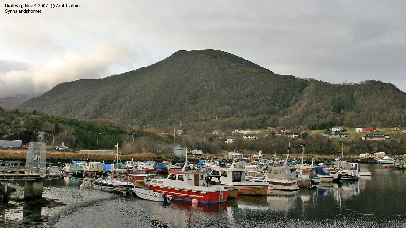
Killing time in Brattvåg
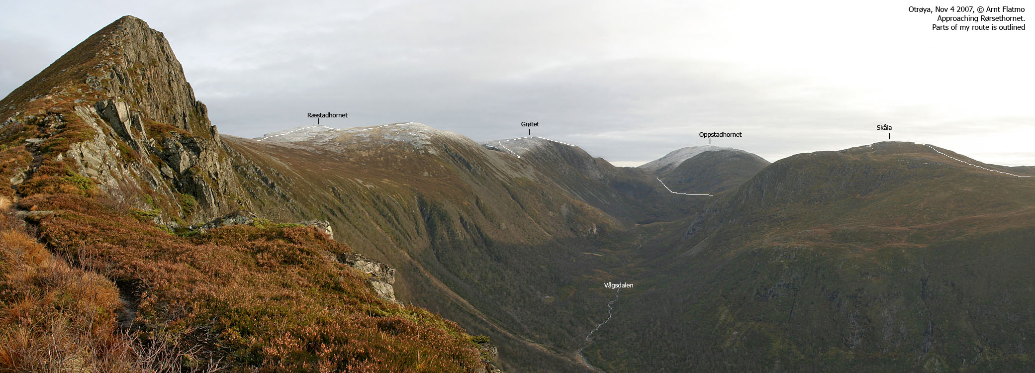
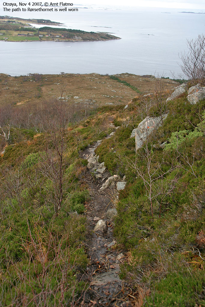
To Rørsethornet
To Ræstadhornet
Wide-angle view from Ræstadhornet
50mm and zoom views from Ræstadhornet
To Grøtet
Wide-angle and zoom views from Grøtet
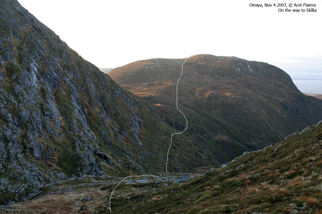
To Skåla
Wide-angle view from Skåla
Descent + later..
No Javascript: 1 2 3 4 5 6 7 8 9 10 11 12 13 14 15 16 17 18 19 20 21 22 23 24 25 26 27 28 29 30 31 32 33 34 35 36 37 38 39 40 41 42 43 44 45 46 47 48 49 50 51 52 53 54
|


