
Norwegian Mountains, Møre og Romsdal
Oppstadhornet from Sør-Heggdal, Aug 19 2007
To the main Oppstadhornet page.

Scrambling on Oppstadhornet
(Click for larger image)
It was a grey Sunday, and if I wanted at least some views from a mountain, choices were limited. I took a chance and hoped that a coastal peak would have more wind, thus not permanent fog that seemed to be stuck the inland mountains. As I hadn't been to Otrøya yet, I decided that Oppstadhornet - the highest peak on the island - would be my goal for the day. Torill Berg also had an opportunity to go hiking, and joined me and my dog Troll.
Arriving the ferry at Brattvåg, I feared the "worst". A thick belt of fog covered Klausethornet. I couldn't see Oppstadhornet from Brattvåg, but I assumed the fog would be thick there too. Oh well. We had driven this far, and might as well continue. There was light rain, but we didn't expect any rainshowers.
As we approached Sør-Heggdal (our trailhead), we could see that there was much less fog on Oppstadhornet. That was good news enough to stay optimistic.
To Oppstadhornet
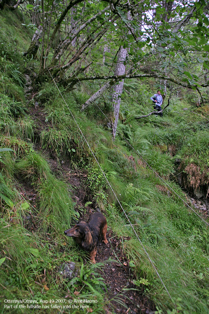
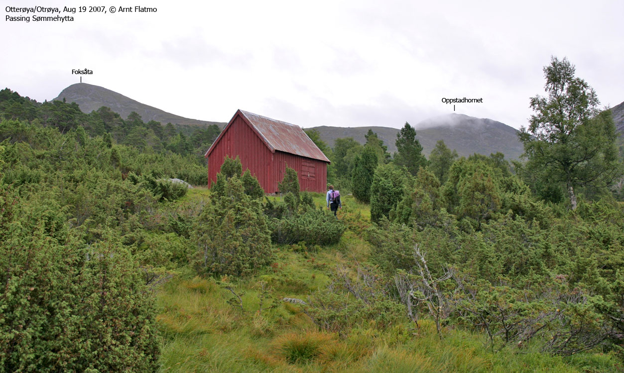
We left the Sør-Heggdal trailhead at noon. The first leg was on a convenient tractor road, allowing Troll to walk. An willingly he walks when Torill comes along. The second leg was on a (for the most parth) nice forest path up to Sømmehytta (300m elev.), where Troll occasionally struggled with slippery rocks on the path. From Sømmehytta, the path across the meadows was vague and gradually faded away.
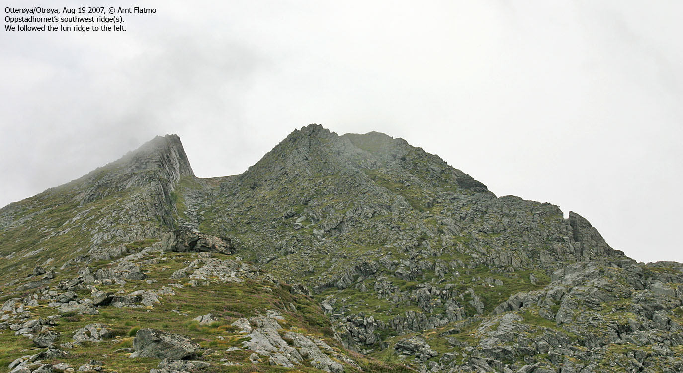
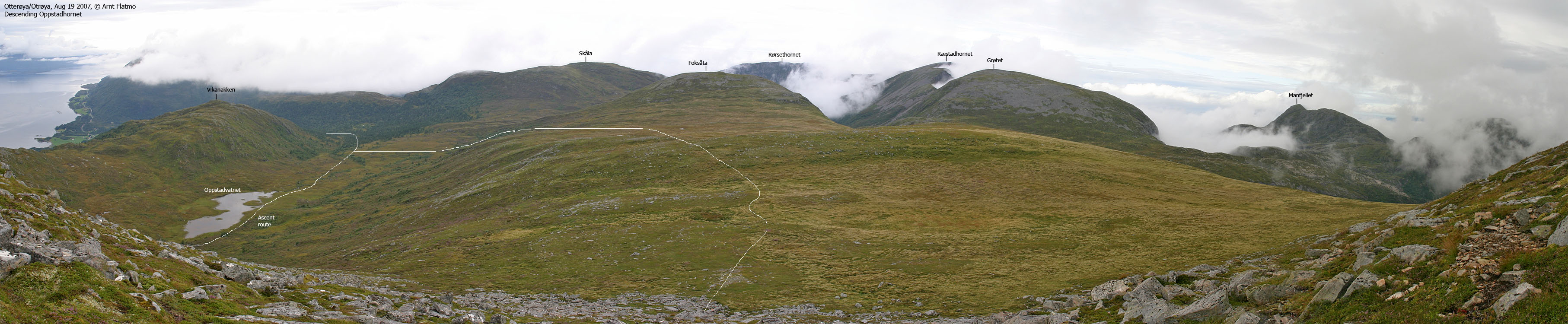
We agreed to ascend via the southwest ridge, crossed a long meadow and Oppstadvatnet on its north side before we reached the southwest ridge. One may argue that there are two ridges. The leftmost ridge dropped steep to the south, but had a more gentle north side. Of the two ridges, this one surely looked the most fun. Troll was able to walk the lower part of this ridge, but as it got more and more exposed, I put him into the bacpack. Again..
The rocky ridge was very slippery from rain and mist and I suggested that we should just stick to the path. OK, Torill said and began scrambling the rock! The nerve! Ignoring my well-founded suggestion, just like that!. I hid a clever smile behind my concerned face and concluded that the week up north had done her the world of good. The scrambling was good practice. While the terrain was easy enough, the ultra-slippery rock made things more challenging. And yes, there was a certain exposure too. Falling to the south would be Ouch, very ouch.
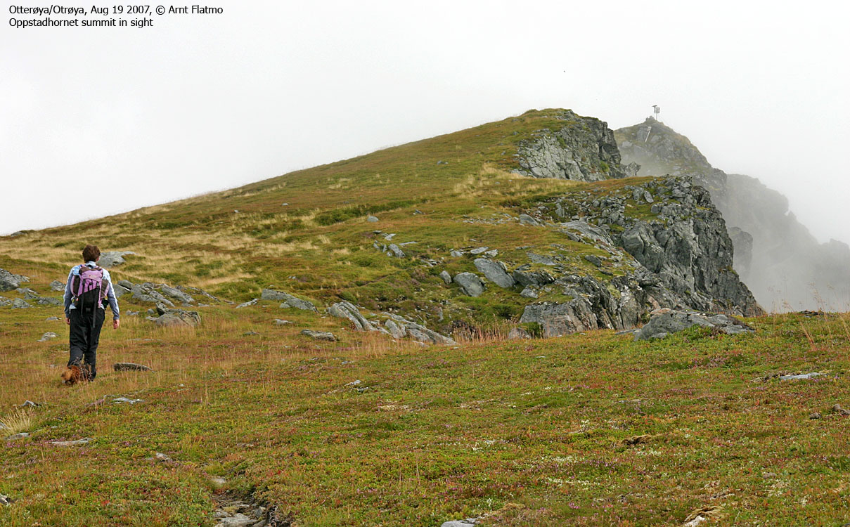
We had the summit of Oppstadhornet in clear sight all the way. Just as we approached the summit (14:00PM), fog closed in on the mountain. As time had to be "killed", we decided to hang around for a while. The next ferry didn't leave until 17:25PM. After twenty minutes or so, the fog began to lift. The views were at good enough to conclude that there would have been no views from the inland mountains. Except from the Trolltinden/Ytstetinden massif, perhaps. There was sheep poo all over the summit, and the dog would surely need a detox back home.
A few minutes later, a couple arrived at the summit. Troll put on his usual act; first he tried to bark them off the mountain. When they didn't respond to his verbal threat, he sat down by their backpacks (food inside) and gave them his deer eyes look. We decided to leave and let them enjoy their lunch without further distractions.
Descent
We left Oppstadhornet 14:45PM and followed a very vague path across Slettheia. In front of Foksåta, we lost the path and headed off-trail back down to the meadows between Sømmehytta and Oppstadvatnet. On the way down and along Heggdalselva, we ended up on a completely different path than the one we had ascended. After a little while, we had to ask each other; we didn't climb across all these dead trees, did we?. Then we reached a wire (løypestreng). We passed this wire on the way up, but much further down.
In a little while, we were back on the right path. The fog was closing in on the mountain again, and we had probably visited the top under the best conditions that day. We were back at the trailhead 16:25PM. Good timing. Now we'd only had to wait 30 minutes for the ferry to Brattvåg.


