
Norwegian Mountains, Møre og RomsdalLiafjellet from Kleivane, Jan 21 2006Back to the main Liafjellet page
Windy mountain
The weather wasn't exactly great on this Saturday, but it could have been much worse. It had been snowing in the mountains, and I knew that the cold wind that was sweeping across the coastline would be very unpleasant for my little four-legged buddy named Troll. Stuck in the backpack as he would be. So I chose to stay in the lowlands. I also had to wait around for a guy to install a satellite dish, and while the guy was doing his job, I headed towards Liafjellet. I chose to drive up from Apalset and was on my way 12:15PM. I noticed the trailsign that said "Liafjellet, 50min". Troll was in the backpack. He could clearly walk on the path that had just a thin layer of snow, but I knew he would sit down in protest and give me headache. I lost the path (due to more snow) at 320m elevation, but hiking was still fairly easy. The snow was hard and the route ahead was obvious. I let Troll out of the backpack a bit higher up. We reached the top 1:05PM, which meant that it had taken us exactly - 50 minutes to the top. Amazing... The wind was very cold up here and I had to put on more clothes and protect my face. I had done my "homework" and knew there was a higher top further east. From the trig. point, this seemed to be correct. I enjoyed the hike across the ridge, and so did Troll. He ran ahead of me, stopping now and then to make sure I was following. It took us only 5 minutes across the ridge, but when I arrived the eastern point, the trig. point (where I came from) now seemed to be the highest point. I let my GPS compute the average elevation for 10 minutes while taking pictures. I wrapped Troll in my Gore-Tex jacket, and he seemed to be fine for the time being. The GPS stated that the average elevation was 525m, and I was quite confused. It is seldom that the 1:15,000 maps are wrong. But so they seemed to be in this case. We headed back and took another waypoint at the trig. point. Again, the GPS reported 528m as the average. Troll was very eager to get back down, and by 1:30PM, we were on way. It took us only 30 minutes back to the car and within the next minute we were on our way back to Ålesund. When I arrived the house, the dish-guy had just completed the installation, and now I had satellite TV. Good timing! |
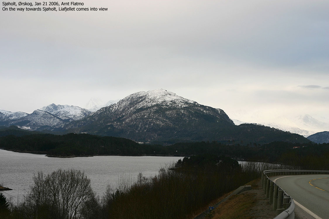
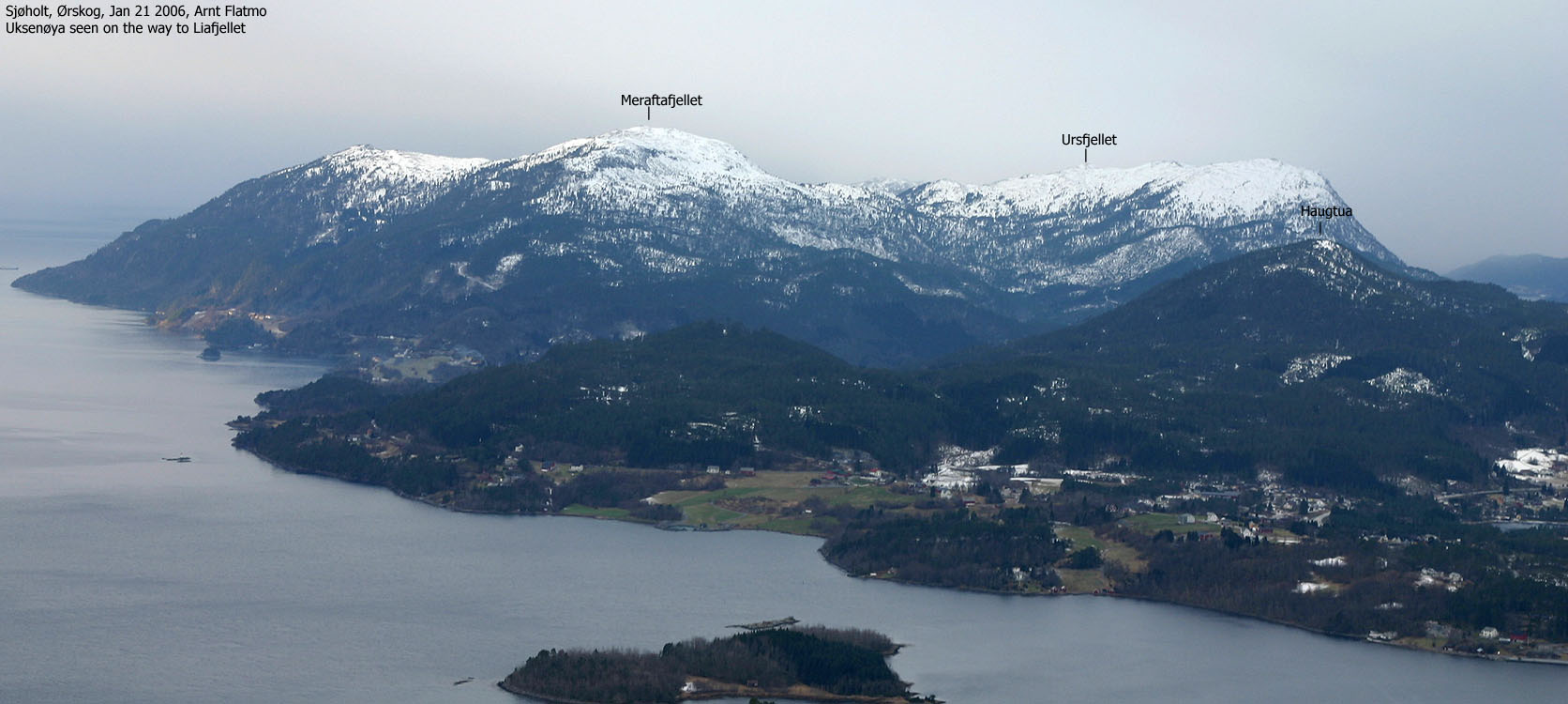
To Liafjellet


Wide-angle summit views, 360 degrees


50mm summit views, 360 degrees


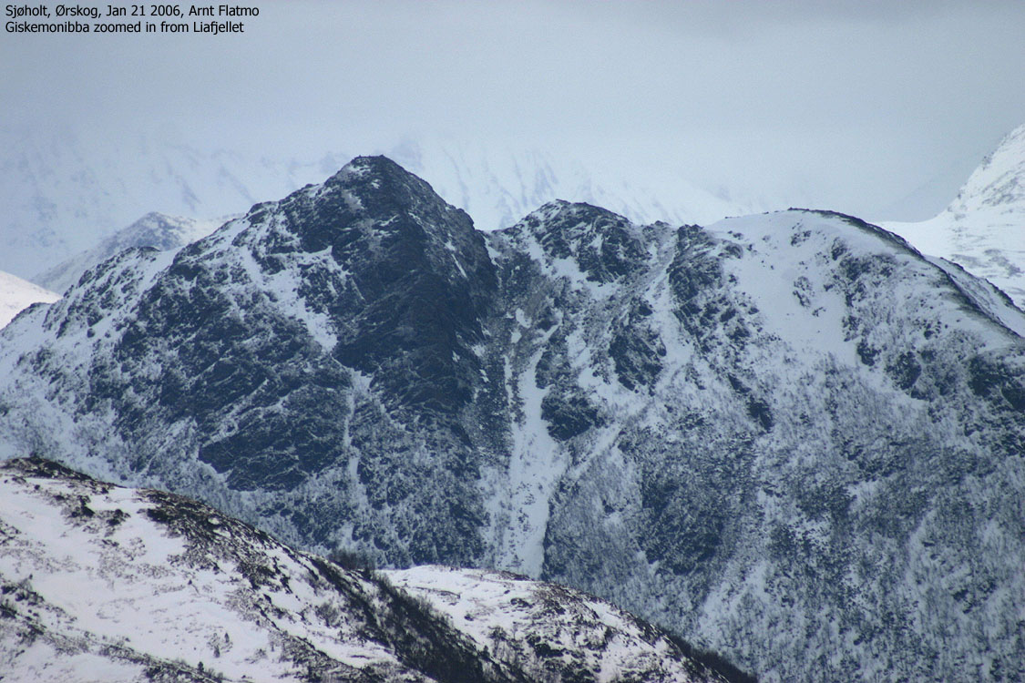
Other summit views


Descent via the high point


No Javascript:
1 2 3 4 5 6 7 8 9 10 11 12 13 14 15 16 17 18 19 20 21
|
|

