
|


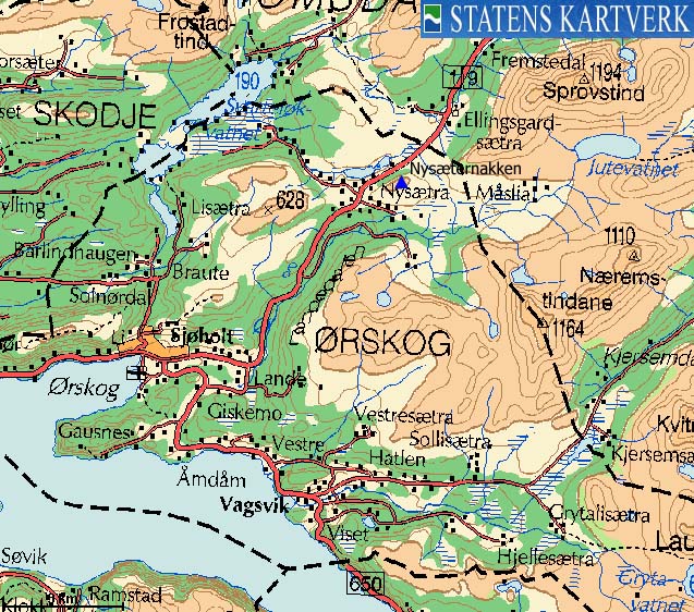
Nysæternakken is a hump above the highway E39's highest point on Ørskogfjellet. The hill will offer better views than from the road below, and it is for the most part visited by the Ørskogfjellet cabin owners. Conveniently enough for those who think this is a tough climb, the logbook has been placed by a cairn 400m SW of the high point.
Nysæternakken (M711: 549m, Ø.K.: 549m, UTM 32 V 393806 6934243) has a primary factor of 151m towards the higher Sprovstinden (1194m). The defining saddle (approx. UTM 32 V 394866 6934058) is found between Nysæternakken and Varguraksla. Ref. Økonomisk Kartverk (5m contours), the saddle is within the range 396-400m, interpolated to 398m.
My GPS reported 553m on the highest point as average over a 10 minute period.


Notes: Class ratings are in reference to YDS. Click here for more information.
The trails described below are not necessarily the *easiest* trails to this mountain.
|
Nysætra - Nysæternakken (summer/autumn)
|
|
Access
From Ålesund, follow highway E136->E39 towards Åndalsnes. From the E136/E39/Olsvika roundabout near Breivka, follow E39 to the RV650 (Geiranger/Stordal) / E39 junction above Sjøholt. Follow E39 7,4Km up to Nysætra, highway E39's high point on Ørskogfjellet. Turn right onto a gravel road. One of the signs says "Jutevatnet". Suggesting where to park in a cabin village is always a "dangerous game", so you need to use your own judgement. On my hike, I parked just after I noticed this was a toll road.
The route
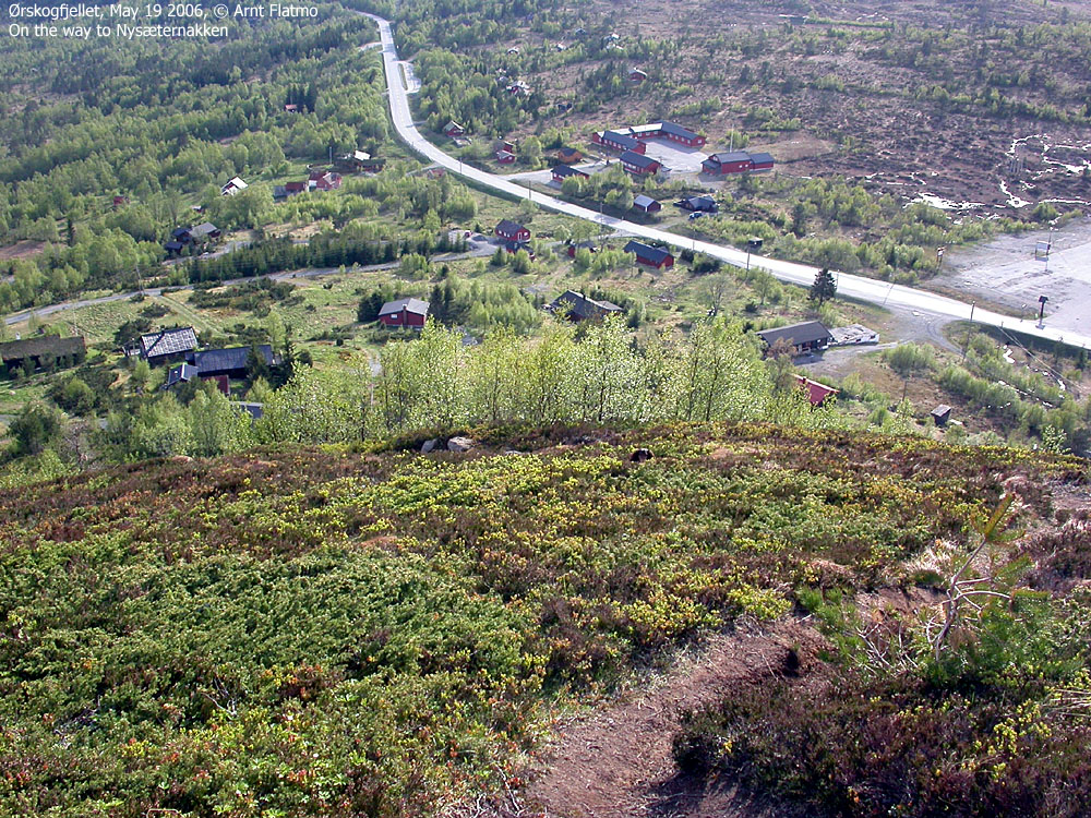
Locate a grassy path that runs up between the lower cabins. At one of the uppermost cabins, a blue ribbon marks the beginning of the ridge path which climbs up to point 432m and continues NE up the ridge. The main cairn (holding the logbook) is located at UTM 32 V 393471 6934050, approx. 505m elevation. The high point is located 385m further NE, and just marked by a couple of rocks.


I had just visited Giskemonibba and decided to visit Nysæternakken before heading home to Ålesund. It was like the annual health check at the Doctor. Not something I wanted to do, but avoidable. After all, Nysæternakken was on my list of Ørskog mountains. I was full of prejudice regarding this hill. First of all, it is just a hump. Second, I had to pass privately owned cabins in order to get onto the path.
But I found a place to park and convinced my dog that he should do a little bit more legwork before we called it a day. Well, convinced... He laid down on the path and showed me his few remaining teeth when I suggested he should move on. "The protocol" at this stage, is that I put the dog in the backpack, and let him out 5 minutes later. But I didn't. I left him there and headed upwards.
He doesn't have perfect vision anymore, so I paused a bit higher up, watching his reaction to my out-of-protocol action. He was clearly confused. I whistled the "positive tune" and he came along. Ho ho. Human vs. animal: 1-0.
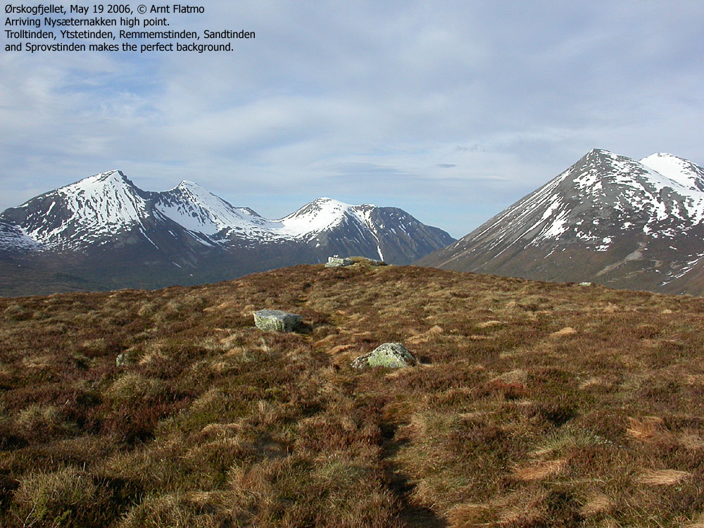
We left the car 18:40PM and reached the high point 19:00PM. There were plastic and beer cans floating around. I wasn't all that surprised. I could have picked it up, but I didn't. This wasn't my mountain. I have picked up numerous items on Mt. Ulriken in Bergen (except the dipers left by one of the 7-fjellstur participants in 2005), but not here. The cabin owners should be able to keep this hill tidy. I turned around after taking pictures, and the dog seemed to understand that this would be the last walk this Friday evening.
We were back at the car 19:30PM, and I was glad to tick this hill of my list.
Note: Apologies for the poor picture quality. My camera was at the repair shop, and I had to bring along the 4-year old Nikon Coolpix 4500.


No Javascript:


No Javascript:
 westcoastpeaks.com
Other Møre & Romsdal mountains
Other Norwegian mountains
westcoastpeaks.com
Other Møre & Romsdal mountains
Other Norwegian mountains

