
|

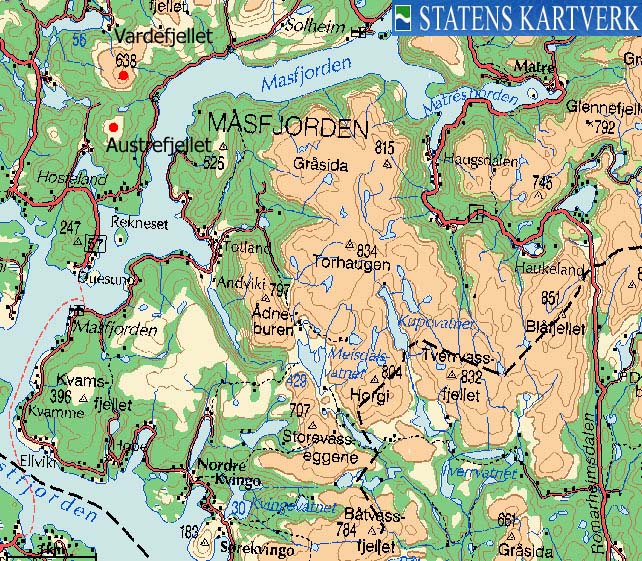
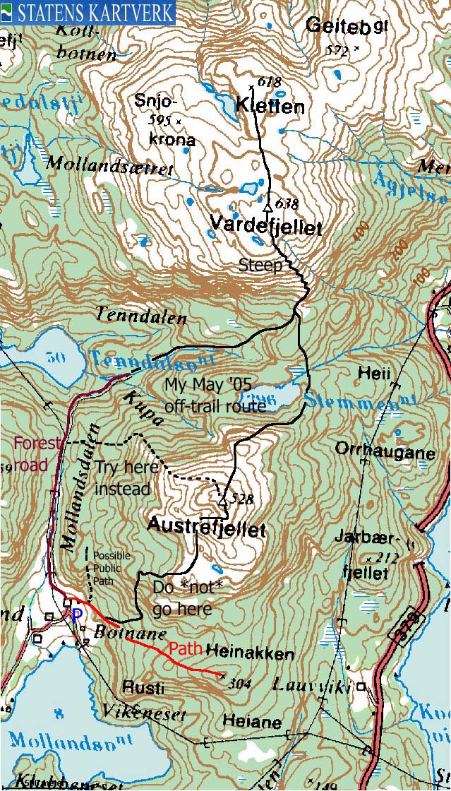
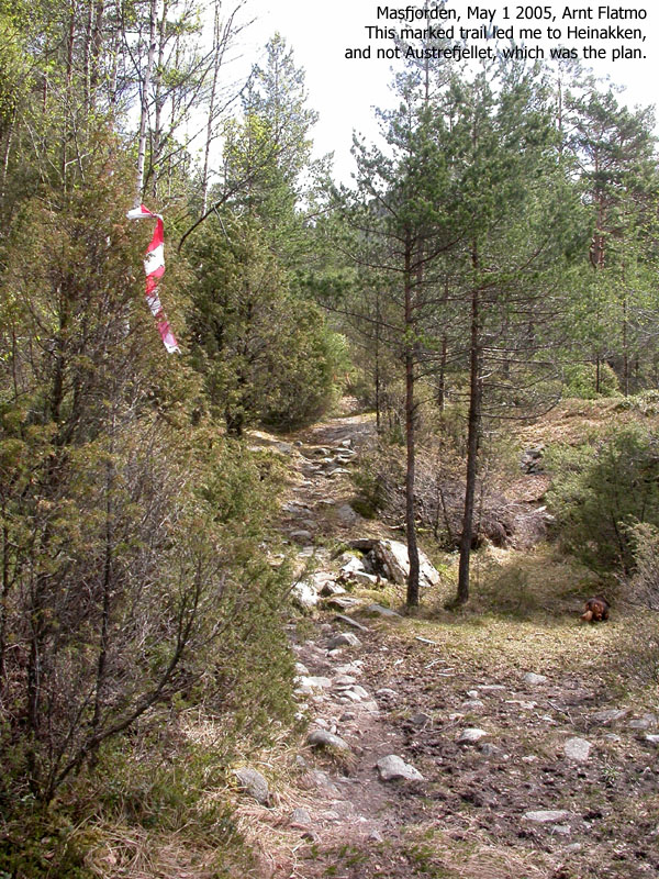
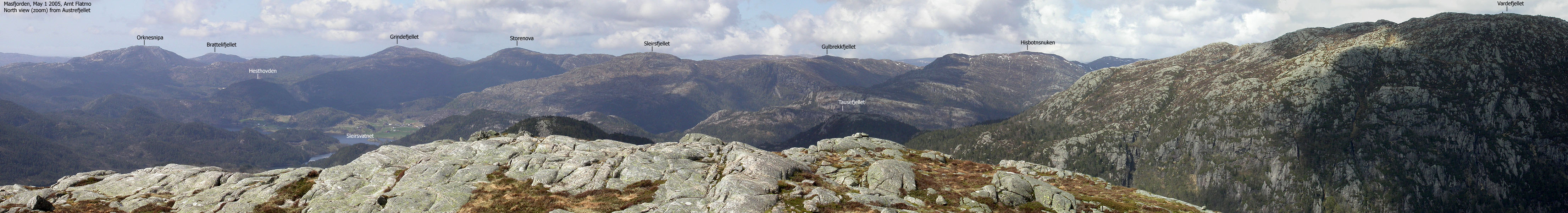
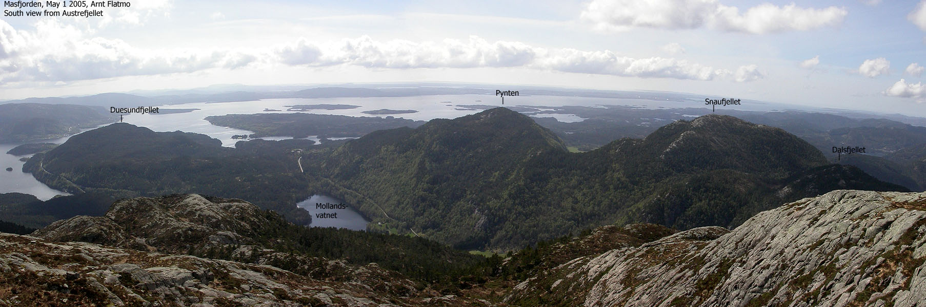
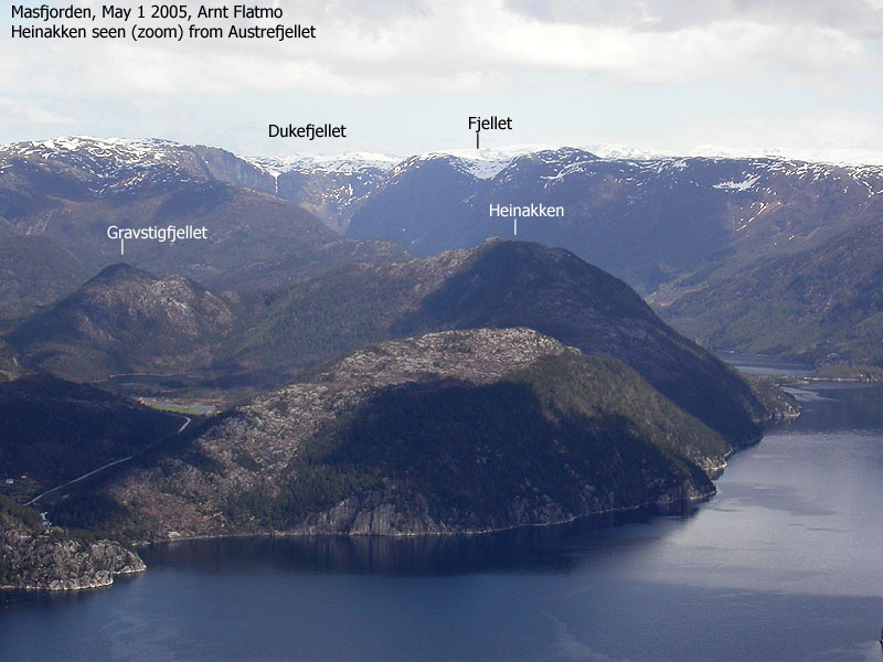
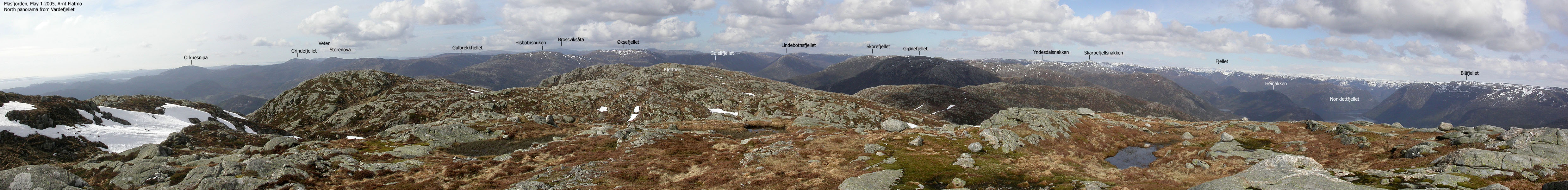
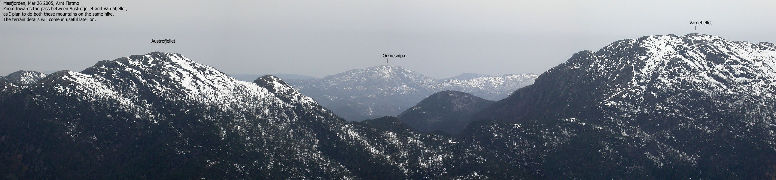
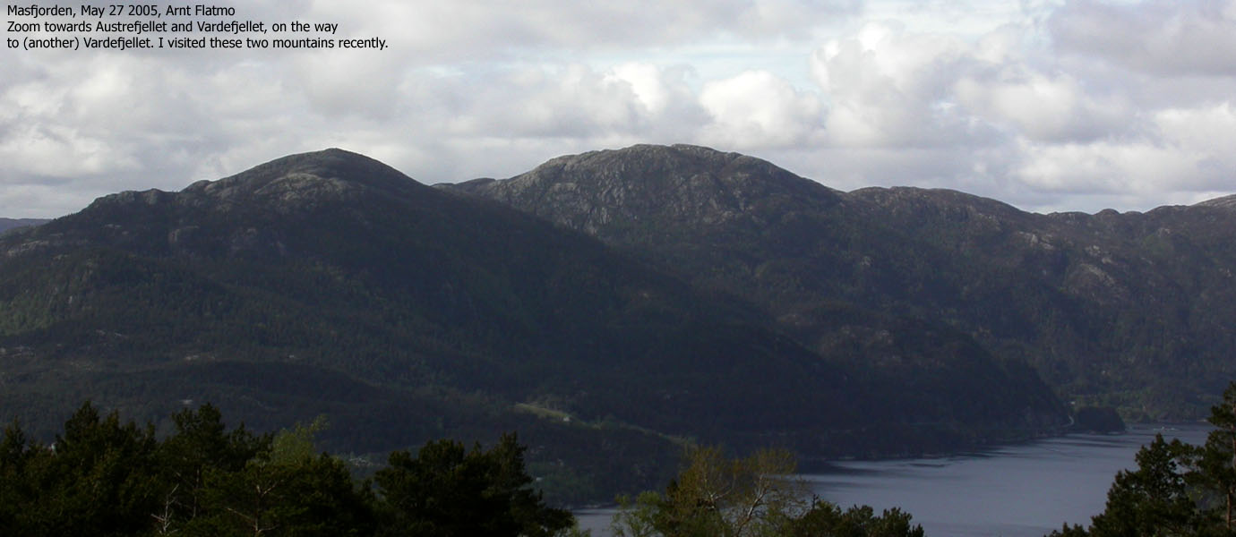
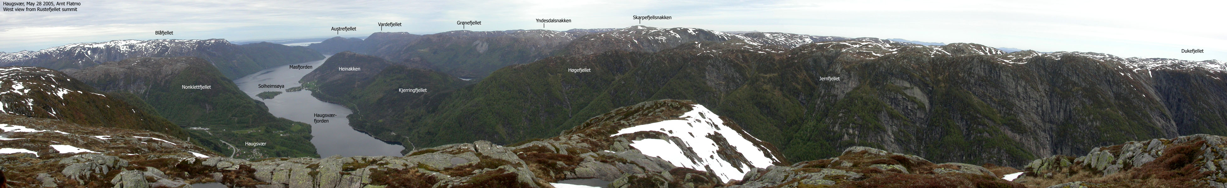
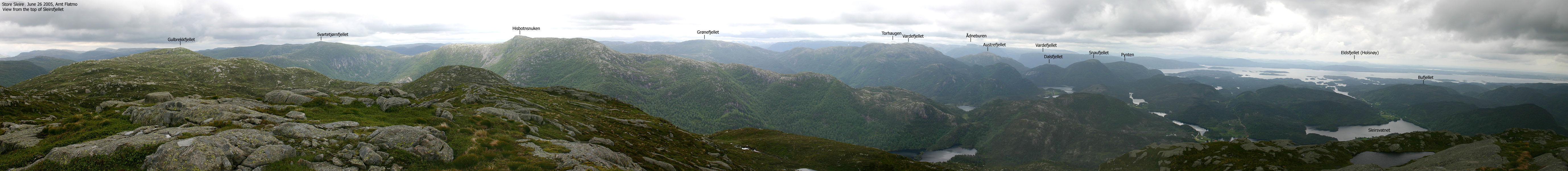
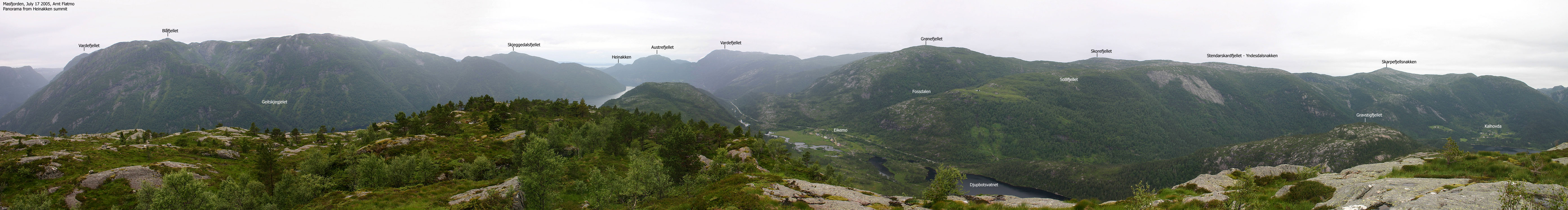
Austrefjellet (Austefjellet) and Vardefjellet belong to a chain of tops that defines the north side of Masfjorden. The views are nothing less than outstanding, and here is my dilemma; I really would like to recommend these mountains to the public, but I'm not sure where the public path runs. *Apparently*, a good route runs from the uppermost farm at Molland, and I have spoken with people who had found this path to be quite good. My advice is that you ask at Molland and make sure you don't confuse the path to Austrefjellet with the marked path towards Heinakken (not be confused with the higher and more prominent Heinakken deeper into Masfjorden) You should also ask if there is a public path from Mollandsdalen valley up to Vardefjellet.
For these reasons, I have omitted my usual route description. Refer to the trip report if you still are interested in the details.
Austrefjellet (M711: 528m, Ø.K: Highest contour is 525m) has a primary factor of 225m towards the higher Vardefjellet (635m) The saddle is found at the west end of Lake Stemmetjørn, N of the mountain. Ref. Økonomisk Kartverk (5m contours), you cross the 305m contours on the high route, but not 300m. The saddle height has been interpolated to 303m.
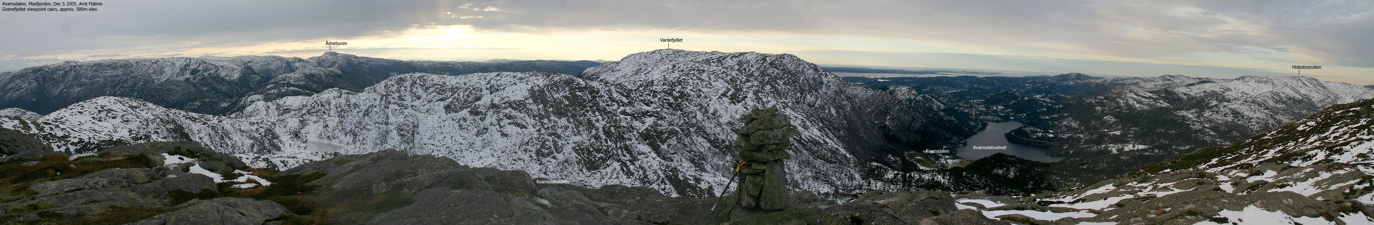
Vardefjellet (M711: 638m, Ø.K: 637,66m) has a primary factor of 200m towards the higher Grønefjellet (655m). The saddle is found near Lake Huldalstjørni. Ref. Økonomisk Kartverk (5m contours), you cross the 440m contours on the high route, but not 435m. The saddle height has been interpolated to 438m.
Heinakken (M711: 304m, Ø.K: Highest contour is 300m) has a primary factor of 56m towards the higher Austrefjellet (528m) The saddle is found in a pass N of Heinakken. Ref. Økonomisk Kartverk (5m contours), you cross the 250m contours on the high route, but not 245m. The saddle height has been interpolated to 248m.
Notes: Class ratings are in reference to YDS. Click here for more information.
The trails described below are not necessarily the *easiest* trails to this mountain.
|
Molland - Austrefjellet - Vardefjellet round trip (summer/autumn)
|
|
From Bergen, you have two main alternatives;
a) w/ferry (Leirvåg - Sløvåg)
From Bergen, follow highway E39 northbound. After the Nordhordlandsbrua bridge,
pay (NOK 45,- for passenger cars per May 2005) at the Toll station. Drive 2,4Km
and turn left onto highway RV57 (Leirvåg). Follow RV57 36,6Km, then turn
right right towards the Leirvåg - Sløvåg ferry. The ferry is 1,4Km
from this exit. Note that the ferry sometimes stop by Skipavik, west of Sløvåg.
Per July 2005, the ferry schedule was published on
ruteinfo.net.
From Sløvåg, continue 3,9Km. Turn right onto RV57 towards Duesund. Follow this road 11,8Km and turn left towards Molland.
Another ferry alternative is Masfjordnes - Duesund. A scenic, but not the fastest or shortest route.
b) Via Kringla:
From Bergen, follow highway E39 northbound. After the Nordhordlandsbrua bridge,
pay (NOK 45,- for passenger cars per May 2005) at the Toll station. Drive 66,6Km
and at the Kringla junction, turn left towards Solheim/Duesund. Follow this road
for 5,6Km and turn right at the Solheim junction. Follow the road along Masfjorden
for 13,4Km before turning right onto highway RV57. Follow RV57 (Rutledal) 1,4Km
before turning right towards Molland.
Another alternative is to drive along Haugsværfjorden via Solheim.
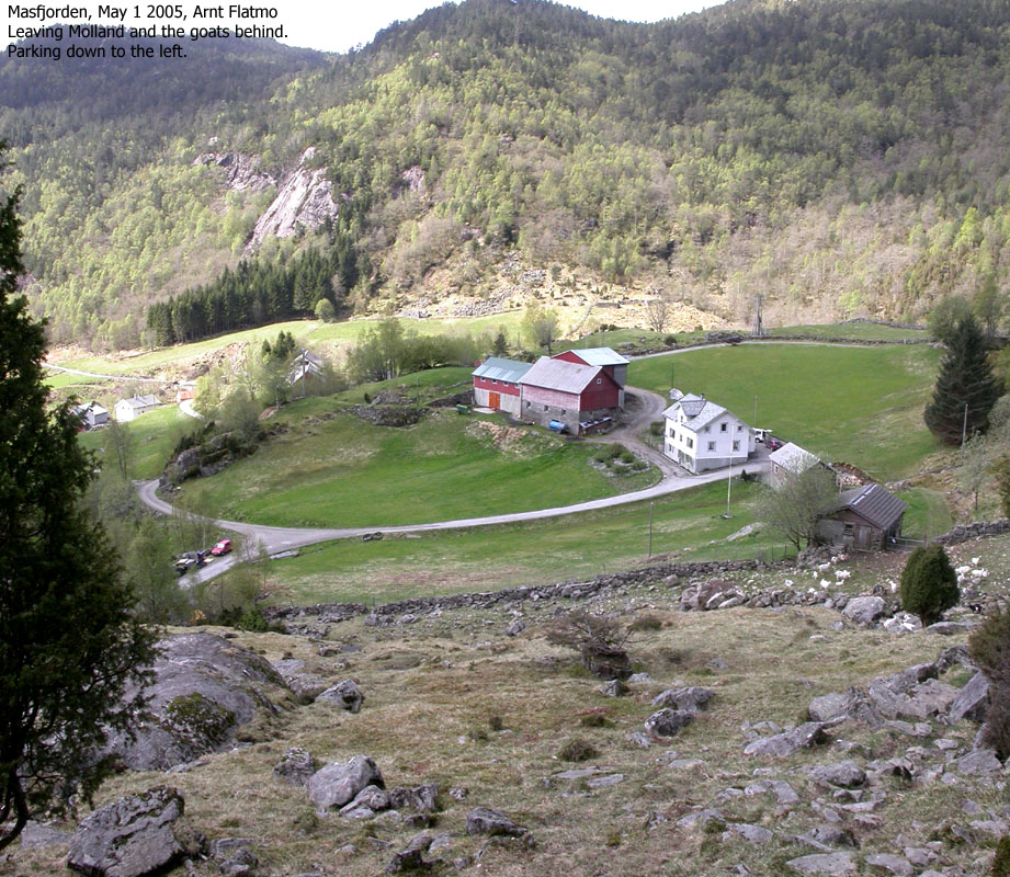
From Molland, drive 1,6Km and find parking on the road below the northernmost farm. There is room for 1 car on the right-hand side of the road.
At Molland, ask for the public path to Austrefjellet. Make sure you don't end up on the Heinakken trail. For the Austrefjellet to Vardefjellet (and back to Molland) route, refer to my trip report below.
|
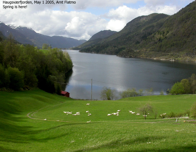
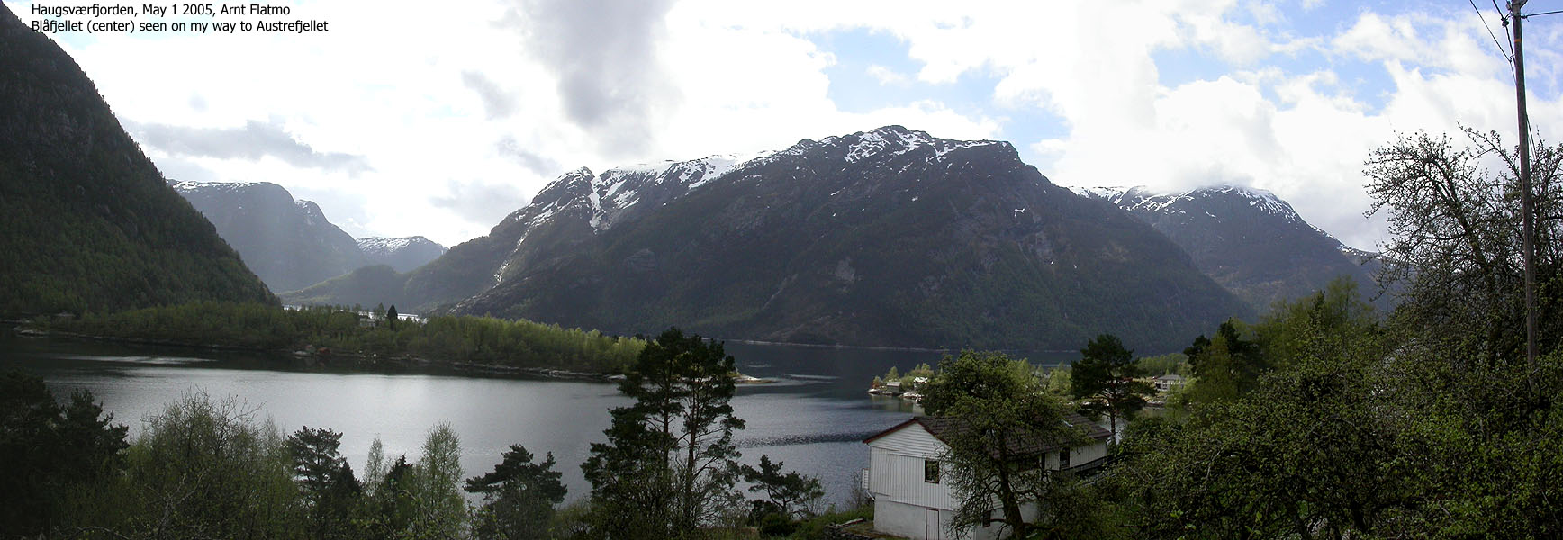
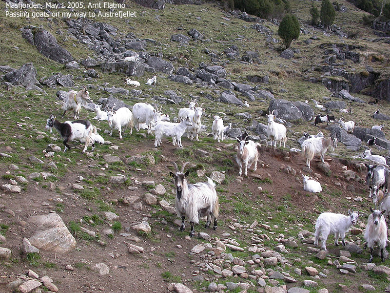
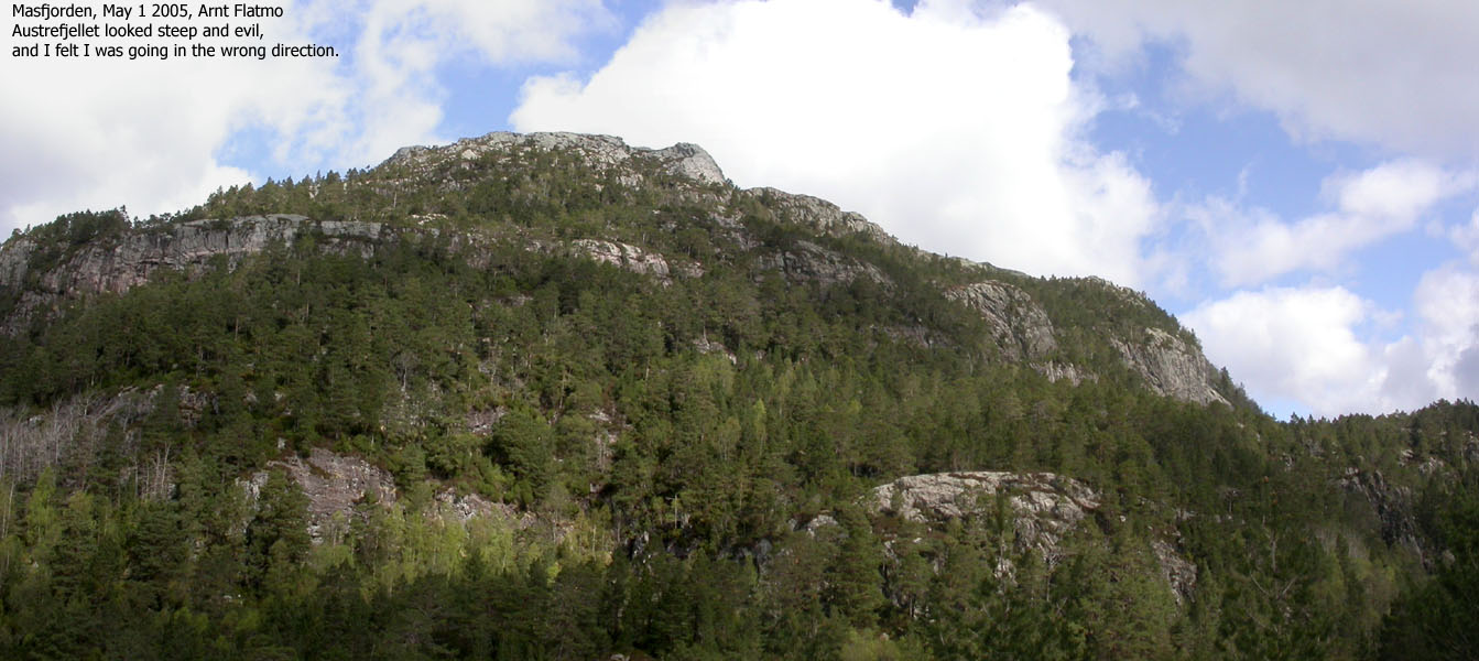
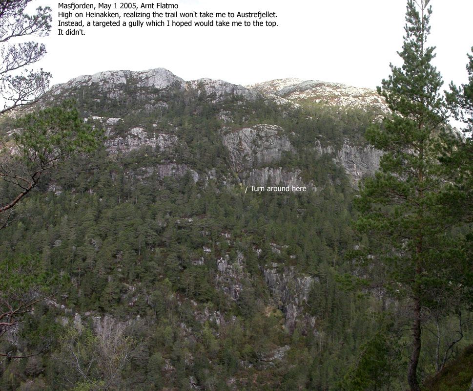
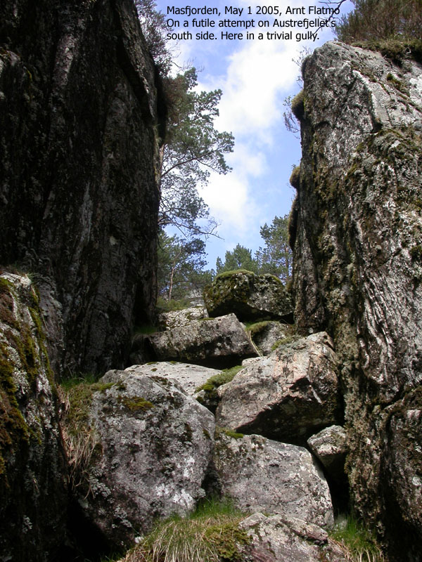
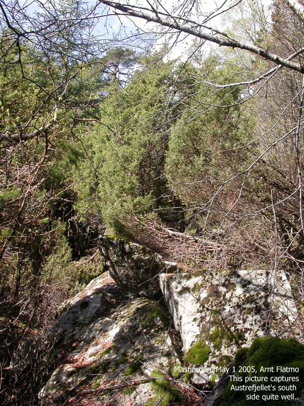
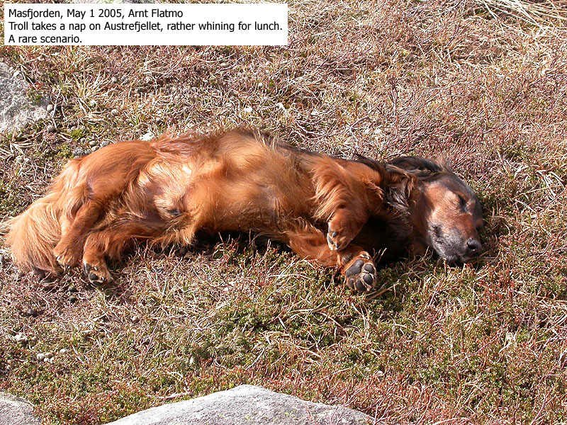
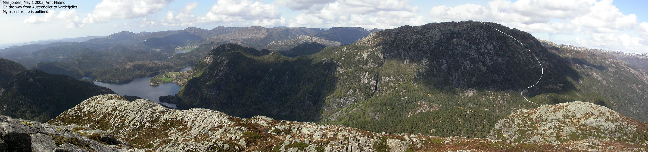
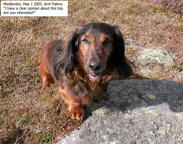
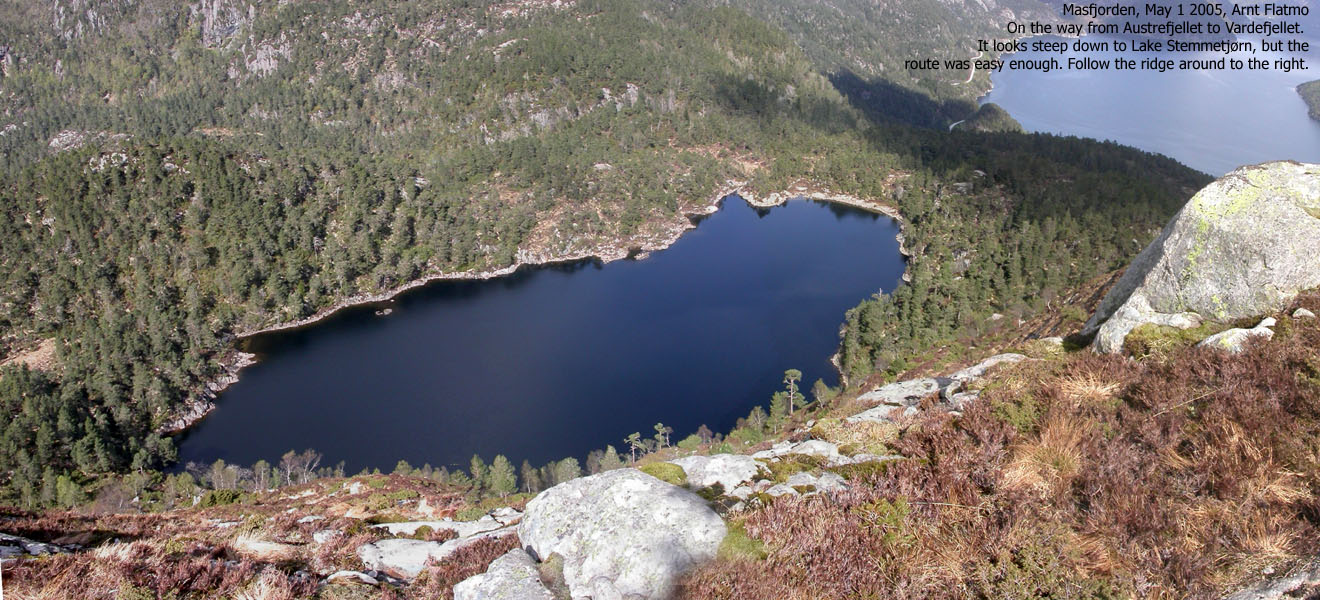
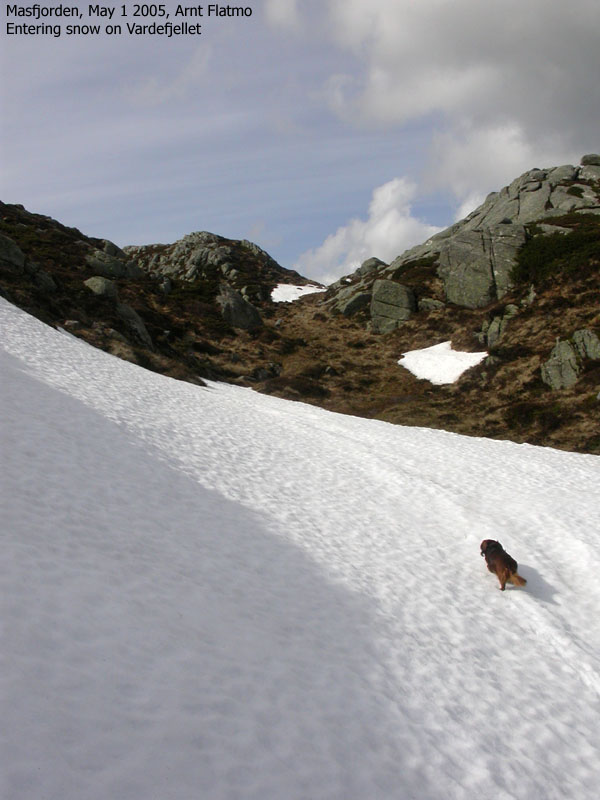
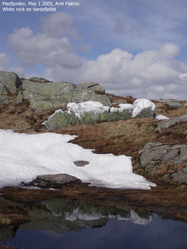
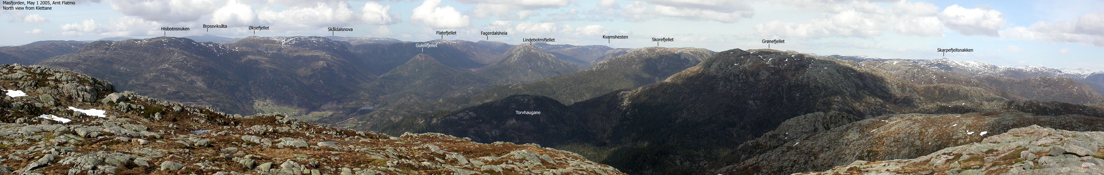
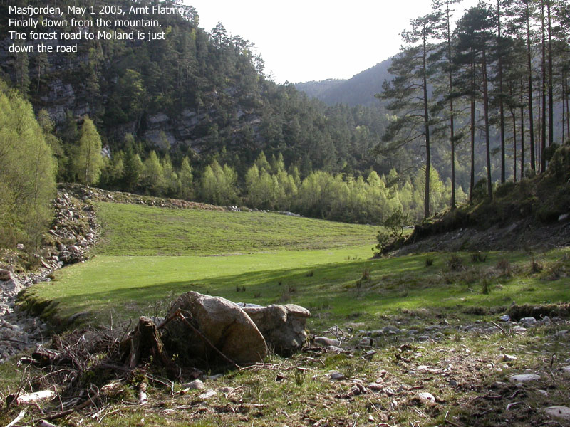
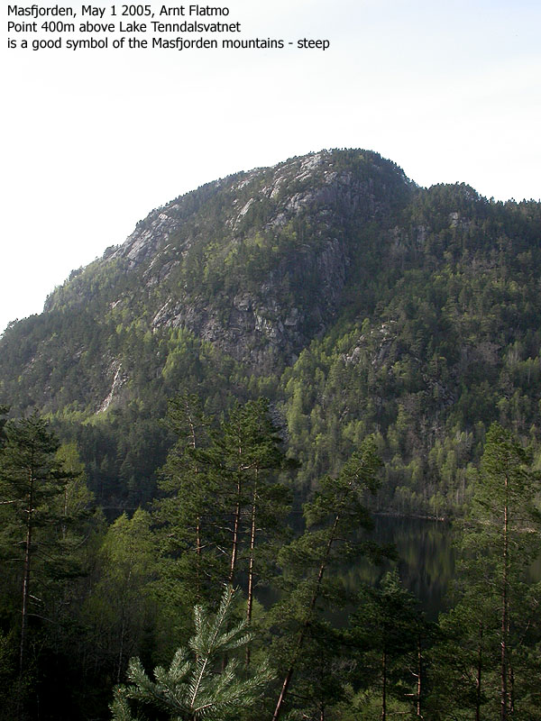
Trip report May 1 2005I had reserved this Sunday for Austrefjellet and Vardefjellet. I did not reckon I would be able to do both of these tops on an evening hike. In fact, the trip turned out to be a whole different kind of trip than I had anticipated. In my hiking log, I wrote that this was the worst forest hike ever. And I do have a few forest hikes to compare with. It started out quite well. An old man at Molland (he didn't live there) told me there was a good path to Austrefjellet from Molland. He pointed the initial direction and off we went, the dog and I. 12:15PM we went through the gate behind the farm and said hello to a few dozen goats before we continued on a visible path. I had assumed the path would soon turn north and head up a distinct valley above Molland. But since this didn't happen, I figured either I had missed the path, or that the path was taking the long way around. After a while, I realized that I was on my way to Heinakken, but decided to go all the way. At least, I would get a good overview of Austrefjellet's south side from up there. We reached the top of Heinakken 12:55PM. The dog had walked all the way, but I put him in the backpack. I expected there would be no more paths for a while. Austrefjellet's south side was not a friendly face. I noticed a distinct gully in the centre of the mountain side and figured this would be my only chance. I followed the ridge down to the Heinakken - Austrefjellet saddle and took a direct course towards the gully. There had been nothing out of the ordinary regarding the forest so far, but now things got interesting. I climbed up a short, but steep couloir before entering a dense juniper jungle (Yes, a jungle is dense by its definition) below the gully I was heading for. At the base of the gully I realized there was no way I would be able to climb up to the gully with the dog. There was nothing but vertical walls around me, and I decided to give up on the south side. I figured I should head back towards Mollandsdalen and try a western approach. This had been my plan ever since I hiked Snaufjellet from Molland back in March. On my way down from the gully, I came across a path that I followed. This path merged with my ascent route after a while. I had overlooked this path on the way upwards, and I wondered if there were other paths that I could have missed. I headed back up again, but found no more paths. I yelled words my mom wouldn't have liked and decided to play hardball. I had a vertical cliff high above me. I decided to follow the base of this cliff, and hopefully I would be able to make it up the mountain. The course was straight north. This was a tremendously evil pine forest. Mixed with juniper bush all over the place. I had to crawl just to get through. Again and again, my route was blocked by cliffs that I had to scramble. Every cliff had just one possible way up, and after a while I seriously hoped that I didn't have to return here. Good will and fortune finally brought me above the forest and things started to look good. After a short walk above the tree line, I reached the top of Austrefjellet 14:40PM. While the dogs chewed on his lunch, I stripped butt naked and tried to clean my clothes from needles I had collected on my way through the forest. With clothes that no longer made me yell "ouch", I was at liberty to enjoy the fantastic view from up there. We moved out 15:00PM. Vardefjellet was the next target and I was excited getting the ascent route (which I had planned during my Snaufjellet hike) into closer view. It looked steep from Austrefjellet, but head-on views can give the wrong impression. But first I had to find a way down Austrefjellet. I was looking straight down on Lake Stemmetjørn 150m below me, but I didn't see the hill between me and the lake. I think I skipped at least one heartbeat. With the good motto "seek and you shall find", I moved to the very edge of what had to be a cliff. Everything now became much more clear, and I was able to identify a very doable route down to the lake. Unfortunately, I was too eager getting down to the lake so I missed the optimal route along the northeast ridge. I adjusted my course and climbed back onto the ridge. Getting to the foothills of Vardefjellet was unproblematic, but I had go through a juniper field before I could touch the rock. The route up Vardefjellet was indeed steep, but it wasn't directly exposed. Perphaps close to, but not directly exposed. I let the dog out halfway up the hillside. He had complained for a while now, and seemed happy to do some legwork again. We reached the top of Vardefjellet 16:15PM. After a round of pictures, we continued over to Klettane which we reached 16:30PM. We had a 10 minute break on top of Klettane before we started our journey back towards Molland. I followed the same route down Vardefjellet (Troll was in the backpack), but instead of hiking down to Lake Stemmetjørn, I entered a valley that would lead us towards Lake Tenndalsvatnet. I knew there was a forest road down there that would take us back towards Molland. We had 1,5Km with more bush ahead of us before we reached this road, but the forest was in general quite friendly. Half-way down the forest we were on top of some nasty cliffs and had to spend time looking for a route down the cliffs. From above, only one route seemed possible. From below, I could see several routes for descent. Just before we reached the forest road, I ran into a the corpse of a sheep in a stream. Not a pretty sight. Troll walked the road back to Molland, and by 18:10PM the hike was over. The hike had taken us 6 hours. I had walked 12,5Km (which was surprisingly short), but I had climbed 1200 vertical meters and gone through the worst forest I have ever seen. It was for sure a hike I will remember.
|
Move cursor to read notes, and click on the images to see full version.
Some of the thumbnails may have been cropped to fit the format.
To Molland:


To Heinakken:


To Austrefjellet:


To Vardefjellet:


Back to Molland:


No Javascript:
1 2 3 4 5 6 7 8 9 10 11 12 13 14 15 16 17 18 19 20 21 22 23 24 25 26 27 28 29 30 31 32 33 34 35 36 37 38 39 40 41 42 43 44 45 46 47 48 49 50


No Javascript:
Other hordaland mountains
 Other Masfjorden K. mountains
westcoastpeaks.com
Other Masfjorden K. mountains
westcoastpeaks.com

