
|


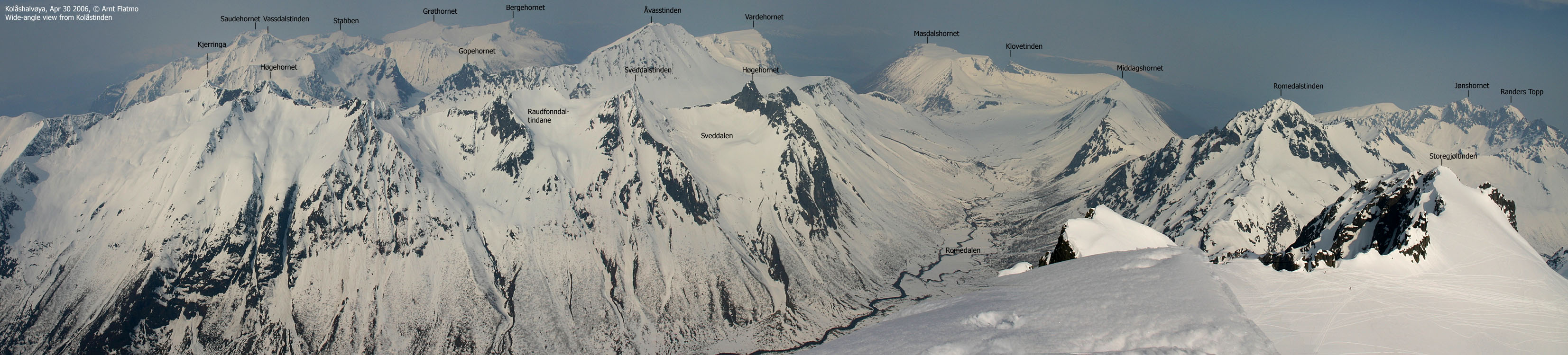
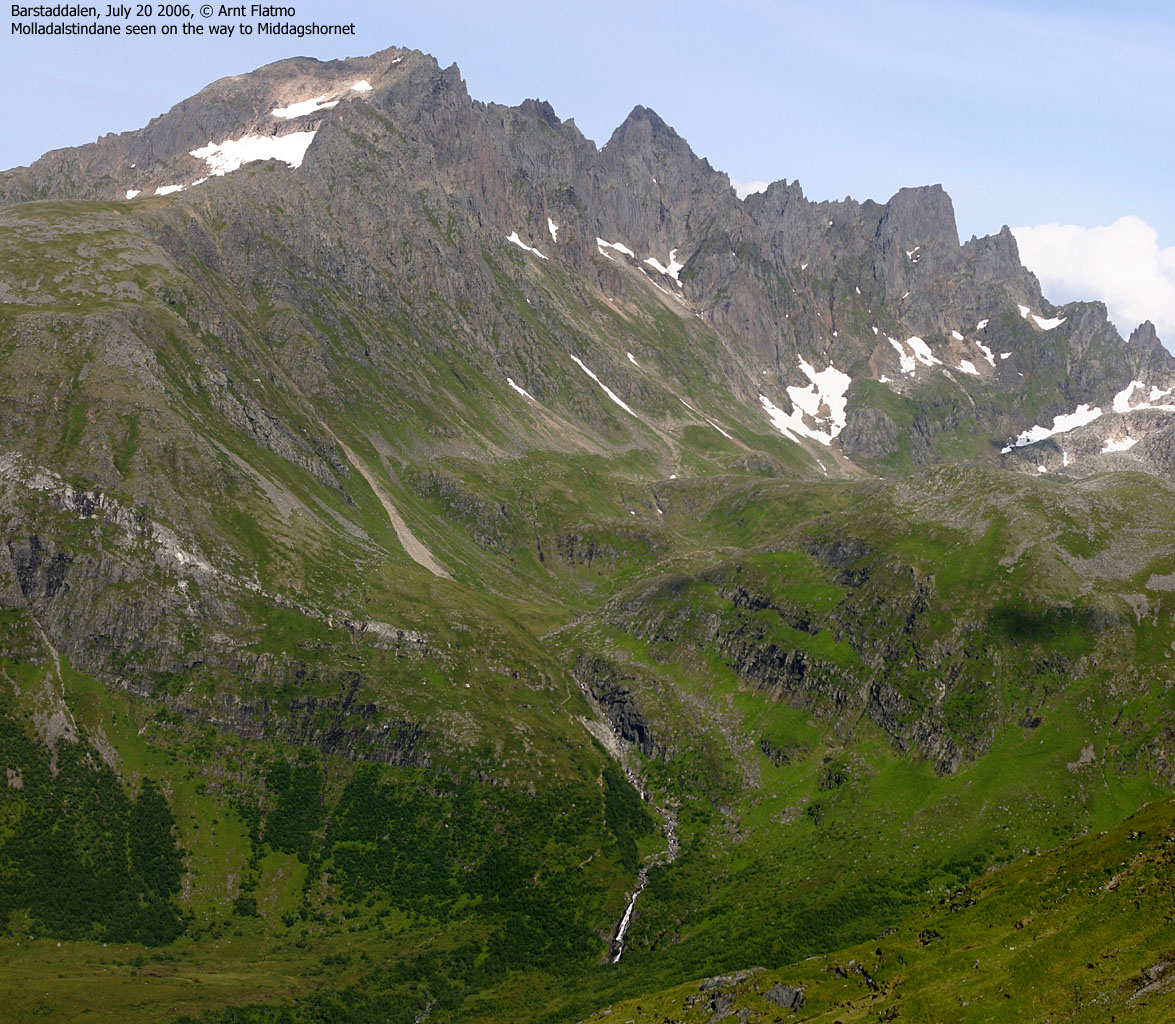
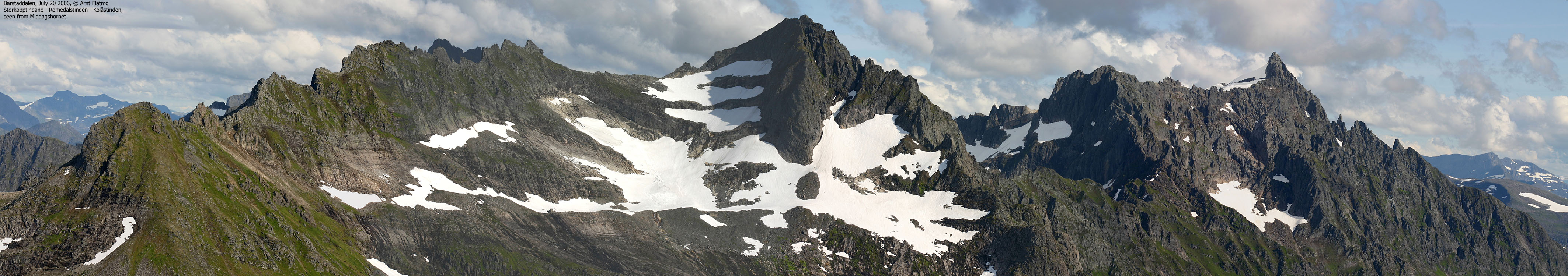
Middagshornet is perhaps the best place to enjoy the views towards the wonderful Molladalen valley. In addition, the mountain is centrally located, on the ridge that divides Barstaddalen and Romedalen, and offers GOOD views towards the most prominent Ørstahalvøya mountains (except Saudehornet). Thew views reach even longer. You can easily see Gjegnen (Blånibba) above Nordfjord, 61Km to the southwest.
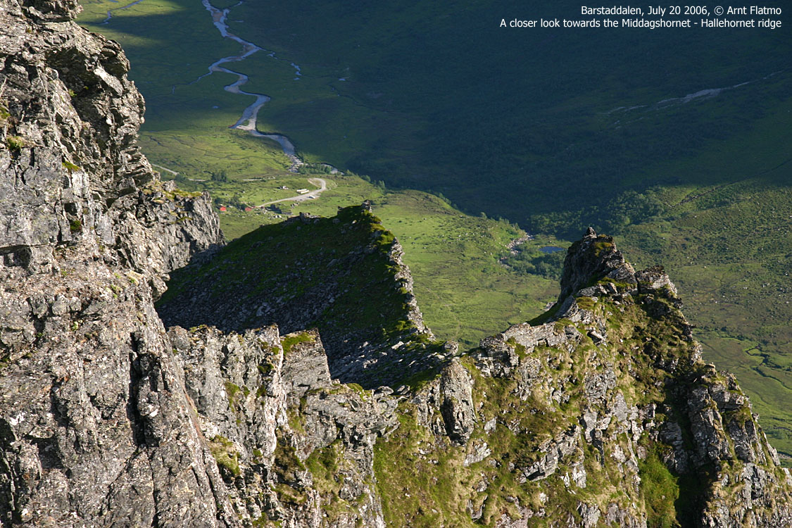
The mountain is normally hiked from Melbøsætra in Barstaddalen or Vartdalssætra in Årskogdalen. Either way, you may also include the lower top Hallehornet on your hike. I have not walked the ridge between Middagshornet and Hallehornet, but from what I understand, there should be no difficulties along this ridge.


Middagshornet (Norge 1:50,000: 1091m, Økonomisk Kartverk: -, UTM 32 V 358529 6910968) has a primary factor of 381m towards the higher parent mountain Romedalstinden (1295m). The defining saddle is between the two tops. Ref. Norge 1:50,000, the saddle is within the range 700-720m, interpolated to 710m.


Notes: Class ratings are in reference to YDS. Click here for more information.
The trails described below are not necessarily the *easiest* trails to this mountain.
|
1.1: Barstaddalen - Middagshornet (summer)
|
|
Access
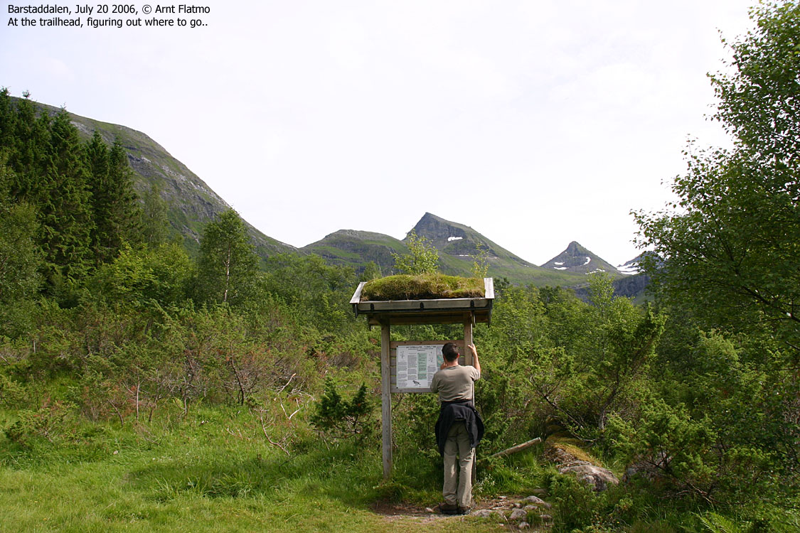
From Ålesund, follow highway E39 towards Bergen/Volda to the ferry at Solavågen. Take the ferry over to Festøya. Turn right in the direction of Volda and follow the road 3,7Km. Turn left towards "Erdal", 400m after you've passed the FIRST "Erdal" sign. Follow this road (Melbø Sætreveg) to its end. Pay toll at a self-serviced toll booth. The fee for passenger cars were NOK 10,- per July 2006. Find parking at road end.


The route
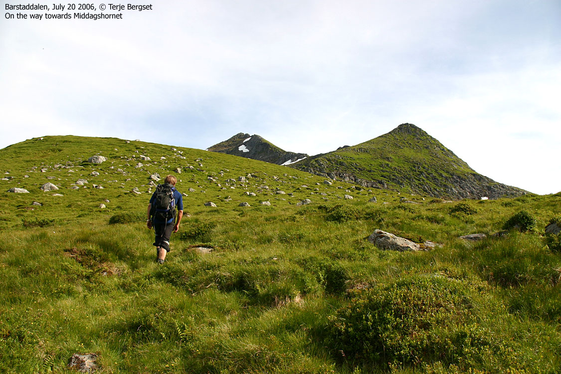
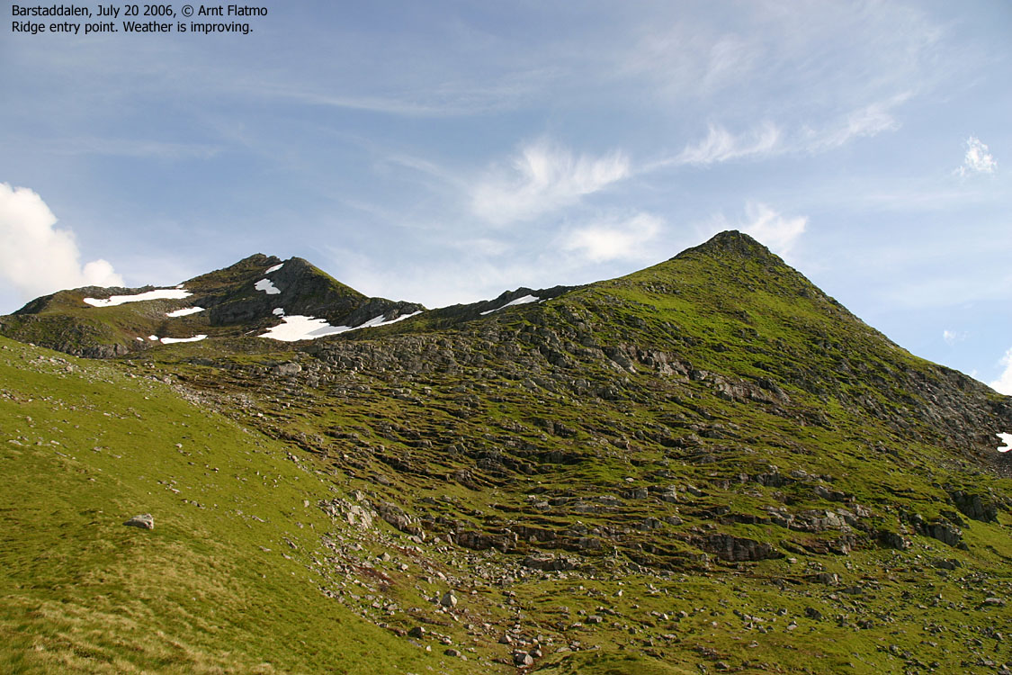
From the upper Barstaddalen parking area, follow the "Romedalen" trailsign, cross the river and pass a gate (close it). Then follow a quite visible path up to the ridge between Trongegga and Middagshornet.
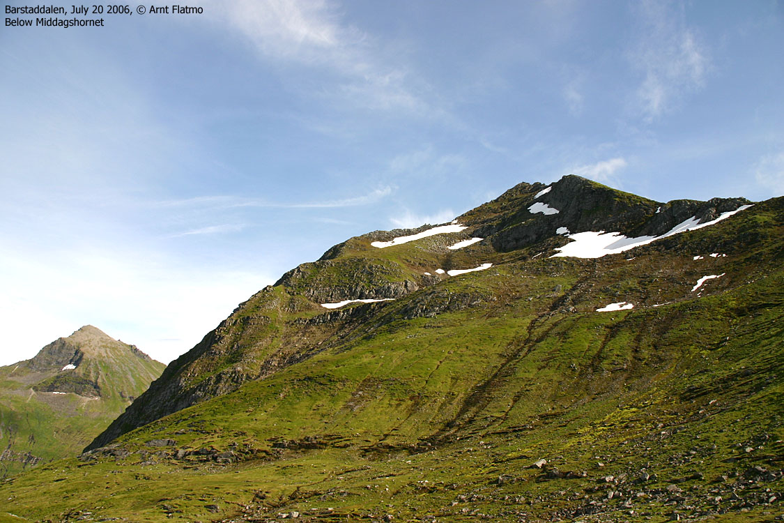
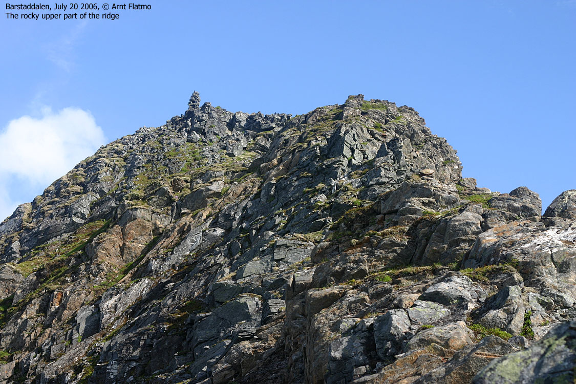
By the first small lake, leave the path and head for the very beginning of the Middagshornet ridge. There are only faint tracks here, but you don't need a path. From the cairn at approx. 800m elevation, the ridge gets steeper, more narrow and distinct. A path appears as well. The sharp end of the ridge is scrambling terrain, but the path takes you safely upwards on the right-hand side of the ridge crest.
Just before the summit, you turn a "corner" and have the final yards ahead of you. One single point has made me "upgrade" the route from YDS class 2 to 2+. But small children can get up here, and so can you.
Descend your ascent route, or return via Hallehornet. From Hallehornet, you can choose if you want to return via the Molladalen or Romedalen routes.
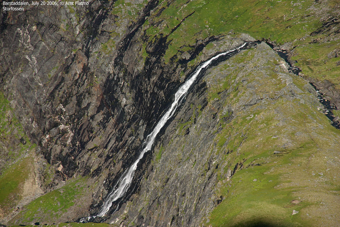
I have no information about Middagshornet in winter. There are couloirs towards Romedalen that look fun, but there may be avalanche danger. In any case, the ridge becomes even more narrow and exposed with snow.

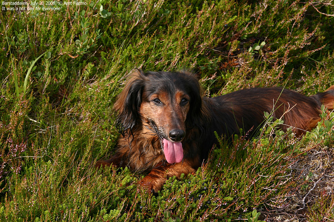
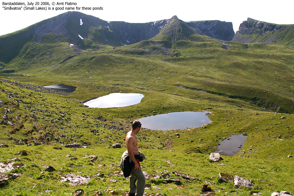
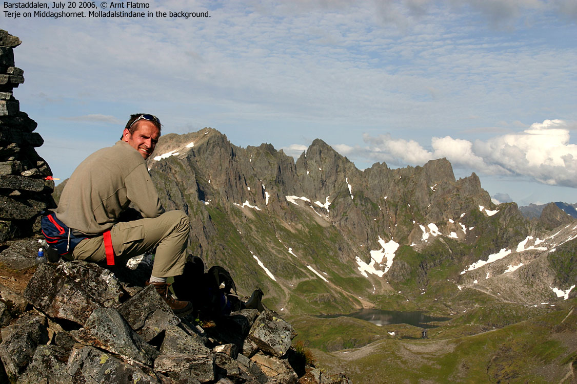
On this outstanding afternoon, Terje Bergset and I took the trip across Storfjorden, drove up Barstaddalen and headed for Middagstinden (1091m). "The third wheel" was my dog "Troll", soon to extend his tongue to a new dimension. We left the trailhead 16:25PM and enjoyed the gentle meadows up to the Småvatna lakes, where we turned left and headed up Middagshornet's northwest ridge.
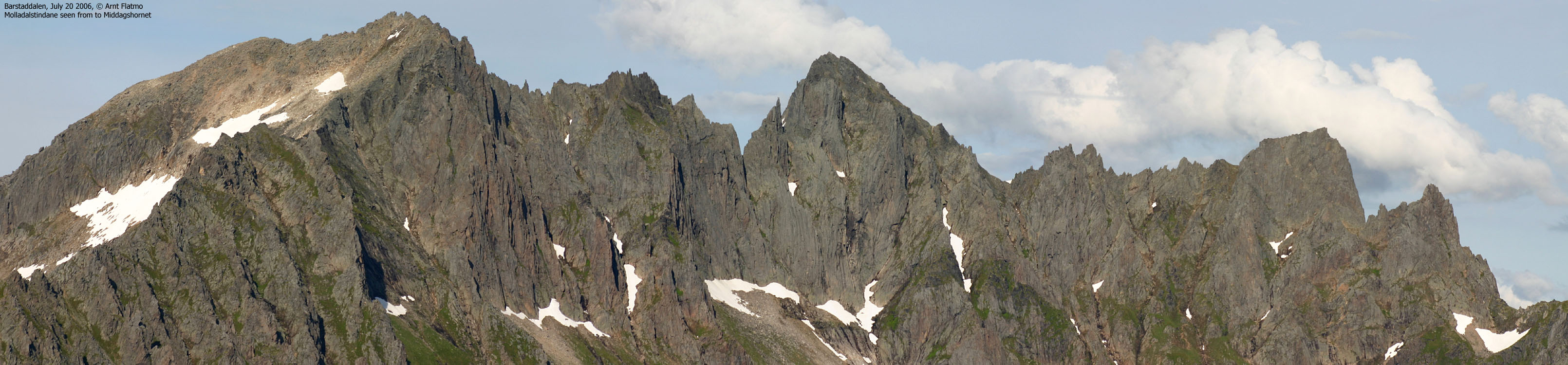
As we entered the ridge, I chose to put Troll in my backpack. He had done a good job so far, but it was a tremendously hot afternoon. He wanted to rest, but didn't want to part from us, either. It is a matter of reading his signals, and now was the time to let him rest. The hike up the ridge was strenuous, but nevertheless enjoyable. Molladalen opened up to the west and Romedalen to the south. Kolåstinden presented itself as the true "Monarch of Sunnmøre".
The ridge turned more and more narrow, but the path ran conveniently around any obstacle. Only the final 5m to the top had a little more "twist" than the rest of the route. We arrived the top 18:05PM and had earned WATER. It was less hazy than expected on such a hot afternoon. I immediately recognized Gjegnen (Nordfjord), 61Km to the southwest. My immediate thought was that we were now sitting on ONE of the very finest viewpoint on Sunnmøre. There are indeed many good viewpoints, but some are better than others.
After 25 minutes on top, it was time to head down. We had considered hiking across Hallehornet, but settled for an early return to Ålesund. On the way down, I received word from Torill and Einar (see Emdalstindane) that they had successfully climbed Store Skagastølstind via Andrews Renne. I had to call Torill and congratulate them with their fine achievement.
As expected, Troll walked all the way down to the trailhead. Terje was in front, with Troll on his "tail". After a while, Troll found a spot to pass and increased the pace significantly. This humored us. Apparently, we weren't walking fast enough for this (soon) 13-years old little fellow. We were back at the trailhead 19:40PM and arrived Festøya 19:52PM. Of course, the ferry left 19:50PM, but (fortunately) the next one left only 20 minutes later. This was a most EXCELLENT afternoon hike!
To Middagshornet


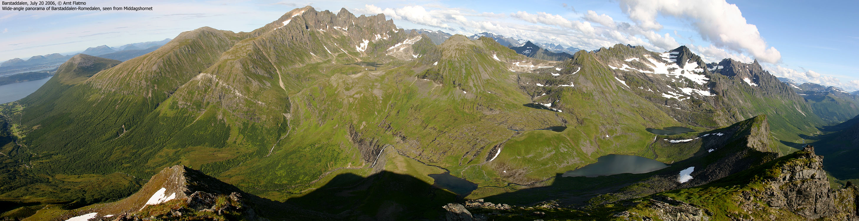
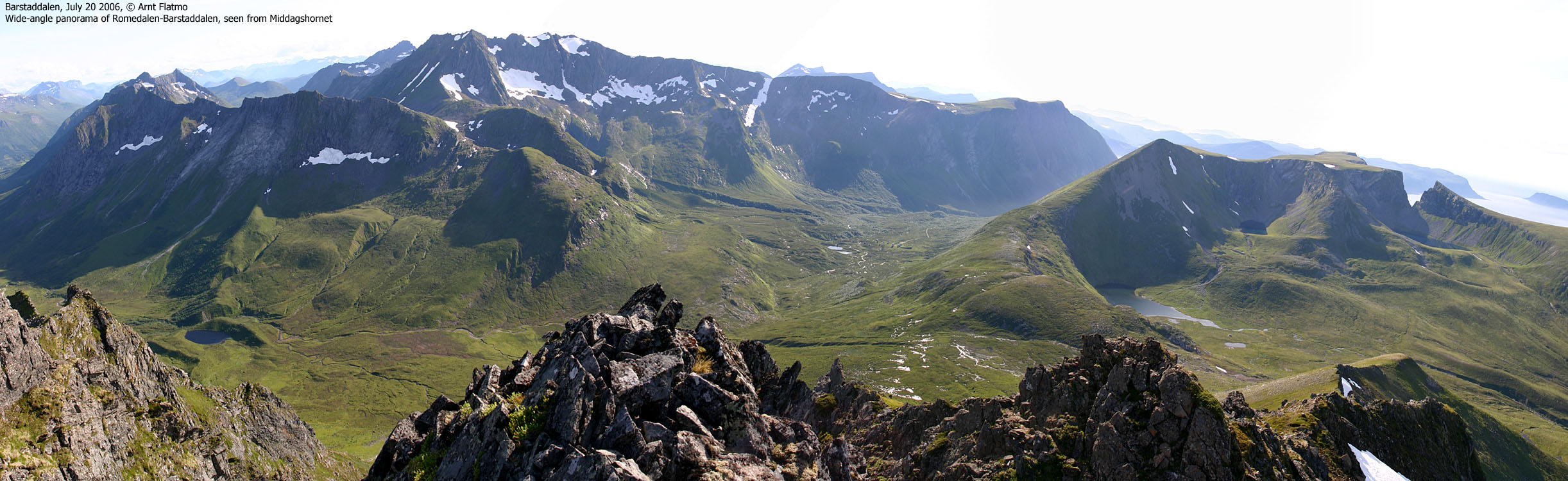
360 deg. wide-angle panorama from Middagshornet

50mm panoramas, two parts


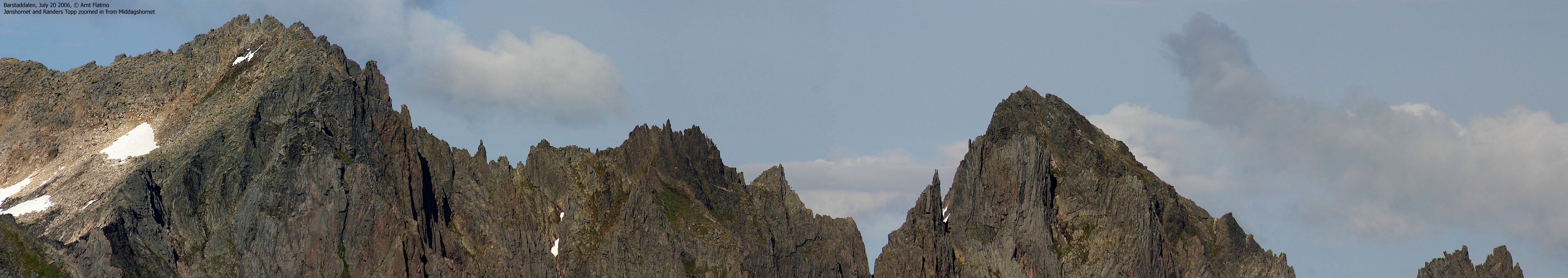
Various zooms from Middagshornet


2 wide-angle panoramas (2 parts), more of the valleys are seen


No Javascript:
1 2 3 4 5 6 7 8 9 10 11 12 13 14 15 16 17 18 19 20 21 22 23 24 25 26 27 28 29 30 31 32 33
 westcoastpeaks.com
Other Møre & Romsdal mountains
Other Norwegian mountains
westcoastpeaks.com
Other Møre & Romsdal mountains
Other Norwegian mountains

