
|

Melstveitåsen seen from outside Øystese(No Javascript) |
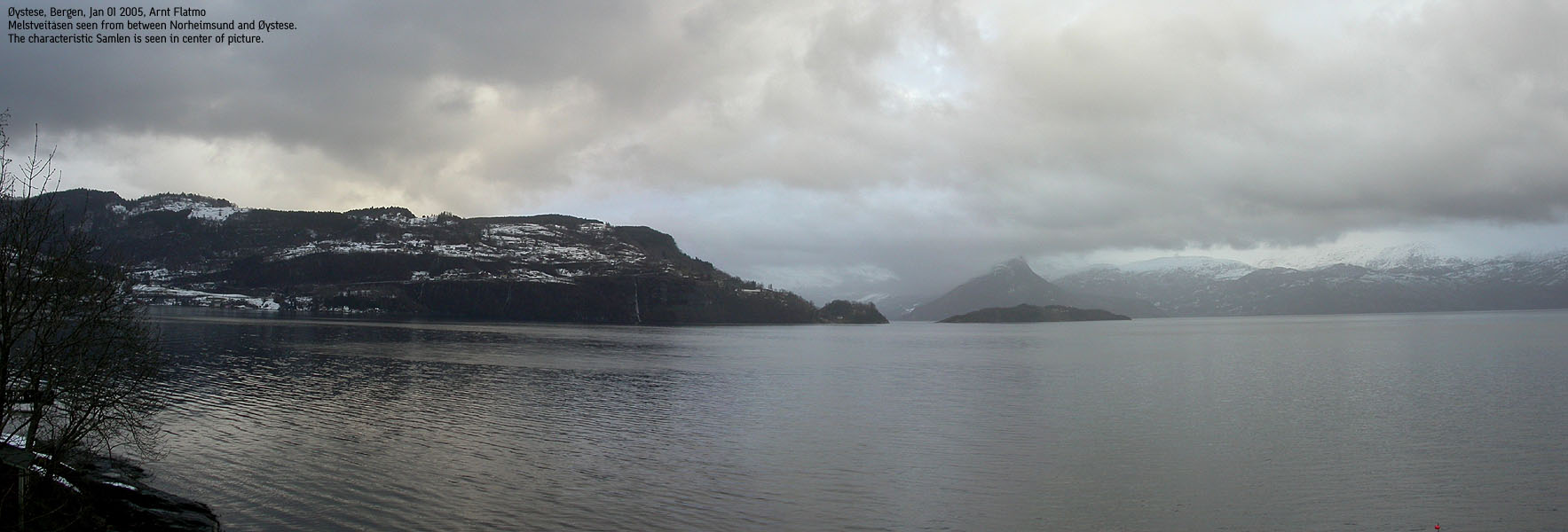
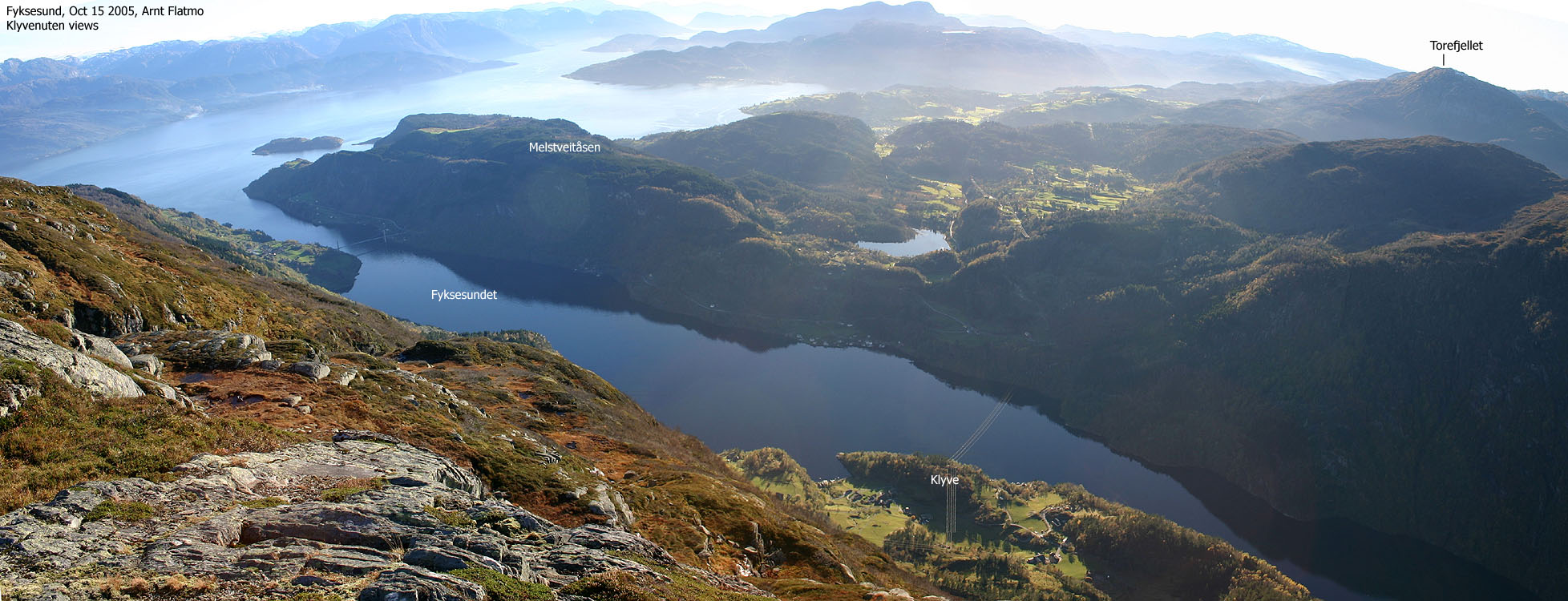
Melstveitåsen is a forest hill located between the village Øystese and the Fyksesundet sound by Hardangerfjorden. The name ("Melstveit hill") is derived from the Melstveit farm, located just south of the hill. A road runs all the way from highway RV7 to Melstveit, and a forest road continues from Melstveit. There is no apparent trail from this forest road to the high point (which, from what I can see, is not marked in any way), but the distance from the road to the top is very short - less than 500m. The hike up to Melstveit and on the forest road onwards, seem to be a popular walk for the locals.
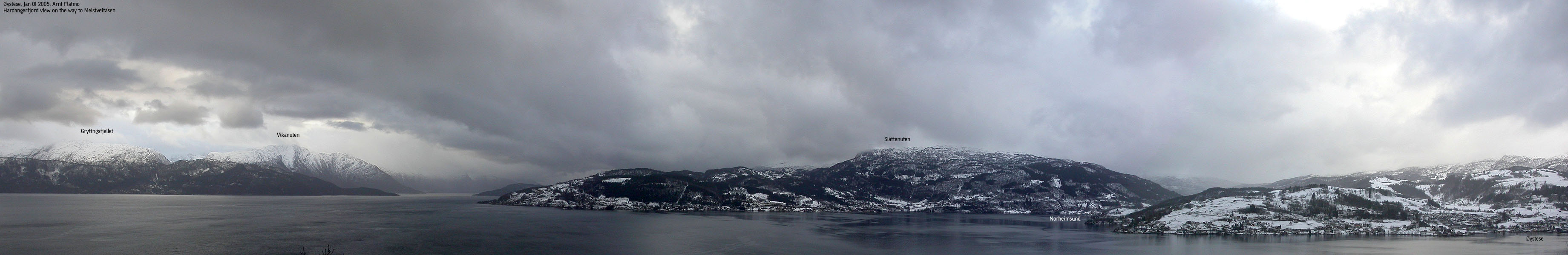
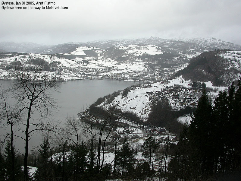
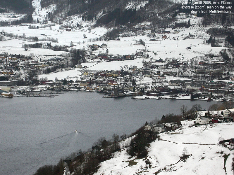
As this hill is surrounded by higher mountains, the only good views are towards Hardangerfjorden. You have Vikanuten by Jondal in view on your way up to Melstveit, and the characteristic Samlen is also seen as you head upwards. In addition, good views towards Øystese and Norheimsund - and Slåttenuten above Norheimsund.
Melstveitåsen (M711: 358m, Ø.K: 354m) has a primary factor of 235m towards the higher Manfjellet (1263m). The saddle is found E of Lake Skorsvatnet, located NE of Melstveitåsen. The lake drains south to Hardangerjorden, and must be passed on the east side. Ref. Økonomisk Kartverk (5m contours), you cross the 125m contours on the high route, but not 120m. The saddle height has been interpolated to 123m.
Normally, I would have used the Ø.K. height (354m), but as my GPS (finally) displayed 358m, I have chosen to stick with the height from the M711 map. This attaches some uncertainty to the primary factor, as I have used Ø.K. to determine the saddle height. Note also that there is a northern top (M711: 357m, Ø.K: 349m), which I only presume is lower, based on the map.
Notes: Class ratings are in reference to YDS. Click here for more information.
The trails described below are not necessarily the *easiest* trails to this mountain.
|
RV7 - Melstveitåsen (winter)
|
|
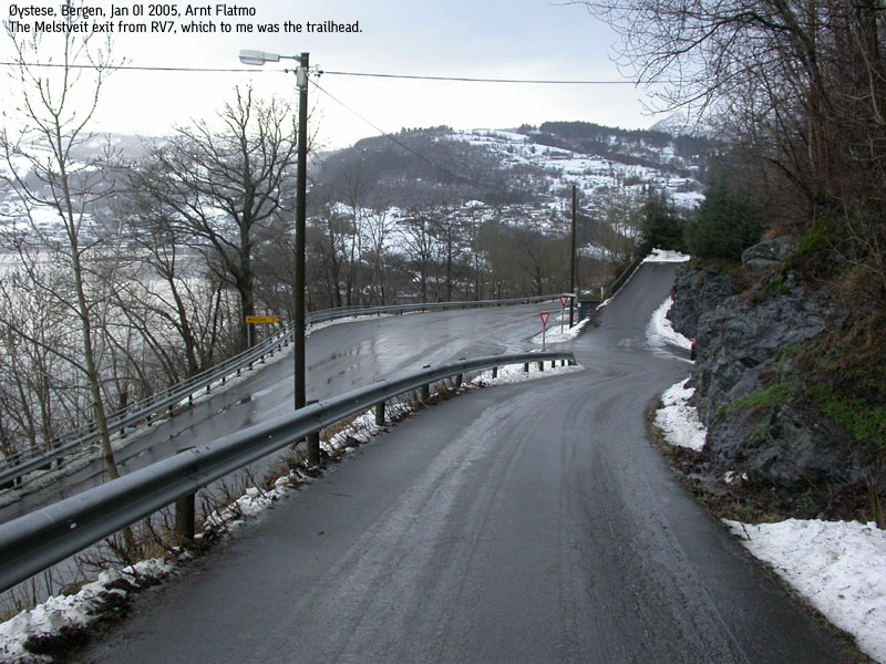
From Bergen, follow highway E16 towards Oslo. At the RV7/E16 junction at Trengereid, turn right onto highway 7. Follow this road down to Samnangerfjorden, across Kvamskogen and to Norheimsund by Hardangerfjorden. From Norheimsund, follow RV7 northbound for approx. 9,4Km until you see the "Melstveit" sign. This exit is approx. 50,2Km from the Trengereid junction. There is room for one car to park here.
Follow the road upwards. After 330m (distance from RV7), a road forks to your right. Go straight ahead. After 540m, a road forks to your left. Follow the main road which makes a sharp right turn here. At approx. 280m elevation, just below Melstveit, the road forks again. Take the rightmost road and walk past the Melstveit farm. Yes, you may drive all the way up Melstveit, but that takes most of the excersise away.
When you pass a few shacks in the forest, you see the high point behind the shacks. As the forest road descends a bit, you will see that getting up on the forest ridge is tricky from here. Instead, follow the forest road upwards until you are at the western end of the forest ridge. Leave the forest road and follow the ridge east/northeast to the high point. You may stumble upon an old tractor road that leads towards the high point. This makes traveling a bit easier.
Descend your ascent route. Alternatively (I have not walked here), hike across the entire Melstveitåsen forest plateau and follow the trail along Laupsaelvi river back to RV7.
Also note that the forest road that you followed upwards, ends in the forest. I am not sure exactly where it ends.
|
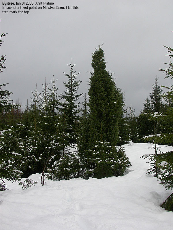
Trip report Jan 1 2005After a low-key celebration of the new year, I wanted to commence with collecting new Hordaland hills and mountains. The weather did not invite for the higher mountains, and the forecast for the day was in general not very good. I had pondered on where to go, but settled on Melstveitåsen. There was some kilometres of road involved, and I figured that would be good for the dog. A break from the hikes in the backpack, so to speak.The driving conditions across Kvamskogen were not good. Hailshowers made the road very slippery and I felt the car was "floating" on wet snow. Again, I was reminded how different things are on each side of the Gullfjellet massif. While I could hike up to the Ulriken Tower (605m elev.) on a (near) snow-free trail, the snow was lying next to the road down from Samnangerfjorden to Hardangerfjorden. I parked the car by the RV7 exit to Melstveit, and me and the dog headed upwards 11:15AM. The dog was not happy about the wet snow on the road and his head hung low. Since I had chosen this hike because of the dog (I had always expected to collect this hill on the way back from some other mountain), he'd better walk. Motivation was the key. The required level of motivation was a bit tiresome, and I came to think back to my childhood years, where the family "motivated" me to finish the porridge. "One spoon for Grandma. One spoon for Grandpa", etc. The picture of me and the dog heading up towards Melstveit was something in that alley. I dress up (clothes and backpack) the same way, regardless of the height of the mountain. And in winter, I normally bring along the ice-axe. The axe is a very useful tool, which helps me to take steep shortcuts and prevents falls on icy slopes and trails. On the way upwards (passing several houses), people by their breakfast tables must have wondered what sort of person was heading up to this low hill, on a paved road, with an ice-axe and a (fairly) large backpack. And - cheering up this small dog to put one foot in front of the other. Oh well, if I can bring amusement to the people... After passing Melstveit, I found that the forest road ran longer than the map indicated. I followed the forest road until I passed the west end of the forest ridge that led to the high point. The snow was deep in the forest (up to the knee) and Troll had to ride the backpack for a while. I ran into something that had to be an old tractor road. It was hard to tell because of the snow, but the consecutive open route in the forest led me to this conclusion. This tractor road led to a point which I concluded had to be the high point. According to my GPS, the height was 357-358m and I was 20m away from the high point dot on the map. It was impossible to move 20m in this thick forest, and determined that I through this effort, could claim Melstveitåsen as "conquered". It had taken us one hour to the top. After spending 10 minutes walking about near the high point, we returned. Troll started walking again once we hit the forest road. I stopped and talked to a couple that was heading upwards. We then returned down the road and were back at the car 13:15PM. Fortunately, the roads had been plowed in the meantime, and the drive back to Bergen was enjoyable.
Pictures from the Jan 01 2005 hike
Move cursor to read notes, and click on the images to see full version.
Pictures from the drive back home
No Javascript: 1 2 3 4 5 6 7 8 9 10 11 12 13 14 15 16 17 18 19 20
|

No Javascript:
Other hordaland mountains
 Other Kvam K. mountains
westcoastpeaks.com
Other Kvam K. mountains
westcoastpeaks.com


