
|

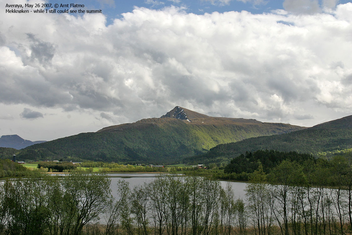
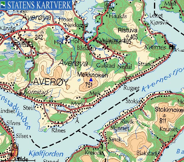
On the maps from Statens Kartverk, the highest mountain on Averøya island is named Mekknøken (Norge 1:50,000) and even Mek-knoken (Økonomisk Kartverk). The local name, which you will find on trailsigns, is Meekknoken. The mountain has its name from the place Mek (map name) / Meek (local name) on the south side of the mountains. This website will refer to this mountain as Mekknøken, but at least the reader is now aware of the local name.
Mekknøken is a coastal mountain, and offers excellent views toward the mighty Trollheimen, Sunndalsfjella and Romsdalsfjella mountain ranges, and, of course everything west of these ranges. One of the major Averøya tourist attractions is the Atlanterhavsvegen road. This road connects Averøya island to the Moldehalvøya peninsula. The other access point is the Bremsnes - Kristiansund ferry.
Mekknøken is an easy mountain to reach, and there are several routes to the top. This web page will describe the route up Nekkstaddalen valley. This is probably the shortest route to the top. You also have the option to visit the neighbour tops Fagerfjellet (634m) / Holstuva (626m), if you want an extended hike.

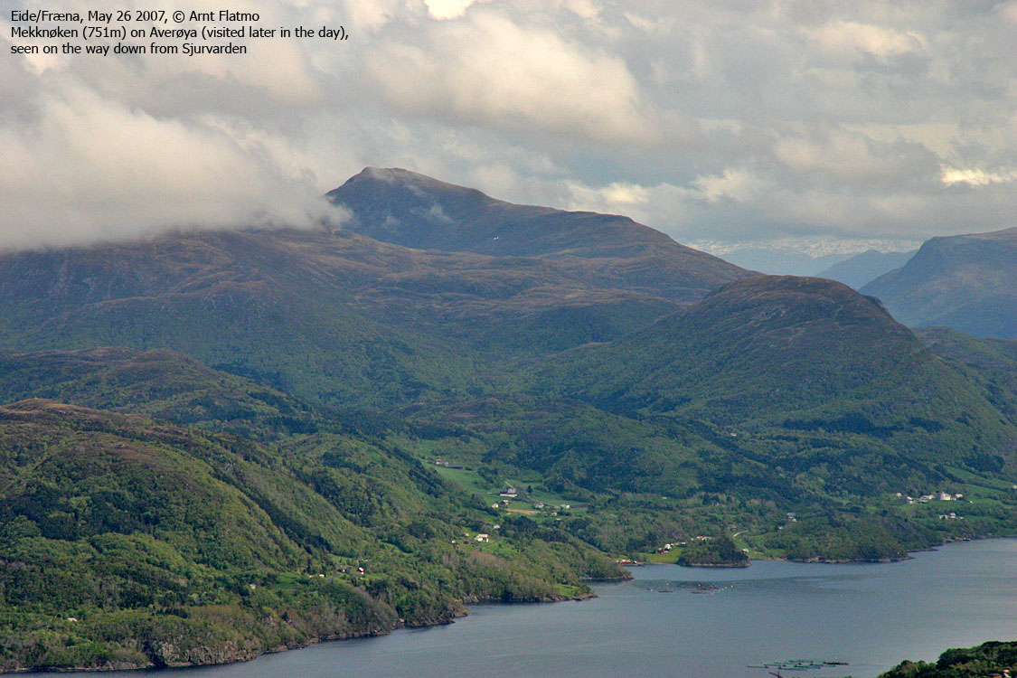
Mekknøken (Norge 1:50,000: 750m, Økonomisk Kartverk: 750,96m, UTM 32 V 427997 6983853) has a primary factor of 751m, being the highest mountain on Averøya island.
Google's interactive map. You can zoom, pan and click on the markers.
Notes: Class ratings are in reference to YDS. Click here for more information.
The trails described below are not necessarily the *easiest* trails to this mountain.
|
Mekknøken via Nekkstaddalen (summer/autumn)
|
|
Access
(all distances are approx. distances)
The Nekkstaddalen road has no roadsign, and is easy to miss unless you look for it. The road begins near Ba and runs 27,Km up the valley. If you come from Kristiansund, the exit is on your left-hand side, 12,5Km from Bremsnes, and 200m after a gas station on your left-hand side.
The route
From the trailhead, follow a rocky path until you are out of the forest (280m). The path runs to the right of a small hill (the 320m contour) and then climbs southbound up the mountain. At 400m elevation, the path turns east/northeast and follows a ridge up to the Mekknøken foothills. You have Lake Taraldsvatnet down on your right-hand side.
Ahead of you are 200 vertical meters up to the summit, which is marked by a pole and a canister for the visitor register. Descend your ascent route, or traverse the top and descend towards Lake Litlvatnet, before joining your ascent route.


No Javascript:
 westcoastpeaks.com
Other Møre & Romsdal mountains
Other Norwegian mountains
westcoastpeaks.com
Other Møre & Romsdal mountains
Other Norwegian mountains

