
European Mountains
Bulgaria
Malyovitsa (2729m) & Malka Malyovitsa (2460m),
July
11 2011
To the main Malyovitsa page (maps, route descriptions, other trip reports, etc.)

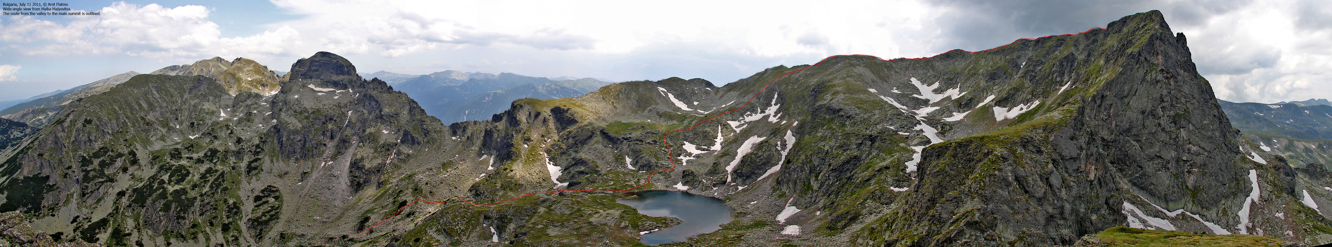
The route, seen in Googlhe Earth
(Click for larger image)
Summary...
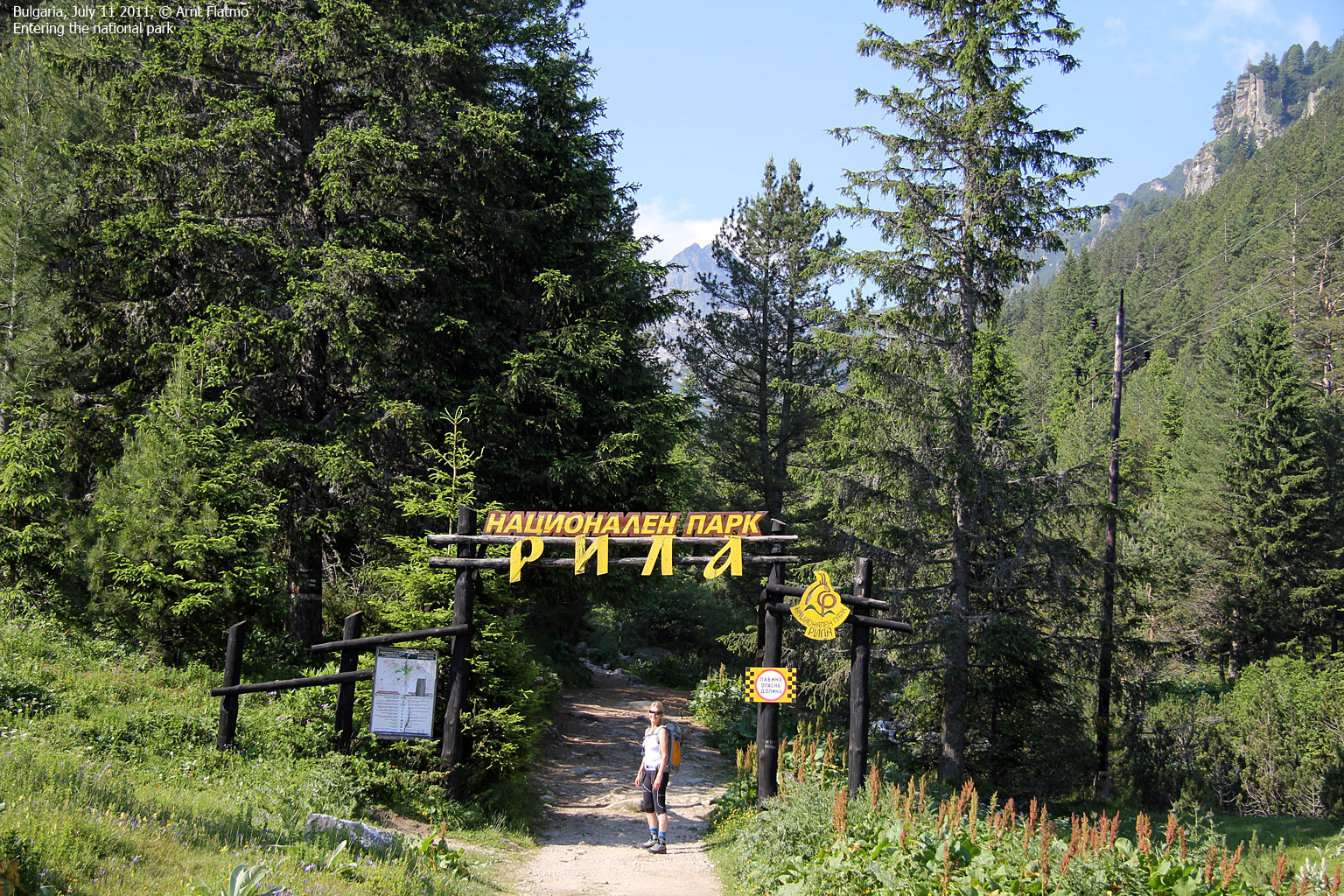
Our week in Bulgaria was progressing quite well. We had driven across the country, hiked Musala - the highest peak, and Cherni Vrah - a huge mountain just south of Sofia. Today, we left the Borovets village and found our way to the Malyovitsa trailhead - ready to hike a beautiful peak.

Bakery visit in Samokov
(Click for larger image)
Hotel Maliovica...
As there was a hotel conveniently placed next to the Malyovitsa trailhead, we decided to check in, even if it was quite still early in the day. Our guide book referred to Hotel Maliovica was an excellent hotel. This might have been true some decades ago, but our room didn't meet any 2011 standards. Not by a mile! The door was barely attached to the frame, and we later discovered that the toilet didn't flush properly. Due to language barriers, we chose the path of least resistance and decided to stick with the room.

Hotel Maliovica
(Click for larger image)
Malyovitsa peak...
But there was light in the
dark tunnel; from our balcony, we could see our main
target for the day - Malyovitsa peak. Oh, what a beautiful peak! Based on the
view from the hotel, it seemed like a ... fairly long walk.

Malka Malyovitsa and Malyovitsa
(Click for larger image)
Heading out...
By 9:28am, we were on the trail up the valley. We reached the Malyovitsa hut almost one hour later, and had a nice chat with a rock climber who was preparing for today's "work". It didn't strike me until I saw the old truck outside the hut, but the trail was actually a rough 4WD road. Being a regular driver on this road has GOT to be one of the worst jobs on this planet!

Malyovitsa hut
(Click for larger image)
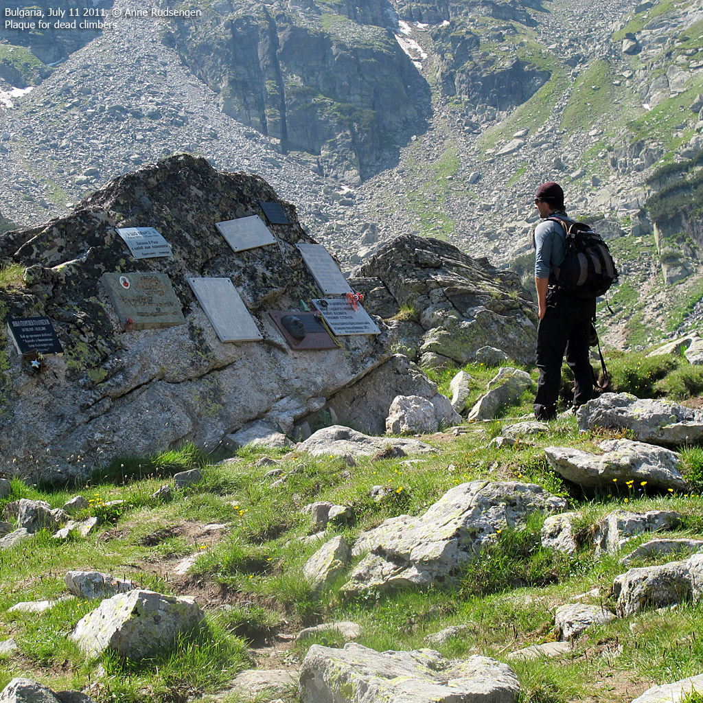
The valley...
After a little while, we left the hut and continued up the valley. Apparently, we were now in the cradle of Bulgarian mountaineering and rock climbing. This valley is truly impressive, by any standards. The upper valley is divided into the first and the second terrace, and at the entry of the second, we passed a rock with plaques for dead climbers and mountaineers. I learned that this is also a popular skiing area, but based on the steep slopes all around, then avalanches has got to be a serious factor.

The upper valley
(Click for larger image)
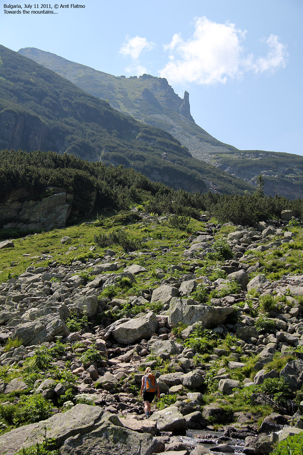
Upwards...
Finally, it was time for
some proper elevation gain. We were now about to push from 2260m
to 2729m. After a while, we reached lake Elenski (2480m). And on the far
side of the lake, Malka Malyovitsa and Orleto rose proud and tall.
I didn't say anything at the time, but I just had to get to the top of
Malka Malyovitsa after we had been to the main peak. I decided to break the
news later on...

Orleto and Malka Malyovitsa
(Click for larger image)
On top!
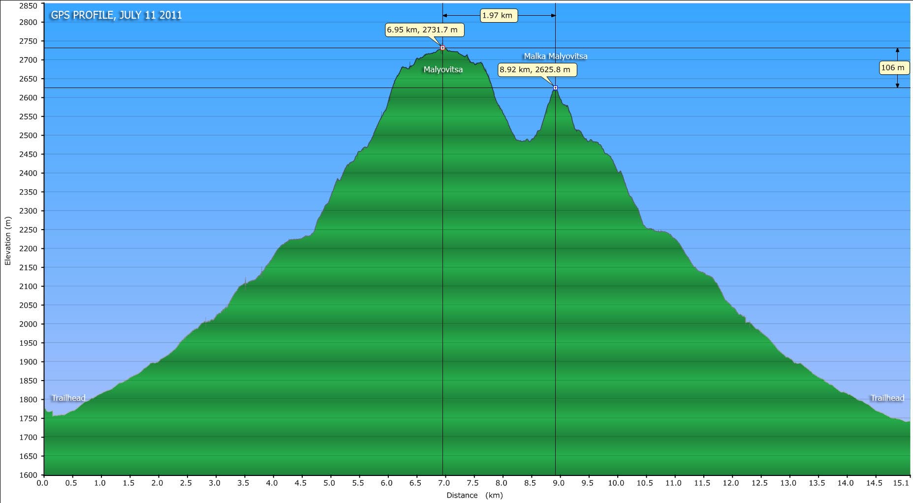
After 7km and 3h:10m on the trail, we reached Malyovitsa summit. The walk up the watershed ridge was nice, and we had a good view towards the Rila monastery - possibly the most popular tourist attraction in Bulgaria. The summit view was nowhere as impressive as the valley view. We heard thunder in the distance (near Musala), but it didn't seem it was coming our way. At this time, I was under the impression that we had summited the highest peak in the northwest part of the Rila mountain range, but I later learned that there was another peak - 2 meters higher - 2,8km to the east. The distance wasn't the problem, but in order to get there, we had to cross Orlovets. And that didn't seem to be an easy task...

On top of Malyovitsa
(Click for larger image)
Malka Malyovitsa...
On our way down from Malyovitsa, I told Anne about my desire for Malka Malyovitsa, and she gave thumbs up for one more ascent. The ascent from the lake was easy enough, and after some minor, easy scrambling, we reached the top of Malka Malyovitsa at 1:50pm, scaring up a mountain goat along the way...
GPS woes...
The GPS/GPS map had confused me throughout the trip. The contours on the map and the elevations reported by the GPS just didn't match. And now I discovered that the GPS reported different elevations, depending on which screen I was looking at. The tracks seemed to be more trustworthy than the waypoints. Were the waypoints a mix of barometer and GPS readings? I haven't figured all this out yet. On the internet, Malyovitsa is widely known to be 2729m. My GPS track shows 2733m on the summit. That's only a 4 meter difference. Also on the internet, Malka Malyovitsa is known to be 2640m. My GPS track on the summit shows 2627m. That's 13 meters lower! On top of this, my 2627m summit waypoint on Malko Malyovitsa lies between the GPS map contours 2540m and 2550m!

Descending Malka Malyovitsa
(Click for larger image)
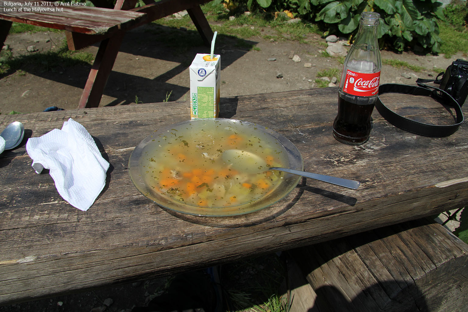
Returning to the hotel...
Back at the Malyovitsa hut, we once again met the rock climber and we had yet another nice chat with him, while enjoying a nice soup. We were now eager to get back to the hotel for a shower and a proper meal and moved on.
At the meadow in front of the hotel, Anne met her Rila Park Ranger colleagues. At first, the Park Rangers thought this encounter was about a taking pictures, but eventually Anne made them understand that they were indeed colleagues. The encounter was duly celebrated through handshakes and smiles...
At 4:50pm, we were back at the hotel - 7h:20m after heading out. As mentioned earlier - the toilet had issues, but the shower actually worked. While taking my shower, I kept a close eye on the cracks on the walls, expecting creatures and bugs to be crawling out, any second now..

At the Malyovitsa hut
(Click for larger image)
The dinner was a sensation. The dining room was huge, but we were the only guests. I could easily picture that this was a ballroom in the 70's. The receptionist was now both waiter and cook, and we asked what the hotel recommended. In fact, we pointed out that just particular sentence in the parlour. She (the waiter and the cook) pointed on something in the book that translated to a hot-dog. Well... OK? And a salad, perhaps?
WHY DIDN'T I TAKE A PICTURE OF THAT DINNER PLATE WITH THAT LONESOME HOT-DOG??
Afterwards, we got a pleasant surprise. Our new Polish friends (Patrycja and Grzes) that we met in Borovets had just checked in to the hotel. We joined them for dinner and stared at them (with envy) throughout their meal. They were obviously more successful with understanding the menu. In the end, enough beer made me look at the brighter side of life...
Next day: Vihren


