
|

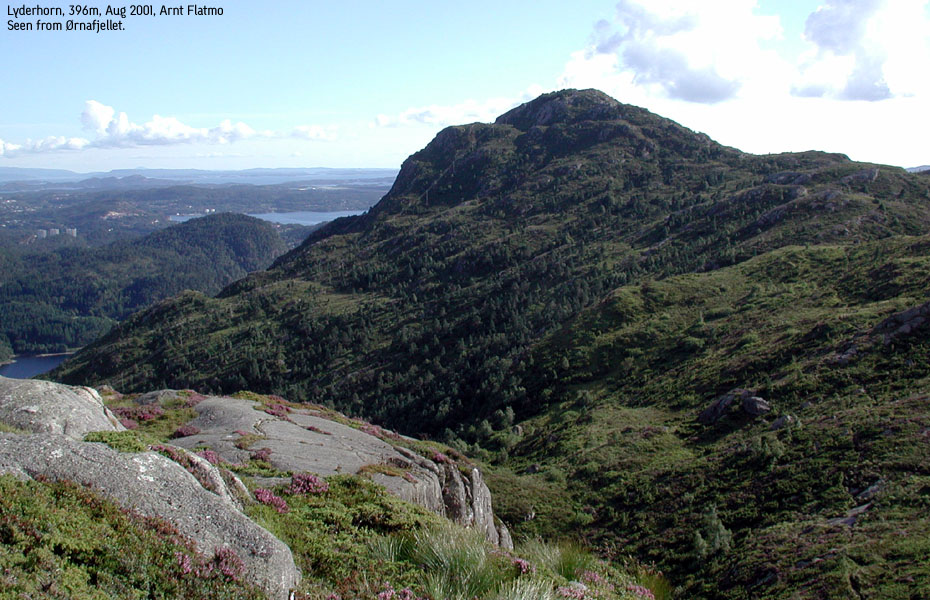
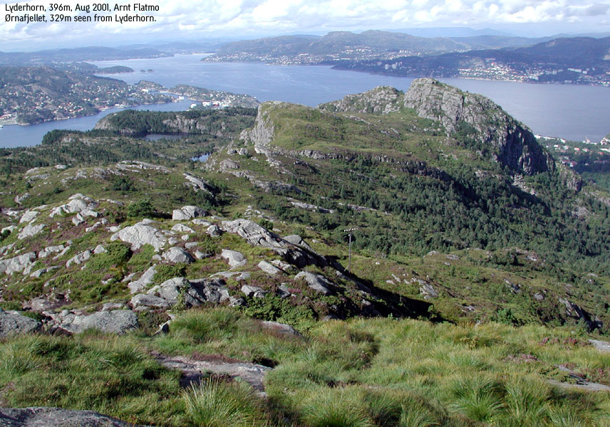
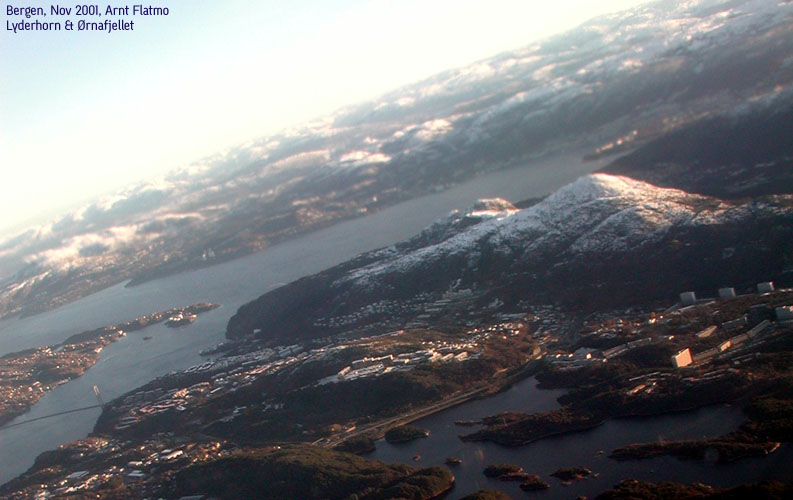
Lyderhorn seen from Ørnafjell(No Javascript) |
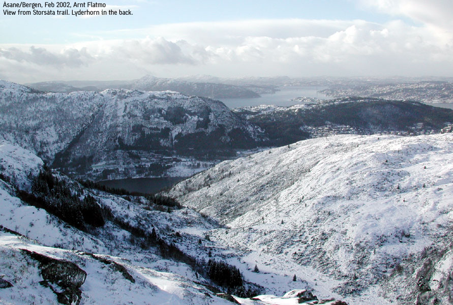
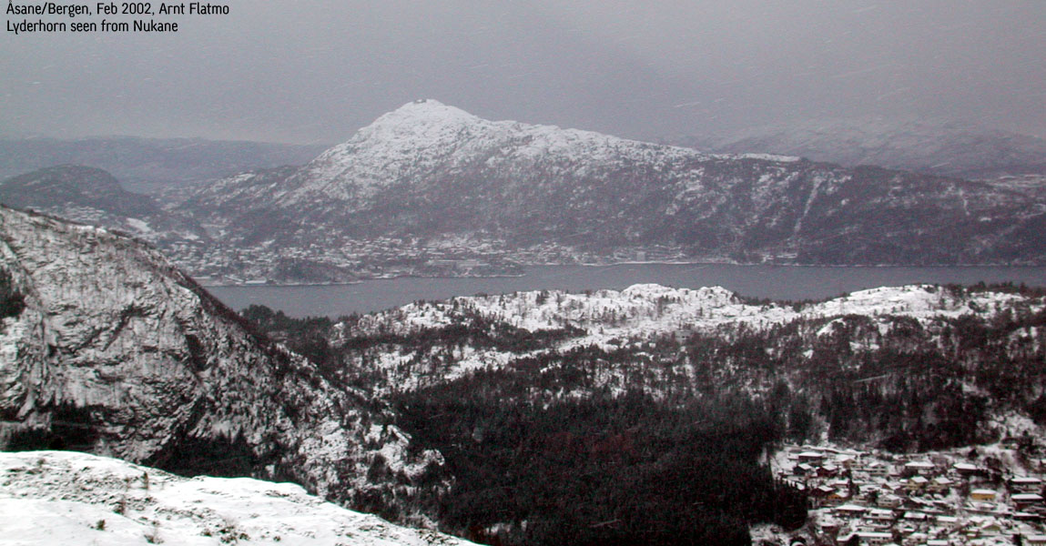
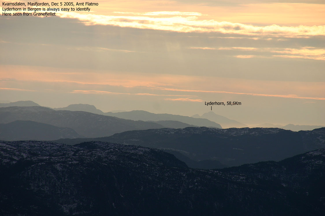
Lyderhorn is perhaps the most characteristic mountain in the Bergen region, and the mountain is tremendously popular all year around. I take it for granted that some eager afternoon walkers hike this mountain every day of the year. With a quick pace, the summit is only 30 minutes (some do it faster) from some of the trailheads.
A large number of trails from all around the mountain will take you up to this great viewpoint. On this page, I have added a few short round-trip selections, helping you to visit this fine peak.
Primary Factor:
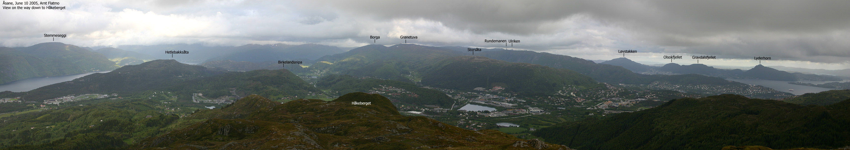
Lyderhorn has a primary factor of 348m towards the higher Løvstakken. The saddle is found north of Bjørndalstj. The adjacent 5m contours in the saddle are 50m. The height is interpolated to 48m.
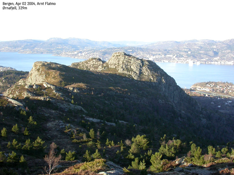
Ørnafjell has a primary factor of 51m towards the higher Lyderhorn. The saddle is 70m southwest of the Ørnafjellet summit. The adjacent 5m contours in the saddle are 280m. The height is interpolated to 278m.
Note: Class ratings are in reference to YDS (Yosemite Decimal System).
Note: The trail described below is not necessarily the easiest trail to this mountain.
|
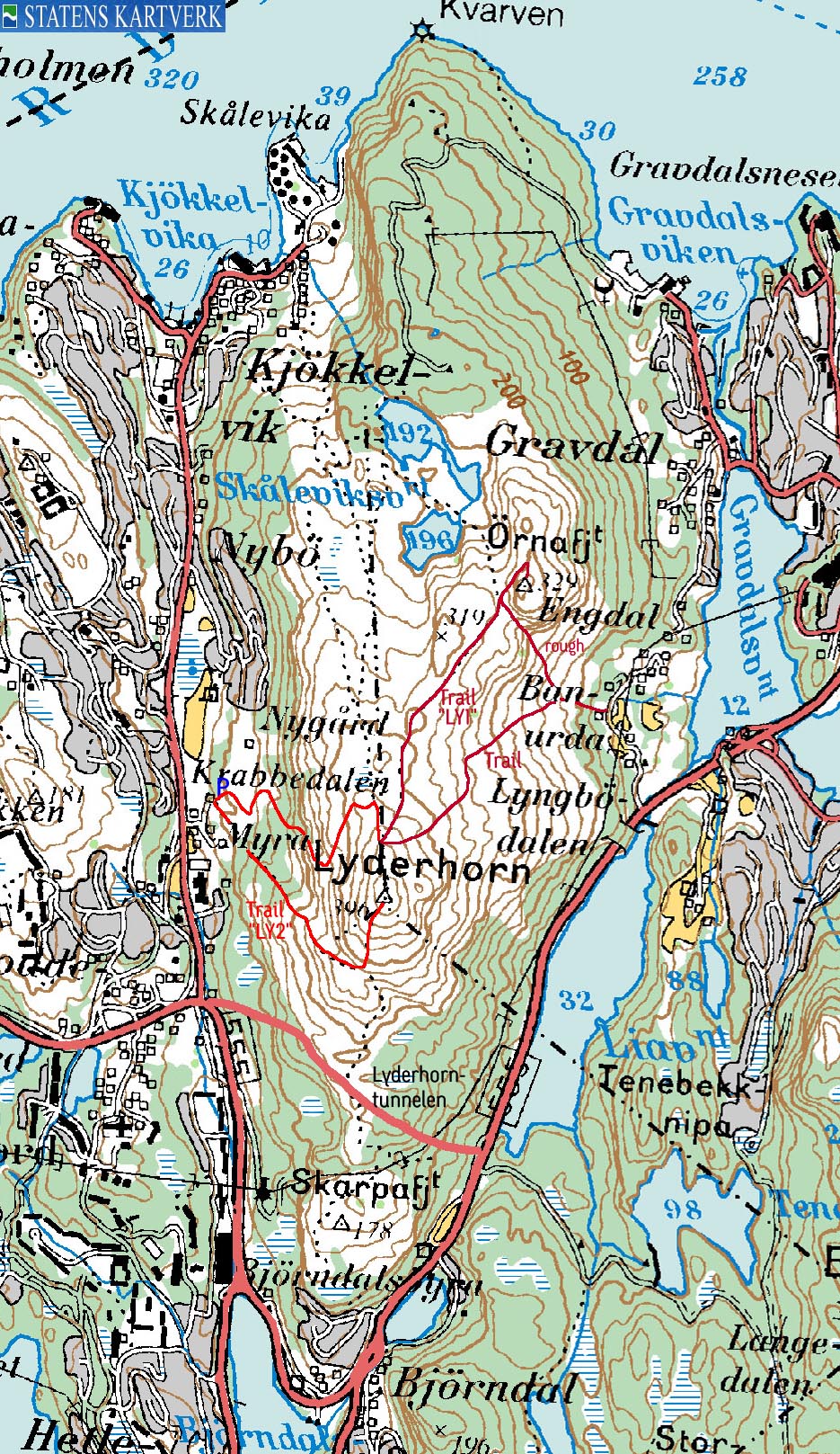
Route LY2: Myra - Lyderhorn (all seasons)
|
|
Access
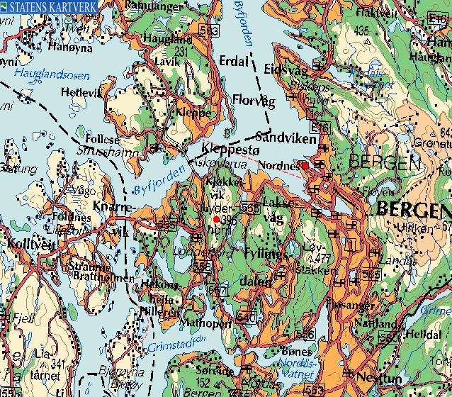
From Bergen, follow highway 555 towards "Askøy/Sotra". You will drive through "Damsgårdstunnelen" (tunnel). As you leave this tunnel, drive approx 3,4Km before you exit right towards "Loddefjord". Go left in the first roundabout ("Loddefjord). Turn left in the next roundabout and follow the road as it descends for 350m.
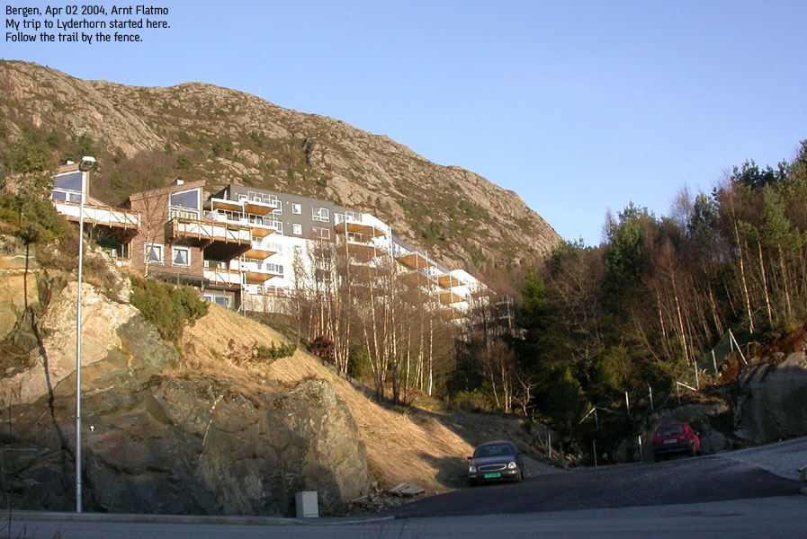
Exit left towards "Skålevik". Drive this road for approx. 600m and turn right when you see the "Lyderhornslien" street name sign. This road immediately forks. Go left and drive upwards. The road switchbacks up to the high buildings on top. Don't drive all the way to the top, but park below these buildings as the road turns sharp to the left. You will see the trail begins at the road bend. There is parking available for a few cars.
The route
Ascent
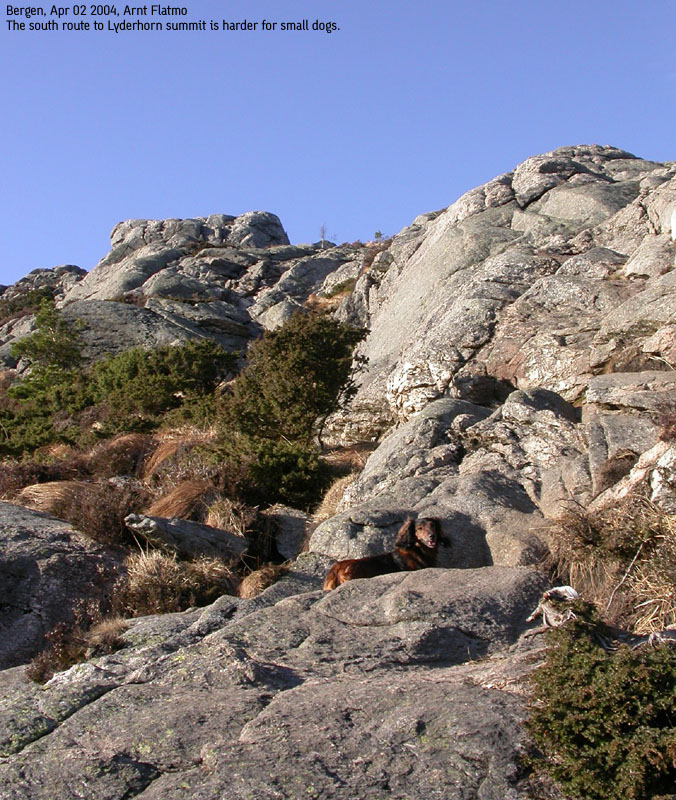
The trail is extremely well traveled and as such, extremely boggy after rain. Follow the trail (southeast) as it climbs a distinct ridge up to 270m elevation. Eager scramblers may take interest in the steep cliffs up to the left as they walk this ridge. Turn left at the top of the ridge and climb up a steeper section where you may use your hands for support now and then. Follow this path to the top.
Descent
Follow the northbound trail for 270-280m and look hard for a path that runs to your left. It is not signed, and not very wide. This path descends in the direction of the ridge you ascended, but makes a left turn at 250m elevation and runs downwards parallel to the ascent route. The trail ends at the northernmost of the two high buildings on top of the road. Follow "Lyderhornslien" road down to your car.
Move cursor to read notes, and click on the images to see full version.
Some of the thumbnails may have been cropped to fit the format.
Pictures are presented in the order they were taken.


No Javascript:
1 2 3 4 5 6 7 8 9 10 11 12 13 14 15 16 17 18 19 20 21 22 23
|
Route LY1: Banurda - Lyderhorn - Ørnafjell (all seasons)
|
|
Access
From Bergen, follow highway 555 towards "Askøy/Sotra". You will drive through "Damsgårdstunnelen" (tunnel). As you leave this tunnel, drive approx 1,7Km before you exit right towards "Søreide/Håkonsvern". Exit right in the first roundabout and drive towards "Lyngbø". Drive 1Km (you're driving parallel to the highway, opposite the direction you came) and notice a road going to the left. Exit onto this road. You will see a green "Lyderhorn" trailsign here. Park by the mailboxes at the beginning of the road.
The route
Ascent
Follow the road for 450m, and look for a green sign to Lyderhorn just behind a house on your left hand side. This forest trail runs next to a stream in the beginning, before it levels out. This part of the trail can be quite wet and muddy. Soon, the trail takes a direct approach to the summit, and this part can be steep at places. No need for climbing, but you may need to take some long steps from time to time.
Descending via Ørnafjell
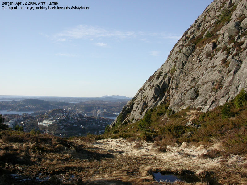
From Lyderhorn, there is a trail heading northeast to Ørnafjell. The south side of the mountain is steep, so the trail takes you around the north side for access. There is a steep shortcut which you may look for just as you get around the mountain and see a small building right ahead. You get a great view towards Lyderhorn from this mountain.
Locate the vague path that runs down the pass at the steep southwest side of Ørnafjell. There is a faint trail, but there is a chance that you will lose it and have to scramble through the forest. Still, a fun hike. This path will connect to the ascent route closer to the houses where the trail begun.


No Javascript:


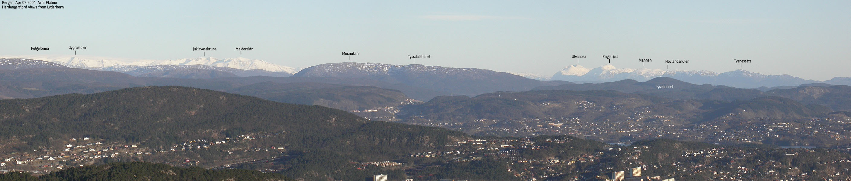
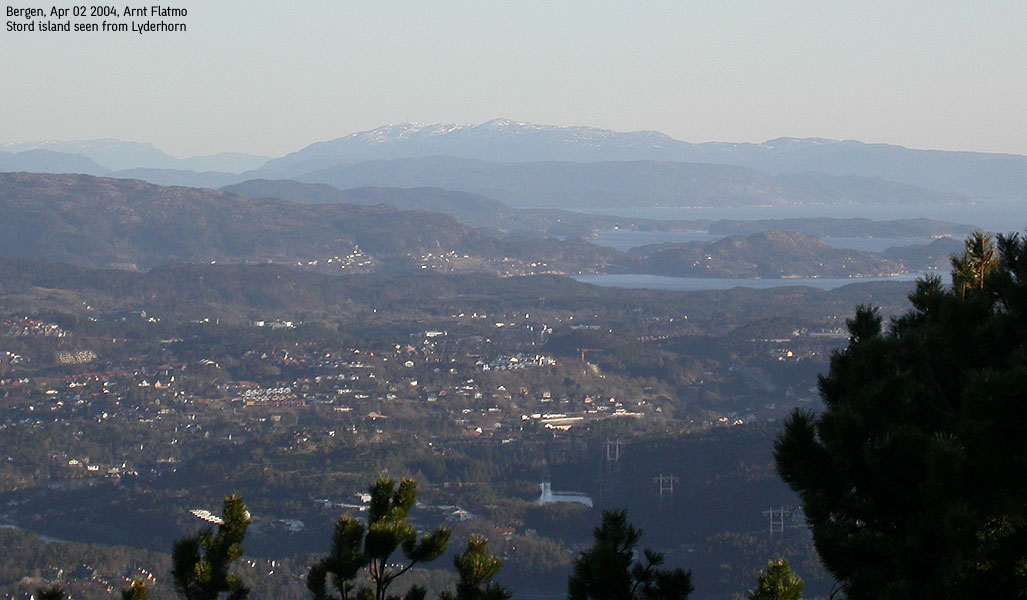
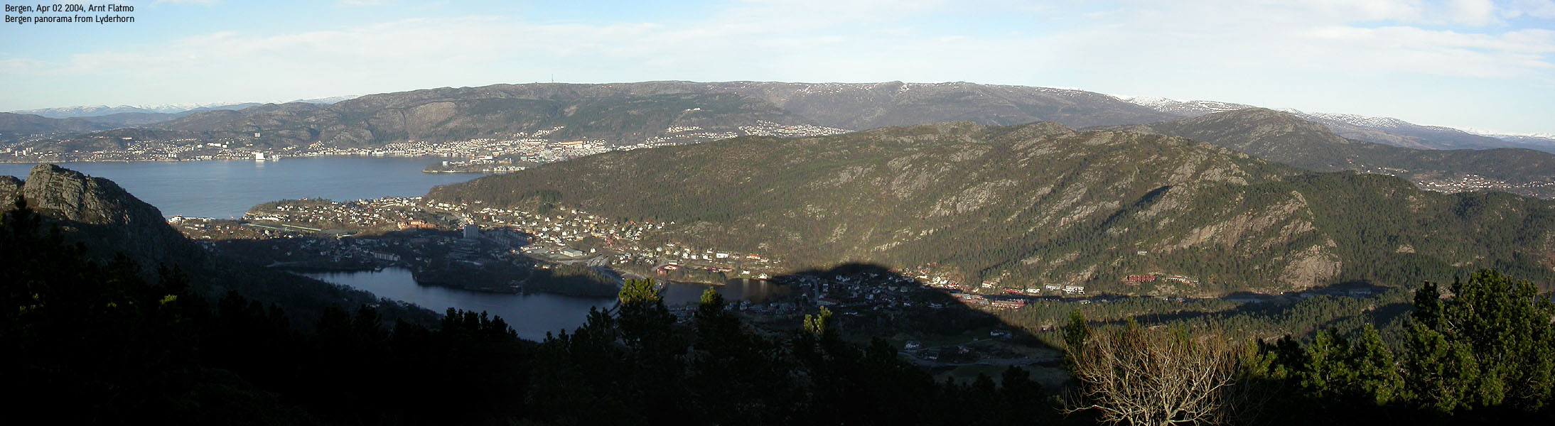
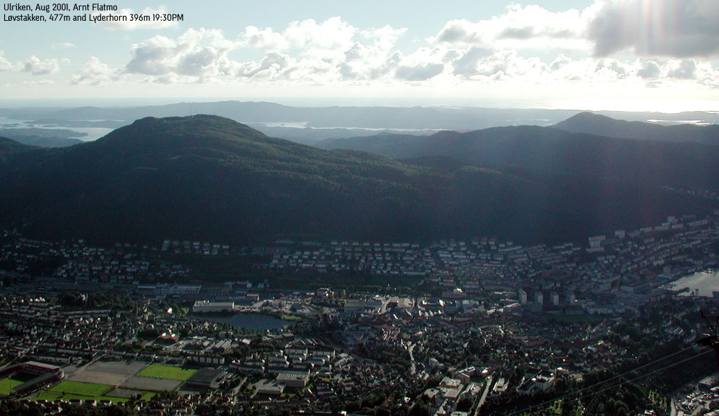
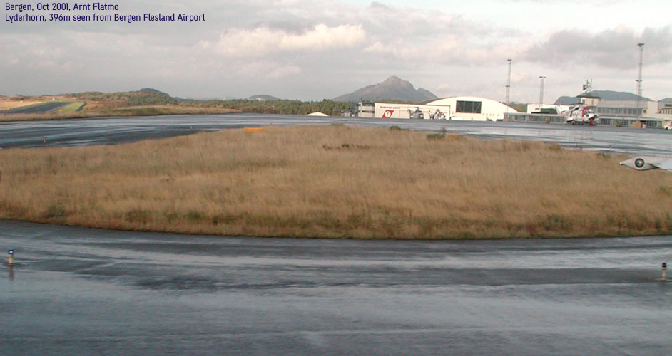
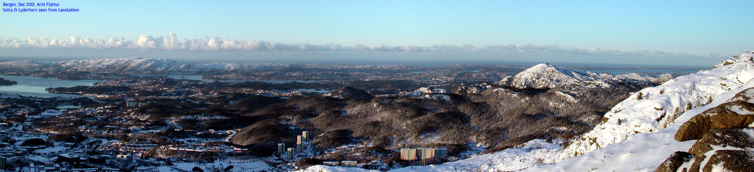
See also some Aerial shots of Bergen
No Javascript:
1 2 3 4 5 6 7 8 9 10 11 12 13 14
 Other hordaland mountains
Other mountains in this area
westcoastpeaks.com
Other hordaland mountains
Other mountains in this area
westcoastpeaks.com

